
Where Flight Simulation Enthusiasts Gather from Around the World!
AVSIM Library - Search Results

| Category: Flight Simulator X - Scenery | |
| Merrill Field PAMR |

|
Images related to this file:
File Description:
This is a version for FSX of the Merrill Field made by Roger Wensley (me) for FS9, converted by John B Loney jnr. "PAMR read this first" explains this but I have modified John's original procedure, and instead of first installing the Merrill Field original plus two updates I have included here the current FS9 version as installed on my computer. Note that to see the apron lighting working in FS9 it was necessary to have Sidney Schwartz's light library installed, along with his updated textures (to avoid severe blurries caused by a faulty texture). The original installation instructions are included giving file library priorities etc. Just ignore the bits that do not apply, such as installing AI that is not included. I have of course omitted the original AI as this is replaced by John's version. I have no comment to make on installing in FSX as I have not done so, and I have not tested it in FSX. If you have comments or questions I will respond as much as I am able. Merrill Field is in Anchorage Alaska, between Anchorage International to the southwest and and Elmendorf Air Force Base to the north. It caters for general aviation and is the land equivalent of the Lake Hood float plane base, with fuel and numerous maintenance facilities, and several hundred parking spots for small planes. There are three runways, and the longest is 4,000 feet of 100 feet wide asphalt, the second 2,635 feet of asphalt 75 feet wide, and the third 2,000 feet of 60 feet wide gravel. The first two have runway lights. It is a controlled airfield with a relatively new control tower to cater for the numerous flights and to coordinate with Elmensdorf and Anchorage International, the latter also controlling flights from Lake Hood and the adjacent gravel strip Z41. (See my Lake Hood scenery). The gravel runway at Merrill Field is not connected with active taxiways to the rest of the airfield; this avoids you being ordered to land on it when flying a plane too large to do so.
| Filename: | Merrill_Field_PAMR.zip |
| License: | Freeware, limited distribution |
| Added: | 3rd July 2017, 18:00:19 |
| Downloads: | 452 |
| Author: | Roger Wensley and John B loney jnr |
| Size: | 21.73 MB |
| Category: Flight Simulator 2004 - Scenery | |
| Hana Heli-Obstacle Course v2.0 |
|
Images related to this file:
File Description:
Hana Airport is a regional airport of the State of Hawaii on the east shore of the island of Maui, 3 NM northwest of the unincorporated town of Hana. The airport covers 119 acres and has one runway. It is primarily a commuter facility used by unscheduled air taxis and general aviation. This scenery is intended as a single/multiplayer helicopter obstacle course where heli pilots can meet to compete, show off, and share their helo skills. Since birdseye (Timm Turner) already did a neat scenery called Hana_Scenery_PHHN (search for "hana" in the HoverControl Downloads), we decided to convert PHHN to a full helicopter training area. Makes a great place for helo pilots to gather to practice and perfect their skills, and challenge other pilots! And keep an eye-out for that Hot Air Balloon, cruising around an altitude of 3000 feet (don't forget to wave at them!). Another unique thing about this scenery is the neighboring islands (Honolulu Intl/Hickam AFB, Bellows AFB, Lanai City, Kahului, Molokai, etc). If you get frustrated during your heli obstacle course training, just take a heading of 275 degrees, and relax at one of the neighboring islands. We also added an Easter Egg - If you set your FS calendar to July 21st, you'll see a large ridge fire up in the hills. Load Jordan Moore's Erickson S64E (http://www.hovercontrol.com/) & try your skills at water bombing!
| Filename: | Hana_HeliObstacle_Course_v20.zip |
| License: | Freeware |
| Added: | 7th December 2010, 03:28:47 |
| Downloads: | 475 |
| Author: | Greg Spellmen & Bob Ferguson |
| Size: | 58.56 MB |
| Category: Flight Simulator 2004 - Scenery | |
| Hana Heli-Obstacle Course v3.0 |
|
File Description:
Hana Airport is a regional airport of the State of Hawaii on the east shore of the island of Maui, 3 NM northwest of the unincorporated town of Hana. The airport covers 119 acres and has one runway. It is primarily a commuter facility used by unscheduled air taxis and general aviation. This scenery is intended as a single/multiplayer helicopter obstacle course where heli pilots can meet to compete, show off, and share their helo skills. Since birdseye (Timm Turner) already did a neat scenery called Hana_Scenery_PHHN (search for "hana" in the HoverControl Downloads), we decided to convert PHHN to a full helicopter training area. Makes a great place for helo pilots to gather to practice and perfect their skills, and challenge other pilots! And keep an eye-out for that Hot Air Balloon, cruising around an altitude of 3000 feet (don't forget to wave at them!).
Another unique thing about this scenery is the neighboring islands (Honolulu Intl/Hickam AFB, Bellows AFB, Lanai City, Kahului, Molokai, etc). If you get frustrated during your heli obstacle course training, just take a heading of 275 degrees, and relax at one of the neighboring islands. We also added an Easter Egg - If you set your FS calendar to July 21st, you'll see a large ridge fire up in the hills. Load Jordan Moore's Erickson S64E (http://www.hovercontrol.com/) & try your skills at water bombing!
| Filename: | Hana_HeliObstacle_Course_v30.zip |
| License: | Freeware |
| Added: | 28th August 2011, 17:53:18 |
| Downloads: | 468 |
| Author: | Greg Spellmen, Bob Ferguson |
| Size: | 95.52 MB |
| Category: Flight Simulator 2004 - Scenery | |
| VFR of Lario - Como lake, Italy |
|
Images related to this file:
File Description:
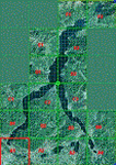
This is the first of the expected seventeen sceneries in the "VFR of Lario" project, that will include the full view of the Como Lake, made with photorealistic terrain (multiseason & night) and with 3D GMax realistic objects, including some motions. Further the Como seaplane airport, the project will include some other virtual ones, and all the piers of NLC (Navigation Lake Como). The project will be completed with a related AI seaplane traffic.
The "VFR of Lario" project REQUEST the installation of the scenery "Itcoast2.zip" & the related "ITAC2_P1.zip", both available for free download from different libraries.
Information: Como is the main and beautifull city on the namesake lake (called Lario), placed in the north of Italy, closed to the Helvetic border. It includes the AeroClub Como seaplanes international airport, with his own flight school. Como has the headseat of NLC, the fleet management for connection of forty Lario's piers. This first scenery covers approximately an area of 7.5x6 kmt.
Contents: airport water track with hangar and static seaplanes; breackwater and stadium lake front, war memorial monument, Volta's temple and lighthouse, main Cathedral, Social theater, city old towers and wall, villa Olmo, square Cavour's buildings, NLC main pier and some minor others, Como-Brunate's funicolar connection (animated), lake fountain, Tavernola shipyard, Baradello's castle, Valduce hospital; motor ships (animated), steamer, hydrofoils and other minor boats; several other buildings (GenericBuilding system), trees and lights widespread all over the scenery.
| Filename: | VFR_of_Lario__Como_lake_Italy.zip |
| License: | Freeware |
| Added: | 22nd December 2011, 23:30:47 |
| Downloads: | 3,550 |
| Author: | Aldo Della Vedova, Daniele Lanfranchi, Diego Caligiuri |
| Size: | 25.33 MB |
| Category: X-Plane - Original Aircraft | |
| China Clipper Martin M-130 for X-Plane 6.40/6.51 |
|
File Description:
China Clipper or Martin M130 for X-Plane 6.40/6.51 - Built by the Martin Company for Pan American Airlines, they were known by the company as Martin Ocean Transports. Only three of these aircraft were built, the China Clipper, the Philippine Clipper and the Hawaii Clipper. To the public, China Clipper became a generic name and originally was applied to all three of the Martin M-130's in Pan Am's fleet and, later, even to the Boeing B-314's which came later. With 4-950 HP radial engines giving a cruising speed of 163 mph and with a range in excess of 3200 miles the "Clippers" were used in the pacific by Pan Am. The "China Clipper" on November 22, 1935 inaugurated the first trans-pacific postal service with 111,000 letters; it returned to San Francisco on December 6, 1935. In 1936 the Hawaii Clipper and Philippine Clipper inaugurated paying passenger service to the Philippines and Hong Kong respectively. These were the original "Clippers" for those including the Boeing B134 to follow. Look for the B134 soon for X-Plane. Just a note : since landing gear skids are used for the wing braces X-Plane thinks that the plane has landing gear and will actually place it on the ground at the airport you select, choose an airport near water and then request a seaplane takeoff or pick a location and altitude on the regional or planet map.
| Filename: | China_Clipper_Martin_M130_for_XPlane_640651.zip |
| License: | Freeware, limited distribution |
| Added: | 11th February 2003, 05:51:20 |
| Downloads: | 1,327 |
| Author: | Robert App |
| Size: | 1.13 MB |
| Category: Flight Simulator 2004 - Scenery | |
| Graskop Airfield, South Africa |
|
Images related to this file:
File Description:
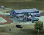
Graskop Airfield does not appear in the default FS2004, neither is the town included which is a pity as the airfield lies right on the edge of a gorge where bungee jumping and even a Gorge-lift (elevator) or a slide across the gorge can be enjoyed by the adrenaline junkies. Added to this, the airfield (and town of Graskop) is merely 10km from the world famous God's Window (also featured in the film, "The Gods must be Crazy").
This package will add a custom (Gmax & Sketchup) made Graskop Airfield, Mpumalanga, South Africa with photoreal textures and ground textures. The included Landclass file will also add the town.
The small airfield has been recreated with custom true to life models and photoreal textures. While being a very small airfield with only one hangar and a large antenna tower, the importance of the airfield far outweighs its size. The airfield plays a vital role in the fight against wildfires as there are water bombers based at the airfield during critical times. In real life the runway is quite challenging, being sloped quite significantly and very narrow, with a one-way-in one-way-out landing and takeoff procedure. Due to the limits within flightsim, the slope could not be replicated but all the other challenges are there.
The asphalt runway is aligned 15/33 and only 800m long by 8.5m wide and sits at an elevation of 4 854ft.
| Filename: | Graskop_Airfield_South_Africa.zip |
| License: | Freeware, limited distribution |
| Added: | 3rd September 2021, 00:55:30 |
| Downloads: | 161 |
| Author: | Kobus van Wyk & Morne van Wyk |
| Size: | 4.13 MB |
| Category: Flight Simulator 2004 - Scenery | |
| VEAT Argatala, India |
|
Images related to this file:
File Description:
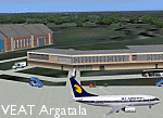
Googly scenery for VEAT Argatala, India - one of the airports that Microsoft seem to have, um, "forgotten" in FS2004. In the real world it is regularly served by Boeings and Airbii of Alliance Air, Indian Airlines, Jet Airways and Kingfisher Airlines (and smaller aircraft), using the 6000 foot runway with little room for manoevre. These scenery files add aprons, taxiways, buildings and other airport features to Flight Simulator's bland representation and allow you, and "AI" traffic, to land, taxi, park and take off realistically. The scenery does not purport to be ultra-accurate. Based on high-detail satellite imagery from Google Earth, the layout is proportianally correct but the added airport features, such as buildings, are built from default Microsoft objects and add-on libraries so will not look like the real thing. You are not obliged to download and install any additional scenery libraries, but to enjoy this scenery in its entirety, you may wish to. It will work fine, with or without. Details of optional additional scenery library downloads are provided within.
[File re-uploaded at request of AVSIM]
| Filename: | VEAT_Argatala_India.zip |
| License: | Freeware |
| Added: | 14th May 2010, 04:49:05 |
| Downloads: | 1,658 |
| Author: | John Hinson |
| Size: | 65.16 KB |
| Category: Flight Simulator 2004 - AI Aircraft | |
| Oberpfaffenhofen v2.2 - traffic package |
|
Images related to this file:
File Description:
This AI-Package has been prepared for the Oberpaffenhofen Airport (EDMO) located in
South-Germany 20 NM west of Munich and contains the following beautiful aircraft:
Dornier Do-27, Do-28, Do-228, Fairchild/Dornier, FD-328 Turboprop and Jet version,
FD-728 (did not go onto production line) and the amphibian Dornier Seastar,
Boeing-707 (AWACS/E3A), Breguet-Atlantic, Dassault/Dornier Alpha-Jet,
Lockheed-P3 Orion, British-Aerospace Canberra B.20, Hawker Sea-Fury, North-American
F-86A, and Bell UH-1D. The corresponding scenery "oberpfaffenhofen-v2.2_fs2004.zip"
is available here at the library.
Most of the planes perform testflights after a long term maintenance in the local
traffic pattern and some of the bigger ones leave IFR (in accordance with
"Instrument Flight Rules") to other airfields per attached flightplan. All the attached outstanding airplanes have been created by well known designers(see briefing). My part was just to put them together and to generate an almost reasonable AI-Flightplan. Gentlemen, let's take a rest, watching the airplanes and listening to ATC.
Re-upload.
| Filename: | Oberpfaffenhofen_v22__traffic_package.zip |
| License: | Freeware |
| Added: | 8th April 2011, 11:49:12 |
| Downloads: | 2,048 |
| Author: | Klaus Jone |
| Size: | 23.59 MB |
| Category: Flight Simulator 2004 - Scenery | |
| 5B2 - Saratoga County Airport |
|
Images related to this file:
File Description:
5B2 - Saratoga County Airport v1.0

Located in the foothills of the Adirondack Mountains in upstate NY USA. This facility is owned by Saratoga County, formerly housed Rich Air and currently houses North American Aviation. 5B2 is a non-controlled airfield catering to small engine a/c up to a few private jet daily traffic serving 'The Northcountry' and Saratoga Springs, New York.
All Objects fully designed and completely redone in GMAX using high resolution 32bit photo-real textures. Optional DXT3 textures included. Also includes new AFCAD file, more accurate airport grounds perimeter, satellite photo-real grounds, custom taxiways, taxi-signs and taxi lights, area roads, animated hangar doors, and near area landclass. Some GA AI traffic tracks included with this release, afcad also designed to support general AI. Rwy12 objects (Lars Extra Object Library) required for a few static parking lot cars. All textures mipmapped for performance. By EdGeneer Cox.
| Filename: | 5B2__Saratoga_County_Airport.zip |
| License: | Freeware, limited distribution |
| Added: | 24th February 2012, 19:24:19 |
| Downloads: | 1,537 |
| Author: | EdGeneer Cox |
| Size: | 103.26 MB |
| Category: Flight Simulator X - AFCAD Files | |
| CYXE - John G. Diefenbaker International Airport / Saskatoon, Saskatchewan, Canada |
|
Images related to this file:
File Description:
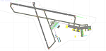
CYXE - John G. Diefenbaker International Airport / Saskatoon, Saskatchewan, Canada
This airport update was made with the latest version of ADE (Airport Design Editor) and made for FSX as a replacement for the stock (default) airport. I found that most stock airports in FSX lack a decent amount of character and realism and this area in particular was dreadful! The stock airport was rather inaccurate. I've made several additions to the airport which are listed below. All these enchancements are as close to the real airport as I can get with stock library objects. I've used satellite images, terminal photos and maps throughout the whole process so building locations are as accurate as possible. Happy landings in the beautiful Canada!
Features:
*Expanded parking apron
*Main terminal building with its jetways and regional jet parking area
*Seperate parking aprons for GA traffic
*Hangars and other airport buildings added
*Airport vehicles and objects throughout the airport
*Parking lots with static vehicles
*Airport fire station with fire trucks/ambulance
*De-icing ramp with static de-icing vehicles/runway plows
*Cargo ramp
| Filename: | CYXE__John_G_Diefenbaker_International_Airport__Sa.zip |
| License: | Freeware |
| Added: | 25th July 2012, 06:29:06 |
| Downloads: | 1,303 |
| Author: | Jaison Diaz |
| Size: | 152.47 KB |


© 2001-2026 AVSIM Online
All Rights Reserved
Privacy Policy |