
Where Flight Simulation Enthusiasts Gather from Around the World!
AVSIM Library - Search Results

| Category: Flight Simulator X - Helicopters | |
| Fire Rescue Boeing CH-47D Chinook |

|
File Description:
This is a repaint of the Boeing CH-47D Chinook helicopter in U.S. Forest Service Fire Rescue livery N10HE. These are textures only and require the original model (available by downloading either the Hellenic Army Aviation or U.S. Armed Forces Chinook). In the U.S. Forest Service, the Chinook is often called upon for firefighting duties. These include transporting and para-dropping firefighters and equipment as well as using a large bucket to drop water directly onto forest fires. The Chinook is also used in search and rescue operations. Special thanks to Delizisis Thanasis and Delizisis Panagiots for their original textures used as paint templates.
| Filename: | Fire_Rescue_Boeing_CH47D_Chinook.zip |
| License: | Freeware, limited distribution |
| Added: | 24th January 2007, 15:50:28 |
| Downloads: | 2,924 |
| Author: | Mike Lanza |
| Size: | 1.17 MB |
| Category: Flight Simulator X - Scenery | |
| Hawaii - Niihau |
|
Images related to this file:
File Description:
Niihau, the westernmost of the inhabited Hawaiian Islands, is privately owned and used primarily to raise cattle. It's small population works the ranch. Because it is so isolated, it is the last of the Hawaiian Islands where Hawaiian is the primary language.
Niihau has no airport of its own. You get there by taking off from Kauai and flying west. I'd recommend using Port Allen (PAK). Unless visibility is limited, you can see Niihau across the water from the airport. Just take off and fly a heading of 270 degrees. However, a saved flight which places you just off Niihau's shore is included in the package should you need it.
| Filename: | Hawaii__Niihau.zip |
| License: | Freeware |
| Added: | 15th December 2009, 23:19:34 |
| Downloads: | 2,525 |
| Author: | Richard Sorochak |
| Size: | 36.49 MB |
| Category: Flight Simulator X - Scenery | |
| Aerodromo de Tela - MHTE |
|
Images related to this file:
File Description:

Tela Airport (Spanish: Aeropuerto de Tela) (IATA: TEA, ICAO: MHTE) is an airport serving Tela, a town in the Atlántida Department on the northern coast of Honduras. In 2009, plans were laid to lengthen the runway from 1,346 metres (4,416 ft) to 1,600 metres (5,200 ft) and possibly to construct a new terminal building. There are hills southeast of the runway. Northeast approach and departure are over the water. The La Mesa VOR-DME (Ident: LMS) is located 31.0 nautical miles (57.4 km) southwest of the airport. The Bonito VOR-DME (Ident: BTO)is located 35.4 nautical miles (65.6 km) east of the airport.
| Filename: | Aerodromo_de_Tela__MHTE.zip |
| License: | Freeware |
| Added: | 25th January 2021, 02:29:26 |
| Downloads: | 208 |
| Author: | Luis Flores |
| Size: | 87.71 MB |
| Category: Flight Simulator X - Scenery | |
| Grand Forks Int'l Airport v1.1 |
|
Images related to this file:
File Description:
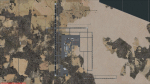
This scenery addon updates Grand Forks International Airport (KGFK) for FSX only. This is an updated version of the original scenery addon KGFK10 that contained the newly constructed runway. This update includes several bug fixes, such as removal of duplicate taxiway signs and other objects. It also includes updated local scenery to more closely match the actual airport. Local bodies of water used as visual checkpoints have also been added. All instrument approaches have been updated for currency, to include correct waypoint names and procedures. Several missing instrument approaches have also been added. The airport was updated using Airport Design Editor. By Raymond Mills.
| Filename: | Grand_Forks_Intl_Airport_v11.zip |
| License: | Freeware |
| Added: | 20th October 2010, 22:34:31 |
| Downloads: | 993 |
| Author: | Raymond Mills |
| Size: | 15.85 KB |
| Category: Flight Simulator 2002 - Scenery | |
| Holger Lake,British Columbia |
|
File Description:
Located in the higher elevations of British Columbia, Canada lies Holger Lake, a very popular, but secluded and discreet tourist spot. Only one way in…..by plane (or helicopter!). Featuring a modest, lighted, dirt runway as well as covered plane ports and a covered water hanger with tie downs and storage. A large full service guesthouse with a porch for relaxing and viewing the northern lights (when in season). Daily scheduled sightseeing trips are also provided by various local charters. Drop in, sit back and stay awhile!
Thanks to Holger Sandmann for his wonderful new mesh (you can find it at AVSIM) and for finding this area!
| Filename: | Holger_LakeBritish_Columbia.zip |
| License: | Freeware |
| Added: | 19th February 2003, 12:41:48 |
| Downloads: | 2,115 |
| Author: | Michael Carr - MCDesigns 2003 |
| Size: | 4.22 MB |
| Category: Flight Simulator 2004 - Flight Plans | |
| Amelia Earhart 1937 World Flight Commemorative |
|
File Description:
The mystery of Amelia Earhart's disappearance in 1937 during her World Flight has never been solved. On 2 July 1937, with 19,000 NM behind her, she left Lae, New Guinea for tiny Howland Island in the central Pacific Ocean, a 2224 NM flight over open water. She and navigator Fred Noonan never arrived. This world flight commemorates their attempted world flight. Three Flight Options are offered and descriptive notes are included. This commemorative is designed to be flown with the excellent FSDB Lockheed L10E Electra, as customized by Dave Bitzer and Norman Hancock. Other aircraft can be used, though with less realism. A recommended reading list is also included.
| Filename: | Amelia_Earhart_1937_World_Flight_Commemorative.zip |
| License: | Freeware |
| Added: | 18th May 2006, 21:48:29 |
| Downloads: | 1,601 |
| Author: | Charles Wood |
| Size: | 1.51 MB |
| Category: Microsoft Train Simulator - Miscellaneous Files | |
| MSTS Route - Albula Line 2 |
|
File Description:
MSTS Route - Albula Line 2.
A highly detailed protypical Swiss mountain route.
This revision almost doubles to 40km the modeled portion of the
real-life Albula Line, and adds 10km of a branch line to Davos.
It uses more prototypical third-party add-ons for viaducts,
stations, gantries, etc., offers multiple reversal and helicoidal
tunnels, the 6 km Albula Tunnel, and 12 new environments
(new weather and water, incompatible with Sky! Conductor).
The 20-odd activities require a separate set of
rolling stock, available in file RhBpack.zip.
Uses default MSTS tracks. Includes several maps.
(Previous version had over 17000 downloads at different sites.)
Freeware by Michael Vone.
| Filename: | MSTS_Route__Albula_Line_2.zip |
| License: | Freeware, limited distribution |
| Added: | 10th January 2003, 06:04:48 |
| Downloads: | 10,025 |
| Author: | Michael Vone |
| Size: | 17.83 MB |
| Category: Flight Simulator 2004 - Scenery | |
| Pitcairn Islands - Complete Scenery |
|
File Description:
This project is a complete & much more accurate scenery rendition of the Pitcairn Islands archipelago than the default scenery in FS2004.
The scenery includes all 4 islands redesigned, with detailed coastlines, Landclass with the only settlement, Adamstown represented, and accurate Waterclass representing the shallow reef banks bright colors.
A fictional AFCAD for each island was also made, with all 4 having a water landing area either along the coast or inside the lagoons. Ducie Island has a small sand strip as well.
Some scenery objects were added, mostly on Pitcairn Island, to recreate both the island's jetty & the Old Radio/Weather station.
Enjoy everyone!
| Filename: | Pitcairn_Islands__Complete_Scenery.zip |
| License: | Freeware, limited distribution |
| Added: | 5th August 2019, 06:36:31 |
| Downloads: | 282 |
| Author: | Leonardo Santos |
| Size: | 12.15 MB |
| Category: Flight Simulator X - Scenery | |
| The Dry Tortugas Photo Scenery |
|
Images related to this file:
File Description:
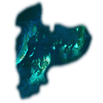
Where are the Dry Tortugas? Should you be wondering, at the western end of the Florida Keys. Located 68 miles west of Key West, they are accessible only by boat and of course via your favorite seaplane.
Source Data: National Agriculture Imagery Program (NAIP) Orthoimagery, 1 meter per pixel resolution. The scenery package also corrects the MS-FSX Island and Lighthouse position errors overlooked by UTX-USA and UTX-TAC.
For your finest virtual experience it is highly recommended you download, install and use with: South Florida and The Bahamas Water Class scenery. (S-FL_Bahamas_WC.zip)
Enjoy your flight and don't forget your Scuba Gear or the sunscreen! - Wally-Bob
| Filename: | The_Dry_Tortugas_Photo_Scenery.zip |
| License: | Freeware, limited distribution |
| Added: | 23rd August 2014, 11:08:17 |
| Downloads: | 918 |
| Author: | Walter Roberts |
| Size: | 50.9 MB |
| Category: Flight Simulator 2004 - Scenery | |
| Europe SRTM mesh Part 13: Western Spain & Portugal |
|
File Description:
Europe SRTM LOD9 mesh part 13 of 13: Covers Spain west of 4.5°W and Portugal.
This Europe SRTM project was optimized for the lowest HDD space use: Each part macthing exactly the boundaries of its neighbors, you'll have a complete corevage of Europe without gap or overlapping scenery. Based on SRTM Data v1 and v2 (3 arcsec, 90m) and sampled to LOD9 resolution (76m). Each SRTM tile was carefully checked and repaired with Blackart v4.02: water areas are now flattened (lighter mesh), and SRTM voids were treated taking advantage of Blackart's sophisticated interpolation algorithm. When required, biggest voids were patched with oversampled SRTM 30 arcsec data and/or manual input.
| Filename: | Europe_SRTM_mesh_Part_13_Western_Spain__Portugal.zip |
| License: | Freeware, limited distribution |
| Added: | 20th October 2005, 11:22:13 |
| Downloads: | 15,507 |
| Author: | Yohann Baptiste |
| Size: | 34.22 MB |


© 2001-2026 AVSIM Online
All Rights Reserved
Privacy Policy |