
Where Flight Simulation Enthusiasts Gather from Around the World!
AVSIM Library - Search Results

| Category: Flight Simulator 2004 - AI Aircraft | |
| Germanwings Fleet - Flightplans Summer 2008 |

|
File Description:
This is a complete AI package (repaints and flightplans) for Germanwings 2008. Included are 12 repaints of all variants, all named jets and all logo jets, but not all registrations. Color and form matched, no photo pastes (except T-Com). 28 of 29 Airbus A319-100 aircraft used in flightplans, leaving out D-AGWL as it's brand new. Also BAe 146-200 D-AMAJ not used, as it's operated by WDL Aviation (available seperately). All liveries in DXT3 and 32Bit, with correct lightmaps. Flightplans in plain TTools text format, as well as an MRAI compatible installer file for ease of installation. AI Airbus A319-100 model by Craig Ritchie (thank you for your kind permission), enhanced paintkit v5 and base textures by EvolveAI. If you prefer to use the EvolveAI model you need to rename the textures and the aircraft.cfg entries. Thanks for downloading and enjoy.
| Filename: | Germanwings_Fleet__Flightplans_Summer_2008.zip |
| License: | Freeware, limited distribution |
| Added: | 3rd August 2008, 10:49:14 |
| Downloads: | 1,538 |
| Author: | Dieter Barthelmeus |
| Size: | 11.09 MB |
| Category: Flight Simulator X - AFCAD Files | |
| Murtala Muhammed International Airport, Lagos (DNMM) Version 2 |
|
File Description:
Hi again fellow simmers....
This is an major update to my previous AFCAD on this famous West African airport.
Here are all its features:
- ILS offset fixed as well as some smaller details, like the fact that rwys 1L/1R are
permanently closed to take-off and landings.
- Corrected runway lightings/markings.
- DME on Rwy 19R now working.
- Right Hand Pattern Approach/Take-off only.
- Added correct amount of gates at the International Terminal with parking codes for airlines
that actually fly to DNMM (British Airways, Air France, KLM, Alitalia, Virgin Atlantic,
Virgin Nigeria, Sabena, Swiss, Afriqiya, Emirates, Qatar Airways, South African Airways and
more).
- Domestic Terminal fully laid out and functional with domestic airline parkinting codes
(Albarka, Chanchangi, ADC, Belleview, Kabo Air, etc).
- Cargo parking fully functional.
- Military parking (C130, MiG-21, MiG-29, Alpha Jet, Jaguar, Tornado).
To Install:
1. DELETE THE PREVIOUS 'AF2_DNMM.BGL' file from the 'Flight Simulator X/Addon
Scenery/scenery' folder.
2. Extract all files from the downloaded '.zip' file.
3. Now COPY the NEW 'AF2_DNMM.BGL' file and place it into 'Flight Simulator X/Addon
Scenery/scenery' folder.
4. Start up the Flight sim and the changes will be present.
READ THIS !!!
I've tried to the best of my ability to produce and much detail as possible but i'm sure
something has been left out (there always is).
I've used the latest Jeppesen charts and other materials at my disposal and even my own
eyesight at great risk to myself (yep, even pilots are restricted from certain places at
airports)
Also, lots of airports have changed drasticly on the past couple years like Abuja airport
(DNAA) and I would love to do justice to it as its fast becoming a major hub in the region. I
would be willing to join forces to with anyone that is good with AFCAD on this project.
Enjoy!
[email protected]
13:44 30/07/2007
| Filename: | Murtala_Muhammed_International_Airport_Lagos_DNMM_.zip |
| License: | Freeware |
| Added: | 30th July 2007, 19:44:57 |
| Downloads: | 3,279 |
| Author: | usman saleh |
| Size: | 7.38 MB |
| Category: Prepar3D V1-4 - Scenery | |
| KLVN - Airlake Airport - Lakeville, MN, USA |
|
File Description:
KLVN - Airlake Airport beta version .4 - by Jason Boche
This is an update of the default P3Dv4.5 KLVN airport. Aside from the original 12/30 runway, everything else at this airport has been completely ripped and replaced.
Enhancements include:
-Extended runway on each end to depict current configuration
-Accurate taxiways including Hamburg Ave. and buildings representing the current general aviation hangars
-Added navigational equipment on the field
-Added a few asphault and dirt service roads
-Added FBO and other buildings as close as I could match them
-Added some general aviation aircraft, civilians, vehicles at the FBO and hangars, and two fuel trucks
-Moved fuel station to where I believe it is currently according to Google maps with 100LL fuel trigger functional
-Moved the windsock to accurate location
-Moved the beacon to accurate location
-Moved GA parking spots
-Added trees around FBO and beacon
-Added utility poles
-Added a few square miles of Lakeville city, farm, and residential land class and autogen according to Google maps. This is probably the biggest improvement. It now looks like people live, work, and shop north/northwest of KLVN.
-Reworked the runway 12/30 blast pads to what I believe is the "proper" method. Instead of freehand polygon asphault, they are now actual runway extensions on both ends with yellow chevron markings
-Reworked the land class on the southwest end of the airport where I believe hangar expansion is intended. Prior to this, there was a sharp contrast between where the KLVN airport boundary ended and where generic farm landclass began which was right in the middle of the southwest taxiways and it looked bad. Now that whole region is grass and looks to be part of the airport parcel.
-Minor building adjustments west of the FBO to better match actual placement.
-Fixed a gap on the southeast end of Hamburg ave taxiway where it rounds the corner for the rwy 30 hold short line
-Randomized the directional facing of some of the cars parked at GA hangars
-Renumbered the parking spots 1-4 with #5 being the refueling spot
-Reversed the start direction of parking spots 1-3.
-Pulled the refueling parking "start" spot back because on start the engine cowling & prop were too far forward inside the fuel pump equipment
-Added an autogen exclusion to the rwy 12 short final due to trees popping up on short final path.
-KLVN tower viewpoint 25 meters above FBO.
-Removed the perimeter fence around the entire field
| Filename: | KLVN__Airlake_Airport__Lakeville_MN_USA.zip |
| License: | Freeware |
| Added: | 13th May 2020, 17:18:40 |
| Downloads: | 84 |
| Author: | Jason Boche |
| Size: | 14.81 KB |
| Category: Flight Simulator X - AFCAD Files | |
| KLVN - Airlake Airport - Lakeville, MN, USA |
|
File Description:
KLVN - Airlake Airport beta version .3 - by Jason Boche
This is an update of the default FSX KLVN airport. Aside from the original 12/30 runway, everything else at this airport has been completely ripped and replaced.
Enhancements include:
-Extended runway on each end to depict current configuration
-Accurate taxiways including Hamburg Ave. and buildings representing the current general aviation hangars
-Added navigational equipment on the field
-Added a few asphault and dirt service roads
-Added FBO and other buildings as close as I could match them
-Added some general aviation aircraft, civilians, vehicles at the FBO and hangars, and two fuel trucks
-Moved fuel station to where I believe it is currently according to Google maps with 100LL fuel trigger functional
-Moved the windsock to accurate location
-Moved the beacon to accurate location
-Moved GA parking spots
-Added trees around FBO and beacon
-Added utility poles
-Added a few square miles of Lakeville city, farm, and residential land class and autogen according to Google maps. This is probably the biggest improvement. It now looks like people live, work, and shop north/northwest of KLVN.
-Reworked the runway 12/30 blast pads to what I believe is the "proper" method. Instead of freehand polygon asphault, they are now actual runway extensions on both ends with yellow chevron markings
-Reworked the land class on the southwest end of the airport where I believe hangar expansion is intended. Prior to this, there was a sharp contrast between where the KLVN airport boundary ended and where generic farm landclass began which was right in the middle of the southwest taxiways and it looked bad. Now that whole region is grass and looks to be part of the airport parcel.
-Minor building adjustments west of the FBO to better match actual placement. Will only be shown on high scenery detail.
-Fixed a gap on the southeast end of Hamburg ave taxiway where it rounds the corner for the rwy 30 hold short line
-Randomized the directional facing of some of the cars parked at GA hangars
-Renumbered the parking spots 1-4 with #5 being the refueling spot
-Reversed the start direction of parking spots 1-3.
-Pulled the refueling parking "start" spot back because on start the engine cowling & prop were too far forward inside the fuel pump equipment
-Added an autogen exclusion to the rwy 12 short final due to trees popping up on short final path.
-KLVN tower viewpoint 25 meters above FBO.
-Removed the perimeter fence around the entire field
| Filename: | KLVN__Airlake_Airport__Lakeville_MN_USA.zip |
| License: | Freeware |
| Added: | 22nd November 2013, 23:26:10 |
| Downloads: | 225 |
| Author: | Jason Boche |
| Size: | 446.33 KB |
| Category: Prepar3D V1-4 - Aircraft Repaints, Textures and Modifications | |
| North American P-51D 4th FG (WD-M) 'Suzon' |
|
Images related to this file:
File Description:

This folder contains a repaint for the A2A WoP3 P-51D Mustang (with AccuSim), in the colors of P-51D-20-NA 44-63736 WD-M, which was the aircraft flown by Lt George Green of the 335th FS/ 4th FG on 18 march 1945 during a mission to Berlin. While the 335th was strafing Prenslau Aerodrome, Green's CO, major Pierce McKennon, was hit by flak and had to bail out. Green landed in the field where McKennon had come down with his parachute, threw out his parachute, and the two of them squeezed into the small Mustang cockpit, Green sitting on McKennon's lap. While the rest of the squadron kept the Germans at a distance, Green managed to get 'Suzon' airborne again with centimeters to spare. They flew the 600 miles back to the UK, sharing an oxygen mask. Green was promoted to Captain by a grateful CO. Repaint by Jan Kees Blom, based on the A2A paintkit.
| Filename: | North_American_P51D_4th_FG_WDM_Suzon.zip |
| License: | Freeware |
| Added: | 30th October 2018, 15:26:44 |
| Downloads: | 68 |
| Author: | Jan Kees Blom |
| Size: | 12.63 MB |
| Category: Flight Simulator X - Gauges | |
| GPS2020 – V12.0 |
|
Images related to this file:
File Description:
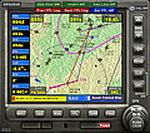
Major upgrade for V10.3, with focus on zooming, Direct-To, inserting waypoints in the flight plan, and User waypoints (waypoints not present in FSX/P3D database).
Key improvements:
- Zooming maps with the mouse wheel now finally like in Google Maps, Google Earth, Bing Maps, Garmin BaseCamp, Little Navmap (FSX utility), etc..
- Direct-To Track Updating: dark red track line continuously follows aircraft movements. For proper operation, the user should install XMLVARS/XMLTools in FSX/P3D (most users will already have done this).
- Visual indication of "Direct-To Active".
- Flight plan: multiple POI's (points clicked on a map) can be inserted in the FPL, they will be named sequentially as TARGET1 to TARGETnnnn.
- Inserting in the flight plan, all sorts of waypoints from all possible sources, can be done with a quicker method with the green buttons alone, without needing to open the Direct-To page.
- Other refinements in code and screen layout since V10.3.
It is recommended to replace V10.3 with this V12.0!
| Filename: | GPS2020__V120.zip |
| License: | Freeware |
| Added: | 29th June 2020, 17:50:18 |
| Downloads: | 560 |
| Author: | Hugo Jansen |
| Size: | 15.7 MB |
| Category: Flight Simulator X - Scenery | |
| X2MB - RAF Membury - Berkshire, England |
|
File Description:
RAF Membury (ICAO X2MB) is a former Royal Air Force station built in the civil parish of Lambourn in Berkshire, England. The airfield is located approximately 4.6 miles (7.4 km) mi north-northwest of Hungerford, at the Membury services stop of the M4 motorway; about 60 miles (97 km) miles west-southwest of London. The airfield also lies immediately next to the Iron Age hill fort of Membury Camp.
Opened in 1942, it was used by both the Royal Air Force (RAF) and United States Army Air Forces (USAAF). During the war it was used by several combat units with varying missions. It was also a major supply and maintenance depot. After the war, it was a private airport until the construction of the M4 motorway in the 1960s when it was closed.
Today the remains of the airfield are located on private property with the former technical site now being an industrial estate (Membury Business Park).
Source: Wikipedia
| Filename: | X2MB__RAF_Membury__Berkshire_England.zip |
| License: | Freeware |
| Added: | 7th April 2016, 17:26:37 |
| Downloads: | 126 |
| Author: | Terry Boissel |
| Size: | 1.63 MB |
| Category: X-Plane - Aircraft Repaints, Textures and Modifications | |
| Eurowings Airbus A320 |
|
Images related to this file:
File Description:
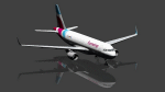
This is an X-Plane Eurowings A320 repaint for use with the payware A320 CFM by Peter Hager. Use the sharklet model. Version 1.1, details added.
Some Information by Wikipedia: Eurowings GmbH is a German low-cost airline headquartered in Düsseldorf and a fully owned subsidiary of the Lufthansa Group. It serves a network of domestic and European destinations as well as some long-haul routes and maintains bases at Berlin Tegel Airport, Cologne Bonn Airport, Düsseldorf Airport, Hamburg Airport, and Vienna International Airport.
Eurowings has gone through a major transformation in recent years. It was part of Lufthansa Regional until October 2014. At that time it began operating on behalf of Germanwings within their network. Since spring 2015, Eurowings has been redeveloped into a low-cost carrier for short- and long-haul flights. By October 2015, it had also started to incorporate Germanwings' route network as part of the merger of the two brands.
| Filename: | Eurowings_Airbus_A320.zip |
| License: | Freeware |
| Added: | 29th April 2017, 18:07:25 |
| Downloads: | 58 |
| Author: | Ralf Maylin |
| Size: | 12.96 MB |
| Category: X-Plane - Aircraft Repaints, Textures and Modifications | |
| Eurowings Airbus A320 (Winglets) |
|
Images related to this file:
File Description:
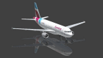
This is an X-Plane Eurowings A320 repaint for use with the payware A320 CFM by Peter Hager. Use the winglet model, this is an ex Air Berlin plane.
Some Information by Wikipedia: Eurowings GmbH is a German low-cost airline headquartered in Düsseldorf and a fully owned subsidiary of the Lufthansa Group. It serves a network of domestic and European destinations as well as some long-haul routes and maintains bases at Berlin Tegel Airport, Cologne Bonn Airport, Düsseldorf Airport, Hamburg Airport, and Vienna International Airport.
Eurowings has gone through a major transformation in recent years. It was part of Lufthansa Regional until October 2014. At that time it began operating on behalf of Germanwings within their network. Since spring 2015, Eurowings has been redeveloped into a low-cost carrier for short- and long-haul flights. By October 2015, it had also started to incorporate Germanwings' route network as part of the merger of the two brands.
| Filename: | Eurowings_Airbus_A320_Winglets.zip |
| License: | Freeware |
| Added: | 29th April 2017, 18:08:05 |
| Downloads: | 393 |
| Author: | Ralf Maylin |
| Size: | 12.91 MB |
| Category: Flight Simulator X - AFCAD Files | |
| Seiser Alm STOL and Gliding Area |
|
Images related to this file:
File Description:
Seiser Alm, is the largest high altitude Alpine meadow in Europe. Located in Italy's South Tyrol province in the Dolomites mountain range, it is a major tourist attraction, known for skiing and hiking.
This is a simple fun creation of a real world R/C sailplane and Para gliding site in the Italian Dolomites. There is no airport, no flatten so you must exercise caution when landing a STOL aircraft or sailplane. I have landed many types here including sailplanes and the FSDS Porter as well as a Cessna 185. The nearest real world airport is LIPD Bolzano. There are two landing areas represented one high is the actual site where R/C sailplanes with wingspans of up to 10 meters are launched into the air, as well as paragliders. .The lower field is a bonus area with a nice flat area for easier landings and take offs. It is the real world site of a famous ski lodge and resort.(look for the Chalet!)
| Filename: | Seiser_Alm_STOL_and_Gliding_Area.zip |
| License: | Freeware |
| Added: | 4th July 2014, 05:19:40 |
| Downloads: | 161 |
| Author: | Jon Davidson |
| Size: | 75.1 KB |


© 2001-2026 AVSIM Online
All Rights Reserved
Privacy Policy |