
Where Flight Simulation Enthusiasts Gather from Around the World!
AVSIM Library - Search Results

| Category: Prepar3D V1-4 - Scenery | |
| Sauze and Val Susa (TO) Italy N45.05.52 E7.20.35 to N45.02.01 E6.50.00 |

|
File Description:
Sauze and Val Susa (TO) Italy Abbey of San Michele della Chiusa, is an architectural complex perched on the summit of the Pirchiriano mountain, at the mouth of the valley of Susa N45.05.52 E7.20.35.
The Fort of Exilles, N45.05.59 E6.56.10 is one of the most important defensive systems in Piedmont. Its position in the middle of a stretch of the high Susa Valley made it a strategic one. Around the Fort were born through the centuries many legends, but perhaps the most famous of all, is that related to a mysterious character the Iron Mask, better described by Alexandre Dumas in the novel of the same name. The village of Sauze d'Oulx N45.02.01 E6.50.00 includes the old alpine village where a large circular hotel built in the 1960's as a holiday center for the FIAT workers in the nearby Turin and higher, the new part formed by villas and hotels. Important VFR points for approching airport airport Torino or Val di Susa.
Within the downloaded package you will find readme files for scenery installation. Good fly VFR. Pasquale Marrulli.
| Filename: | Sauze_and_Val_Susa_TO_Italy_N450552_E72035_to_N450201_E65000.zip |
| License: | Freeware |
| Added: | 4th November 2017, 16:47:39 |
| Downloads: | 175 |
| Author: | Pasquale Marrulli |
| Size: | 15.99 KB |
| Category: Prepar3D V1-4 - Scenery | |
| Valdez Alaska USA N61.06.53 W146.19.52 and Tatitlek Alaska USA N6052.00 W146.41.37 |
|
File Description:
Valdez Alaska USA N61.06.53 W146.19.52 The town is positioned at the head of a fjord on the eastern side of the Prince William Strait (at the end of the Valdez bay). It is surrounded by the Chugach mountains with many glaciers and peaks up to 2100 m above sea level. Although the northernmost port in North America is free of ice all year round. It is also the northernmost point of the Pacific coastal forest located in the 107-meter hill southwest of the town called Blueberry Hill. Valdez has an ICAO PAVD airport that in the scenario in addition to the city of Valdez you will also find a small village called Tatitlek Alaska USA N6052.00 W146.41.37 with related ICAO 7KA airport airports infrastructures have been improved with the addition of a port for landing ships and seaplanes on Valdez and Tatitlek. Important VFR point for approaching airport and seairport PAVD and 7KA.
Within the downloaded package you will find readme files for scenery installation. Good fly VFR. Pasquale Marrulli.
| Filename: | Valdez_Alaska_USA_N610653_W1461952_and_Tatitlek_Al.zip |
| License: | Freeware |
| Added: | 21st May 2018, 22:35:56 |
| Downloads: | 230 |
| Author: | Pasquale Marrulli |
| Size: | 3.27 MB |
| Category: Prepar3D V1-4 - Scenery | |
| Loreto Marche Italy N 43.26.27 E 13.36.36 |
|
File Description:
Loreto Marche Italy (N 43.26.27 E 13.36.36) Loreto is an Italian town in the province of Ancona in the Marche region
and is famous for being the headquarters of the Basilica of the Santa Casa, one of the most important and ancient places
of Marian pilgrimage in the Catholic world. The city rises on the top of a gentle hill, with a wide countryside around
characterized by the cultivation of the olive tree. The shape of the dome and the bell tower of the Basilica, whose
top is the figure of the Madonna, stands out for its height and majesty. The Basilica houses the famous relic of the
"Holy House" of Nazareth where, according to tradition, the Virgin Mary was born and lived where he received the
announcement of the miraculous birth of Jesus. The panorama that can be enjoyed ranges from the Adriatic Sea to Monte
Conero, up to the Umbrian-Marche Apennines. Important VFR point for approaching airport Ancona Falconara. Within the
downloaded package you will find readme files for scenery installation. Good fly VFR. Pasquale Marrulli.
| Filename: | Loreto_Marche_Italy_N_432627_E_133636.zip |
| License: | Freeware |
| Added: | 4th May 2018, 04:42:54 |
| Downloads: | 164 |
| Author: | Pasquale Marrulli |
| Size: | 19.22 KB |
| Category: Navigation and ATC - Navigation | |
| LSZS - Samedan visual approach chart v3 |
|
Images related to this file:
File Description:
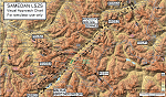
Custom made visual approach chart and pilot's briefing for Engadin (St. Moritz) Samedan LSZS airport in Switzerland, Europe's highest elevation airport (5,600 ft.) situated in the Swiss Alps. This airport is a day VFR operations only and has no instrument approach due to extreme terrain around it. A demanding visual descent into a canyon, in between steep rising terrain, is required to make the visual approaches for both runways with a steep 4.4* degrees final approach portion guided by the PAPI's. Still, executive jets up to Boeing 737(BBJ) size approach the airport often in the winter peak season VFR with these procedures. It is designed as per real operators' pilot briefing for Samedan. Real airport's full pilot briefing document also included. The real airport's excellent briefing (included) intentionally does not contain the maneuvers needed for the approach of jets through the mountains but only reporting points for all and maneuvers for light aircraft only. This gap is what this chart covers. Version 2 chart included better graphics and refined visual procedure for jets and version 3 now includes real pilot's briefing guide.
| Filename: | LSZS__Samedan_visual_approach_chart_v3.zip |
| License: | Freeware, limited distribution |
| Added: | 20th March 2015, 23:35:11 |
| Downloads: | 2,026 |
| Author: | Kyprianos Biris |
| Size: | 7.1 MB |
| Category: Flight Simulator 2002 - Scenery | |
| EGGP Liverpool John Lennon Airport V3.1 |
|
File Description:
This new version has come about as a result of over a month sitting in front of Paint Shop Pro! All the textures have been redone including the night textures (If anyone knows how to light up AI aircraft then I'd love to hear from them!).
Many new macros have been created and hence the airport now has a lot more buildings! The railway bridge has been finished and I've also created my own version of the road bridge.
I've switched tree creation to GroundMaker as this was less frame rate hugging and allowed what I consider to be a more realistic representation of the wooded areas around the airport.
The scenery is aligned to the Visual Flight / Getmapping VFR Scenery published by Just Flight and has been specifically designed to complement the add-on. You do not however need the VFR scenery to use these files!
This scenery forms part of the "UK2002 Scenery Project" co-ordinated by John Woodside - http://fsaviation.net/. Thanks also go to John and to Peter Leadbeater for the information they have supplied to me regarding the airport
| Filename: | EGGP_Liverpool_John_Lennon_Airport_V31.zip |
| License: | Freeware |
| Added: | 22nd March 2003, 02:36:29 |
| Downloads: | 2,824 |
| Author: | Paul Derbyshire |
| Size: | 3.67 MB |
| Category: Prepar3D V1-4 - Scenery | |
| Porto Santo Stefano Italia Coordinate N42.26.14 E 11.06.90 |
|
File Description:
Porto Santo Stefano is the capital of the Italian town of Monte Argentario, in the province of Grosseto, Tuscany. Italy. Renowned tourist resort of great seafaring tradition situated on the northwest coast of Argentario. It is an active shopping, fishing and beach resort overlooking a bay dominated by the Spanish Fortress. Great VFR point for Piombino or Elba Island. Within the package you will find instructions for installing the scenario that is also compatible with P3d. Good flight. Pasquale Marrulli
| Filename: | Porto_Santo_Stefano_Italia_Coordinate_N422614_E_11.zip |
| License: | Freeware |
| Added: | 29th September 2017, 16:53:47 |
| Downloads: | 206 |
| Author: | Pasquale Marrulli |
| Size: | 3.03 KB |
| Category: Flight Simulator 2004 - Scenery | |
| Sakhir Airbase (OBKH) and F1 Circuit, Bahrain |
|
File Description:
This is a rework of the original Afcad2 file for Sakhir Airbase (OBKH) made by Chris Doehring.
The file will add the Sakhir Airbase, which is missing in FS2004, and the racetrack where the 2010 F1 season started.
The track is located west of the airfield at a very short distance, and it will provide a good reference for those who like VFR flying besides being a nice eye-candy.
Many thanks to Chris Doehring for allowing me to upload this file.
| Filename: | Sakhir_Airbase_OBKH_and_F1_Circuit_Bahrain.zip |
| License: | Freeware |
| Added: | 18th March 2010, 16:56:57 |
| Downloads: | 1,459 |
| Author: | Chris Doehring, Giacomo Gramazio |
| Size: | 233.66 KB |
| Category: Flight Simulator X - Flight Plans | |
| Out To Grass UK |
|
File Description:
Out To Grass (OTG) is a series of ten flight plans covering most of England and using only grass airfields. The flights, each having several legs, are intended to exploit the VFR Photographic Scenery X and the UK2000 Scenery airfields for the three areas covering England. Full briefings are included describing the areas and airfields visited, along with some help with the flying. The Readme has full instructions for installation and recommendations for freeware add-ons required. By Gordon Wilkinson.
| Filename: | Out_To_Grass_UK.zip |
| License: | Freeware |
| Added: | 29th April 2012, 21:22:13 |
| Downloads: | 278 |
| Author: | Gordon Wilkinson |
| Size: | 431.62 KB |
| Category: Flight Simulator X - Scenery | |
| Anthorn VLF Transmitter - Cumbria, UK |
|
File Description:
Formerly RNAS Anthorn until 1958, work began on the VLF Transmitter in 1962.
Work was completed in 1964 and the station was accepted by the MoD the same year.
This Scenery depicts only the masts and thier lights, I have not modelled any of the site buildings.
It works well enough in FSX Accelleration with Horizon VFR Scenery.
I have not tested it in any other FSX versions though I suspect it will work fine.
For image of the scenery please use "ZipDive".
| Filename: | Anthorn_VLF_Transmitter__Cumbria_UK.zip |
| License: | Freeware |
| Added: | 23rd December 2015, 12:34:09 |
| Downloads: | 397 |
| Author: | Mark Byers |
| Size: | 1.61 MB |
| Category: Flight Simulator 2004 - Scenery | |
| Québec Short Hops - Île-aux-Coudres |
|
File Description:
Ile-aux_Coudres is a lovely island situated in the St.Lawrence River some 40nm downstream from Québec City. It has lots of candies and reproduction of historical buildings and landmarks. I think it has an exclusive first in FS, the runway is lit with kerosene pots for night flying as it was years ago. With these sceneries, ideal for the VFR pilot. you will be able to hop form one field to the other following the lighthouses' beacons and other aids.
| Filename: | Qubec_Short_Hops___leauxCoudres.zip |
| License: | Freeware |
| Added: | 5th November 2003, 20:03:41 |
| Downloads: | 2,290 |
| Author: | Léon Louis |
| Size: | 5.33 MB |


© 2001-2026 AVSIM Online
All Rights Reserved
Privacy Policy |