
Where Flight Simulation Enthusiasts Gather from Around the World!
AVSIM Library - Search Results

| Category: Flight Simulator 2004 - Scenery | |
| Mt Taranaki/Egmont, NZ, Photoreal Scenery |

|
File Description:
40 x 50 kilometres of photo-real scenery. Fully autogenned, daytime summer textures only. (It will display throughout the year though.)
This showcases the amazing volcanic Mt Taranaki. Like many New Zealand mountains it has both a Maori and European name. Mt Taranaki dominates the Taranaki landscape, and is a spectacular example of of how the central North Island has been effected by volcanic activity.
This is a remake of the original Godzone Taranaki scenery adjusted to match the new elevaton meshes. It is best with the Geographx 20m elevation mesh, and the minimum recommended mesh is the Geographx 75m.
| Filename: | Mt_TaranakiEgmont_NZ__Photoreal_Scenery.zip |
| License: | Freeware, limited distribution |
| Added: | 16th January 2006, 05:57:36 |
| Downloads: | 4,876 |
| Author: | Robin Corn |
| Size: | 40.09 MB |
| Category: Flight Simulator X - Scenery | |
| Nellis Air Force Base - KLSV |
|
File Description:
This file contains several BGL's which enhance the default
FSX Nellis Air Force Base (KLSV ). I have added some
ramp parking for miltary aircraft. Additionally, I have added several
scenery objects to enhance the visual experience.
The other change I made was to eliminate the "mesa effect" caused by
the stock FSX airport as it sits above/below the surrounding
terrain using "sloped flattens" to blend the airport level
terrain into the surrounding terrain.
I am using the "FSX Usa 10 M terrains Project - West Coast Version 1.1"
mesh but the default FSX mesh should blend O.K.
| Filename: | Nellis_Air_Force_Base__KLSV.zip |
| License: | Freeware |
| Added: | 21st December 2007, 04:37:40 |
| Downloads: | 3,344 |
| Author: | Paul Strogen |
| Size: | 855.47 KB |
| Category: Flight Simulator X - Scenery | |
| Paulinia S.P. - Complement to Americana S.P. 4/5 |
|
File Description:
4/5 - This is the complement of Americana to cover all region taht include the lake Praia Azul. This scenery is composed by five parts. Folow instructions on Readme.txt and have a nice visual flight. Is a good idea install the FSX Mesh South America parts F7 and F8 cordinates in the map to have the essential mesh terrain. There is a link to download:
www.ceaero.com.br/meshxsa/dowsa.html
Other pack that you need install if want to see all hangars in SDAI Aeroclube de Americana,
is the STATIC BJECTS LIBRARY found on RWY12 OBJECTS PLACER found in http://www.rwy12.com/rwy12/
| Filename: | Paulinia_SP__Complement_to_Americana_SP_45.zip |
| License: | Freeware |
| Added: | 8th June 2008, 14:09:41 |
| Downloads: | 1,456 |
| Author: | Gilson A. Rocchetti |
| Size: | 71.84 MB |
| Category: Flight Simulator 2004 - Scenery | |
| Madrid Barajas from 2005 onwards |
|
Images related to this file:
File Description:
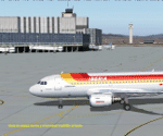
Madrid Barajas FS9 standalone airport, to substitute/update the original FS9 version with the actual 4 RWY operation and two new terminals. Resubmitted at libarian's request. You MUST have a good mesh for spanish terrain, otherwise this scenery won't look good. May I suggest a visit to AirHispania L.A.V. web site, www.airhispania.com, for a free download of their mesh from the scenery section, under "Publicaciones" (publications). Based on LEMDGB from the Zafra brothers original work to complement/update Simwings original Madrid airport, and published with their permission, this version does not require any payware. Taxiway signs now obsolete. Enjoy . Fernando de la Portilla
| Filename: | Madrid_Barajas_from_2005_onwards.zip |
| License: | Freeware |
| Added: | 21st February 2010, 01:45:52 |
| Downloads: | 8,202 |
| Author: | Fernando de la Portilla |
| Size: | 804.05 KB |
| Category: Flight Simulator 2002 - Scenery | |
| NY-New York City, Central Park Area Terrain Mesh (10m) |
|
File Description: Take a break and enjoy Sunday afternoon in the park. This high resolution mesh demonstrates the amount of detail FS2002 is able to display. But you will not see any improvement in the park if you are still using the default value of TERRAIN_MAX_VERTEX_LEVEL=19 (in the [TERRAIN] section) of your fs2002.cfg file! This value is adequate for the default mesh, but will not display all the additional detail available in mesh constructed from 30m or better source data. I recommend a value of 21 for the most detail, but a value of 20 may be preferable if FPS is a serious problem. Hop in your favorite helicopter, depart from La Guardia (KLGA) airport, and head west toward the city. (If you are new to helicopters, set your Aircraft realism to Easy and turn off Crash Detection while getting started - and relax in this scenic park!)
| Filename: | NYNew_York_City_Central_Park_Area_Terrain_Mesh_10m.zip |
| License: | Freeware, limited distribution |
| Added: | 21st July 2002, 17:35:04 |
| Downloads: | 2,845 |
| Author: | Steve Greenwood |
| Size: | 1017.33 KB |
| Category: Flight Simulator 2002 - Scenery | |
| Mount Rushmore National Memorial Area 10 M Mesh |
|
File Description:
One of America's most well-known sights, the Mount Rushmore National Memorial is located at Keystone about 35 miles from Rapid City. The granite sculptures of the heads of George Washington, Thomas Jefferson, Abraham Lincoln and Theodore Roosevelt were constructed between 1927 and 1941. Visitors can partake in ranger or self-guided tours of the mountain sculpture. Stroll along the presidential trail for an 'up-close' look. The sculptors studio contains some original sketches of the designs for the mountain. This park also contains the Lincoln Borglum Museum and a visitor's information center. Now you too - can visit the Area with Detailed 10 M mesh Terrain. Designed with Usgs 10 m dem - offers a high level of terrain Details. Coverage: N44.1132 W103.7383 - N43.7531 W103.2562.
| Filename: | Mount_Rushmore_National_Memorial_Area_10_M_Mesh.zip |
| License: | Freeware |
| Added: | 6th September 2002, 02:34:43 |
| Downloads: | 1,969 |
| Author: | Raimondo Taburet |
| Size: | 1.98 MB |
| Category: Flight Simulator 2004 - Scenery | |
| Europe SRTM mesh Part 13: Western Spain & Portugal |
|
File Description:
Europe SRTM LOD9 mesh part 13 of 13: Covers Spain west of 4.5°W and Portugal.
This Europe SRTM project was optimized for the lowest HDD space use: Each part macthing exactly the boundaries of its neighbors, you'll have a complete corevage of Europe without gap or overlapping scenery. Based on SRTM Data v1 and v2 (3 arcsec, 90m) and sampled to LOD9 resolution (76m). Each SRTM tile was carefully checked and repaired with Blackart v4.02: water areas are now flattened (lighter mesh), and SRTM voids were treated taking advantage of Blackart's sophisticated interpolation algorithm. When required, biggest voids were patched with oversampled SRTM 30 arcsec data and/or manual input.
| Filename: | Europe_SRTM_mesh_Part_13_Western_Spain__Portugal.zip |
| License: | Freeware, limited distribution |
| Added: | 20th October 2005, 11:22:13 |
| Downloads: | 15,508 |
| Author: | Yohann Baptiste |
| Size: | 34.22 MB |
| Category: Flight Simulator 2004 - Scenery | |
| Bella Coola Valley Terrain Mesh and Scenery Enhancements |
|
File Description:
One of the most spectacular watersheds of British Columbia's Midcoast, the Bella Coola Valley looks pretty boring in its default FS rendition. These files provide a LOD10 (38-m) mesh made from CDED1 0.75-arcsec data, a new landclass file, and accurate placements of lakes, rivers, streams, and roads. Also includes the glaciers of the Monarch Mt. Icefield and several forestry roads and clearcuts along the side valleys. Made with Ground2K4 based on Landsat 7 ETM+ satellite imagery.
| Filename: | Bella_Coola_Valley_Terrain_Mesh_and_Scenery_Enhanc.zip |
| License: | Freeware, limited distribution |
| Added: | 1st April 2004, 20:49:32 |
| Downloads: | 8,871 |
| Author: | Holger Sandmann |
| Size: | 20.74 MB |
| Category: Flight Simulator 2004 - Scenery | |
| Glen Canyon / Lake Powell, Utah 38m Terrain Mesh |
|
File Description:
USGS SRTM30 1 arc-second, resampled to LOD10 (38.2 meters).
This high-resolution terrain mesh is centered at Glen Canyon
National Recreation Area in south-eastern Utah. Coverage area:
From West -111.6° to West -110.2° and North 36.8° to North 38.0°.
It includes the National Recreation Area with Lake Powell,
Navajo Mountain, the Henry Mountains, parts of Capitol Reef
National Park / Grand Staircase Escalante National Monument,
the town of Page in northern Arizona and surrounding areas.
| Filename: | Glen_Canyon__Lake_Powell_Utah_38m_Terrain_Mesh.zip |
| License: | Freeware, limited distribution |
| Added: | 25th January 2004, 20:30:45 |
| Downloads: | 5,420 |
| Author: | Andreas Trawny |
| Size: | 8.31 MB |
| Category: Flight Simulator 2002 - Scenery | |
| Terrain Mesh for Canada's Maritime Provinces (2/2) |
|
File Description:
Re-upload. The files in this package contain a new 76m (LOD09) terrain mesh for Canada's Maritime Provinces. The source data is the Shuttle Radar Topography Mission (SRTM-3, 90m). All data were compiled and edited in MicroDEM 6.02, converted with BIGBSQ and resampled to LOD (Level of Detail) 9, or 76.4 meters horizontal resolution, with the Microsoft Terrain Software Developer's Kit (SDK) utilities. Two parts : Maritimes09a.zip and Maritimes09b.zip.
| Filename: | Terrain_Mesh_for_Canadas_Maritime_Provinces_22.zip |
| License: | Freeware, limited distribution |
| Added: | 29th January 2010, 00:42:41 |
| Downloads: | 238 |
| Author: | Gilles Gauthier |
| Size: | 23.59 MB |


© 2001-2026 AVSIM Online
All Rights Reserved
Privacy Policy |