
Where Flight Simulation Enthusiasts Gather from Around the World!
AVSIM Library - Search Results

| Category: Flight Simulator 2004 - Scenery | |
| Terrain Mesh of Glacier National Park |

|
File Description:
New and updated scenery enhancements for the mountain ranges of southeastern British Columbia and parts of the Alberta Rocky Mountains. They require an existing installation of my files bcmesh9d.zip and/or bcmesh9e.zip. Scenery coverage follows the Trans-Canada Highway from Banff National Park to west of Revelstoke (~350km), with accurate transportation network, rivers and lakes, hydro dams, ski hills, glaciers, and landclass/waterclass updates based on satellite imagery. Also, similar enhancements to the parks and towns of the southern Kootenay, Selkirk, and Monashee mountains. The mesh source data are 0.75-arcsec (~23-m) CDED files, compiled at LOD10 (38-m) resolution. Due to significant changes in FS2004 to vector layering and autogen features, the special scenery enhancements cannot be used with FS2002. However, terrain mesh, new lakes and land/waterclass replacements will work well in FS2002.
| Filename: | Terrain_Mesh_of_Glacier_National_Park.zip |
| License: | Freeware, limited distribution |
| Added: | 18th December 2003, 23:17:35 |
| Downloads: | 8,858 |
| Author: | Holger Sandmann |
| Size: | 12.79 MB |
| Category: Flight Simulator 2004 - Scenery | |
| Turkey Mesh SRTM V2, Part II |
|
Images related to this file:
File Description:
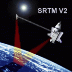
SRTM Version 2 is the result of a substantial editing effort by the National Geospatial Intelligence Agency and exhibits well-defined water bodies and coastlines and the absence of spikes and wells.
| Filename: | Turkey_Mesh_SRTM_V2_Part_II.zip |
| License: | Freeware |
| Added: | 25th January 2011, 14:32:45 |
| Downloads: | 2,883 |
| Author: | Tuncer Celik |
| Size: | 79.06 MB |
| Category: Flight Simulator X - Scenery | |
| Slovenia - LOD11 (19 meters resolution) Mesh |
|
Images related to this file:
File Description:

Slovenia, no matter how small, is a country with wide variety of landscapes.
From flat lands in the North-Eastern part one can see lovely rolling hills in
southern regions and razor sharp edges of 8500 ft peaks of the Alps in the
North-Western region.
SRTM elevation data that was used and is provided as default FS X terrain simply
can't cope with the task of representing our terrain in at least a little close
to reality manner, shapes and altitudes of some of our nicest peaks are deformed
beyond recognition, our highest mt. Triglav is with 38 meters SRTM mesh falling
short by almost 3000 ft!
So Slovenia Scenery Team developed this 19 meters resolution using FSX compatible
tools for it's payware scenery, but after development of even finer mesh with 10
meters resolution, we decided to offer the original 19 meters mesh to general
fligt simulation public. Mesh is FS X only and is not compatible with FS9.
Even if released as freeware, this files were uploaded to only some selected
flight simulation sites and redistribution of this scenery is not allowed without
written permission from the authors.
File is packed into a convenient installer that should perform all of the actions
automatically, but, please, do read the License agreement and "Read me" file
included in the installation.
| Filename: | Slovenia__LOD11_19_meters_resolution_Mesh.zip |
| License: | Freeware, limited distribution |
| Added: | 15th May 2012, 19:03:19 |
| Downloads: | 2,215 |
| Author: | SST - Slovenia Scenery Team |
| Size: | 45.15 MB |
| Category: Flight Simulator 2004 - Scenery | |
| ACAPULCO MEXICO AIRPORT AND MESH (UPDATE). |
|
File Description:
This update includes movement to RADAR and some BUSES in the airport.
And other small changes for greater realism.
| Filename: | ACAPULCO_MEXICO_AIRPORT_AND_MESH__UPDATE.zip |
| License: | Freeware |
| Added: | 15th September 2005, 22:07:20 |
| Downloads: | 7,215 |
| Author: | Dr. José Luis Águila Boudib. |
| Size: | 348.58 KB |
| Category: Flight Simulator 2004 - Scenery | |
| Turkey Mesh, Part 1 of 5 |
|
File Description:
Created from 3 arc second data and re-sampled @LOD9 (best fit for this data). The created area extends from N35E025 (lower left corner) to N44E047 (upper right corner). You need all the five bgl-files plus the two correction files to cover the whole area. Otherwise you will have only a coverage of the corresponding file. Matthew Style's SRTM_3ARCSEC_TO_BGL program was used to interpolate the srtm data and automate the bgl file creation (Many Thanks to Matthew for his great utility).
| Filename: | Turkey_Mesh_Part_1_of_5.zip |
| License: | Freeware |
| Added: | 15th February 2010, 09:30:31 |
| Downloads: | 12,000 |
| Author: | Abdulkadir Ozturk |
| Size: | 31.29 MB |
| Category: Flight Simulator 2004 - Scenery | |
| Turkey Mesh SRTM V2, Part I |
|
Images related to this file:
File Description:

SRTM Version 2 is the result of a substantial editing effort by the National Geospatial Intelligence Agency and exhibits well-defined water bodies and coastlines and the absence of spikes and wells.
| Filename: | Turkey_Mesh_SRTM_V2_Part_I.zip |
| License: | Freeware |
| Added: | 25th January 2011, 14:32:24 |
| Downloads: | 3,448 |
| Author: | Tuncer Celik |
| Size: | 88.4 MB |
| Category: Flight Simulator 2004 - Scenery | |
| Israel SRTM 90m Mesh Ver. 1.0 |
|
File Description:
Finally, VFR/CVFR pilots are able to enjoy the tall peaks of the Hermon mountain, the Golan heights and the ravines of the Western slopes of the Carmel mountains, the road to Jerusalem and the sub-sea level features of the Sea of Galilee and the famous Dead Sea.
The Negev Desert can finally show off its fascinating topography which includes, among others, the Small Crater and Ramon Crater whose features are clearly visible from space. There are many canyons, ravines, dry streams and other dramatic ground landscapes which can make a Negev Dessert VFR Expedition quite exciting. The trip could end at Eilat. Now you can see this well known touristic resort, bordered on the West and East by the tall and rugged mountains which have been among its more typical features.
| Filename: | Israel_SRTM_90m_Mesh_Ver_10.zip |
| License: | Freeware, limited distribution |
| Added: | 23rd April 2004, 12:54:03 |
| Downloads: | 12,092 |
| Author: | Alexander Lawrence |
| Size: | 7.26 MB |
| Category: Flight Simulator 2004 - Scenery | |
| Wairoa Airport - NZWO |
|
Images related to this file:
File Description:

Northern Hawkes' Bay. Made for Christian Stock's NZ mesh in the form of "Mountains of New Zealand" and topo in the form of "Lakes and Rivers of New Zealand".
| Filename: | Wairoa_Airport__NZWO.zip |
| License: | Freeware |
| Added: | 18th January 2011, 05:57:56 |
| Downloads: | 306 |
| Author: | Godfrey Tier |
| Size: | 1.74 MB |
| Category: Flight Simulator 2002 - Scenery | |
| Fix for Aosta LIMW |
|
File Description:
FS2002 Fix for Aosta LIMW FS2000 scenery of Franco Busu & Domenico Peracchione (limw.zip)
It makes apron and taxiways smooth for taxiing and it corrects apron area mesh terrain overlay.
| Filename: | Fix_for_Aosta_LIMW.zip |
| License: | Freeware |
| Added: | 16th October 2002, 11:52:18 |
| Downloads: | 1,321 |
| Author: | Kyprianos Biris |
| Size: | 526.74 KB |
| Category: Flight Simulator 2002 - Utilities | |
| Ground2K patch V.04 |
|
File Description:
The patch V.04 allows more than 260 re-mesh points per area (LOD13);
Upper limit not known.
This patch is compatible with older versions.
Unzip and replace ground2K.exe
| Filename: | Ground2K_patch_V04.zip |
| License: | Freeware |
| Added: | 12th May 2003, 12:18:03 |
| Downloads: | 1,520 |
| Author: | Christian Fumey |
| Size: | 308 KB |


© 2001-2026 AVSIM Online
All Rights Reserved
Privacy Policy |