
Where Flight Simulation Enthusiasts Gather from Around the World!
AVSIM Library - Search Results

| Category: Flight Simulator 2004 - Scenery | |
| UUEE Moscow Sheremetyevo 2015 DEMO |

|
Images related to this file:
File Description:
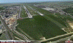
UUEE MOSCOW SHEREMETYEVO 2015 DEMO is a scenery of UUEE Sheremetyevo airport in Moscow, Russia, fully compatible with FS2004.
This product is a fully functional DEMO version of the commercial payware product. Most objects are modelled as in the full version but covered with low resolution textures. Using this free demo ensures no problems with online (VATSIM, IVAO, multiplayer etc.) flying in case some users use the payware scenery and some don't.
Moscow is the capital city and the most populous federal subject of Russia. The city is a major political, economic, cultural and scientific center in Russia and in Eastern Europe. Sheremetyevo International Airport (SVO/UUEE) is an international airport located in Khimki, Moscow Oblast. It is a hub for passenger operations of the Russian international airline Aeroflot, and is one of the three major airports that serve Moscow, along with Domodedovo International Airport and Vnukovo International Airport
The product is equipped with an automatic installer, which means that the scenery will be automatically added to the Flight Simulator Scenery Library. Please uninstall all previous versions of this airport you may have installed before. Please make also sure that no duplicated AFCAD files are installed.
Enjoy your virtual flying with Drzewiecki Design!
| Filename: | UUEE_Moscow_Sheremetyevo_2015_DEMO.zip |
| License: | Commercial demo |
| Added: | 4th April 2016, 21:52:46 |
| Downloads: | 850 |
| Author: | Drzewiecki Design |
| Size: | 13.68 MB |
| Category: Flight Simulator X - Scenery | |
| CVN68_Carrier_North Sea_V1 |
|
Images related to this file:
File Description:
This scenery is based on the great CVN 68 Nimitz carrier model from Javier Fernandez.
The scenery shall replace my current CVN 75 scenery in the North Sea.
The scenery includes the following scenery elements, objects and dynamic traffic:
The carrier CVN 68 Nimitz and a lot of stuff on deck, 2 flying Helicopters over the Carrier,
4 Navy-Destroyers escorting the Carrier, 2 moving Destroyer based on a "Boats Traffic Plan
which are traveling around the group, 1 moving Tanker,a Oilrig about 30 nm northwest from the Carrier with a landable Platform !!
Seven F-18 Hornets as AI traffic, three F-18 Hornets based on recorded flights.
For the re-play of the start and landing traffic, the tool FSRecorder is required. The tool is part of this scenery package.
The carrier is built up as an airport with the code " CV68 ".
For installation and more info see the documentation inside the zip file.
For full carrier operation (catapul/cable catch) you need one of the two tools: RCBCO-30.zip, or ArrCab26.zip both available at the AVSIM lib.
CREDIT goes to :Javier Fernandez for his super great carrier model and to
Matthias Neusinger for his excellent FSRecorder tool.
| Filename: | CVN68_Carrier_North_Sea_V1.zip |
| License: | Freeware |
| Added: | 2nd June 2010, 01:37:06 |
| Downloads: | 2,919 |
| Author: | Dietmar Loleit |
| Size: | 32.58 MB |
| Category: Prepar3D V1-4 - Scenery | |
| NEW YORK CITY X DEMO |
|
Images related to this file:
File Description:

NEW YORK CITY X DEMO features a detailed scenery of New York city in the United States of America, fully compatible with FSX, FSX STEAM, P3D v1/v2/v3/v4 and FSW by Dovetail.
A demo version of New York City X is provided. This is a fully functional freeware scenery, perfectly aligned with the full payware version. This ensures no problems with online (VATSIM, IVAO and multiplayer) flying in case some users have the payware scenery and some don't. The demo gives you the most important (largest) downtown buildings with a low quality photoreal ground for Manhattan area, as well as low quality heliports.
This scenery add-on features 2500 sq km of terrain with autogen and over 6100 photoreal New York buildings in the city, which is the most populous in the United States and the center of the New York Metropolitan Area, one of the most populous urban agglomerations in the world.
The product is equipped with an automatic installer, which means that the scenery will be automatically added to the Flight Simulator Scenery Library.
Please uninstall all previous versions of similar sceneries you may have installed before. Please make also sure that no duplicated AFCAD files are installed.
Enjoy your virtual flying with Drzewiecki Design!
| Filename: | NEW_YORK_CITY_X_DEMO.zip |
| License: | Freeware |
| Added: | 10th August 2017, 18:06:09 |
| Downloads: | 698 |
| Author: | Drzewiecki Design |
| Size: | 25.8 MB |
| Category: Flight Simulator X - Scenery | |
| TNCB - Flamingo Airport (Bonaire) |
|
File Description:
Welcome to one of the 3 ABC's beautifull dutch island, Bonaire.
Flamingo Intl. is an international airport located at Kralendijk, Bonaire, Netherlands Antilles. Flamingo Airport serves as a connecting
point for flights of KLM to some destinations in South America. It once served as a hub for BonaireExel, BonaireExpress,CuraçaoExel,
CuraçaoExpress and now serves Dutch Antilles Express as it's secondary hub & also "EZAir" serves Bonaire as its main airline, although
the airline itself is based at Curaçao.
It is the 3rd largest airport in the Netherlands Antilles behind St.Maarten's Princess Juliana International Airport & Curaçao's Hato
International Airport and is the 4th largest between the islands of the Dutch Kingdom behind the already mention St. Maarten,
Curaçao & Aruba's Queen Beatrix International Airport. Arkefly, Continental, Delta & KLM are currently the largest airline operators
that operate flights to Bonaire.
The airport is large enough to accommodate most international widebody airliners such as the Boeing 747, the Boeing 777 and the
Airbus A340, although the largest widebody type to operate to Bonaire today is the MD11. It can also accommodate medium sized
aircraft such as the Boeing 737 and Airbus A310 as well as small aircraft such as the de Havilland Dash 8, ATR 42 and other such
turboprop aircraft.
| Filename: | TNCB__Flamingo_Airport__Bonaire.zip |
| License: | Freeware |
| Added: | 13th April 2009, 08:00:18 |
| Downloads: | 2,343 |
| Author: | Daniel Louvet |
| Size: | 1.01 MB |
| Category: Flight Simulator 2004 - Scenery | |
| Peawanuck CYPO / Winisk CYWN - Northern Ontario, Canada |
|
Images related to this file:
File Description:
Peawanuck is on the bank of the Winisk River, 23 miles upstream from where the river empties into the Hudson Bay just west of James Bay. It has a population of around 240, and was established in 1986 when the original settlement (Winisk) at the mouth of the river was destroyed by a flood. The airport is on a bluff in a corner of the river at 171 feet ASL, with a gravel runway just over 3,500 feet long and aligned 11-29. There is only basic runway lighting, with no ILS, VASI, or PAPI; there is also no apron lighting, or fuel. Service is provided by Air Creebec with connector flights to Moosonee and Timmins, and on to Montreal. A search of their timetable did not provide any information regarding timings but I made the AI flight from Timmins a daily one; it is probably only once or twice a week. There is also a daily private Cessna from Moosonee. Winisk, at the mouth of the river, has another gravel runway which is over 6,000 feet long. There is also a large hangar and to the north the remaining buildings and fuel tanks etc of a Radar Control site which was closed in 1965 after only 7 years of use.
| Filename: | Peawanuck_CYPO__Winisk_CYWN__Northern_Ontario_Cana.zip |
| License: | Freeware, limited distribution |
| Added: | 29th December 2012, 09:14:03 |
| Downloads: | 281 |
| Author: | Roger Wensley |
| Size: | 2.61 MB |
| Category: Flight Simulator 2004 - Scenery | |
| PAAT (ATU) - Attu - Alaska, USA |
|
Images related to this file:
File Description:
Attu is AT the western end of the Aleutian chain of islands in Alaska, around 40 miles west of Shemya. There was small village on Attu before the Japanese invasion in mid 1942, but the island is now uninhabited. The Coast Guard Loran navigation station remains in place, though it is no longer in operation and visitors to the island are now either tourists or wildlife experts conducting surveys of numbers of nesting birds, etc. The runway still usable is aligned 02-20 and 5,800 feet long; right hand circuits on 02 to stay away from rising ground to the west. The "terminal" building has lost its sign regarding the Horny Bird, removed in 2010 by one of the last of the station operators, but the building is still there, as are some sheds and shacks that lately were used for the uncomfortable accommodation of bird counters. FS9 has used an incorrect icao identification for Attu but correcting it now would make life complicated so ATU it is and shall remain. I have removed the default FS9 roads that came complete with streetlights and telephone poles and replaced and amended the layout with gravel roads to better resemble real life, though the island shape is at best approximate, as is usual in FS9.
| Filename: | PAAT_ATU__Attu__Alaska_USA.zip |
| License: | Freeware, limited distribution |
| Added: | 2nd March 2015, 20:58:09 |
| Downloads: | 280 |
| Author: | Roger Wensley |
| Size: | 3.27 MB |
| Category: Flight Simulator 2004 - Scenery | |
| Cape Hooper CWFH and FOX-4 DEW Line Station in Nunavut, Canada |
|
Images related to this file:
File Description:
Cape Hooper is around 60 miles north of Kivitoo (FOX-D) and 140 miles south of Clyde River CYCY on the northeast-facing coast of Baffin Island. FOX-4 is still in use as a new and mostly-unmanned North Warning System site was established there in 1990 before the DEW line station was closed in 1991. Actually the DEW line station was not "closed" as such, they just stopped using it. The site of FOX-4 is on the top of a bump at the end of one of many long promontories that stick out into the Davis Strait between Baffin Island and Greenland, close to the far eastern end that is called Cape Hooper. There is a gravel runway to the west, down at 65' ASL; it is only just over 3,000' long and most material was delivered by sea to the beach at the southern end of the runway. The runway is signed as
"324T - 144T" as this is Northern Domestic Airspace where all runways are signed "true" and not "magnetic"; it is 013/193 magnetic with a huge magnetic variation of 48.9 degrees in this area where the magnetic field is mostly vertical, and so useless for navigation.
| Filename: | Cape_Hooper_CWFH_and_FOX4_DEW_Line_Station_in_Nuna.zip |
| License: | Freeware |
| Added: | 11th July 2011, 00:28:40 |
| Downloads: | 413 |
| Author: | Roger Wensley |
| Size: | 1.65 MB |
| Category: Flight Simulator 2004 - Scenery | |
| Green Lake CBG2 in British Columbia Canada |
|
Images related to this file:
File Description:
Green Lake is on the eastern side of the Coast Mountains of British Columbia, around 40 miles north of Cache Creek and 15 miles south of 100 Miles House (a previous posting). The airfield is beside the lake shore and serves the Flying U holiday ranch with a grass runway 2,575 feet long and aligned 18-36. There is no lighting. There is also mooring on the lake for boats and float planes. I have posted it as Green Lake CBG2, but I suggest that you just add it to your previously created "BC airfields", if you followed my previous suggestion. You then avoid the inevitable doubling up of common textures etc. Plus that way you will have just one FS9 library post to do and new airfields will not need yet another posting. Up to you. It just occurred to me that probably only a few of you have a copy of the Nav Canada Airfields handbook, so won't know the airfield altitudes, which is useful to have amid mountains. So, Pemberton is 670 feet Above Sea Level, Cache Creek 2,034 feet ASL, and Green Lake 3,550 feet ASL. The others to follow as posted. If you find a defect, email me.
| Filename: | Green_Lake_CBG2_in_British_Columbia_Canada.zip |
| License: | Freeware, limited distribution |
| Added: | 18th November 2020, 19:44:00 |
| Downloads: | 88 |
| Author: | Roger Wensley |
| Size: | 10.05 MB |
| Category: Microsoft Flight Simulator (2020) - Utilities | |
| FBWA320_LINDA_Module_ByJujunet_v0.3 |
|
File Description:
This module allow to control hidden controls of the FBW A320, using LINDA software and FSUIPC. Require : FSUIPC ver 7 full licence, Microsoft Flight Simulator and LINDA software. Installation : Uncompress archive in any place. Move A32nx.evt file to your FSUIPC root folder. Move A320.hvar on \Community\fsuipc-lvar-module\modules. On LINDA software : Click on "Maintenance", on top, select "--aircrafts--". Click on "Select Source Folder", below "Import Aircraft Module", browse to the folder FBWA320, click on "Import", or "Overwrite" if updating. This module for Linda freeware allows to bind : -Landing and Nose light independently -Seat-belt -No Smoking -Mode and zoom on ND -Display function ARPT, VOR, WPT, NDB... on ND -Terrain on ND -Eicam pages, with an encoder -ILS -Barometer increment and decrement with automatic detection of position (HPA or inHg) -Toggle between HPA and inHg -Toggle between QNH setting and STD -Autobrake Cycle -Reverse ON/OFF -Full compatibility for Managed/Selected on SPD, HDG, ALT and Selected mode on VS. To create your own module, or customize this one, go to my Youtube Tutorial : My channel : https://www.youtube.com/channel/UCVgdlnaAk2Q4EOSCICW_0iA Changelog : Version 0.1 : Initial Release Version 0.2 : Update to work with FBWA320 v0.8.0, Version 0.3 : Update to work with FBWA320 v0.11.0
| Filename: | FBWA320_LINDA_Module_ByJujunet_v03.zip |
| License: | Freeware |
| Added: | 16th January 2024, 14:31:38 |
| Downloads: | 35 |
| Author: | Julien GICQUIAUD |
| Size: | 14.32 KB |
| Category: Flight Simulator X - Scenery | |
| NEW YORK CITY X DEMO |
|
Images related to this file:
File Description:

NEW YORK CITY X DEMO features a detailed scenery of New York city in the United States of America, fully compatible with FSX, FSX STEAM, P3D v1/v2/v3/v4 and FSW by Dovetail.
A demo version of New York City X is provided. This is a fully functional freeware scenery, perfectly aligned with the full payware version. This ensures no problems with online (VATSIM, IVAO and multiplayer) flying in case some users have the payware scenery and some don't. The demo gives you the most important (largest) downtown buildings with a low quality photoreal ground for Manhattan area, as well as low quality heliports.
This scenery add-on features 2500 sq km of terrain with autogen and over 6100 photoreal New York buildings in the city, which is the most populous in the United States and the center of the New York Metropolitan Area, one of the most populous urban agglomerations in the world.
The product is equipped with an automatic installer, which means that the scenery will be automatically added to the Flight Simulator Scenery Library.
Please uninstall all previous versions of similar sceneries you may have installed before. Please make also sure that no duplicated AFCAD files are installed.
Enjoy your virtual flying with Drzewiecki Design!
| Filename: | NEW_YORK_CITY_X_DEMO.zip |
| License: | Freeware, limited distribution |
| Added: | 10th August 2017, 18:05:30 |
| Downloads: | 2,789 |
| Author: | Drzewiecki Design |
| Size: | 25.8 MB |


© 2001-2026 AVSIM Online
All Rights Reserved
Privacy Policy |