
Where Flight Simulation Enthusiasts Gather from Around the World!
AVSIM Library - Search Results

| Category: Flight Simulator 2004 - Aircraft Repaints, Textures and Modifications | |
| Luxair Bombardier Dash 8 -Q402 "Update" |

|
File Description:
Update for my Dreamwings Dash 8-Q400 Luxair Repaint (required). Fixes some problems on the fuse. Read the "read me!" for more details.
Have Fun!
| Filename: | Luxair_Bombardier_Dash_8_Q402_Update.zip |
| License: | Freeware |
| Added: | 7th November 2008, 22:38:14 |
| Downloads: | 1,126 |
| Author: | Christian Winkel / Dreamwings |
| Size: | 809.74 KB |
| Category: Flight Simulator 2004 - Aircraft Repaints, Textures and Modifications | |
| TUIfly, Boeing 737-8K5 (D-ATUB) |
|
Images related to this file:
File Description:

My first repaint of a TUIfly aircraft for iFly's fabulous 737NG. It comes with custom shadows, custom shine effects, realistic dirt, new windows and doors as well as TUIfly-specific antenna- and fusemarkings. It also features completely new wing and engine inlet textures. I hope you enjoy it.
| Filename: | TUIfly_Boeing_7378K5_DATUB.zip |
| License: | Freeware |
| Added: | 19th July 2011, 20:46:12 |
| Downloads: | 421 |
| Author: | Christian Weiss, iFly |
| Size: | 8.91 MB |
| Category: Flight Simulator 2004 - Scenery | |
| Hauraki Gulf, v6 |
|
Images related to this file:
File Description:
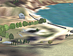
This replaces all my previous Pakatoa Island and Hauraki Gulf sceneries. You must have Christian Stock's NZ mesh in the form of "Mountains of New Zealand" and topo in the form of "Lakes and Rivers of New Zealand" (payware).
New additions...PAKIHI ISLAND: Small jetty and nearby buildings. TAKANGAROA ISLAND: House on Island. House & Jetty island north of Takangaroa Island. MOTUREKAREKA ISLAND: Wreck of the Rewa. PONUI ISLAND: Chamberlain's Bay Airstrip. Chamberlain's Donkey Farm. Third Bay Airstrip. Motunau Bay Jetty. KARAMURAMU ISLAND: Jetty and quarry. ROTOROA ISLAND: Rotoroa Jetty. MOTUIHE ISLAND: Motuihe Wharf.
| Filename: | Hauraki_Gulf_v6.zip |
| License: | Freeware |
| Added: | 17th April 2010, 16:10:12 |
| Downloads: | 218 |
| Author: | Godfrey Tier |
| Size: | 6.61 MB |
| Category: Flight Simulator 2004 - Scenery | |
| Scenery Enhancements for the Innsbruck (LOWI), Austria |
|
File Description:
New roads, railroads, streams, river, landclass, and waterclass for the Innsbruck area, Austrian Alps. Based on 30-m and 10-m satellite imagery. Not a finished product but rather a "Sunday afternoon" project :-) to illustrate the visual improvements that can be achieved with a few hours of time commitment and the help of the wonderful Ground2K4 by Christian Fumey. The scenery looks best with one of the SRTM-based add-on meshes. I have included my Ground2K4 source code so that interested users can improve on and expand the project area (requires a separate download of my pre-processed satellite imagery).
| Filename: | Scenery_Enhancements_for_the_Innsbruck_LOWI_Austri.zip |
| License: | Freeware, limited distribution |
| Added: | 1st March 2004, 14:17:27 |
| Downloads: | 21,781 |
| Author: | Holger Sandmann |
| Size: | 1.3 MB |
| Category: Flight Simulator 2004 - Scenery Design | |
| Jordan, North of Beirut |
|
File Description:
This package DOES NOT contain finished FS scenery products! Instead, the three bitmaps (N33.7-35.0 E35.4-36.5) are meant to be used for FS landscape scenery design with Ground2K4 (by Christian Fumey) or similar utilities. Source data are public domain Landsat 7 ETM+ satellite images, at 15-m and 30-m ground resolution. I used professional GIS software for the geographic transformation to lat/long-WGS84 projection, and photo processing software for channel merging and image enhancements. Each image has been tested in Ground2K4 for accurate placement. Note: these images have been ECW-compressed and need special (free) software for decompression (instructions included).
| Filename: | Jordan_North_of_Beirut.zip |
| License: | Freeware, limited distribution |
| Added: | 4th March 2004, 23:58:58 |
| Downloads: | 462 |
| Author: | Holger Sandmann |
| Size: | 12.7 MB |
| Category: Flight Simulator 2004 - Scenery Design | |
| Ketchikan and Revillagigedo Island, Alaska |
|
File Description:
This package DOES NOT contain finished FS scenery products! Instead, the three bitmaps (N55.2-56.1 W130.6-131.9) are meant to be used for FS landscape scenery design with Ground2K4 (by Christian Fumey) or similar utilities. Source data are public domain Landsat 7 TM satellite images, at 15-m and 30-m ground resolution. I used professional GIS software for the geographic transformation to lat/long-WGS84 projection, and photo processing software for channel merging and image enhancements. Each image has been tested in Ground2K4 for accurate placement. Note: these images have been ECW-compressed and need special (free) software for decompressing (instructions included).
| Filename: | Ketchikan_and_Revillagigedo_Island_Alaska.zip |
| License: | Freeware, limited distribution |
| Added: | 8th March 2004, 13:55:52 |
| Downloads: | 257 |
| Author: | Holger Sandmann |
| Size: | 16.13 MB |
| Category: Flight Simulator 2004 - Scenery Design | |
| Ketchikan and Annette Island, Southeast Alaska Background Bitmaps |
|
File Description:
This package DOES NOT contain finished FS scenery products! Instead, the three bitmaps (N54.3-55.4 W130.6-131.9) are meant to be used for FS landscape scenery design with Ground2K4 (by Christian Fumey) or similar utilities. Source data are public domain Landsat 7 TM satellite images, at 15-m and 30-m ground resolution. I used professional GIS software for the geographic transformation to lat/long-WGS84 projection, and photo processing software for channel merging and image enhancements. Each image has been tested in Ground2K4 for accurate placement. Note: these images have been ECW-compressed and need special (free) software for decompressing (instructions included).
| Filename: | Ketchikan_and_Annette_Island_Southeast_Alaska__Background_Bitmaps.zip |
| License: | Freeware, limited distribution |
| Added: | 8th March 2004, 16:00:20 |
| Downloads: | 375 |
| Author: | Holger Sandmann |
| Size: | 14.92 MB |
| Category: Flight Simulator 2004 - Scenery Design | |
| Caribbean Islands of Guadeloupe |
|
File Description:
This package DOES NOT contain finished FS scenery products! Instead, the two bitmaps (N15.7-16.6 W60.9-62.0) are meant to be used for FS landscape scenery design with Ground2K4 (by Christian Fumey) or similar utilities. Source data are public domain Landsat 7 ETM+ satellite images, at 15-m and 30-m ground resolution. I used professional GIS software for the geographic transformation to lat/long-WGS84 projection, and photo processing software for channel merging and image enhancements. Each image has been tested in Ground2K4 for accurate placement. Note: these images have been ECW-compressed and need special (free) software for decompressing (instructions included).
| Filename: | Caribbean_Islands_of_Guadeloupe.zip |
| License: | Freeware, limited distribution |
| Added: | 12th March 2004, 01:15:19 |
| Downloads: | 629 |
| Author: | Holger Sandmann |
| Size: | 3.56 MB |
| Category: Flight Simulator 2004 - Scenery Design | |
| Luxor area, Nile Valley, Egypt, Bitmaps For Ground2K4 |
|
File Description:
This package DOES NOT contain finished FS scenery products! Instead, the three bitmaps (N25.2-26.5 E31.8-33.0) are meant to be used for FS landscape scenery design with Ground2K4 (by Christian Fumey) or similar utilities. Source data are public domain Landsat 7 ETM+ satellite images, at 15-m and 30-m ground resolution. I used professional GIS software for the geographic transformation to lat/long-WGS84 projection, and photo processing software for channel merging and image enhancements. Each image has been tested in Ground2K4 for accurate placement. Note: These images have been ECW-compressed and need special (free) software for decompressing (instructions included).
| Filename: | Luxor_area_Nile_Valley_Egypt_Bitmaps_For_Ground2K4.zip |
| License: | Freeware, limited distribution |
| Added: | 1st April 2004, 20:37:33 |
| Downloads: | 829 |
| Author: | Holger Sandmann |
| Size: | 19.8 MB |
| Category: Flight Simulator 2004 - Scenery Design | |
| Central Willamette Valley, Oregon |
|
File Description:
This package DOES NOT contain finished FS scenery products! Instead, the three bitmaps (N44.0-45.1 W122.4-123.5) are meant to be used for FS landscape scenery design with Ground2K4 (by Christian Fumey) or similar utilities. Source data are public domain Landsat 7 ETM+ satellite images, at 15-m and 30-m ground resolution. I used professional GIS software for the geographic transformation to lat/long-WGS84 projection, and photo processing software for channel merging and image enhancements. Each image has been tested in Ground2K4 for accurate placement. Note: These images have been ECW-compressed and need special (free) software for decompressing (instructions included).
| Filename: | Central_Willamette_Valley_Oregon.zip |
| License: | Freeware, limited distribution |
| Added: | 13th April 2004, 12:44:18 |
| Downloads: | 363 |
| Author: | Holger Sandmann |
| Size: | 19.44 MB |


© 2001-2026 AVSIM Online
All Rights Reserved
Privacy Policy |