
Where Flight Simulation Enthusiasts Gather from Around the World!
AVSIM Library - Search Results

| Category: Flight Simulator 2004 - Scenery | |
| CWGP- Gladman Point - Nunavut, Canada |

|
Images related to this file:
File Description:
This is a DEW line Auxiliary Station on the south shore of King William Island; the island is around 70 miles square and Gjoa Haven is on the southeast corner. The station was closed in 1992 and has now been totally dismantled and removed, a pollutant hazard for the inhabitants of Gjoa Haven. The runway is still there and is a shade over 5,000 feet of gravel 150' wide. There are no lights, signage, or windsock, and in this case even the hangar has gone. A North Warning System station was built in 1990 on a small part of the site of the DEW Station, north of the runway.
| Filename: | CWGP_Gladman_Point__Nunavut_Canada.zip |
| License: | Freeware, limited distribution |
| Added: | 18th November 2012, 09:21:52 |
| Downloads: | 209 |
| Author: | Roger Wensley |
| Size: | 1.23 MB |
| Category: Flight Simulator 2004 - AI Flight Plans | |
| Air Canada Winter 2012/2013 |
|
Images related to this file:
File Description:

This is part of our flightplans for the Winter 2012/2013 season. The team aims to provide high quality flightplans for the FS community. Each flightplan has been tested using many resources, and our goal is to make a realistic representation of each airline's route network.
| Filename: | Air_Canada_Winter_20122013.zip |
| License: | Freeware, limited distribution |
| Added: | 22nd December 2012, 18:52:02 |
| Downloads: | 723 |
| Author: | Rob Corp & Alpha India Group |
| Size: | 44.39 KB |
| Category: Flight Simulator X - Scenery | |
| CYSC Sherbrooke Airport - Quebec, Canada |
|
Images related to this file:
File Description:
This scenery includes all buildings for Sherbrooke Airport (CYSC) developed in GMAX, as well as a patch to remove Aerport of Lenoxville (Airview) since it no longer exists. CYSC now features:
Two-level air terminal with a pilots' lounge;
Paved parking lot with space for approximately 80 vehicles;
Commercial hangar;
Private hangars for aircraft storage;
Aircraft taxiways;
Asphalt runway, 5,900 feet long by 150 feet wide;
Several electronic instruments and visual aids for aerial navigation;
Automated Meteorological observation station.
| Filename: | CYSC_Sherbrooke_Airport__Quebec_Canada.zip |
| License: | Freeware, limited distribution |
| Added: | 23rd December 2012, 16:03:18 |
| Downloads: | 2,789 |
| Author: | Pierre Gallant |
| Size: | 9.94 MB |
| Category: Flight Simulator 2004 - AI Flight Plans | |
| Shell Canada - Winter 2012/2013 |
|
Images related to this file:
File Description:

Shell Canada operates a small fleet of 1 Embraer 175 and 1 Dornier 328 aircraft to carry their staff from Calgary and Edmonton to Northern Alberta's oil sands. You may use AI Flight Planner Version 2 for installing the flightplan. Many thanks to Juergen Baumbusch for painting the fleet! Have fun!
| Filename: | Shell_Canada__Winter_20122013.zip |
| License: | Freeware |
| Added: | 28th February 2013, 22:22:30 |
| Downloads: | 482 |
| Author: | Christian Hegewald |
| Size: | 5.85 KB |
| Category: Flight Simulator X - Aircraft Repaints, Textures and Modifications | |
| "Private (Canada)" Boeing 777-200LRX |
|
Images related to this file:
File Description:
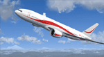
This is a fictional repaint of PMDG's 777-200LR in a private livery. I made it for myself and figured it was worth sharing! The C-GXLJ was at the time of upload an unused Canadian registration that was meant to be short for Xtra Large Jet! Feel free to stick a different flag on the paint, or travel as a Canadian in our virtual world!
| Filename: | Private_Canada_Boeing_777200LRX.zip |
| License: | Freeware |
| Added: | 17th December 2013, 20:43:05 |
| Downloads: | 1,570 |
| Author: | Luc Arsenault |
| Size: | 16.29 MB |
| Category: Flight Simulator X - AI Aircraft | |
| Air Canada Boeing 747-400 |
|
File Description: This is an AI Aardvark Boeing 747-400, Just drop the file ''adv b744 aca'' in
to your aircraft selection folder. Pls read the README.txt for more information.
For FS9/FSX.
| Filename: | Air_Canada_Boeing_747400.zip |
| License: | Freeware |
| Added: | 7th May 2014, 20:12:33 |
| Downloads: | 387 |
| Author: | Hans Timothy |
| Size: | 1.59 MB |
| Category: Flight Simulator 2004 - Scenery | |
| CYUX - Hall Beach - Nunavut, Canada |
|
Images related to this file:
File Description:
This is the Fox-Main DEW line station that I somehow omitted to include when I posted Hall Beach. It is all those large radar things in the background in the screen shot.
Just install it like any scenery, just below HallBeachCYUX in the FS9 library priority.
| Filename: | CYUX__Hall_Beach__Nunavut_Canada.zip |
| License: | Freeware, limited distribution |
| Added: | 11th May 2014, 13:44:09 |
| Downloads: | 224 |
| Author: | Roger Wensley |
| Size: | 864.63 KB |
| Category: Flight Simulator 2004 - Scenery | |
| Deline CYWJ - Northwest Territories, Canada |
|
Images related to this file:
File Description:
This is the third in a series of airfields that follow in a southward direction that early access route to the Canadian northern shore, the Mackenzie River. Deline is south of Tuktuk, Inuvik, Fort McPherson, and Fort Good Hope, all already posted. Deline is at 704 feet asl and around 50 miles east of the the Mackenzie, where the Great Bear River flows out of the western end of Great Bear Lake on its way to the Mackenzie. This lake is huge. The town of Deline has a population of around 500, and the first trading post (of the North West Company) was established there as early as 1799. The Hudson Bay Company opened an outpost in 1825 to support the Franklin Arctic Exploration expedition, and it was then called Fort Franklin. The name was changed to Deline in 1993. The airport is just over a mile north of the town, and has almost 4,000 feet of gravel runway. There is no fuel available. The original airfield is still visible just to the north of the town, from before it was rebuilt on higher ground (better drainage) and away from the houses. AI will follow with later posts.
| Filename: | Deline_CYWJ__Northwest_Territories_Canada.zip |
| License: | Freeware, limited distribution |
| Added: | 5th July 2014, 14:47:36 |
| Downloads: | 244 |
| Author: | Roger Wensley |
| Size: | 2.54 MB |
| Category: Flight Simulator 2004 - Scenery | |
| Wrigley CYWY - Northwest Territories, Canada |
|
Images related to this file:
File Description:
Wrigley is the next in a series of airfields that follow (approximately) in a southward direction that early access route to the Canadian northern shore, the Mackenzie River. At the far northern end there is Tuktoyaktuk, then Inuvik, Fort McPherson, Fort Good Hope, and Deline, all posted. Wrigley is at 489 feet asl and on the east bank of the the Mackenzie, around 135 miles due south of Deline. The town of Wrigley has a population of only 125 or so folks, and was relocated to its current position in 1965 from Fort Wrigley to be near the WW2 era airfield; I have no idea where Fort Wrigley is, or was. The airport is just over a mile south of the town, and has 3,500 feet of gravel runway. North Wright Air have scheduled flights to here and other airfields up and down the Mackenzie (including Deline, Fort Simpson, and Fort Good Hope etc) which is reflected in the revised AI. There is again a mandatory radio frequency but I have set the "tower" as unmanned so you will announce intentions and join downwind. There is no fuel available.
| Filename: | Wrigley_CYWY__Northwest_Territories_Canada.zip |
| License: | Freeware, limited distribution |
| Added: | 5th July 2014, 21:01:37 |
| Downloads: | 212 |
| Author: | Roger Wensley |
| Size: | 3.81 MB |
| Category: Flight Simulator 2004 - Scenery | |
| CZFN - Tulita - Northwest Territories, Canada |
|
Images related to this file:
File Description:
Tulita (Fort Norman until 1996) is another in the series of airfields that follow (approximately) the Mackenzie River. At the far northern end of the river and on the eastern side of the delta there is Tuktoyaktuk, then Inuvik, Fort McPherson, Fort Good Hope, Deline, Wrigley, Fort Simpson Island and Fort Simpson, and then Fort Liard at the southern end of the list of those in the Northwest Territories. South of Fort Liard there are Peace River and Dawson Creek, both of which are already posted. Tulita is at the junction of the Mackenzie and Great Bear Rivers, on the east bank of the Mackenzie and the south bank of the Great Bear, around 40 miles southeast of Norman Wells. The town has a population of about 480 folks. The airport is above and to the east of the town, and has 3,000 feet of gravel runway. The scheduled flights are by North Wright and I have also added a Buffalo DC3 and GA. There is a mandatory radio frequency but in this case I have set the "tower" to "unmanned" so you will report position and intentions. There is no fuel available.
| Filename: | CZFN__Tulita__Northwest_Territories_Canada.zip |
| License: | Freeware, limited distribution |
| Added: | 12th July 2014, 08:05:54 |
| Downloads: | 275 |
| Author: | Roger Wensley |
| Size: | 2.66 MB |


© 2001-2026 AVSIM Online
All Rights Reserved
Privacy Policy |