
Where Flight Simulation Enthusiasts Gather from Around the World!
AVSIM Library - Search Results

| Category: Flight Simulator 2004 - Scenery | |
| Alaska South Slope 5; Ambler PAFM |

|
Images related to this file:
File Description:
There are four main northwestern Alaska towns which are serviced by Alaska Airlines, and from which local flights spread out. The northernmost is Barrow. Southwest of Barrow is Kotzebue, then Nome, and the furthest south is Bethel (not yet made). This is a continuation of the series for the flights from Kotzebue, 130 miles to the east to Ambler on the bank of the Kobuk River. The next additions will be a few miles further east, Shungnak and Kobuk, and a small strip just to the north of Kobuk. Ambler is a small village (population now around 260) beside the Kobuk River, the river being the reason for the existance of the village as it served (and still does) as both a source of food and a transport route. The airfield is just north of the village, with two runways, each around 3,500 feet of lit gravel and aligned 36-18 and 09-27, with PAPI on 36. There are scheduled flights by Era (now renamed Ravn) and by Bering Air, both of them originating in Kotzebue and routing east to Ambler, Shungnak, Kobuk, and then back again. The AI includes these flights along with Everts Air and GA. There are revisions to Kotzbue to provide more parking.
| Filename: | Alaska_South_Slope_5_Ambler_PAFM.zip |
| License: | Freeware, limited distribution |
| Added: | 11th October 2016, 23:26:52 |
| Downloads: | 207 |
| Author: | Roger Wensley |
| Size: | 4.21 MB |
| Category: Flight Simulator 2004 - Scenery | |
| Port Hardy CYZT in British Columbia, Canada |
|
Images related to this file:
File Description:
Port Hardy airport is on the coast of Vancouver Island in BC, at the far northern end and 5 miles east of the town. The town and the airport are both gateways to local touristic attractions such as Cape Scott Provincial Park, the North Coast and BC Marine Trails, and kayaking, caving, surfing, fishing, camping, and scuba diving (and I discovered just how big orca are). Fishing, logging, and mining have been important and to an extent still are for the town population of just over 4,000. The airport, along with the ferries, connects Port Hardy to the rest of the west coast with Pacific Coastal Saab 340 or Beechcraft 1900C flights to and from Vancouver at least twice a day. There are also Grumman Goose amphibious flights to local float bases such as Port McNeill, Alert Bay, Whaletown, Surge Narrows, Echo Bay, and Minstrel Island. These are all included in the AI and previously posted. There are three runways: 11-29 of 5,000 feet with ILS on 11 and righthand circuits on 29, 07-25 of 4,000 feet with righthand circuits on 25, and 16-34 with a much shortened 3,500 feet on 34 due to a displaced threshold. There is a control tower but it is not manned 24 hours a day; a "mandatory frequency" (MF for short and a Canadian invention) is used by the tower when it is manned, and when there is no tower response the aircraft continues to announce intentions and position. Something I have been meaning to explain to those who query it, is that in real life as well as in FS9 helicopters at a mixed use airport or airfield will act as if they are planes and join downwind, turn on base and then finals, "land" along the runway and then use the taxiway to the parking. This means all aircraft are doing the same thing and an orderly queue avoids collisions. This is one of a series connected in some way with Pacific Coastal airline destinations, the first being Bella Coola. There is AI available for Pacific Coastal online.
| Filename: | Port_Hardy_CYZT_in_British_Columbia_Canada.zip |
| License: | Freeware, limited distribution |
| Added: | 11th November 2018, 16:48:50 |
| Downloads: | 234 |
| Author: | Roger Wensley |
| Size: | 19.26 MB |
| Category: Flight Simulator X - Scenery Design | |
| (Version 2.0) KEFD -Ellington 2025 Refresh FSX (Circa 2006-2010)- Johnson Space Center Houston |
|
Images related to this file:
File Description:
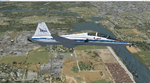
Version 2.0 covers landclass across the entire greater Houston area, with a large increase in LOD. This version significantly tightens up and improves the landclass from version 1.0, and adds a vast amount of scenery objects that brings the Bay Area-KEFD area into the modern era. This improves and adds a highly accurate runway 17 approach with accurate placement of buildings and scenery around the year 2011-modern day. In addition, includes several new files including a new airport/helipad via Houston Clear lake regional airport, T41 La Porte Municipal and surrounding shipping ports, Kemah Boardwalk, and a giant improvement to Johnson Space Center Houston. Rundway 35 and Runway 22 landclass is significantly increased, and more accurate as well. You can fly an accurate VFR approach or set up an ILS for any one of KEFD's runways with ease with this improvement.List of Version 2.0 additions and changes: - I added a ton of scenery objects and tightened up the landclass at Johnson Space Center Houston- NASA Control Center--- Added Talon Park with T38s (via static objects)--- Added Gemeni V rocket and 747 for the shuttle transporter--- And a whole bunch of vegetation, new buildings, and tour buses.- Added Kemah boardwalk and several boat docks- Removed a TON of highrise textures and replaced with medium and large city suburb landclass.- Added Clear Lake regional Hospital with helipad and surrounding scenery by Walter Reed Park- Added El Jardin or "Bayport Container port" with several scenery objects and significantly tightened up landclass.-- Looks great when setting up ILS approach for RWY 22- Tightened up Bay Area BLVD landclass, "adding" University of Houston Clear Lake"-- UHCL was semi already present, just made it more pronounced.- Made Red Bluff road landclass super recognizable!-- Red Bluff road is used to set up VFR approach and or field break for RWY 22 and RWY 17 R.----- Its common to see private jets and the USAF doing a break along Red Bluff road.- Added First Baptist Church, and water tower to Pasadena Convention center- Made Fairmont Parkway pronounced with landclass- Added Houston Port Authority at Morgan's Point--- Another Landmark for the RWY 22 ILS approach, NASA religiously uses this to line up the 10 mile ILS.- Tightened up landclass at Village Grove East and along Fairmont Parkway- Added a TON of scenery objects and landclass corrections for approach of RWY 17 L and 17 R.---- Added Home Depot, Lowes, Walmart Super center, Guitar center etc.---- added South Main Baptist Church--- Bondy Jr High, Turner Elementary, and Pasadena Memorial High School--- Added Saint Luke's Hospital--- Added Hampton Inn Suites and HCA rehab hospital--- Added a ton to the container facility behind best buy and storage facility--- Added smaller churches on RWY 17 approach--- Added a ton of scenery at the base of RWY 17 R, i.e., concrete plant, containers, trucks-- Added gas stations on the corner of beltway 8 and genoa red bluff-- Significantly changed and tightened up landclass at the base of RWY 22 and RWY 17 L and 17 R-- Made several roads and Beltway pronounced------ This decision looks AWESOME at night, really adds demarcation to the roads.**All of this makes the RWY 17 approach super recognizable** RWY 22 approach landclass is much more accurate.- Significantly changed and tightened up landclass near southbelt ellington and interstate 45.- Added Grace Church-- I wanted to do San Jacinto College south, but seemed over kill at that point.- SIGNIFICANTLY tightened up landclass for RWY 35 approach and near baybrook mall.-- Along I45- Added TDECU stadium at the University of Houston Main Campus---- So you can practice flybys for Cougar games!- Added the Battleship at San Jacinto Monument- I also "borrowed" T41 La Porte Municipal's tower camera to make a SWEET view of KEFD.- I included landclass for Sealy Texas this time, as well as my significant enhancements of Austin, Texas greater area as well (optional, but recommended!)---------------------------------------------------------------------------Version 1.0 originally added:- Added the Johnson Space Center Houston, which is now greatly enhanced and blended.- San Jacinto Community College-Central- Pasadena Convention Center- Pasadena Water Treatment Facility- NASA Bouncy Lab- Pasadena Shopping center, now greatly enhanced and blended.- Baybrook Mall and other shopping spots.- Significant Landclass improvements across the entire greater Houston Area File also includes landclass and scenery improvements for the greater Austin, Texas Area (optional), KIAH, KDWH, and Sealy, Texas. Each of these projects combined covers roughly 15,000 square miles of landclass improvement. Allowing you to fly entirely from Houston to Austin, or Houston to San Antonio in accurate landclass. -Enjoy!DJN
| Filename: | Version_20_KEFD_Ellington_2025_Refresh_FSX_Circa_2.zip |
| License: | Freeware |
| Added: | 12th October 2025, 16:15:47 |
| Downloads: | 68 |
| Author: | Dan Nelson |
| Size: | 277.28 MB |
| Category: X-Plane - Scenery | |
| Houston Galveston Scenery Package v6.51-7.xxx |
|
File Description:
As promised, here are my Houston-Galveston Scenery Packs. I live in Houston and have been working on these areas for quite some time. Like all of us, we like to make our hometown airports as elaborate and as challenging as possible. Even tho these packs are in no way accurate, they are fun and interesting to fly around and site-see. Being the lazy person I am, no research was done and no claim to RL landmarks are implied.
I have added many objects to the airports and cities including terminals, hangers, buildings, parks, balloons, and other fun and interesting things. All of which were begged, borrowed or stolen from all the wonderful designers in the X-Plane Community such as Dave Spurlock, Christian Franz, Ted Davis, Robert Bunce, Tom Curtis, B. Brooks and all the others who have inspired me.
Like all my scenery packages, the additions to the citys and airports are purely fictional. The airports themselves are unaltered. I have enhanced "George Bush Intercontinental"(KIAH), "William P. Hobby"(KHOU), "Ellington Field Military Base"(KFLD) and "Scholes International" at Galveston (KGLS) airports. Look for the Johnson Space Center too.
| Filename: | Houston_Galveston_Scenery_Package_v6517xxx.zip |
| License: | Freeware |
| Added: | 16th June 2003, 00:51:43 |
| Downloads: | 2,659 |
| Author: | Bill Moore |
| Size: | 23.72 MB |
| Category: Flight Simulator X - Original Aircraft | |
| Germany "Bundeswehr", Tornado IDS |
|
File Description:
****This file is a COMMERCIAL DEMO****
The Panavia Tornado is a family of twin-engine combat aircraft, which was jointly developed by the West Germany, United Kingdom and Italy. There are three primary versions of the Tornado; the Tornado IDS (Interdictor/Strike) fighter-bomber, the suppression of enemy air defences Tornado ECR (Electronic Combat/Reconnaissance) and the Tornado F.3 (only United Kingdom) a air fefence variant. It is one of the world's most sophisticated and capable interdiction and attack aircraft, with a long range, large payload and high survivability.
Developed and built by Panavia, a tri-national consortium consisting of MBB of West Germany, British Aerospace, and Alenia Aeronautica of Italy. The Tornado first flew on August 14, 1974, and saw action with the RAF and AMI (Italian Air Force) in the Gulf War (Operation Desert Storm). International co-operation continued after its entry into service within the Tri-National Tornado Training Establishment, a tri-nation training and evaluation unit operating from RAF Cottesmore, England. Including all variants, 992 aircraft were built for the three partner nations and Saudi Arabia (first export customer).
| Filename: | Germany_Bundeswehr_Tornado_IDS.zip |
| License: | Commercial demo |
| Added: | 17th December 2008, 17:07:11 |
| Downloads: | 2,009 |
| Author: | Andreas Meyer |
| Size: | 3.88 MB |
| Category: Flight Simulator X - Scenery | |
| SKBO 2011 |
|
File Description:
El Dorado International Airport (IATA: BOG, ICAO: SKBO) is an international airport located in Bogota, Colombia. It is the largest Latin America airport in terms of cargo movements with 593,946 tons (2010) and the third in terms of passenger traffic, only behind Sao Paulo-Guarulhos International Airport and Mexico City's Benito Juarez International Airport, transporting 18,934,203 passengers in 2010; as well as the largest airport in Colombia and the main international and domestic air gateway in the country, serving as an important hub for Avianca, Copa Airlines Colombia, Aires, Satena, EasyFly and other cargo companies.
This file has the right coordinates, with the apron and characteristics of the airport. The runways were reoriented to the correct direction, runway were resized the gates placed on correct location and number, CATAM was placed (Colombian Air force and Colombian National Army) and Colombia National Police and Colombian National Armada were assigned a correct apron. All the jet ways including the ones of the executive terminal are working. There is a copy of all the airport charts required to navigate in and out of this airport which are courtesy of: Areonatica Civil de Colombia
| Filename: | SKBO_2011.zip |
| License: | Freeware |
| Added: | 29th June 2011, 21:16:37 |
| Downloads: | 2,942 |
| Author: | Anwar Gonzalez |
| Size: | 14.34 MB |
| Category: Flight Simulator 2004 - Scenery | |
| CZFN - Tulita - Northwest Territories, Canada |
|
Images related to this file:
File Description:
Tulita (Fort Norman until 1996) is another in the series of airfields that follow (approximately) the Mackenzie River. At the far northern end of the river and on the eastern side of the delta there is Tuktoyaktuk, then Inuvik, Fort McPherson, Fort Good Hope, Deline, Wrigley, Fort Simpson Island and Fort Simpson, and then Fort Liard at the southern end of the list of those in the Northwest Territories. South of Fort Liard there are Peace River and Dawson Creek, both of which are already posted. Tulita is at the junction of the Mackenzie and Great Bear Rivers, on the east bank of the Mackenzie and the south bank of the Great Bear, around 40 miles southeast of Norman Wells. The town has a population of about 480 folks. The airport is above and to the east of the town, and has 3,000 feet of gravel runway. The scheduled flights are by North Wright and I have also added a Buffalo DC3 and GA. There is a mandatory radio frequency but in this case I have set the "tower" to "unmanned" so you will report position and intentions. There is no fuel available.
| Filename: | CZFN__Tulita__Northwest_Territories_Canada.zip |
| License: | Freeware, limited distribution |
| Added: | 12th July 2014, 08:05:54 |
| Downloads: | 272 |
| Author: | Roger Wensley |
| Size: | 2.66 MB |
| Category: Flight Simulator 2004 - Scenery Design | |
| Small Airstrip Objects SS FS9 scenery objects |
|
File Description:
As far as I know, this is the most comprehensive collection to date of small airport scenery objects. More importantly, these are, for the most part, objects that have never before been made available. Most of these objects were suggested by Rob de Vries in the Netherlands, who also provided me with many useful photos on which to base the designs. My thanks to Rob.
Objects include:
* Runway end and side markers in a variety of materials and colors.
* Ground markings of various kinds, including a compass rose, runway & airport closed indicators, and general aviation parking guides.
* Animated wind T, tetrahedron, and wind sock (wind sock by Jörg Dannenberg).
* Segmented circles in two styles and colors, with runway and pattern indicators. (For information on how to use segmented circles, see enclosed FAA document circles.pdf.)
* Weathered asphalt and concrete surfaces.
Most of the objects come in new and weathered versions. In addition, the segmented circles and wind indicators come with and without night lighting. These are standard FS9 scenery objects and can be placed using Instant Scenery or other programs that are able to use FS9 scenery libraries.
| Filename: | Small_Airstrip_Objects_SS_FS9_scenery_objects.zip |
| License: | Freeware |
| Added: | 12th November 2007, 08:17:15 |
| Downloads: | 5,027 |
| Author: | Sidney Schwartz |
| Size: | 3.97 MB |
| Category: Flight Simulator 2002 - Adventures | |
| RFDS Road Accident Landing Mission |
|
File Description:
There has been a Motor Vehicle Accident (MVA) roughly 72nm south of Broken Hill. The Police, Fire brigade, Ambulance and State Emergency Service (SES) are at the accident site. A man is trapped and is being extricated but this will take some time, and he will need further medical help. You need to fly to the scene and land on the road.
Have you got what it takes to fly it and maybe save a life?
Includes appropriate chart, briefing and debriefing documents, weather, saved flights and scenery.
Other required file: my Nomad_N22C aircraft (Nomad_N22C.ZIP)
Recommended file: my Broken Hill Scenery (YBHI.ZIP) as well.
These files are avialable from this web site.
| Filename: | RFDS_Road_Accident_Landing_Mission.zip |
| License: | Freeware |
| Added: | 31st May 2003, 00:11:50 |
| Downloads: | 1,415 |
| Author: | Mike Hill |
| Size: | 2.49 MB |
| Category: Flight Simulator 2004 - Original Aircraft | |
| Piper PA-22/20 Pacer |
|
File Description:
The Piper Pacer is a 4 seat tube and fabric aircraft. based on the earlier Piper Clipper and Vagabond it was Piper's major step away from the Cub into a larger General Avation aircraft that could compete in the market place with the 4 seat Cessna's. This model depicts a Tripacer converted to a taildragger configuration.
This model of the Pacer is made with FSDS 2.24 and is fully compatible with Flight Sim versions 8 and 9 (2002 and 2004 A Century of Flight)
This package features:
Reflective textures and Dynamic Shine
Opening front and rear doors
rolling wheels
full animation of control surfaces
Custom 2D Panel
Full Virtual cockpit gauges
Repaintable base textures for your own repaints
| Filename: | Piper_PA2220_Pacer.zip |
| License: | Freeware, limited distribution |
| Added: | 26th August 2003, 16:26:20 |
| Downloads: | 11,590 |
| Author: | Brian Gladden |
| Size: | 1.73 MB |


© 2001-2026 AVSIM Online
All Rights Reserved
Privacy Policy |