
Where Flight Simulation Enthusiasts Gather from Around the World!
AVSIM Library - Search Results

| Category: Flight Simulator X - AFCAD Files | |
| KPIT - Pittsburgh International - Pittsburgh, PA, USA |

|
Images related to this file:
File Description:
This release features new terminals, runways, taxiways, aprons, two FBOs, fire stations, POL facilities, FedEx and UPS depots, USAF Reserve and Pennsylvanian ANG facilities, access roads, enhanced scenery and terrain masks, and parking,(including hangar parking) for 146 aircraft.
| Filename: | KPIT__Pittsburgh_International__Pittsburgh_PA_USA.zip |
| License: | Freeware, limited distribution |
| Added: | 30th January 2016, 12:30:48 |
| Downloads: | 1,070 |
| Author: | Allen Laughmiller |
| Size: | 62.04 KB |
| Category: Prepar3D V1-4 - Aircraft Repaints, Textures and Modifications | |
| Beechcraft KingAir B200 (VH-OYA) |
|
Images related to this file:
File Description:
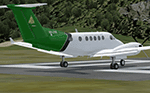
OYA is one of the RAAFs ARDU (Aircraft Research and Development Unit) planes, They conduct and analyse the results of ground and flight tests of existing and new RAAF aircraft. Textures for Flight1's Kingair B200 for FSX onwards.
| Filename: | Beechcraft_KingAir_B200_VHOYA.zip |
| License: | Freeware |
| Added: | 14th June 2018, 01:36:07 |
| Downloads: | 92 |
| Author: | Ron Attwood |
| Size: | 20.76 MB |
| Category: Flight Simulator 2004 - AFCAD Files | |
| EHAM new TWYs |
|
File Description:
It includes all the taxiways of schiphol and the new runway and more parkings out of the AFCAD2 by
Victor Nauta.
I've added the new peace of A and B taxiway, Y apron, and the taxiways around the 'Zwanenburgbaan'
| Filename: | EHAM_new_TWYs.zip |
| License: | Freeware |
| Added: | 8th December 2003, 23:13:43 |
| Downloads: | 1,775 |
| Author: | Nils Lips |
| Size: | 20.22 KB |
| Category: Flight Simulator X - AFCAD Files | |
| CZBB Boundary Bay Airport, BC, Canada |
|
File Description:
This is a complete redo of the default FSX CZBB Boundary Bay Airport, BC using ADE v1.37, Google Earth satellite image and the latest airport chart effective as of 31 July 2008. The airport center and boundary repositioned. Control tower moved and replaced. Runway 07/25 extended to 5606 ft from 3540 ft and new taxiway E added. VASI Added to Runway 07/25. Taxiway signs added and/or corrected. Airport aprons resized and added where necessary. Taxiways and roads added. Static airport library objects and vegetation added for an improved look. XWind runways activated. Airport views are from the roof of the control tower when in tower view. A fuel truck has been added - Shift-F will bring this truck to your aircraft for refueling and will automatically refuel AI aircraft after landing and before take off. Airport chart and history included.
| Filename: | CZBB_Boundary_Bay_Airport_BC_Canada.zip |
| License: | Freeware |
| Added: | 5th November 2009, 02:16:37 |
| Downloads: | 448 |
| Author: | Robert Catherall |
| Size: | 381.61 KB |
| Category: Flight Simulator X - AFCAD Files | |
| CZBB Boundary Bay Airport, BC |
|
File Description:
This is a complete redo of the default FSX CZBB Boundary Airport, BC using ADE v1.37, Google Earth satellite image and the latest airport chart effective as of 31 July 2008. The airport center and boundary repositioned. Control tower moved and replaced. Runway 07/25 extended to 5606 ft from 3540 ft and new taxiway E added. VASI Added to Runway 07/25. Taxiway signs added and/or corrected. Airport aprons resized and added where necessary. Taxiways and roads added. Static airport library objects and vegetation added for an improved look. XWind runways activated. Airport views are from the roof of the control tower when in tower view. A fuel truck has been added - Shift-F will bring this truck to your aircraft for refueling and will automatically refuel AI aircraft after landing and before take off. Airport chart and history included.
| Filename: | CZBB_Boundary_Bay_Airport_BC.zip |
| License: | Freeware |
| Added: | 26th March 2009, 08:31:55 |
| Downloads: | 491 |
| Author: | Robert Catherall |
| Size: | 137.2 KB |
| Category: Flight Simulator 2004 - Scenery | |
| Hall Beach CYUX in Nunavut, Canada |
|
Images related to this file:
File Description:
Hall Beach is on the Melville Peninsula, part of the mainland of Canada, south and west of Baffin Island. It is around 40 miles south of Igloolik and 50 miles west of Rowley, both of them my previous posts. The airfield was built to support the construction and operation of a main DEW line radar station and to support the rest of the associated chain. Because of the employment opportunities this brought, a village developed nearby. The airfield continues in regular use and the runway, though still gravel, is 5,400' long and 150' wide and lighted; the alignment is 124T and 304T as this is in northern domestic airspace and bearings are given as 'true" and not "magnetic". There are scenery folders for the village, roads, grass, etc, and AI for two airlines with regular service to Hall Beach.
| Filename: | Hall_Beach_CYUX_in_Nunavut_Canada.zip |
| License: | Freeware, limited distribution |
| Added: | 22nd November 2011, 14:33:08 |
| Downloads: | 456 |
| Author: | Roger Wensley |
| Size: | 3.83 MB |
| Category: Flight Simulator 2004 - Scenery | |
| Canouan TVSC in the Grenadines |
|
Images related to this file:
File Description:
Canouan Island is the one of the middle islands in the chain known as St Vincent and the Grenadines, between Mustique and Union Island. Canouan is around 5 miles long and shaped like a hook, with a resident population of 1,200. There has been major touristic development on the island since the early 1990's and the island now has paved roads, electricity, and desalinated water along with a golf course.
The airport is at the southern end of the island and the runway has been extended to 5,875 feet on reclaimed land, making Canouan the jet airport for the Grenadines with flights from North and South America. There are connecting flights to the other islands by SVG and LIAT. The airport apron has been extended to accomodate larger planes and I have shown the airport with this apron work still in progress and during the expansion of the terminal building. The AI has two international flights, on Wednesday and Saturday, and both by American.
| Filename: | Canouan_TVSC_in_the_Grenadines.zip |
| License: | Freeware, limited distribution |
| Added: | 11th June 2013, 22:59:04 |
| Downloads: | 656 |
| Author: | Roger Wensley |
| Size: | 3.6 MB |
| Category: Prepar3D V1-4 - Aircraft Repaints, Textures and Modifications | |
| Air Austral 1998 AI Package |
|
File Description:
Air Austral had yet to venture into longhaul flying in 1998, with 2 737-300s and a 737-500 flying to neighboring islands and venturing a bit into Western and Southern Africa. As the Comoros and Mayotte didn't have flag carriers, Air Austral and Air Madagascar connected destinations to these islands beyond RUN. Note that the YVA airport has since closed and the HAH airport further north is used now. These plans use the old airport and a scenery will eventually be created. Today, the airline has grown many times it's size in 1998 and now flies 777-300ERs and 787s across the globe.
Repaints for the FAIB 737-300 and 737-500 by APG and Alex\Funk included. Flightplans by Chasen Richardson. Part of the 1998 Flight Simulator Project. Follow us on Facebook at facebook.com/flightsim98 and on instagram as @bayviationsim. For more Retro AI, check out the forums at: http://retroai.proboards.com/
| Filename: | Air_Austral_1998_AI_Package.zip |
| License: | Freeware, limited distribution |
| Added: | 28th December 2019, 19:53:40 |
| Downloads: | 158 |
| Author: | Antoine Calleja, Alex\Funk,Chasen Richardson\Bayviation |
| Size: | 1.16 MB |
| Category: Flight Simulator X - Scenery | |
| George Bush Intercontinental/H Airport - KIAH - Texas, USA |
|
Images related to this file:
File Description:
This is an accurate and up-to-date version of George Bush Intercontinental Airport with two optional files and made only for FSX, do not use in P3D: There is one version with the Crosswind runways activated and in full operation where all 5 runways will be used for takeoff/landing and one version as the default airport runway operation: All terminals have been completely replaced with something better than the stock airport, this now includes terminal B south and the new terminal C expansion, the Fedex ramp and building replaced, and the northeast cargo ramp and buildings updated, assigned parking updated as per their website including a gate and parking spots for the A380, taxiways and taxi signs updated to the latest charts, drainage canals, support vehicle roads rebuilt and many other scenery improvements and objects added, airport views are from the roof of the control tower (when in tower view) please view the readme before installation.
| Filename: | George_Bush_IntercontinentalH_Airport__KIAH__Texas.zip |
| License: | Freeware, limited distribution |
| Added: | 28th May 2018, 01:35:54 |
| Downloads: | 44,409 |
| Author: | Ray Smith |
| Size: | 6.05 MB |
| Category: Flight Simulator 2004 - Flight Plans | |
| RTW-K4-03 |
|
File Description:
An FS2K4 GPS flight and plan by the Ancient Brit and the RTW-K4 Team for the FS2K4 default aircraft (B737-400) and scenery. Depart Sumburgh (EGPB), runway 33, The Orkneys, UK and arrive 51 minutes later at Flesland, (ENBR), Bergen, Norway. The plan is fully flight briefed with Word and text briefings and kneeboard in-flight briefing. A start-up flight that loads the plan, weather and kneeboard flight briefing is included; also a short Finals practise flight is included. This is a short positioning flight featuring snow and an ILS Finals coming through clouds.
| Filename: | RTWK403.zip |
| License: | Freeware |
| Added: | 26th September 2003, 23:38:27 |
| Downloads: | 1,537 |
| Author: | Denis Egan |
| Size: | 57.51 KB |


© 2001-2026 AVSIM Online
All Rights Reserved
Privacy Policy |