
Where Flight Simulation Enthusiasts Gather from Around the World!
AVSIM Library - Search Results

| Category: Flight Simulator 2004 - AFCAD Files | |
| UK2000 London City V2 |

|
File Description:
A high quality AFCAD2 file for the UK2000 London City Airport. Built from scratch, using the latest CAA charts, this AFCAD2 compliments the addon scenery perfectly. This file gives you the current real life taxiway names and gate numbers at this airport. Airlines are allocated to the gates and all gates are used. This file gives you 24 usable parking positions at this airport, comprising 10 Gates and 14 GA ramps. New in this release, added gate assignments for airlines that have recently started to serve the airport. This file has been fully tested with no problems found. Requires the payware 'UK2000 Part 4' or 'UK2000 London City' package by G. Summons available at http://www.uk2000scenery.com - this file is not compatible with any other scenery for London City airport.
| Filename: | UK2000_London_City_V2.zip |
| License: | Freeware |
| Added: | 9th December 2005, 02:03:47 |
| Downloads: | 874 |
| Author: | Lee Brompton |
| Size: | 25.95 KB |
| Category: Flight Simulator 2004 - AFCAD Files | |
| LGAT Version 2 |
|
File Description:
Update for previous version. Fixes some bugs and improves the general layout of the airport.
This file sets Athens Athinaikon (LGAT) to the state found at an picture at airliners.net. Today, LGAT, the former main airport of Athens, is closed and replaced by LGAV - Athens Venizelos. The western part of the airport seems to be demoslished and half-way being replaced by a park. On the eastern part, some retired 747-200, 727 and DC3 of Olympic Airlines wait for their destruction. This AFCAD keeps half of the airport usable, enough to house some GA traffic and a few airliners as a buffer. This airport is only based on one single picture at airliners.net. It doesn't keep it's earlier functionality (of the 1990's) as there are only a few parking positions left.
| Filename: | LGAT_Version_2.zip |
| License: | Freeware |
| Added: | 4th January 2004, 11:22:50 |
| Downloads: | 1,100 |
| Author: | Felix Hippmann |
| Size: | 5.96 KB |
| Category: Flight Simulator 2004 - AFCAD Files | |
| Edinburgh with Crosswind Runways |
|
File Description:
A High quality AFCAD2 file for Edinburgh Airport (EGPH) with Crosswind runways. Built using CAA charts, this file gives you all the real life parking and taxiways at this airport, including the newly extended taxiway 'A'. A tower view is provided, and assigned gates for each airline that serves the airport. Both Cargo areas are represented, as well as the GA apron. Using the crosswind runway technique, runways 06/24 and 12/30 will now be used at the same time for take-off and landing. Taxiway 'L' and Runway 12/30 have both been extended especially for this purpose. This pack contains 2 setup Options - you can have asphalt taxiways or concrete taxiways. Requires the feeware FS2004 Edinburgh Airport scenery by Ian Gallacher. Not suitable for the default FS2004 airport.
| Filename: | Edinburgh_with_Crosswind_Runways.zip |
| License: | Freeware |
| Added: | 20th February 2005, 15:19:54 |
| Downloads: | 1,482 |
| Author: | Lee Brompton |
| Size: | 53.35 KB |
| Category: Flight Simulator 2004 - Scenery | |
| Maupiti airport, French Polynesia, NTTP |
|
File Description:
This is a whole new Maupiti. It contains the terminal, tower, helipad, boat docking area to get to the main island, and an afcad by Ray Smith, which makes the airport come alive at night with runway lighting, and blue marker lights around the tarmac. This island is often referred to as a mini version of Bora Bora, and it is just a short hop from there. It is the smallest airport in the Society Islands, and one of the smaller islands also. The airport is also located out on one of the motus, or coral reefs surrounding the island, and as with Bora Bora it is necessary to take a boat from the airport to the main island. Aircraft which use this airport are mainly Air Tahiti ATR's, or tourist helicopters.
| Filename: | Maupiti_airport_French_Polynesia_NTTP.zip |
| License: | Freeware |
| Added: | 4th June 2004, 13:40:33 |
| Downloads: | 9,679 |
| Author: | Bill Melichar |
| Size: | 1.45 MB |
| Category: Flight Simulator 2004 - Scenery | |
| Laramie Regional KLAR |
|
Images related to this file:
File Description:
FS2004 Scenery-Laramie Regional Airport (KLAR) is located in Laramie Wyoming, home of the University of Wyoming, Wyoming Technical Institute and a number of businesses and organizations. Laramie Regional Airport was built in 1934 and was originally named Brees Field, after General Herbert Jay Brees of the US Army. The original hangar still stands today. In 1944, the runways were paved to allow hundreds of B-24 bombers to land at Laramie and bring crews for rest and recuperation to the UW recreation camp in the Snowy Range. In 1945 Summit Airways began to provide passenger service. The Brees Field Airport Board was formed in 1965 to oversee airport operations. In 1992, the airport's board changed the airport's name to Laramie Regional Airport. Created with EZ Scenery by John B. Loney, Jr.
| Filename: | Laramie_Regional_KLAR.zip |
| License: | Freeware, limited distribution |
| Added: | 23rd May 2010, 01:32:22 |
| Downloads: | 1,330 |
| Author: | John B. Loney, Jr. |
| Size: | 835.24 KB |
| Category: Flight Simulator 2004 - AFCAD Files | |
| Boston Logan Int'l (KBOS) with active Crosswind Runways |
|
Images related to this file:
File Description:
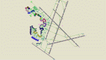
This is a high spec AFCAD2 for the (Freeware) FS2004 Boston Logan Int'l Airport (KBOS) scenery by Fly Tampa / George Grimshaw. This afcad has been built using FAA Charts and information from the Airport Website. All gates are named and have airlines assigned to them. The Fedex and UPS aprons are represented and can accommodate many cargo aircraft. The final parking area is random GA parking and the various maintenance areas to the north of the airport. This airport now features an accurate tower view. Finally, by using the crosswind runway technique, all runways can be used simultaneously for take-off and landing (see brief). Enjoy!!
This file will work with version 2.1 of the airport ONLY (adds the new runway 14/32, new American Eagle gates).
| Filename: | Boston_Logan_Intl_KBOS_with_active_Crosswind_Runwa.zip |
| License: | Freeware |
| Added: | 4th March 2010, 13:26:27 |
| Downloads: | 2,246 |
| Author: | Lee Brompton |
| Size: | 40.32 KB |
| Category: Flight Simulator 2004 - Scenery | |
| Murray Field KEKA |
|
Images related to this file:
File Description:
FS2004 Scenery - Murray Field (IATA: EKA, ICAO: KEKA, FAA LID: EKA) is a county-owned public-use airport in Humboldt County, California, United States. Murray Field Airport serves Eureka and Humboldt County. The airport has more than one runway. The longest is a paved runway extending 3000 feet. The facility is at an elevation of 7 feet at a distance of about 3 miles from Eureka. The airport is primarily used for general aviation. Also FedEx Express utilizes the small airport as a stop for package delivery from and to Humboldt County. Murray Field was first established in 1919 by pilot Dayton Murray, and was later renamed in his honor. It has a restaurant and a charter service, Northern Air, as well as a Civil Air Patrol office. Created by John B. Loney, Jr.
| Filename: | Murray_Field_KEKA.zip |
| License: | Freeware, limited distribution |
| Added: | 20th March 2012, 01:35:39 |
| Downloads: | 346 |
| Author: | John B. Loney, Jr. |
| Size: | 5.92 MB |
| Category: Flight Simulator X - Scenery | |
| Rio Vista Municipal Airport, California (O88) |
|
Images related to this file:
File Description:
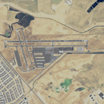
Rio Vista Municipal Airport, is located on the western edge of the city of Rio Vista in the heart of California's San Joaquin River Delta, about 260 mile northeast of San Francisco. Rio Vista Municipal Airport has an 4,200-foot long, 75-foot wide primary runway. There is also a 2,200-foot long, 60-foot wide secondary runway and a helipad. This is a major overhaul of the default airport, dramatically improving accuracy of taxiways, runways, aprons, structures and other scenery details. Designed so that anyone familiar with the actual airport will experience immediate recognition, the project includes several custom buildings and many custom scenery objects modeled on the actual airport. The surrounding area has been extensively modeled. Including, 324 accurately place wind turbines, 3690 houses, and a total count of 4740 scenery objects.
| Filename: | Rio_Vista_Municipal_Airport_California_O88.zip |
| License: | Freeware |
| Added: | 5th December 2011, 21:26:45 |
| Downloads: | 944 |
| Author: | John Hottel |
| Size: | 19.21 MB |
| Category: Flight Simulator X - AFCAD Files | |
| 7N1 - Costa's Corning Painted Post - New York |
|
Images related to this file:
File Description:
7N1
Corning-Painted Post Airport (FAA LID: 7N1) is a public use airport in Steuben County, New York, United States.[1] It is located two nautical miles (4 km) northwest of the central business district of Corning.[1] The airport is owned by the Town of Erwin[1] and located near Painted Post, New York. It is included in the National Plan of Integrated Airport Systems for 2011-2015, which categorized it as a general aviation facility. The stock FSX airport was a generic type. I updated most everything to 2014 Google Earth standards. I use generic buildings and resize reshape to suit. All objects are stock.I put in most of the parking spaces, gas trigger, the neighborhood houses and some trees to round it out. Hope you enjoy.
| Filename: | 7N1__Costas_Corning_Painted_Post__New_York.zip |
| License: | Freeware |
| Added: | 17th June 2014, 07:51:50 |
| Downloads: | 207 |
| Author: | Jon Davidson |
| Size: | 8.5 KB |
| Category: Prepar3D V1-4 - Scenery | |
| The atolls of the Maldives Asia |
|
File Description:
The atolls of the Maldives are numerous and some atolls are also uninhabited. The most famous atolls are: The Male Atoll and Baros N4.18.26 E73.20.91 with the VRMM airport, the Gan atoll N0.41.36 E73.9.27with the VRMG airport, Hanimardhoo Atoll N 6.44.56 E73.10.06 with the VRMH airport, the Kaadedhahoo atoll N0.29.21 E72.59.41 with the VRMT airport and the Kadhdhoo N1.51.30 E73.31.15 with the VRMK airport. The aforementioned airports have been improved and the most important resorts have been created on the islands of Baros, Gan, Hanimaadhoo, Kaadedhahoo and Kadhdhoo, and small ports have been created with ships and boats. I remember that all the islands can be easily visited by seaplanes in their respective tiny ports. Good VFR flight. Within the downloaded package you will find readme files for scenery installation. Good fly VFR. Pasquale Marrulli.
| Filename: | The_atolls_of_the_Maldives_Asia.zip |
| License: | Freeware |
| Added: | 12th March 2018, 22:07:58 |
| Downloads: | 506 |
| Author: | Pasquale Marrulli |
| Size: | 8.56 KB |


© 2001-2026 AVSIM Online
All Rights Reserved
Privacy Policy |