
Where Flight Simulation Enthusiasts Gather from Around the World!
AVSIM Library - Search Results

| Category: Prepar3D V1-4 - Scenery | |
| YSWS West Sydney Airport P3Dv4 basic |

|
File Description:
Western Sydney International (Nancy-Bird Walton) Airport (YSWS) will be a 24/7 facility. It is under construction and due for opening to regular services in late 2026. Aircraft have landed here for the purpose of development and testing. This scenery was done with ADE4 using P3Dv4 default objects. It is very basic, but placed as best possible based on Google Earth and Air Services Australia information. Rwy 05/23 both have ILS with frequencies published. There are currently no ATC services offered and charts may be located with a dedicated search. Hopefully someone better than I comes to the party and shares a detailed version.
| Filename: | YSWS_West_Sydney_Airport_P3Dv4_basic.zip |
| License: | Freeware |
| Added: | 29th March 2026, 01:52:51 |
| Downloads: | 16 |
| Author: | Sean Harrison |
| Size: | 297.5 KB |
| Category: Flight Simulator 2004 - AFCAD Files | |
| Presidente Nicolau Lobato International, Dili, East Timor (WPDL) v2 |
|
File Description:
"Euraka!" I cried in the middle of the night. My wife rolled over and mumbled "its not me, it must be the cat". But I was pleased with myself, for I had suddenly thought of a way to eliminate Microsoft's radiused corners where taxiway meets runway. They are a nifty arrangement, when you want them, but at this airport (clearly evidenced by Google Earth) they do not exist on the concrete connections. So here is a revised version of my Googlyafcad for WPDL Dili-Comoro-Komoro-Presidente Nicolau Lobato International or whatever it is called today. I considered calling this version 1.0062A so as to impress but I think you might prefer me to call it it version 2. Unfortunately, Microsoft's perception of this airport in Flight Simulator is a wee bit under scale and the ramp areas provided barely allow the parking of a flea, never mind the Boeing 737s that serve this airport. This A&F Data file allows you and "AI" traffic to land, park and take-off in the proper manner. But there is more . . . the Google Earth picture clearly shows three parked
helocopters, so to give the place a little atmosphere, I've provided an additional file which will place three static helicopters at the airport. They will only show if you have the Rwy12 libraries
installed, but the file won't bite if you don't. (replaces af2_wpdl.zip)
| Filename: | Presidente_Nicolau_Lobato_International_Dili_East_.zip |
| License: | Freeware |
| Added: | 12th February 2007, 13:07:25 |
| Downloads: | 750 |
| Author: | John Hinson |
| Size: | 44.33 KB |
| Category: Flight Simulator 2004 - Scenery | |
| Yuba Co-Oroville Muni |
|
File Description:
FS2004 Scenery - Yuba County Airport (IATA: MYV, ICAO: KMYV) is a public airport located three miles (4.8 km) southeast of Marysville, serving Yuba County, California, USA. The airport has two runways and is mostly used for general aviation. Oroville Municipal Airport (IATA: OVE, ICAO: KOVE) is a public airport located 3 miles (5 km) southwest of the city of Oroville in Butte County, California, USA. Oroville Municipal Airport covers 920 acres and has two runways. This airport is about 23nm NW of Yuba Co. An 18 hole golf course is located right next to the facility for you "Fly-in Golfers". EZ Scenry libraries require, some are included. By John B. Loney, Jr. and Robert Lacy.
| Filename: | Yuba_CoOroville_Muni.zip |
| License: | Freeware, limited distribution |
| Added: | 28th August 2007, 03:37:55 |
| Downloads: | 734 |
| Author: | John B. Loney, Jr. and Robert Lacy |
| Size: | 2.61 MB |
| Category: Flight Simulator X - Scenery | |
| Yuba Co-Oroville Muni |
|
File Description:
FSX Scenery - Yuba County Airport (IATA: MYV, ICAO: KMYV) is a public airport located three miles (4.8 km) southeast of Marysville, serving Yuba County, California, USA. The airport has two runways and is mostly used for general aviation. Oroville Municipal Airport (IATA: OVE, ICAO: KOVE) is a public airport located 3 miles (5 km) southwest of the city of Oroville in Butte County, California, USA. Oroville Municipal Airport covers 920 acres and has two runways. This airport is about 23nm NW of Yuba Co. An 18 hole golf course is located right next to the facility for you "Fly-in Golfers". EZ Scenry libraries require, some are included. By John B. Loney, Jr. and Robert Lacy.
| Filename: | Yuba_CoOroville_Muni.zip |
| License: | Freeware, limited distribution |
| Added: | 11th May 2010, 21:36:46 |
| Downloads: | 1,305 |
| Author: | John B. Loney, Jr. |
| Size: | 9.77 MB |
| Category: Flight Simulator 2004 - Scenery | |
| Mega Airport Memmingen (EDJA/FMM), Germany |
|
Images related to this file:
File Description:
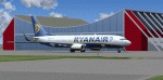
Memmingen Airport (EDJA) is located 100km West of Munich in Southern Germany. Several airlines operate out of the airport including Ryanair, Hapag-Lloyd Express, and Air Berlin. It's a small public airport. One of 4 airports in Bavaria with commercial air service and it has the highest elevation of all of Germany's commercial airports. Prior to 2008-09-25, it was known as Allgäu Airport/Memmingen. The airport not only serves Memmingen and the Allgäu area but also provides a low-cost alternative to Munich Airport.
This scenery is developed for FS2004 and updates the airport with new buildings and textures, along with the correct runway and taxiway dimensions and lighting.
| Filename: | Mega_Airport_Memmingen_EDJAFMM_Germany.zip |
| License: | Freeware, limited distribution |
| Added: | 7th July 2010, 23:19:27 |
| Downloads: | 6,251 |
| Author: | Ben Elsen |
| Size: | 9.49 MB |
| Category: Flight Simulator X - Scenery | |
| Greater Kankakee KIKK |
|
Images related to this file:
File Description:
FSX Scenery - Greater Kankakee Airport (IATA: IKK, ICAO: KIKK, FAA LID: IKK) is a public airport located three miles (5 km) south of the central business district of Kankakee, in Kankakee County, Illinois, United States. The airport was opened in 1962 and continues to operate as a general aviation facility serving the Kankakee area and South Chicago. It is 60 miles (97 km) south of Chicago and 75 miles (121 km) north of Champaign, Illinois. It is the largest Airport between the Chicago Midway Airport and the Champaign Airport. Greater Kankakee is a general aviation airport, consisting of mostly private aircraft with a mix of corporate and business aircraft usage. Created by John B Loney Jr.
| Filename: | Greater_Kankakee_KIKK.zip |
| License: | Freeware, limited distribution |
| Added: | 20th March 2012, 01:36:22 |
| Downloads: | 647 |
| Author: | John B. Loney, Jr. |
| Size: | 4.09 MB |
| Category: Flight Simulator X - Scenery | |
| Goma Intl (FZNA) DRC and Gisenyi (HRYG) Rwanda |
|
Images related to this file:
File Description:
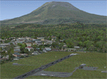
This project includes the neighboring Goma Intl (FZNA) and Gisenyi (HRYG) airports. After Goma's only runway was severely damaged by the eruption of Mount Nyiragongo in 2002, the runway, originally 3000m long, was reduced to 1800m of serviceable pavement after lava flowed onto the northern part runway and through the city center. In 2013, German NGO Welthungerhilfe ("World Hunger Aid") signed a contract to rehabilitate 500m of runway damaged by the lava flow. Goma resumed scheduled international flights in 2015, and this project reflects the airport as of March 2016, with runway 18/36 renumbered to 17/35. SRTMGL1 (30m) mesh brings the volcanoes in the area into much greater detail. This scenery is complimented by the Kigali Intl (HRYR) scenery (FSX_HRYR_Kigali_2016.zip).
Updates were created or rebuilt in a manner which carefully aligns airport data with current satellite imagery. Scenery was created using Airport Design Editor X v1.70.6042, SBuilderX 3.13, and the FSX Object Placement Tool. Scenery objects were added and modified from stock FSX scenery to resemble as closely as possible the actual airports. The FSX apron lights included are from the set created by Jim Dhaenens.
| Filename: | Goma_Intl_FZNA_DRC_and_Gisenyi_HRYG_Rwanda.zip |
| License: | Freeware |
| Added: | 4th August 2016, 21:11:20 |
| Downloads: | 2,276 |
| Author: | Carlyle Sharpe |
| Size: | 5.25 MB |
| Category: Flight Simulator 2004 - AFCAD Files | |
| Belfast Aldergrove (EGAA) |
|
File Description:
Belfast Aldergrove is a joint civil and military aerodrome 18 miles NW of Belfast. The civil airport (now known as Belfast International) is the main passenger airport in the Province and handles practically all air cargo. RAF Aldergrove is the only remaining military airfield in Ulster. Details at http://www.raf.mod.uk/rafaldergrove.
This AFCAD file corrects many of the inaccuracies of the FS2004 default airport. The corrections are based on information from the aerodrome chart, Google Earth, and personal observations. None of the changes are strictly accurate to scale. An apron area for helicopters and the occasional RAF transport aircraft has been provided for the military base. The cargo area has also been enlarged and parking provided for up to eight aircraft. Additional parking places have also been provided on the main passenger apron and on the GA apron off taxiway A. A holding area adjacent to taxiway C near the threshold of Rwy 17 has been removed. Various other improvements have been made to taxiways and holding areas on the military side of the airfield. Much of the original base is now disused hence the large number of closed taxiways.
| Filename: | Belfast_Aldergrove_EGAA.zip |
| License: | Freeware |
| Added: | 3rd April 2009, 18:54:38 |
| Downloads: | 513 |
| Author: | John Hubbard |
| Size: | 9.25 KB |
| Category: Prepar3D V1-4 - Scenery | |
| GMTT - Tangier Ibn Battuta Airport |
|
File Description:
Tangier Ibn Battuta Airpor (French: Aéroport de Tanger-Ibn Battouta), IATA: TNG, ICAO: GMTT, is an international airport serving Tangier (Tanger in French), the capital city of the Tanger-Tetouan-Al Hoceima region in Morocco. A new airport terminal building was opened in 2008 to provide for many more flights and increased passenger capability, as Tangier has grown rapidly and modernised.
Aircraft parking space of 40,640 square metres (437,445 sq ft) supports up to four Boeing 737s and one Boeing 747.
For small craft two dedicated sections are assigned. The air terminal is 12,000 m2 (129,167 sq ft) and designed to handle 1,250,000 passengers per year. The cargo terminal is 529 m2 (5,694 sq ft) of covered space.
The 3500 meter long runway 10/28 is open and is capable of handling all sizes of aircraft up to the size of a Boeing 747 and Airbus A380-800.
The airport has an ILS status (Loc – Glide – DME) and offers the following radionavigational aids: VOR – DME – NDB. PAPI lighting available for runway 10/28 for approaches from either direction.
| Filename: | GMTT__Tangier_Ibn_Battuta_Airport.zip |
| License: | Freeware |
| Added: | 9th June 2021, 00:08:54 |
| Downloads: | 774 |
| Author: | Eduardo Puelker |
| Size: | 10.22 MB |
| Category: Flight Simulator 2004 - Scenery | |
| KLXV Leadville CO |
|
File Description:
Leadville/Lake County Airport at 9927' is North America's highest airport. Near the continental divide in Colorado, this airport has a departure procedure going out both ways. That will tell you a little something about the high density altitude.
| Filename: | KLXV_Leadville_CO.zip |
| License: | Freeware |
| Added: | 25th May 2010, 01:06:09 |
| Downloads: | 1,410 |
| Author: | Stuart Baxter |
| Size: | 362.52 KB |


© 2001-2026 AVSIM Online
All Rights Reserved
Privacy Policy |