
Where Flight Simulation Enthusiasts Gather from Around the World!
AVSIM Library - Search Results

| Category: Flight Simulator X - Scenery | |
| POLISH AIRPORTS VOL. 2 X V4 DEMO |

|
Images related to this file:
File Description:
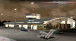
POLISH AIRPORTS VOL. 2 X V4 DEMO is a package of detailed sceneries of EPSC Szczecin, EPLL Lodz, EPZG Zielona Gora and EPRA Radom airports in Poland, fully compatible with FSX/FSX:SE/P3Dv1/P3Dv2/P3Dv3/P3Dv4 and FSW by Dovetail.
This product is a fully functional DEMO version of the commercial payware product. It features same airports layout as in the full version but with limited 3D objects and low resolution textures. Using this free demo ensures no problems with online (VATSIM, IVAO, multiplayer etc.) flying in case some users use the payware scenery and some don't.
Szczecin-Goleniow "Solidarnosc" (SZZ/EPSC) is the main domestic and international airport serving the city of Szczecin in Poland. Lodz Wladyslaw Reymont (LCJ/EPLL), formerly known as Lodz-Lublinek Airport, is a regional airport in central Poland. Zielona Gora-Babimost (IEG/EPZG) is a regional post-military airport located within the greater Zielona Gora agglomeration. Radom Airport (RDO/EPRA), also known as Radom-Sadków Airport is a civil and military airport in central Poland
The product is equipped with an automatic installer, which means that the scenery will be automatically added to the Flight Simulator Scenery Library. Please uninstall all previous versions of this airport you may have installed before. Please make also sure that no duplicated AFCAD files are installed.
Enjoy your virtual flying with Drzewiecki Design!
| Filename: | POLISH_AIRPORTS_VOL_2_X_V4_DEMO.zip |
| License: | Freeware, limited distribution |
| Added: | 23rd August 2017, 01:43:20 |
| Downloads: | 2,316 |
| Author: | Drzewiecki Design |
| Size: | 23.79 MB |
| Category: Flight Simulator 2004 - Scenery | |
| Frozen rivers and lakes (and sea) for Alaska's winter |
|
Images related to this file:
File Description:
This "freezes" all lakes and rivers (and some sea) for winter flying and means they can be landed on with skis or wheels; it is meant for low level flying rather than high level jet flights. This edition covers all of Alaska, except for the Aleutian Islands, as the worst area to do this for is a string of islands. Terrible. Fiddly. It is reversible with an "untick" in the FS scenery library. I have spent some time making sure that the sea and the larger inlets along the southern coast do not get frozen too as they stay ice-free in winter. Along the north shore I went for the peak of the winter with sea ice all the way to the permanent polar cap; this is not totally realistic as there is usually a partially open lead along the coast, but anything else would be ...... fiddly. This is really for use with Ultimate Terrain, though it will work without it. But as UT is what gets all the lakes and rivers there and in the right place it would be a shame not to be using UT. There is a blurry transition between southern Alaska and Canada so you may need the recent Canada post too.
| Filename: | Frozen_rivers_and_lakes_and_sea_for_Alaskas_winter.zip |
| License: | Freeware, limited distribution |
| Added: | 8th September 2011, 11:53:51 |
| Downloads: | 681 |
| Author: | Roger Wensley |
| Size: | 493.23 KB |
| Category: Flight Simulator 2004 - Scenery | |
| Arctic Runway Signs in the "Northern Domestic Airspace", Canada |
|
Images related to this file:
File Description:
These are scenery bgl's to replace those previously posted for Cape Dorset, Gjoa Haven, Igloolik, and Whale Cove. All of these airfields are within what is marked on the chart as "Northern Domestic Airspace" and their runway signage is not given as a magnetic bearing but as a true bearing. This is because at those latitudes, close to magnetic north, the magnetic field is more vertical than horizontal and magnetic readings become unreliable. Planes report their course as a true course, and fly at a height that reflects their true course instead of their magnetic course. The picture shows the runway sign for Qikiqtarjuaq CYVM (which used to be called Broughton Island) which I am working on right now, and I realised that my training was so far behind me that I had forgotten all of the above. The boundary line of the two air spaces is not a straight line; the furthest south it reaches is on the west coast of Hudson Bay just north of Churchill. To the east it passes through the southern end of Baffin Island, and to the west it is north of the coast at the Alaskan border, and there is an illustration included here.
| Filename: | Arctic_Runway_Signs_in_the_Northern_Domestic_Airsp.zip |
| License: | Freeware, limited distribution |
| Added: | 11th June 2011, 03:06:36 |
| Downloads: | 307 |
| Author: | Roger Wensley |
| Size: | 1.21 MB |
| Category: Flight Simulator 2004 - Original Aircraft | |
| Lockheed EP-3E Aries II |
|
Images related to this file:
File Description:
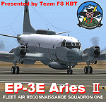
FS2004 Lockheed EP-3E Aries II, a turboprop-based signals reconnaissance aircraft, operated by the United States Navy. It is based on a Lockheed P-3 Orion airframe, which is in turn based on the Lockheed L-188 Electra passenger airliner. There are eleven EP-3Es in the Navy's inventory, the last of which was delivered in 1997. A total of twelve P-3C aircraft were converted to replace older versions of the aircraft, which had been converted in the late 1960s and early 1970s.
On April 1, 2001, an EP-3E (PR-32) was intercepted by Chinese F-8 fighter jets about 70 miles off the Chinese island of Hainan. One of the Chinese jets bumped the wing of the EP-3E, which was forced to make an emergency landing in China. VQ-1 provides electronic reconnaissance from the east coast of Africa to the west coast of the United States. The squadron maintains a permanent detachment in Misawa Japan and has maintained a continuous presence in the Arabian Gulf since July 1992.
The model is the seventh P3 series aircraft by Team FS KBT. This model was made with Gmax. By Team FS KBT
| Filename: | Lockheed_EP3E_Aries_II.zip |
| License: | Freeware |
| Added: | 10th April 2010, 08:39:01 |
| Downloads: | 6,971 |
| Author: | Team FS KBT |
| Size: | 31.24 MB |
| Category: Flight Simulator X - Scenery | |
| RAF Horsham St Faith - Norfolk, England |
|
File Description:
RAF Horsham St Faith is a former Royal Air Force station near Norwich, Norfolk, England which was operational from 1939 to 1963. It was then developed as Norwich International Airport.
The airfield was first developed in 1939 and officially opened on 1 June 1940 as a bomber station. It had been built pre-war and had five C-type hangars, permanent brick and tiled buildings with central-heating and a high standard of domestic accommodation.
RAF Horsham St. Faith was a front-line RAF station for many years, and its squadrons participated in many post-war exercises. The station was deactivated on 1 August 1963.
| Filename: | RAF_Horsham_St_Faith__Norfolk_England.zip |
| License: | Freeware |
| Added: | 9th February 2016, 11:17:44 |
| Downloads: | 225 |
| Author: | Terry Boissel |
| Size: | 1.98 MB |
| Category: Flight Simulator 2004 - Aircraft Repaints, Textures and Modifications | |
| Lloyd Aereo Boliviano Boeing 727-200 |
|
File Description:
A repaint of the Vistaliners 727-200 model in the 2004 interim colors of Lloyd Aereo Boliviano. LAB uses its 727s on domestic routes within Bolivia, as well as on international routes around Central and South America. This aircraft, CP-2455, is represented in this first version of LAB's newest colors, which it wore between 2004 and 2005. Today it flies in the final scheme, which has a reduced amount of blue on the fuselage and tail. 32-bit, slightly weathered textures for a high quality repaint; much attention to detail, many photographs used in the making. Original aircraft by Vistaliners for FS 2004, textures by Rodrigo Flores.
| Filename: | Lloyd_Aereo_Boliviano_Boeing_727200.zip |
| License: | Freeware, limited distribution |
| Added: | 7th November 2007, 02:55:18 |
| Downloads: | 805 |
| Author: | Rodrigo Flores |
| Size: | 9.58 MB |
| Category: Flight Simulator X - Scenery | |
| CJX - Crooked Creek Airport - Alaska, USA |
|
Images related to this file:
File Description:
Crooked Creek Airport (IATA: CKD, FAA LID: CJX) is a public airport located two miles (3 km) south of the central business district of Crooked Creek, in the U.S. state of Alaska.
Increased runway length from 2,029 feet to 3,300 feet and width from 60 feet to 75 feet. Changes were made based on 2010 construction plans.
Created with Airport Design Editor 9x by ScruffyDuck Software using current FAA documentation and Google Earth measurements, this package offers a replacement for FSX's stock airport. All these enhancements are as close to the real airport as I can get with stock library objects and addition of custom models.
| Filename: | CJX__Crooked_Creek_Airport__Alaska_USA.zip |
| License: | Freeware |
| Added: | 23rd October 2014, 11:00:32 |
| Downloads: | 351 |
| Author: | Wayne Roberts |
| Size: | 244.27 KB |
| Category: Orbiter - Miscellaneous Files | |
| SpaceHAB Research Double Module (RDM) v3.0 |
|
File Description:
This addon reproduces the SpaceHAb RDM that was the main research facility during STS-107. The SpaceHAB RDM made its first flight on STS-107 but it was lost when the Space Shuttle Columbia broke up over the north-central area of Texas. The SpaceHAB RDM was developed by SpaceHAB Inc. for NASA to provide modern microgravity research facilities to fly on the Space Shuttle. The SpaceHAB RDM measures 4.5 m in width, 3.3 m in height and 11 m in length. It is so long because it uses an external airlock to provide access to the module as it is located in the payload bay.
| Filename: | SpaceHAB_Research_Double_Module_RDM_v30.zip |
| License: | Freeware |
| Added: | 7th August 2003, 15:31:00 |
| Downloads: | 1,376 |
| Author: | David Sundstrom (Orbiter Fan) |
| Size: | 157.39 KB |
| Category: Flight Simulator 2004 - Scenery | |
| Old Lima, Ohio Municipal Airport (KLIA) |
|
Images related to this file:
File Description:
Opened; 1933. Closed; 1980. Built in 1933, it first consisted of 3 sod runways, with a single hangar located in the Northwest corner. It later (around 1960) sported a single paved east-west runway (9/27, 3,500 ft) and two sod strips, with one running parallel to the North of the paved runway. In addition, it had a small office/terminal, a main service hangar, and 3 long T-hangars. It's "golden years" were from 1953-63, when Lake Central Airlines ran DC-3 service connecting Lima to Columbus, Cincinnati, and Pittsburgh. To view the entire scenery, you'll need two Sidney Schwartz libraries - details in readme.
| Filename: | Old_Lima_Ohio_Municipal_Airport_KLIA.zip |
| License: | Freeware |
| Added: | 19th February 2011, 15:55:16 |
| Downloads: | 95 |
| Author: | Stephen Plumb |
| Size: | 5.9 KB |
| Category: Flight Simulator X - Aircraft Repaints, Textures and Modifications | |
| North American AT-6 Harvard (G-BTXI) |
|
Images related to this file:
File Description:
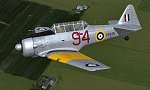
This is a repaint for the freeware Warwick "Wozza" Carter AT-6G Texan. This repaint depicts the restored Harvard Mk.IIB RCAF Ser. FE695, G-BTXI, registered to The Fighter Collection. Based at Duxford, England, the aircraft is painted in the same colors it wore while serving across Eastern and Central Ontario, Canada, from December 1942 until November 1945. The color scheme is known as an "Empire Air Training Scheme". This repaint includes all new exterior textures (including specular and bump maps), new engine and modified wheel well textures, and new and modified cockpit textures throughout. This repaint requires the files t6texmod.zip and fsds_t-6update.zip to be installed first.
| Filename: | North_American_AT6_Harvard_GBTXI.zip |
| License: | Freeware |
| Added: | 27th June 2013, 16:55:56 |
| Downloads: | 312 |
| Author: | John Terrell |
| Size: | 8.5 MB |
© 2001-2026 AVSIM Online
All Rights Reserved
Privacy Policy |