
Where Flight Simulation Enthusiasts Gather from Around the World!
AVSIM Library - Search Results

| Category: Flight Simulator 2004 - AFCAD Files | |
| Guam Int´l Airport (GUM/PGUM) |

|
File Description:
An AFCAD2 File for Guam-Antonio BWon Pat Int´l Airport (GUM/PGUM). The airport is 6,199 miles from the U.S. West Coast and 1,584 miles from Osaka, Japan. The entire airport area has been completely reconfigured with more apron space, more gates, new taxiways and lots of GA parking. Airline Gate allocations are also included based on published airline schedules. Bonus files in this pack include GA and Cargo AI traffic. This file is for the Guam Airport scenery by Bill Melichar (guam04.zip)
| Filename: | Guam_Intl_Airport_GUMPGUM.zip |
| License: | Freeware |
| Added: | 11th December 2004, 01:25:07 |
| Downloads: | 3,487 |
| Author: | Lee Brompton |
| Size: | 61.37 KB |
| Category: Flight Simulator X - Scenery | |
| SBCC - The Cachimbo Air Base - Photoreal - Re-uploaded |
|
Images related to this file:
File Description:
The Cachimbo Air Base is a support base located in Serra do Cachimbo, south of Para State, in the Amazon Forest - Brazil. The unit was created with the main objective of serving as a base of support for aircrafts operations in the traffic link between the north and southeast of Brazil. Previously, the path could only be secure realized following the coast, a much longer way. Now you can fly this great scenery today and feel like how is operating in the middle of the Amazon Forest.
| Filename: | SBCC__The_Cachimbo_Air_Base__Photoreal__Reuploaded.zip |
| License: | Freeware, limited distribution |
| Added: | 27th December 2009, 09:02:24 |
| Downloads: | 2,946 |
| Author: | Jorge Amengol |
| Size: | 8.25 MB |
| Category: Flight Simulator X - Scenery | |
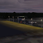
| East Coast Victoria v2 for ORBX v2 YLKE Lakes Entrance YGRL Great Lakes Airport YORB Orbost YMCO Mallacoota |
|
Images related to this file:
File Description:
'East Coast Victoria v2' is made to match ORBX Australia v2 scenery. For ORBX v1 or no ORBX use 'East Coast Victoria'. There are 4 airports. YLKE Lakes Entrance YGRL Great Lakes Airport YORB Orbost YMCO Mallacoota. ORBX has done 2 of these (YORB, YMCO) as they have done every airport included with FSX in Australia to a reasonable standard. If I had not already done them for ORBX V1 I would not have bothered. However these are better than ORBX because the surroundings have been modified to match real life. Towns have been added or shifted. Forests cut down or added. There are also custom accurate versions of the terminal buildings. Included is an AI traffic files that covers the airports (little or no traffic from ORBX). In short a lot more time spent by me as I did not have to do every airport in Australia! These files are for Flight Simulator X. Made using Airport Design Editor using some objects borrowed from Robert Budd's excellent Baccus Marsh. REQUIRED The scenery is designed to interface with ORBX FTX_AU V2 scenery for Australia (payware).
| Filename: | East_Coast_Victoria_v2____for_ORBX_v2____YLKE_Lake.zip |
| License: | Freeware |
| Added: | 16th September 2019, 16:27:48 |
| Downloads: | 388 |
| Author: | Colin Jeffery |
| Size: | 6.32 MB |
| Category: Flight Simulator 2004 - Scenery | |
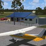
| Paulatuk CYPC in the Northwest Territories, Canada |
|
Images related to this file:
File Description:
Paulatuk is on the coast of northern mainland Canada, 200 miles east of Tuktoyaktuk and 170 miles southwest of Ulukhaktok. It is just to the east of the Parry Peninsula, which has at its northern tip the Cape Parry DEW line Main Station. Paulatuk was established in the 1920's, and the population now numbers around 320. Paulatuk airfield is close to the village but on higher ground, while the village follows the curve of the coast. The 4,000 feet of 100 feet wide gravel runway is aligned 021T/201T where T stands for "true" as opposed to magnetic in the Northern Domestic Airspace. Only JETA-1 is available unless there is 100LL in drums. There are flights by Aklak Air from Inuvik, which is around 250 miles to the west; Aklak Air is actually Kenn Borek under a diferent name. The AI is for a daily passenger flight, and for a cargo flight on Wednesdays. In the summer, float planes use the lake to the south of the village, but I have no information as to docks or any other facilities; probably there aren't any.
| Filename: | Paulatuk_CYPC_in_the_Northwest_Territories_Canada.zip |
| License: | Freeware, limited distribution |
| Added: | 3rd December 2012, 21:58:47 |
| Downloads: | 277 |
| Author: | Roger Wensley |
| Size: | 4.39 MB |
| Category: X-Plane - Scenery | |
| WW01 Susi Air Makki Airstrip v1.0.0 |
|
Images related to this file:
File Description:

This is an X-Plane 11 scenery for Makki Airstrip (WW01) in Makki, Papua, Indonesia. Located in the region of the Baliem Valley, in central Papua. This is one of the destinations for "PT ASI Pujiastuti Aviation", operating as Susi Air, an Indonesia airlines established in late 2004 by Mrs. Susi Pudjiastuti. This scenery was tested and is operational (as of January 10, 2017) in "X-Plane 11 Public Beta #5 64 bit", Windows 10 Home. It was also tested and is operational (as of January 10, 2017) in "X-Plane 10.51 64 bit", Windows 10 Home.
| Filename: | WW01_Susi_Air_Makki_Airstrip_v100.zip |
| License: | Freeware |
| Added: | 11th January 2017, 17:37:12 |
| Downloads: | 55 |
| Author: | Rui Mesquita |
| Size: | 2.54 MB |
| Category: X-Plane - Scenery | |
| WW56 Susi Air Pass Valley Airstrip v1.0.0 |
|
Images related to this file:
File Description:

This is an X-Plane 11 scenery for Pass Valley Airstrip (WW56) in Pass Valley, Papua, Indonesia. Located in a wild life refugee valley, in central Papua. This is one of the destinations for "PT ASI Pujiastuti Aviation", operating as Susi Air, an Indonesia airlines established in late 2004 by Mrs. Susi Pudjiastuti. This scenery was tested and is operational (as of January 10, 2017) in "X-Plane 11 Public Beta #5 64 bit", Windows 10 Home. It was also tested and is operational (as of January 10, 2017) in "X-Plane 10.51 64 bit", Windows 10 Home.
| Filename: | WW56_Susi_Air_Pass_Valley_Airstrip_v100.zip |
| License: | Freeware |
| Added: | 12th January 2017, 04:00:21 |
| Downloads: | 56 |
| Author: | Rui Mesquita |
| Size: | 2.87 MB |
| Category: Flight Simulator X - Scenery | |
| RAF Topcliffe - Yorkshire, England |
|
File Description:
RAF Topcliffe (ICAO: EGXZ) is a Royal Air Force station in North Yorkshire, England. It is a satellite station serving in the role of a Relief Landing Ground for Tucano aircraft of the Central Flying School (CFS) based nearby at RAF Linton-on-Ouse (one of two, the other being Dishforth Airfield). As such, no RAF personnel are based permanently at the airfield and airfield services are provided by personnel assigned to RAF Linton-on-Ouse.
Topcliffe is also used by the Air Training Corps as a motor glider airfield for Gliding induction courses and Gliding scholarships.
| Filename: | RAF_Topcliffe__Yorkshire_England.zip |
| License: | Freeware |
| Added: | 1st January 2016, 17:50:08 |
| Downloads: | 404 |
| Author: | Terry Boissel |
| Size: | 1.34 MB |
| Category: Flight Simulator X - Scenery | |
| RAF Stenigot |
|
File Description:
RAF Stenigot was a Second World War radar station situated at Stenigot, near Donington on Bain, Lincolnshire.
It was part of the Chain Home radar network, intended to provide long range early warning for raids from Luftflotte V and the northern elements of Luftflotte II along the approaches to Sheffield and Nottingham and the central midlands.
I would like to give credit and to acknowledge the following authors without whose work I could not have made this scenery; all credit for the models contained in it is theirs I merely placed it. Ted Andrews - Ian Pearson - Mike Hudson.
| Filename: | RAF_Stenigot.zip |
| License: | Freeware |
| Added: | 3rd October 2015, 18:50:05 |
| Downloads: | 309 |
| Author: | Terry Boissel |
| Size: | 130.31 KB |
| Category: Flight Simulator X - Scenery | |
| 0VG - Lee County Airport - Virginia, USA |
|
Images related to this file:
File Description:
Lee County Airport (FAA LID: 0VG) is a public use airport in Lee County, Virginia, United States.It is owned by Lee County and located five nautical miles (6 mi, 9 km) southwest of the central business district of Jonesville, Virginia.
Added taxiways and aircraft parking along with custom buildings. Created with Airport Design Editor by ScruffyDuck Software using current FAA documentation and Google Earth measurements, this package offers a replacement for FSX's stock airport. All these enhancements are as close to the real airport as I can get with stock library objects and custom buildings.
| Filename: | 0VG__Lee_County_Airport__Virginia_USA.zip |
| License: | Freeware |
| Added: | 21st November 2014, 01:40:00 |
| Downloads: | 317 |
| Author: | Wayne Roberts |
| Size: | 102.53 KB |
| Category: Flight Simulator 2004 - Aircraft Repaints, Textures and Modifications | |
| ATR 72-500 DOVE |
|
File Description:
This package contains livery of Danube Wings for pay-ware addon Flight One Software ATR 72-500. This package contains only BMP files of external textures(templates) and for the proper installation you have to use TEXT-o-MATIC, which comes with the ATR 72-500.This is the repaint of the first aircraft of this company with registration OM-VRA.
Danube Wings is a new company in Slovakia. The company provides scheduled and non-scheduled flights. The scheduled service should begin in March 2009. The vision of Danube Wings is to provide low-fare options for travel in region of Central Europe.
| Filename: | ATR_72500_DOVE.zip |
| License: | Freeware |
| Added: | 14th February 2009, 21:08:09 |
| Downloads: | 402 |
| Author: | Martin Šulek |
| Size: | 3.77 MB |
© 2001-2026 AVSIM Online
All Rights Reserved
Privacy Policy |