
Where Flight Simulation Enthusiasts Gather from Around the World!
AVSIM Library - Search Results

| Category: Flight Simulator X - Missions | |
| Mountain Flying in Switzerland (Part 1 of 3) |

|
Images related to this file:
File Description:
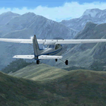
Mountain Flying in Switzerland (Part 1 of 3)
Welcome to beautiful Geneva, Switzerland. Today is a gorgeous day to be taking your first mountain flight in the Swiss Alps. Your round trip will take you over two mountain passes, an airport in the middle of a steep sided canyon and another airport in the heart of the Alps Part 1 of 3: Col de Coux - This first leg takes you from the grass runway in Geneva up and over a mountain pass named Col de Coux and down to an airport in a canyon. Along the way you will be able to enjoy all the beautiful scenery, including incredible views of the snow covered Alps and Lake Geneva, with its world famous jet d'eau. The chief flight instructor from the Aeroclub de Geneve will help you navigate and also handle all the radio communications, but it will be up to you to safely arrive at your destination. You are the Pilot in Command! Includes: - Detailed aeronautical charts of your departure, route, and arrival - FSX Nav Log, Flightplan and GPS with programmed waypoints - Real world voice actors with written text of entire dialog.
| Filename: | Mountain_Flying_in_Switzerland_Part_1_of_3.zip |
| License: | Freeware |
| Added: | 24th June 2010, 01:33:36 |
| Downloads: | 2,698 |
| Author: | Chris Klein |
| Size: | 33.32 MB |
| Category: Flight Simulator 2004 - AI Flight Plans | |
| DHL Cargo *PART 2* DHL-European Air Transport (EAT) |
|
File Description:
Flightplan for the DHL-European Air Transport. DHL move his HUB at march 30th from Brussels to Leipzig. Leipzig are now the biggest HUb in Europe for a Cargo based Airline. Brussels still remains as a small local HUB like Stockholm, Bergamo, Nottingham/East Midlands and so on... With the second part of the DHL-flightplans comes the Belgium-division with 18 Airbus 300B4-200F converted freighters and 11 Boeing 757-200 special converted freighters, diverted into old and new colors. Also included in this part 2 all needed paints for the plan. Old color, new color, Three windows in the back by Boeing 757 and both colors with white nose. to install the liverys please read the "install instructions§ file inside this package. Many thanks to Josef Petric. He gives his blood in the last fiew weeks to create this plan, because it was very diffcult to get informations about the DHL-Flights. Stay tuned. some DHL-feeders will follow soon. You only need the Base files for the AIaardvark Boeing 757-200RR and the FSPainter Airbus A300B4-200F (. Base files package for FS2004 (aia_box.zip and ai_airbus_complete_120685.zip) available at Avsim
| Filename: | DHL_Cargo_PART_2_DHLEuropean_Air_Transport_EAT.zip |
| License: | Freeware |
| Added: | 18th April 2008, 19:38:00 |
| Downloads: | 4,188 |
| Author: | Josef Petric/Juergen Baumbusch |
| Size: | 2.54 MB |
| Category: Flight Simulator 2004 - AI Flight Plans | |
| Vision Airlines (RBY - Ruby) Flightplans - some 52-week and some "normal". |
|
File Description:
These are fictional flightplans for Vision Airlines (ex Vision Air) of North Las Vegas, USA. There are 2 sets of flightplans, each using a different part of the fleet to the other. One set are plans that operate on the 52-week concept - these contain charters that can be varied every week if you use Matthew Ministry's flightplan swapper routine. The other set fly fixed flights each week (in fact 2 planes fly 24-hour plans, canyon sightseeing) and also include Vision's Boeing fleet that fly military charters via Europe. You can use both sets to get the whole fleet, or either to get a flavour of Vision Airlines. If you want to use just 1 week's charters, you can get the whole fleet but the charters will repeat every week. These plans will add some Dorniers (228, 328TP and 328J) to North Las Vegas (KVGT) and points on Vision's scheduled network, plus the Houston-based 328Jets that fly to Alamogordo. If you use the 52-week system the rest of the fleet will fly charters almost nationwide, limited only by the real-world aircraft's range (so no Miami and no Boston, but KLAX, KPDX and KSEA). They will also operate into many smaller regional and municipal airports.
| Filename: | Vision_Airlines_RBY__Ruby_Flightplans__some_52week.zip |
| License: | Freeware |
| Added: | 12th January 2009, 23:12:57 |
| Downloads: | 760 |
| Author: | Morello Ciliegia |
| Size: | 2.44 MB |
| Category: Flight Simulator 2004 - Flight Plans | |
| Crossing North America Flight Adventures-Package 4 |
|
File Description:
Here's the 4th edition of my "Crossing North America" adventure and we are still working our way around in Alaska. The 10 flightplan-adventures included with package #4 begin at Cordova in Prince William Sound, then we travel up and deep into the Klondike region of east central Alaska. We end our adventures at Hoonah, AK just south of the Glacier Bay National Park. Our journey will have had us crossing the Wrangell mountains (twice) and viewing some of Alaska's most dramatically beautiful areas the state has to offer. The next package (#5) will be the final one for Alaska, as it will tour the Southeast part of the state, including the Capital of Juneau. Ironically, it is the capital of Alaska that is the only state capital you cannot drive to, as the only way you can reach Juneau is either by boat or plane. Package #6 will begin our tour of Canada, starting with the Yukon! Packages 1-4 have now totaled 4,678 miles flown, using 34 different aircraft!
With this package #4, the aircraft used are as follows:
default Caravan & KingAir,
Piaggio P-166 turboprop twin,
Cherokee 180,
Cessna 150,
Maule M-760 Amphibian,
Sikorsky S-39,
McDonnell-Douglas MD500E helicopter,
Piper Tri-pacer,
Pilatus PC-12,
Enjoy!
| Filename: | Crossing_North_America_Flight_AdventuresPackage_4.zip |
| License: | Freeware |
| Added: | 9th July 2004, 12:57:23 |
| Downloads: | 3,545 |
| Author: | Steve (Bear) Cartwright |
| Size: | 1.19 MB |
| Category: Flight Simulator 2004 - Scenery | |
| Memmingen Airbase (ETSM, South-Germany) including MilCom AI-Traffic |
|
File Description:
This airbase, located in the beautiful Allgaeu (Bavaria, South-Germany) about
55 NM in the west of Munich, was the homebase of the JaBoG34 riding the F104
1964 thru 1987 and then the Tornado PA200. After JaboG34 had been dissolved
in 2003, it was decided to use the airfield for commercial air traffic.
In memory of the JaBoG34 at the "Memminger Berg" and to keep the ATC people busy,
I created this airfield with combined military / commercial AI-Traffic.
The included AI-Package contains Lockheed F-104 GAF, Republik F-84F GAF,
Panavia-Tornado GAF, Airbus-A310 GAF, Lockheed-P3 Orion GNY, Boeing-727 with
UN paint, Boeing-737 Lauda, Bombardier CRJ-200 Lufthansa and aircraft.cfg for
MS: Beech-Baron 58, King-Air 350, and Learjet 45.
Several F104's and Tornados perform touch and goes in the local area, further an
UN-B727 leaves IFR to Decimomannu (LIED) and a GAF-A310 goes IFR to Cologne.
Some of the commercial airplanes perform touch and goes also, a CRJ-200 goes
IFR to Munich and a Lauda-737 goes IFR to Vienna per attached flightplan.
Lago's FSE is required in order to see most of the major buildings / objects.
Welcome to the party again.
| Filename: | Memmingen_Airbase_ETSM_SouthGermany_including_MilC.zip |
| License: | Freeware, limited distribution |
| Added: | 16th November 2005, 16:22:23 |
| Downloads: | 7,704 |
| Author: | Klaus Jone |
| Size: | 11.47 MB |
| Category: Flight Simulator X - Scenery | |
| Rybachiy Submarine Base "The Hornet's Nest" |
|
Images related to this file:
File Description:
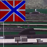
Rybachiy Nuclear Submarine Base, NATO reporting name "The Hornet's Nest." This scenery is specific to the Aerosoft addon "Kamchatka - the Lost Continent." You are welcome to use it, regardless, but in testing, only half the peninsula showed with the Aerosoft scenery inactive.
Rybachiy has a long and chequered past as the home of the Soviet Pacific submarine fleet. It launched the ill fated K-129 in 1968 and is the final stop for submarines before being "disposed" of, a process that includes either sinking the nuclear core, or interring it indefinitely on a floating platform.
I more or less copied the state depicted in Wikimapia, it shows the docks relatively clear of excess retired subs and 10 or 12 Grumble launchers at the SAM site, which is no longer the case. I wonder who's buying up the retired SA-10's..
The odd looking torpedo on the loading dock is the 240 mph, super-cavitating VA-111 Shkval, which is essentially a rocket engined defensive weapon. A consequence of the presumed and persistent superiority of Western underwater acoustics, it is understood that the enemy would "get the drop." In such a circumstance, the crew would load a Shkval and fire it in the direction of the approaching torpedo, which would force the attacking sub to sever the control wire to avoid being hit.
Elsewhere, at the SLBM dock, you can see the R-29 Vysota being loaded. It is being advertized as a launch platform for low orbit satellites, besides MIRV's, of course. The SLBM dock is removed from the main base. Steer north of west from the docks, or use Wikimapia to find it.
This is an edit and enhancement of a scenery addon already published by Blaunarwal. He did an excellent job adding detail to Yelizovo, Petropavlovsk-Kamchatsky and Avachinskiy Bay. I contacted him and asked if he would collaborate and edit his AI boat traffic to match the docks I moved and he graciously agreed. I tried to arrange the files so it would be equally easy to install to the previous version or as an original.
| Filename: | Rybachiy_Submarine_Base_The_Hornets_Nest.zip |
| License: | Freeware, limited distribution |
| Added: | 18th August 2013, 19:32:26 |
| Downloads: | 781 |
| Author: | Rick Keller |
| Size: | 198.88 MB |
| Category: Flight Simulator X - Miscellaneous Files | |
| Boeing 737NGX Checklist |
|
Images related to this file:
File Description:
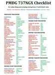
There are already some great checklists for the PMDG NGX done by others but what I've found with these checklists is that I find them to include many steps that I normally don't perform on every single flight, things like testing all fire bells and whistles etc.
So for this reason I decided to first setup the cockpit in a cold & dark state which corresponds to how the flightdeck should look like for every single switch in the cockpit according to the Boeing doc that came with the NGX after running both the shutdown and secure flows and then from this state make a checklist including all the phases of the flight from preflight at the origin to securing the a/c at the destination.
Since I'm doing all my flying online I have also included items such as filing your flightplan, asking ATC for push and engine startup clearence etc. Not fully realistic to include those kind of items in a checklist but the main purpose of this checklist will be to serve as a memory note how to perform a correct flight online in the NGX. Being used to the company of a FS2Crew FO this checklist will be there to help not forgetting about any steps during all the phases of the flight.
If you just like me have been looking for a simple checklist that will help you remember all the normal steps performed on a normal flight I hope you'll enjoy this checklist!
| Filename: | Boeing_737NGX_Checklist.zip |
| License: | Freeware |
| Added: | 18th September 2011, 17:40:11 |
| Downloads: | 8,493 |
| Author: | Richard Asberg |
| Size: | 37.91 KB |
| Category: Flight Simulator 2004 - Gauges | |
| FS2004 GPS Map View Gauge v3.0 |
|
File Description:
The ultimate gauge. The Map will show: Airports details (Runways ID's, length & ILS), VOR's and NDB's frequencies,
Intersections and waypoints, Airspaces, Approaches and flight routes. You can toggle the view
you require for your flight. Also you can zoom in/out to see the nearest airports, vor's and
ndb's. The map will indicate A/C heading flightplan title and waypoints ID's.
Version 3 includes more enhancements such as the ability to input the ICAO code or name of any airport and the map will
show all the frequencies of that airport including ATIS, ILS, AND COM. In addition, the map will show the active
runway designations, length and width.
You can also input ICAO code of any VOR/NDB and the map will show their frequencies.
There was a bug in v2.0, in which if you enter ( click on ENT )the ICAO code of an airport, you will lose the flight
plan loaded. Now you can go back to the flight plan and with the NEXT/PREV buttons you have the choice of where to start
your FP.
The gauge will show Flight Plan Title, originating and destination airports, active waypoint, waypoint index and FP
crusing altitude.
I addition, the gauge will show various useful information, such as, Runway IDs, lenght, width and approach magnetic heading,
Airport name, city, and type. NAV1/2 names, codes, distances and ETA's, ADF1/2 names and codes.
Finally, the gaugee will show other information, such as, magvar, indicated airspeed, mach, ground velocity, ambient
wind velocity and direction, bank angle , and a/c altitude ( radio height ).
All the information above and much more on a single gauge window.
| Filename: | FS2004_GPS_Map_View_Gauge_v30.zip |
| License: | Freeware, limited distribution |
| Added: | 14th September 2005, 14:19:46 |
| Downloads: | 10,848 |
| Author: | Talal Alhaj |
| Size: | 710.05 KB |
| Category: Flight Simulator 2004 - Miscellaneous Files | |
| Sorted POI global cities and airports pack for FSDiscover! |
|
File Description:
README:
FSDiscover! Global Point of Interest pack.
Here is a poi pack of roughly 147 000 cities, 40 000 small airports,
1 177 seaplane bases, 4695 medium airports and 475 of the largest
airports.
Airports are split up in categories, small, medium, big, seaplane base.
Cities are split up into files of 10 000 cities each by size.
There are 15 files for cities.
The smallest cities are in xaa, xab, xac, xad, and so on.
The biggest cities are in xam, xan, until xao.
You should open the files in notepad to see for yourself which city
files to activate in FSDiscover! to balance clutter and detail.
This has been my main problem with the default populated places list;
there is no way to sort by population size
Compared to the default FSDiscover! populated places here are some
notes:
I have noticed that in the default FSDiscover! set for europe and many
other places, the coordinates are placed like on a "honeycomb" grid
which obviously is not very precise. In general, in terms of city map
precision, this pack should be better.
In the default pack, in an area I am familiar with, a city was placed on the other side of
a river compared to reality. In many other areas, you can clearly see
that the cities are not well-aligned with Ultimate Terrain europe or
even some places in UT USA. My theory is that either data was not super
precise for europe to begin with or that the dataset has been arranged
in the honeycomb grid fashion perhaps to reduce clutter or something.
Mostly though, the default populated places FSDiscover! file is very
useful for really small villages since these tend to be forgotten in
other datasets. The problems come when you want to filter out smaller
villages or airports. This is where this pack comes in handy.
Since no data is perfect, you can use this pack alone or in
combination with the FSDiscover! defaults. Personally, I put the same
files in both "Documents/FSDiscover Files" and
"Program Files/FSDiscover" so I can pick and choose a useful combo
from relevant sets inside the options.
Personally, I prefer the cities from this pack and the rest
(mountains, rivers etc.) from the default FSDiscover! pack.
INSTALLATION:
Just unzip the archived files into "C:\Users\YOURUSERNAME\Documents\FSDiscover Files"
or "C:\Program Files (x86)\FSDiscover!\geodata" or both!
I do not know if the geodata folder is completely overwritten some
times or not so keep that in mind. (probably safe, though)
AUTHOR:
fs9_2003 thanks to data made available by opendatasoft.com and ourairports.com
The source for cities:
https://public.opendatasoft.com/explore/dataset/geonames-all-cities-with-a-population-1000
The source for airports:
https://ourairports.com/data
| Filename: | Sorted_POI_global_cities_and_airports_pack_for_FSD.zip |
| License: | Freeware |
| Added: | 6th May 2024, 14:13:54 |
| Downloads: | 53 |
| Author: | Kim Husainov |
| Size: | 3.18 MB |
| Category: Flight Simulator X - Flight Plans | |
| Chas mod of Stearmandriver RNP RNAV Approach into PAJN Rwy 26 for 737NGX |
|
Images related to this file:
File Description:
Modded StearmanDriver(SD) RNP RNAV Rwy 26 into PAJN, Juneau, Alaska. SD gave us a cool little route that while not LATLONG nor Fixname accurate, it couldn't be without legal and occupational liabilities...and it worked, but if you look at his FixNames and the LATLONG from the PAJN.txt file for the 737 NGX...it did work pretty nicely...at least as nicely as the charted RNAV course into Rwy 8. So I created my own procedure LATLONG rightly or wrongly in a multi-step procedure as follows:
1. I took the raw info provided by SD and flew to each of his waypoints,(if you look, almost all of his FIXs were rounded off...to avoid company or legal problems) noting safe altitude, starting out at 7000ft, creating user waypoints in my GTN750, looking around for first, vertical, then horizontal safety...keeping in mind that Ultimately...I would not be using this data for my Duke, but for the Procedure page of my PMDG 737 NGX..which you already saw me fly with SD's fixes.
2. I took my Turbine Duke up and noted the REAL LATLONG as reported by slewing and world map...transposed those numbers into the format that PMDG's procedures needed DDD.mm fractional minutes. I converted using http://www.directionsmag.com/site/latlong-converter/
3.I created my own mid-point user waypoints from the west CHRTRN,and the NNE CHRTS so we could have approaches from those directions.
4. I put my Duke into autopilot, knowing the lateral info...my flightplan was correct, but I would have to handle the Vnav manually. Turns out its rather manageable with the following info: CHRTRN 5000FT - MARMN 3500FT - TRDWL 2500FT - SALMN 1500 - LEMNN 500 - PAJN5 50
My MOD OF SDs RNP RNAV PAJNRwy 26, will be up on Avsim as ChasModRNP RNAV PAJN Rwy 26.zip
Contact:[email protected] - Support: http://forum.avsim.net/topic/466094-any-interest-in-updated-se-alaska-rnav-rnp-approach-procedures-including-juneau/
| Filename: | Chas_mod_of_Stearmandriver_RNP_RNAV_Approach_into_.zip |
| License: | Freeware |
| Added: | 8th May 2015, 11:35:16 |
| Downloads: | 340 |
| Author: | Chas Reed |
| Size: | 144.78 KB |


© 2001-2026 AVSIM Online
All Rights Reserved
Privacy Policy |