
Where Flight Simulation Enthusiasts Gather from Around the World!
AVSIM Library - Search Results

| Category: Flight Simulator 2004 - AI Aircraft | |
| Italian Eurofighter Typhoon (36th Wing) and LIBV Gioia del Colle Air Base |

|
File Description:
-Repaint for the NBAI Typhoon in the color of Italian 36th Wing based at Gioia del Colle (LIBV).
-Updated version of my first airport (LIBV), created with ADE9 and MAIW libraries.
-Flightplans for the Typhoon
| Filename: | Italian_Eurofighter_Typhoon_36th_Wing_and_LIBV_Gio.zip |
| License: | Freeware |
| Added: | 18th May 2012, 15:37:26 |
| Downloads: | 656 |
| Author: | Giorgio Perotti |
| Size: | 2.57 MB |
| Category: Flight Simulator X - Scenery | |
| Gloucestershire Airport |
|
File Description:
Gloucestershire Airport UK (EGBJ) for Microsoft Flight Simulator X (SP1).
This scenery was designed to be used with photographic scenery however a default scenery version also is included. Contains custom built Gmax buildings, taxiways and other objects.
| Filename: | Gloucestershire_Airport.zip |
| License: | Freeware, limited distribution |
| Added: | 31st May 2007, 12:28:25 |
| Downloads: | 4,054 |
| Author: | Terry Shields |
| Size: | 4.23 MB |
| Category: Flight Simulator X - Scenery | |
| LYBE Belgrade Nikola Tesla Airport |
|
File Description:
Belgrade Nikola Tesla Airport (IATA: BEG, ICAO: LYBE) is the primary international airport serving Belgrade, Serbia. Previously known as Belgrade International Airport, it was renamed in 2006 in honour of Serbian-American scientist and
inventor Nikola Tesla.
The airport is situated 12 km (7.5 mi) west, of central Belgrade, in the Surcin Municipality, surrounded by Syrmia's fertile lowlands. Passengers on the right hand side of planes descending from the east have a view of downtown
Belgrade, especially the districts of Cukarica and Novi Beograd. In 2008 the airport installed ILS CAT IIIb equipment to allow aircraft to land and depart in the heaviest of fog, which in past years led to numerous flight diversions
mostly in late December and early January.
The airport is owned and operated by the Public enterprise Aerodrom Nikola Tesla Beograd��. The company recorded profit of 21.5 million euros at the end of 2010.
The national flag carrier and largest airline of Serbia, Jat Airways, uses Belgrade Nikola Tesla as their main hub. It is also one of the hubs for low cost airline Wizz Air. Aviogenex charter airline, and air taxi airlines Air Pink,
Jat Airways AVIO taxi, Prince Aviation and Pelikan Airways also call the airport their home.
The airport charts are included.
This file has the right coordenates, with the apron and characteristics of the airport, airport vehicules and buildings, please take note the the gates numbers needed to changed: C1A= C11, C3A=C13, C5A=C15; general aviation parking
were added a extra number due to repetion on the numbers.
| Filename: | LYBE_Belgrade_Nikola_Tesla_Airport.zip |
| License: | Freeware |
| Added: | 8th November 2012, 03:32:04 |
| Downloads: | 8,838 |
| Author: | Anwar Gonzalez |
| Size: | 15.17 MB |
| Category: Flight Simulator X - Scenery | |
| EGNS - Ronaldsway Airport - Isle of Man, UK |
|
Images related to this file:
File Description:
This scenery is for Ronaldsway Airport which is the main civilian airport on the Isle of Man and made only for FSX with 2 optional files: one version with the Crosswind runway activated and in full operation where both runways will be used for takeoff and landing and one version as the default runway operation: terminal remodeled, both runways now at the correct length, taxiways and taxi signs updated to the latest charts, PAPI for runway 21 now on the correct side of the runway, new control tower, fire station, fuel farm, extra fuel trucks and many other scenery additions, airport views are from inside the control tower (when in tower view). Please view the readme before installation.
| Filename: | EGNS__Ronaldsway_Airport__Isle_of_Man_UK.zip |
| License: | Freeware, limited distribution |
| Added: | 9th February 2014, 00:38:16 |
| Downloads: | 12,604 |
| Author: | Craig Scott |
| Size: | 635.18 KB |
| Category: Flight Simulator X - Scenery | |
| Palermo Punta Raisi LICJ 2011 |
|
Images related to this file:
File Description:
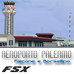
Palermo Falcone e Borsellino airport (also known as Punta Raisi) is an international airport serving the western part of Sicily Island. The airport itself is located 35 km west from Palermo. The airport (LICJ) ranks third by passenger number in southern Italy after Napoli and Catania. This scenery comes with custom terminals, tower, hangers, textures, night lighting, etc. It was designed to fit Mazzokan's Sicily photo scenery and Pietro Mauri's ItalyMesh2004. Both downloads are heavily encouraged. All details about these files are included in the LICJ 2011 User Manual. This scenery was created for FSX only. It has been tested with FSX sp2, but it should work fine with sp1.
| Filename: | Palermo_Punta_Raisi_LICJ_2011.zip |
| License: | Freeware, limited distribution |
| Added: | 30th March 2011, 00:47:52 |
| Downloads: | 6,187 |
| Author: | Thomas Lo Gerfo |
| Size: | 3.07 MB |
| Category: Flight Simulator 2004 - Scenery | |
| Imam Khomaini Intl IKA ver 1.0 (Tehran-Iran) |
|
Images related to this file:
File Description:

.::PERSIAN-SIM::. This package contains simple scenery of IKA Airport (OIIE) scenery and its buildings, aprons and hangars and also changes all international flights of default FS9 AI traffic from OIII to OIIE. The updated navigation systems of the airport contain the additional ILS system to RWY11L, changing ILS RWY 29R to CATII, and changing RUDESHUR (RUS) NDB to VOR. All the mentioned changes have been applied using the latest changes of the real airport. Two new animated windsocks are added to the runway ends in their realistic position at the real airport that help you see the latest changes in wind direction and speed.
| Filename: | Imam_Khomaini_Intl_IKA_ver_10_TehranIran.zip |
| License: | Freeware, limited distribution |
| Added: | 23rd April 2011, 01:29:32 |
| Downloads: | 6,316 |
| Author: | PERSIAN-SIM ::: Behnam Zamani |
| Size: | 23.1 MB |
| Category: Flight Simulator 2004 - Scenery | |
| Hewanorra TLPL on Saint Lucia in the eastern Caribbean |
|
Images related to this file:
File Description:
St Lucia island is to the north of the Grenadines, between Martinique and Saint Vincent. St Lucia is nearly 30 miles long and has a population of 175,000, with two airports. Hewanorra International is at the southern end of the island, the end furthest from the capital, Castries. The reason for this is that at the southern end it was possible to build a runway almost 9,000 feet long, while the airport in the north (Vigie) could not be extended further to accomodate the largest jets. The airport was originally a USAAF base, converted to commercial use.
All buildings are made with photographic textures and include the new terminal and a new control tower. The apron has been extended so that 747's etc can be accommodated, and there are regular international flights by Virgin, BA, Air Canada, Air France, etc and local connecting flights by LIAT; the AI includes both major international airlines and LIAT. The towns around the airport (Vieux Fort etc) are included here: the scenery is based on the "Lesser Antilles Mesh" which is required and can be downloaded for free.
| Filename: | Hewanorra_TLPL_on_Saint_Lucia_in_the_eastern_Carib.zip |
| License: | Freeware, limited distribution |
| Added: | 11th June 2013, 16:23:49 |
| Downloads: | 836 |
| Author: | Roger Wensley |
| Size: | 4.25 MB |
| Category: Flight Simulator X - Scenery | |
| Santa Cruz de la Sierra - Bolivia |
|
File Description:
Scenery Photoreal: Santa Cruz de la Sierra, Bolivia
Santa Cruz de la Sierra: (English: Holy Cross of the Mountain Range), commonly known as Santa Cruz, is the
capital of the Santa Cruz department in eastern Bolivia (17 45', South, 63 14', West)at 416 m above sea level.
The city of Santa Cruz is located not far from the easternmost extent of the Andes Mountains and they are
visible from some parts of the city its Situated too on the Pirai River.
The city of Santa Cruz and its metropolitan area are home to over 70% of the population of the department and
it is one of the fastest-growing cities in the world.
Airports: (NOT included in this package, just Scenery Photoreal of the city)
Viru Viru International Airport (IATA: VVI, ICAO: SLVR) in Santa Cruz de la Sierra, Bolivia is Bolivia's largest
international airport. Viru Viru handles domestic, regional, and international flights from Bolivia to
North America, South America and Europe and is the hub for Bolivia's biggest airline Boliviana de Aviacion (BoA).
The airport is able to handle the largest commercial jets.
El Trompillo Airport (IATA: SRZ, ICAO: SLET) is located in the south part of Santa Cruz, Bolivia, about 2 km
(1.25 miles) away from the central plaza. Airport type:(Public / Military).
Compatible with both FSX and P3D.
| Filename: | Santa_Cruz_de_la_Sierra__Bolivia.zip |
| License: | Freeware |
| Added: | 23rd June 2015, 17:09:33 |
| Downloads: | 1,715 |
| Author: | Marcos A. Rivas Torrez |
| Size: | 69.85 MB |
| Category: Flight Simulator 2002 - Utilities | |
| ATC Radar Screen v4.5 |
|
File Description:
ATC Radar Screen v4.5 is a program that will allow to control a
towered-airport or an entire ARTCC/FIR's sector, during a FS
multiplayer session. This version has some new features: view FSNav's SIDs/STARs in radar screen, change colors of objects in radar screen,new zoom in/out way, refreshes screen more faster, new pilot's online help, new chatbox, host a FS multiplayer session, etc. Doesnt requires any earlier version. This version requires the Manuel's Service Pack 2.
| Filename: | ATC_Radar_Screen_v45.zip |
| License: | Freeware |
| Added: | 20th July 2003, 17:17:28 |
| Downloads: | 1,454 |
| Author: | Manuel Ambulo |
| Size: | 4.05 MB |
| Category: Flight Simulator 2004 - AFCAD Files | |
| Canberra, Australian Capital Territory, Australia (YSCB/CBR) V2 |
|
File Description:
This file is an update of my previous version for the default airport (my previous version not required) a big thanks to Lee Swordy's latest version of AFCAD_2 which i used here, with 35 gates/GA/mil parking asphalt areas around the domestic terminal corrected and gates numbered within the limited space available all taxiways/aprons and the runways now have improved lighting, the helipads have been moved and have also been given lighting (fully tested with Ultimate Traffic but not required)
| Filename: | Canberra_Australian_Capital_Territory_Australia_YS.zip |
| License: | Freeware |
| Added: | 15th December 2003, 01:40:20 |
| Downloads: | 1,086 |
| Author: | Ray Smith |
| Size: | 7.08 KB |


© 2001-2026 AVSIM Online
All Rights Reserved
Privacy Policy |