
Where Flight Simulation Enthusiasts Gather from Around the World!
AVSIM Library - Search Results

| Category: Flight Simulator X - Scenery | |
| Area 51 V1.1 |

|
Images related to this file:
File Description:
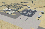
In V1 I added tower comms, taxiways/signs, and deleted start points for all those dirt & other closed runways and made the primary/secondary 14/32.
In V1.1 I have gone through the rest of the airport, aligning and cleaning up scattered oddly placed buildings and placed them in a logical manner - aligned with roads. with parking lots and/or pavement or concrete around their base. Gravel roads added thru the warehouses, sand maintenance roads to water tower and power station, Rec center pool and ballfield touched up. Fire station is in same place but turned towards flight line and added the trucks an ambulance. Fencing all around the flight line.
Also you get the F-117 and Janet 737 WITH traffic file. The Janet 737 is the shuttle aircraft for the Area 51 workers. Watch as the Janet flights arrive each morning from KLAS and depart each night Mon-Fri. KLAS (Las Vegas) Bgl also included with assigned parking at the Janet Terminal.
| Filename: | Area_51_V11.zip |
| License: | Freeware |
| Added: | 24th October 2014, 11:47:01 |
| Downloads: | 2,464 |
| Author: | Jeff Reed |
| Size: | 17.66 MB |
| Category: Flight Simulator 2004 - AI Aircraft | |
| Mikoyan-Gurevich MiG-23 Flogger (Part 2) |
|
Images related to this file:
File Description:

Mikoyan-Gurevich MiG-23 Flogger (Part 2). I present a comprehensive AI traffic model and texture package for this classic (and still-serving) Russian multi-role fighter. The MiG-23, with just over 5,000 built, was Russia's first production of a true multi-role aircraft with a beyond-visual-range air superiority role as its primary function. The aircraft was arguably the direct counterpart of the F-4 Phantom, although it carried about half of the ordnance load. Nevertheless, in capable hands and late versions, the Flogger has been and is a very potent adversary; having served in multiple conflicts in Europe, Asia, Africa, and the Middle East. The MiG-23 entered service in 1970, was eventually operated by 43 countries, and is still in service in 14 of them. An original 8-LOD model brings this aircraft to the flightsim world. This package contains the MiG-23MF; with 6 models and 118 repaints. Original aircraft model, afterburner effects, flight dynamics, and textures by Michael Pearson. Please read included documentation for credits and disclaimers.
| Filename: | MikoyanGurevich_MiG23_Flogger_Part_2.zip |
| License: | Freeware |
| Added: | 29th March 2014, 09:48:56 |
| Downloads: | 638 |
| Author: | Michael Pearson |
| Size: | 26.47 MB |
| Category: Flight Simulator X - Scenery | |
| * Darłowo AFB * - EPDA |
|
Images related to this file:
File Description:
EPDA Airport in Darłowo is a military airfield located on the Polish Baltic coast.
It serves as a base for the naval aviation of the Polish Navy, primarily used for helicopter operations.
Its main tasks include coastal patrols, search and rescue missions, and anti-submarine warfare.
The airfield is home to multi-role helicopters, including the Mi-14 and W-3 Sokół.
Its history dates back to World War II when it was built by the Germans.
After the war, it was taken over by the Polish military and has since functioned as a naval aviation base.
The airport features a concrete runway and infrastructure adapted for the operation of helicopters and military aircraft.
Due to its strategic location on the Baltic Sea, it plays a crucial role in operations related to the security of Poland’s territorial waters.
The airfield is not open to civilian aviation and is used exclusively for military purposes.
Nowadays, it remains an essential part of Poland’s defense system and participates in NATO exercises.
| Filename: | _Darowo_AFB____EPDA.zip |
| License: | Freeware |
| Added: | 10th February 2025, 17:41:56 |
| Downloads: | 76 |
| Author: | Dawid Drobik |
| Size: | 10.44 MB |
| Category: Flight Simulator X - Scenery | |
| Steeple Morden |
|
File Description:
This FSX scenery package is for Former RAF Steeple Morden, USAAF Station No. 122. It includes the main airfield and 14 of the outlying sites
that housed all of the inhabitants. Built in 1940 , originally a grass satellite field of Bassingbourn, Steeple Morden first accommodated the RAF No. 11 and No. 17 OTU (Operational Training Unit), flying Vickers Wellingtons and Bristol Blenheims respectively. The RAF used the airfield from 1940 to July 9th of 1943.
In July of 1943, the RAF turned the base over to the 355th Fighter Group of the 8th USAAF and concrete runways and hard stands were added.
The 355th were famous for destroying more enemy aircraft on the ground than any other unit in the USAAF.
They were dubbed, "The Steeple Morden Strafers" and were comprised of the 354th (WR), 357th (OS) and 358th (YF) Fighter Squadrons.
Study of the site plans and other information revealed that RAF Steeple Morden was very much interwoven with the village of Litlington, Cambridgeshire .
The base may have well be called RAF Litlington instead of Steeple Morden.
| Filename: | Steeple_Morden.zip |
| License: | Freeware |
| Added: | 25th June 2016, 23:51:18 |
| Downloads: | 336 |
| Author: | Terry Flemming |
| Size: | 83.9 MB |
| Category: Flight Simulator 2004 - AI Aircraft | |
| Douglas DC-7 for AI Traffic |
|
Images related to this file:
File Description:

Douglas DC-7 for AI Traffic. The DC-7 propliner was designed for long-range commercial transport, being one of the first aircraft to utilize the polar routes from Europe to North America. Although the DC-7 was a very advanced aircraft for its time of production, it was produced at the cusp of the commercial jetliner age and was quickly eclipsed by a new generation of air travel. Subsequently the DC-7 was not as commercially successful as its predecessors, and only a handful remain in the cargo and aerial firefighting roles. In conjunction with Jake Burrus, I present an 8-LOD AI traffic model to bring this classic transport aircraft to the flightsim world. This package includes 14 models, 40 repaints, and a Photoshop paint kit. The paints in this package focus on DC-7 use from the 1970s to present day, with a few vintage paints thrown in. Aircraft model and master textures by Jake Burrus and Michael Pearson, flight dynamics and repaints by Michael Pearson.
| Filename: | Douglas_DC7_for_AI_Traffic.zip |
| License: | Freeware |
| Added: | 14th July 2015, 20:54:18 |
| Downloads: | 972 |
| Author: | Michael Pearson |
| Size: | 23.99 MB |
| Category: Flight Simulator 2004 - Scenery | |
| Peace River CYPE in northwest Alberta, Canada UPDATED |
|
Images related to this file:
File Description:
This is an updated version of the original post (from 2014) made in November 2018. It provides missing textures, and deals properly with an ai problem that I thought I had already fixed. It also adds extra objects to the apron area and adds a third gate. It is complete in itself and can be installed as-is if you do not have the original post. The Peace River flows east from the Rockies, joining up with the Slave River to empty into Great Slave Lake. The town is on both banks close to a bend where the Peace turns to the north, 245 miles northwest of Edmonton. The population is 7,000 and the surrounding area is either farmland or forest. The airport is just over 3 miles west of the town. The runway is 5,000 feet of wide asphalt (150 feet) aligned 04/22, lit, and with PAPI. There is a second runway to the south of the main runway, 1,900 feet of grass and aligned 08/26. The apron is to the north of the runway at the eastern end and is large; there is a purpose-built terminal building, plus other hangar buildings along taxiway C that extends westward from the apron. The airport is experiencing an increase in scheduled and GA flights in the last few years.
| Filename: | Peace_River_CYPE_in_northwest_Alberta_Canada_UPDAT.zip |
| License: | Freeware, limited distribution |
| Added: | 10th December 2018, 17:33:25 |
| Downloads: | 128 |
| Author: | Roger Wensley |
| Size: | 24.27 MB |
| Category: Flight Simulator 2004 - Scenery | |
| CYPE - Peace River - Northwest Alberta, Canada |
|
Images related to this file:
File Description:
The Peace River flows east from the Rockies, joining up with the Slave River to empty into Great Slave Lake. The town is on both banks close to a bend, 245 miles northwest of Edmonton. The population is 7,000 and the surrounding area is either farmland or forest and used for winter sports; Peace River hosted the 2004 Alberta Winter Games. The airport is just over 3 miles west of the town. The runway is 5,000 feet of wide asphalt (150 feet) aligned 04/22, lit, and with PAPI. There is a second runway to the south of the main runway, 1,900 feet of grass and aligned 08/26. The apron is to the north of the runway at the eastern end and is large; there is a purpose-built terminal building, plus other hangar buildings along taxiway C that extends westward from the apron. The airport gives the impression that it is under-used; there are no long lines of parked planes waiting for the weekend and few scheduled flights. These are mainly (totally?) by Sunwest Home Aviation, but unfortunately nobody has made the textures for Sunwest and my talents do not run in that direction so I have made believable substitutions. There is also a small but obstinate AI difficulty, described in the notes.
| Filename: | CYPE__Peace_River__Northwest_Alberta_Canada.zip |
| License: | Freeware, limited distribution |
| Added: | 10th November 2013, 23:56:22 |
| Downloads: | 334 |
| Author: | Roger Wensley |
| Size: | 10.83 MB |
| Category: Flight Simulator 2004 - Scenery | |
| Alaska South Slope 11; Brevig Mission KTS |
|
Images related to this file:
File Description:
There are four main northwestern Alaska towns which are serviced by Alaska Airlines, and from which local flights spread out. The northernmost is Barrow. Southwest of Barrow is Kotzebue, then Nome, and the furthest south is Bethel (not yet made). This is the fourth in a series for local flights from Nome, and it is on the coast around 50 miles east of Wales, and 60 miles northwest of Nome. There are two other airfields around a large lagoon that is almost totally enclosed from the sea, and Brevig Mission is on the northern shore, just 12 miles northeast of the already-posted Port Clarence. Brevig Mission has a populaton that has risen to 390 in recent years. Tollef Brevik was a Lutheran missionary who was both a pastor and teacher for the Inuit in the area from 1894 onward, travelling from community to community but based in Teller, 6 miles southeast. the village now called Brevig Mission was founded at a later date (unknown to me) and took his name. The airstrip is just east of the village, with two gravel runways; 11-29 which is 3,600 feet of gravel and 04-22 which is 2,600 feet and with PAPI on 22. The AI is the usual for this area, Bering and ERA with some GA and cargo by Everts.
| Filename: | Alaska_South_Slope_11_Brevig_Mission_KTS.zip |
| License: | Freeware, limited distribution |
| Added: | 25th October 2016, 20:52:56 |
| Downloads: | 199 |
| Author: | Roger Wensley |
| Size: | 2.55 MB |
| Category: Flight Simulator 2004 - Scenery | |
| Carp CYRP updated, near Ottawa in Ontario Canada |
|
Images related to this file:
File Description:
This version updates the post of 2006 with specifically modelled buildings for the east apron, plus a new AFCAD file. This is a stand-alone version and does not require you to have downloaded and installed the previous post. Carp airfield is fifteen miles west of Ottawa and two miles south of the town of Carp. There are two runways, 10/28 which is asphalt and almost 4,000 feet long and 100 feet wide, and 04/22 which is gravel and 2,000 feet long. The airfield has a fairly large polulation of general aviation residents and two years ago was expanding under new ownership, with a new terminal building and a large hangar opened and the "Touch'n Go" aviation warehouse that has opened more recently. The first version of Carp really included only the west apron, as that is where all (or almost all) the general aviation is located. I "represented" the east apron buildings without modelling any of them. This version corrects that, and the modeled east apron buildings are the HQ of Helicopter Transport Services Inc. and the adjacent Bell Helicopter service hangar, and the old First Air hangar and offices which are now under new ownership. The smaller hangars on the other side of the apron belong to chapter 245 of the Experimental Aircraft Association.
| Filename: | Carp_CYRP_updated_near_Ottawa_in_Ontario_Canada.zip |
| License: | Freeware, limited distribution |
| Added: | 16th February 2010, 03:18:39 |
| Downloads: | 563 |
| Author: | Roger Wensley |
| Size: | 6.03 MB |
| Category: Flight Simulator 2004 - Scenery | |
| Ivujivik CYIK in Hudson Bay, Quebec, Canada |
|
Images related to this file:
File Description:
Ivujivik is a village of 350 or so inhabitants at N62 25 W78 on the northeastern corner of Hudson Bay. The village does not feature in FS9 but is included in this scenery with approximately the right shape (the coast, even with UT, is not exactly right) so just think of it as a hand-made auto-generated village which gives the airfield a reason. The runway is 3,500 feet of gravel 100 feet wide, which should be enough. I also added the roads, deleted the stock airfield background and added a new background, plus of course there is the scenery file and the AFCAD and AI. You may note that the terminal has the elevation written on the sign as 126', while on the winter photo it is written on the older & bigger sign as 130'. I thought this is because satellite radar has fixed the elevations of all airfields more accurately than before, as Rockcliffe too has gone from 192' to 188'; the alternative explanation is that global warming has raised sea level by 4'. Wow! That's a thought. I presume the new sign was made smaller as a cost saving.
| Filename: | Ivujivik_CYIK_in_Hudson_Bay_Quebec_Canada.zip |
| License: | Freeware, limited distribution |
| Added: | 31st October 2010, 07:41:20 |
| Downloads: | 458 |
| Author: | Roger Wensley |
| Size: | 2.07 MB |


© 2001-2026 AVSIM Online
All Rights Reserved
Privacy Policy |