
Where Flight Simulation Enthusiasts Gather from Around the World!
AVSIM Library - Search Results

| Category: Fly! II - TerraScene | |
| Toledo (Ohio Project) TerraScene Project Pack |

|
File Description:
This is a TerraScene 2.1 Project pack for northwestern Ohio. It covers all of global tile 196,160 with Toledo in the center. It extends into Michigan to the north, including the southern part of Detroit. I have included a grass underlay for Detroit Grosse Ile Airport, which sits on Grosse Ile island. This pack includes updated Tiger Census (2000) shapefile data, adding new water areas, new highways, and other details. All scenery data files are included: USGS data, shapefiles, and a complete water mask. Requires TerraScene 2.1 and Fly!II patched to v240.
| Filename: | Toledo_Ohio_Project_TerraScene_Project_Pack.zip |
| License: | Freeware |
| Added: | 11th April 2003, 23:53:22 |
| Downloads: | 189 |
| Author: | Randall Rocke |
| Size: | 48.69 MB |
| Category: Flight Simulator 2002 - Aircraft Repaints, Textures and Modifications | |
| The AA True Chrome Project: American Airlines Boeing 767-300ER |
|
File Description:
This repaint is part of the American Airlines True Chrome Project. The aim of this project is to provide the most realistic representation of the entire AA fleet. These repaints feature highly accurate 32-bit semi-photoreal textures, realistic alpha map to replicate the aircraft's reflectiveness in combination with photoreal metals and highly refined effects to reflect the most global weather possible. This is but one aircraft out of a series, so look ahead to other releases on the True Chrome Project. Thanks to Andy Cleeremans for uploading, and to POSky for the model.
| Filename: | The_AA_True_Chrome_Project_American_Airlines_Boein.zip |
| License: | Freeware, limited distribution |
| Added: | 25th May 2003, 04:11:19 |
| Downloads: | 1,405 |
| Author: | Daniel Pimentel |
| Size: | 3.99 MB |
| Category: Fly! II - TerraScene | |
| Wilmington (Carolinas Project) TerraScene Project Pack |
|
File Description:
This TerraScene 2.1 Project pack covers all of global tile 200,153, with the Atlantic coastline running from Topsoil Beach in the NE past Wilmington and finishing at North Myrtle Beach and Grand Strand. To the north you will find Lake Waccamaw and the Green Swamp. This pack includes updated Tiger Census (2000) shapefile data, adding new water areas, new highways, and other details. All scenery data files are included: USGS data, shapefiles, and a complete custom water mask. Requires TerraScene 2.1 and Fly!II patched to v230 or later.
| Filename: | Wilmington_Carolinas_Project_TerraScene_Project_Pa.zip |
| License: | Freeware |
| Added: | 4th June 2003, 15:45:24 |
| Downloads: | 159 |
| Author: | Randall Rocke |
| Size: | 47.54 MB |
| Category: Flight Simulator X - Aircraft Repaints, Textures and Modifications | |
| GOL Boeing 737-800 FAIB Santos Dumont Livery |
|
Images related to this file:
File Description:

GOL Boeing 737-800 PR-GXR with livery in honor of the pioneer of global aviation, Alberto Santos Dumont. Santos Dumont (1873-1932) invented the airplane as we know it, capable of taking off by its own means, with an engine in 1906. In celebration of its 150th anniversary, the Brazilian Air Force launched the portal https://www.fab.mil.br /santosdumont150anos/ and GOL painted one of its Boeing 737-800 in honor of the milestone, as it had already done in 2006. Repainted by Alexandre Alves for FAIB Boeing 737-800 Winglets model.
| Filename: | GOL_Boeing_737800_FAIB_Santos_Dumont_Livery.zip |
| License: | Freeware |
| Added: | 26th September 2023, 15:27:12 |
| Downloads: | 307 |
| Author: | Alexandre Alves |
| Size: | 873.35 KB |
| Category: Flight Simulator X - Missions | |
| HelicopterLighthouseMissionsVol7.zip |
|
File Description:
Six Alaskan and Four Hawaiian lighthouse missions.
These missions were programmed in Windows 10 (64bit)for FSX Acceleration and will also work in FSX Steam, P3D V2,V3,V4,V5,and V6. However both mission sets require Orbx global base and vector scenery along with the Orbx Southern Alaska for the Alaskan missions.
Photos of all the lites are included in each mission set. Be sure to read the instructions in the .txt files. You also have to download additional scenery files as outlined in the Download.txt file if required.
| Filename: | HelicopterLighthouseMissionsVol7zip.zip |
| License: | Freeware |
| Added: | 16th September 2024, 16:46:36 |
| Downloads: | 22 |
| Author: | helomissionman |
| Size: | 63.65 MB |
| Category: Flight Simulator X - Miscellaneous Files | |
| AI TimeTable 2 for FSX 1.13 |
|
Images related to this file:
File Description:
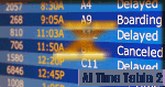
AI TimeTable is a software simulation of an airport time table for MS-FSX, where the airport location is just where your aircraft is positioned.
AITT2 for FSX (AITT2FSX), is the compliant release for MS-FSX of AITT 2 and comes with some light modification both in the user interface and in the global management due to the different interface.
It is able to display also user flight (and its "monitor" state) and give a good rate in displaying the correct flights numbers wheras FSX is not able to do.Requires MS-FSX SP1 and Simconnect.dll
| Filename: | AI_TimeTable_2_for_FSX_113.zip |
| License: | Shareware, limited functionality |
| Added: | 24th February 2010, 01:25:57 |
| Downloads: | 1,011 |
| Author: | V.Mercolino |
| Size: | 8.51 MB |
| Category: Flight Simulator 2004 - Scenery | |
| USA West Mountain Landclass |
|
File Description:
The Landclass File is a stand alone scenery, you can use it with the FS Standart Scenery or other Landclass files like Cloud9, FS Genesis etc.
Now you will see rocky mountain Landclasses in the USA.
Green mountains are now past!! You get now the feeling to fly over high mountains and not over green hills.
The best results you get with FS Global or My World & Ground Enviroment(FS 2004 ) or Birds Eye View( FS2004 )
Installation:
Extract to the folder of FS2004 and activate the scenery in FS2004
| Filename: | USA_West_Mountain_Landclass.zip |
| License: | Freeware |
| Added: | 14th March 2008, 12:12:05 |
| Downloads: | 1,663 |
| Author: | Markus Balz |
| Size: | 176.54 KB |
| Category: Flight Simulator 2004 - Scenery | |
| FPST - Sao Tome International Airport Scenery Fix |
|
File Description:
Some users encountered the elevation issue at Runway 29 and to the southwestern part (Hotel Praia Bay) of my prior released 'FPST - Sao Tome International Airport' scenery, especially those who are using the scenery with the default mesh or freeware meshes; also users with FS Global Mesh 2008 encountered it.
The content in this fix covers two alternatives; one softens heavily the issue but with a loss of mentionable details, the other is a compromise with a less softening of the issue but with a minor loss of details.
| Filename: | FPST__Sao_Tome_International_Airport_Scenery_Fix.zip |
| License: | Freeware |
| Added: | 22nd November 2024, 15:14:30 |
| Downloads: | 79 |
| Author: | Taner Akol |
| Size: | 612.42 KB |
| Category: Flight Simulator 2004 - Sounds | |
| Radar Contact 4 United Kingdom Callsigns |
|
File Description:
New callsign files for RC4
The following new callsigns are included in this file:
EXPO - Excel Airways, LIFELINE - Aeromedicare, BLUE ISLAND - Airx Limited t/a Lecocqs com, ALL CHARTER - All Charter, BOND - Bond Helicopters, BLACKBOX - Boscombe Down DERA, SANTA - British Airways SANTA, BRITWORLD - BWA (2002) Ltd, GO JET - Eurojet Aviation, EUROMANX - Euromanx/Woodgate Executive Air Charter UK, FALCONJET - Falcon Jet Centre, JET LIFT - Global Supply Systems, HIWAY - Highland Airways, INTERFLIGHT - Interflight (Learjet) Ltd , ISLAND FLYER - Island Aviation Ltd, ZAP,Titan Airways Ltd, MANN - Alan Mann Helicopters and ZOOM - Zoom Airlines (OK - this is Canadian)
| Filename: | Radar_Contact_4_United_Kingdom_Callsigns.zip |
| License: | Freeware |
| Added: | 2nd March 2006, 04:03:58 |
| Downloads: | 1,881 |
| Author: | Graham K Jackson |
| Size: | 2.92 MB |
| Category: Flight Simulator 2004 - Scenery | |
| Namibia, Southwestern Africa |
|
File Description:
Replacement landclass file for all of Namibia and parts of western Botswana (S15-30 E11-25). Based on the new Global Land Cover 2000 Project data, this landclass file is still quite basic but better (I believe) than the FS original. In addition, I used Ground2K4 to more accurately represent natural and man-made features in five areas throughout the country, including Windhoek, Swakopmund/Walvis Bay, and the Fish River Canyon. Meant to be used with my Namibia LOD9 add-on mesh series. Landclass source files are included.
| Filename: | Namibia_Southwestern_Africa.zip |
| License: | Freeware, limited distribution |
| Added: | 12th April 2004, 23:44:03 |
| Downloads: | 5,526 |
| Author: | Holger Sandmann |
| Size: | 2.31 MB |


© 2001-2026 AVSIM Online
All Rights Reserved
Privacy Policy |