
Where Flight Simulation Enthusiasts Gather from Around the World!
AVSIM Library - Search Results

| Category: Flight Simulator 2004 - Scenery | |
| CNU8 - Toronto - Markham Airport (2008), Ontario, Canada |

|
Images related to this file:
File Description:
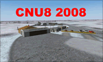
CNU8 - Toronto - Markham Airport (2008) - Markham v1. The airport is owned and operated by Markham Airport Inc., and is not part of the Greater Toronto Airport Authority.
The airport consists of a single 2,000 foot runway for small and private aircraft only (with night flying capabilities). The Royal Canadian Air Cadets Gliding Program uses the north side or the runway 09/27 for glider operations in the spring and fall months, and use a northern traffic pattern. This airport may disappear with the establishment of a planned Pickering Airport or re-location of Toronto/Buttonville Municipal Airport.
(This is a re-upload of the scenery to replace the original that was lost in the AVSIM hack. No changes have been made)
| Filename: | CNU8__Toronto__Markham_Airport_2008_Ontario_Canada.zip |
| License: | Freeware, limited distribution |
| Added: | 16th May 2010, 10:06:40 |
| Downloads: | 1,589 |
| Author: | Keith Murphy |
| Size: | 5.24 MB |
| Category: Flight Simulator 2004 - Scenery | |
| Wekweeti CFJ2 in the Northwest Territories, Canada |
|
Images related to this file:
File Description:
Wekweeti is a small village in the Northwest Territories, around 120 miles north of Yellowknife and 100 east of Gameti, which was recently posted. It has a population of around 125. There is no all-weather road access and the village is reliant upon the airfield for supplies, along with an ice road in the winter months. The area is a complex collection of lakes and small rivers and the airfield is around 3 miles east of the village on a lake shore. The lit gravel runway of 3,400 feet with PAPI at both ends is aligned 307T-127T with T standing for "true" and not the unreliable magnetic heading in the Canadian northern domestic airspace. The airfield is served by Air Tindi from Yellowknife on an almost daily basis, included in the AI here along with some GA and a Thursday delivery by a Buffalo DC3. A note here about my scenery making. There will not be many more to follow this as I am almost at the end of the photos I either took or found for scenery purposes, plus I expect to move on from FS9 at some point during next year.
| Filename: | Wekweeti_CFJ2_in_the_Northwest_Territories_Canada.zip |
| License: | Freeware, limited distribution |
| Added: | 4th January 2020, 18:23:59 |
| Downloads: | 154 |
| Author: | Roger Wensley |
| Size: | 4.39 MB |
| Category: Flight Simulator 2004 - Aircraft Repaints, Textures and Modifications | |
| Vistaliners Air Canada (1982) Boeing 727-200 |
|
File Description:
FS2004 Vistaliners Air Canada Boeing 727-200. This is the long awaited 727 from Erick Cantu. This model includes dynamic shine, spectacular animations, opening doors and cockpit windows, full and accurate lighting, and outstanding wing views. She also has flexing wings which are amazing to see as you lift off, and esp. in heavy turbulance!!!! Please see both included readme's in the file.
| Filename: | Vistaliners_Air_Canada_1982_Boeing_727200.zip |
| License: | Freeware, limited distribution |
| Added: | 23rd November 2004, 18:15:10 |
| Downloads: | 1,914 |
| Author: | Frank Idone, Erick Cantu |
| Size: | 3.01 MB |
| Category: Flight Simulator 2004 - Scenery | |
| Lady Franklin Point CWLF in Nunavut, Canada |
|
Images related to this file:
File Description:
Lady Franklin Point was a DEW line station on the southwest corner of Victoria Island, and then a North Warning System station until January 2000 when there was a fire. As a result there are now no NWS buildings, and no central long DEW line station building, only the outlying and already unused buildings from the DEW line site. However, the runway is still there and over 5,000 feet of gravel in length, aligned and signed 90T/270T, though on the atc it will be called 55/235 as FS9 knows nothing about the Canadian Northern Domestic Airspace. There is no runway lighting. Kugluktuk is around 80 miles to the southwest, on the mainland.
I should have mentioned a long time ago that to see the apron lights working (on my fields that HAVE apron lights) requires you to have the "lights_ss_v2" by Sidney Schwartz installed.
| Filename: | Lady_Franklin_Point_CWLF_in_Nunavut_Canada.zip |
| License: | Freeware, limited distribution |
| Added: | 10th November 2012, 04:04:06 |
| Downloads: | 260 |
| Author: | Roger Wensley |
| Size: | 1.81 MB |
| Category: Flight Simulator 2004 - Scenery | |
| Paulatuk CYPC in the Northwest Territories, Canada |
|
Images related to this file:
File Description:
Paulatuk is on the coast of northern mainland Canada, 200 miles east of Tuktoyaktuk and 170 miles southwest of Ulukhaktok. It is just to the east of the Parry Peninsula, which has at its northern tip the Cape Parry DEW line Main Station. Paulatuk was established in the 1920's, and the population now numbers around 320. Paulatuk airfield is close to the village but on higher ground, while the village follows the curve of the coast. The 4,000 feet of 100 feet wide gravel runway is aligned 021T/201T where T stands for "true" as opposed to magnetic in the Northern Domestic Airspace. Only JETA-1 is available unless there is 100LL in drums. There are flights by Aklak Air from Inuvik, which is around 250 miles to the west; Aklak Air is actually Kenn Borek under a diferent name. The AI is for a daily passenger flight, and for a cargo flight on Wednesdays. In the summer, float planes use the lake to the south of the village, but I have no information as to docks or any other facilities; probably there aren't any.
| Filename: | Paulatuk_CYPC_in_the_Northwest_Territories_Canada.zip |
| License: | Freeware, limited distribution |
| Added: | 3rd December 2012, 21:58:47 |
| Downloads: | 278 |
| Author: | Roger Wensley |
| Size: | 4.39 MB |
| Category: Flight Simulator 2004 - Scenery | |
| CYZS - Coral Harbour - Nunavut, Canada Modified V1 |
|
Images related to this file:
File Description:
This modified version of Coral Harbour corrects the PAPI postion on the runway, installs new taxiway lights and windsocks, and modifies the AI. This is a complete version and does not require you to have installed the original. Coral Harbour is on Southampton Island, which partly blocks the northern end of Hudson Bay and is around the size of Switzerland. The village has a population of just under 800 people and is some 200 miles from Cape Dorset, Ivujivik, and Repulse Bay, and 230 miles from Chesterfield Inlet to the southwest. The airfield is inland from the village and the 5,000 feet of gravel runway is aligned 155T/335T where T stands for "true" as opposed to magnetic in the Northern Domestic Airspace. JETA-1 fuel is officially available, and in practice so is 100LL, though the latter will be in drums. The visiting AI airlines are First Air and Calm Air, and there is a GA plane too that is stock FS9.
| Filename: | CYZS__Coral_Harbour__Nunavut_Canada_Modified_V1.zip |
| License: | Freeware, limited distribution |
| Added: | 23rd August 2014, 11:25:23 |
| Downloads: | 223 |
| Author: | Roger Wensley |
| Size: | 12.92 MB |
| Category: Flight Simulator 2004 - Scenery | |
| Silver City CFQ5 in Yukon Territory Canada |
|
Images related to this file:
File Description:
Silver City is a ghost town in the Yukon Territory, Canada, amid the Rocky Mountains and around 35 miles northwest of Haines Junction. It is on the southern end of Kluane Lake and in the Kluane National Park and this probably explains it's (minimal) survival after what appears to have been the shutdown of mining for silver. There is little information readily available. The date of this scenery is, as usual, around 2010. There was no recent regular service by Yukon Air North or any other airline, and the primary user of the airfield adjacent to the lake is a company called Icefield Discovery Tours. Their activity is probably very similar to the company at Haines Junction and involves trips to the National Park amid mountains and glaciers. There is also another organisation at the airfield, the Kluane Lake Research Station of the Arctic Institute. They have four buildings there but it is unclear how much aerial activity they generate, or if in fact they fly at all for their work. The runway is 3,000 feet of unlit gravel, aligned north-south. This post will be followed by Burwash, which is at the far northwestern end of the lake. There is no video of the Silver City airfield on Youtube, and it is not the most exciting airfield in the world, but the location is enough in real life for a visit to be made. On YouTube there is a series of posts by Angle of Attack showing the preparation and then the flight of an old Cessna 172 from Homer to Oshkosh for the installation of modern instruments. Interesting for me as they visit or fly over airfields I have made: Homer, Merrill, Tok Junction, Burwash, Silver City, Haines Junction, Watson Lake, Fort Nelson, and Grande Prairie. But they fly in the winter so it all looks very different.
| Filename: | Silver_City_CFQ5_in_Yukon_Territory_Canada.zip |
| License: | Freeware, limited distribution |
| Added: | 22nd January 2022, 21:57:41 |
| Downloads: | 97 |
| Author: | Roger Wensley |
| Size: | 9.86 MB |
| Category: Flight Simulator 2004 - Scenery | |
| Twin Lakes Airstrips in British Columbia Canada |
|
Images related to this file:
File Description:
There are three grass airstrips within sight of each other from the air at Twin Lakes in BC, which is between the close junction of Elkin Lake and Vedan Lake. The two lakes are similarly shaped and sized and in the same narrow valley between high ground that runs north-south; hence the name. Elkin is to the north, and Vedan is to the south. Twin Lakes CAG4 is on the strip of land between the two lakes and it is unclear to me who it belongs to etc. It is not in the Nav Canada copy that I have with me which is from 2010, and the online version does not cover grass strips. It is probably owned by whoever lives in the house next to the red hangar. The runway is 3,600 feet of grass aligned 14-32 at 3,945 feet ASL. Chaunigan Lake Lodge CF83 is over to the northwest from Twin Lakes by around 2 miles or so and as the name suggests it services the Lodge of that name, which is on the northeast corner of Chaunigan Lake. The runway is 2,600 feet of grass aligned 02-20 at 4,900 feet ASL. You might want to read about altitude power reductions for the take off. Elkin Creek Guest Ranch CBL9 is at the southern end of Vedan Lake and serves the ranch. This appears to be another high-budget operation and the runway is 3,670 feet of grass aligned 36-18 at 3,999 feet ASL. I have posted this as three separate airstrips, but I suggest that you add these to your "BC airfields" folder as previously suggested. Up to you. If you find a defect, email me. Ignore the post of Chilanko Lodge posted today. I requested Avsim to delete it but it seems they didn't read the email. It was originally posted as a correction for the original post of the three posted here.
| Filename: | Twin_Lakes_Airstrips_in_British_Columbia_Canada.zip |
| License: | Freeware, limited distribution |
| Added: | 21st November 2020, 23:29:09 |
| Downloads: | 126 |
| Author: | Roger Wensley |
| Size: | 25.39 MB |
| Category: Flight Simulator 2004 - Scenery | |
| Smithers CYYD in British Columbia, Canada, Updated |
|
Images related to this file:
File Description:
Made in December 2018 as an update of the original post of 2014, to correct the apron markings, revise the AI, increase the number of GA parking spots, and most importantly to correct the runway lighting by adding the missing approach lights. This scenery is complete and can be installed as-is without first installing the 2014 version. Smithers is in northwest BC, 60 miles east and a bit north of Terrace, and directly east of the southern border of Alaska. The town has a population of 5,500 and is set in a north-south valley between mountains, the most impressive of which is Hudson Bay Mountain to the west. The airport is to the north of the town and has a single runway of 7,544 feet, aligned 33-15. The main user is Central Mountain Air, who are headquartered in Smithers and have a large maintenance hangar there next to the terminal building. The airport has scheduled flights by Central Mountain Air, Jazz, and Hawk Air, which are in the AI. The AI provided here is a new CYYD traffic bgl; in total the AI also includes a Dawson Creek traffic bgl (recently revised and posted) plus a Terrace traffic bgl (which will shortly be revised and posted). An Electra of Conair (who are the largest operator of fire fighting planes in BC, and have re-fill tanks in Smithers) is included and also a HS 748 of Air North.
| Filename: | Smithers_CYYD_in_British_Columbia_Canada_Updated.zip |
| License: | Freeware, limited distribution |
| Added: | 4th January 2019, 18:08:03 |
| Downloads: | 217 |
| Author: | Roger Wensley |
| Size: | 14.22 MB |
| Category: Flight Simulator 2004 - Scenery | |
| Burns Lake CYPZ in British Columbia, Canada |
|
Images related to this file:
File Description:
Burns Lake is 90 miles east of Terrace and 130 miles west of Prince George, on the eastern side of the Coast Mountains. The airfield is at 2343' ASL and the 11/29 runway is just over 7,000' of 75' wide asphalt. There are buildings, some of them new, around the apron at the west end of the runway and both JetA and 1100LL are available. There is also a weather station in a fenced area west of the apron. All apron buildings were modeled specifically for this scenery; there may be some missing if new construction has continued in the last three years.
| Filename: | Burns_Lake_CYPZ_in_British_Columbia_Canada.zip |
| License: | Freeware, limited distribution |
| Added: | 11th May 2011, 16:57:44 |
| Downloads: | 467 |
| Author: | Roger Wensley |
| Size: | 4.57 MB |


© 2001-2026 AVSIM Online
All Rights Reserved
Privacy Policy |