
Where Flight Simulation Enthusiasts Gather from Around the World!
AVSIM Library - Search Results

| Category: Flight Simulator X - Scenery | |
| CYEY - Magny / Amos Airport - Quebec, Canada |

|
Images related to this file:
File Description:
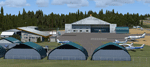
Realistic and original buildings, planes and installations of CYEY Magny airport in Amos, northern Quebec.
| Filename: | CYEY__Magny__Amos_Airport__Quebec_Canada.zip |
| License: | Freeware |
| Added: | 3rd November 2015, 00:08:03 |
| Downloads: | 947 |
| Author: | Jean-Pierre Fillion |
| Size: | 4.13 MB |
| Category: Flight Simulator 2004 - Scenery | |
| Terrace CYXT in BC Canada Updated |
|
Images related to this file:
File Description:
This version of Terrace has night textures that work, good news for the 319 downloaders who did not tell the author that the ones already posted did not work. Why? Terrace is fifteen miles east and inland from Prince Rupert, which is 500 miles north of Vancouver up the BC coast. It is at the point in the mountains where two fjords meet, one coming from Prince Rupert and the other from Kitimat. There are two runways, the main one is a recently-extended 7,500 feet long and lighted 33/15 and the second is 5,373 feet of unlit 03/21. The apron has been enlarged to be able to accomodate a Boeing 737; though I don't think there is an airline using a 737 for flights to Terrace I have parked an Air Canada jet and the pics show the planes that do fly to Terrace, Air Canada and Hawk Air Dash 8-300's. The aircraft and the textures are down-loadable and and can be used for AI.
| Filename: | Terrace_CYXT_in_BC_Canada_Updated.zip |
| License: | Freeware, limited distribution |
| Added: | 3rd July 2010, 03:28:31 |
| Downloads: | 1,064 |
| Author: | Roger Wensley |
| Size: | 3.72 MB |
| Category: Flight Simulator 2004 - Scenery | |
| CYSM - Fort Smith, Northwest Territories, Canada |
|
Images related to this file:
File Description:
Fort Smith is just north of the border between Alberta and Northwestern Territories, midway between Lake Athabasca to the southeast in (mostly) Saskatchewan (80 miles) and Great Slave Lake to the north west (90 miles). The runways all used to be larger, and while I don't know the history it looks as if it is ex-military and these are the remains of what were once 10,000 feet of asphalt. The main runway is now 11/29 and 6,000 feet long, and the secondary one is 1,800 feet of mostly gravel. There is an airline based at the field, Northwestern Air, and fuel (both 100LL and JA-1) is available at a self service point so long as you give it a credit card to read while you fill. The town of Fort Smith is two miles east of the airfield, on the bank of the Slave River and where there are some rapids that require a portage to get around them. Before aviation came along the river was a major route to the north and all those furry animals, which was why the Hudson's Bay Company established an outpost there in 1872. Today it has a population of 2,400 and the main activities are government administration of much of the Northwest Territories, education, and tourism.
| Filename: | CYSM__Fort_Smith_Northwest_Territories_Canada.zip |
| License: | Freeware, limited distribution |
| Added: | 28th January 2012, 17:11:47 |
| Downloads: | 592 |
| Author: | Roger Wensley |
| Size: | 4.29 MB |
| Category: Flight Simulator 2004 - Scenery | |
| Lucky Lake CKQ5 in Saskatchewan, Canada |
|
Images related to this file:
File Description:
The village of Lucky Lake is 80 miles south of Saskatoon, with a small population of less than 300, most of whom are dependant on agriculture for income, either directly or indirectly. Marijuana is a recently introduced crop after the failure of a government-financed potato growing operation called SPUDCO. The village was previously known as Devil's Lake (don't ask me, I don't know). The airfield is half a mile north of the village, with an asphalt runway just over 3,000 feet long, lit, and aligned 07-25 in FS9; this has now changed to 08-26 with the wandering magnetic north. Circuits on 25 are right handed to avoid over-flying the village. 100LL fuel is available.
| Filename: | Lucky_Lake_CKQ5_in_Saskatchewan_Canada.zip |
| License: | Freeware, limited distribution |
| Added: | 25th May 2017, 17:53:36 |
| Downloads: | 138 |
| Author: | Roger Wensley |
| Size: | 5.36 MB |
| Category: Flight Simulator 2004 - Scenery | |
| CYKY - Kindersley Regional Airport, Saskatchewan, Canada |
|
Images related to this file:
File Description:
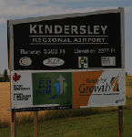
CYKY Kindersley Regional Airport is located in the west-central part of the province of Saskatchewan, Canada. The airport is located 4.6 km north of the town. The scenery consists of custom models of all the buildings at the airport, runway signs, runway and taxiway lighting, rotating beacon, static aircraft, vehicles, animated highway traffic and oil pump jacks, trees that properly change with the seasons, custom tarmac and runway textures, and seasonal ground textures for the airport and surrounding area.
| Filename: | CYKY__Kindersley_Regional_Airport_Saskatchewan_Can.zip |
| License: | Freeware |
| Added: | 14th June 2012, 13:44:10 |
| Downloads: | 1,288 |
| Author: | Gregory Putz |
| Size: | 84.58 MB |
| Category: Flight Simulator 2004 - Scenery | |
| Kuujjuarapik CYGW in northern Quebec, Canada |
|
Images related to this file:
File Description:
Kuujjuarapik is in northern Quebec at the southern end of Hudson Bay, 90 miles east of James Bay and on the north shore of the Great Whale River; Kuujjuarapik means Small Great River in Inuktitut. Once again the Hudson Bay trading post that opened (in 1820) was the catalyst for the establishment of first a seasonal encampment and then the beginnings of a town in the late 1930's.
The two adjacent villages that now form the town have a total population (mainly Cree and Inuit) of around 1,500. When the Quebec hydo-electric project was under construction in the early 1980's a large portion of the Inuit population voted to move to a new settlement called Umiujaq (my post) 100 miles to the north.
The airport is to the west of the town, between the town and the sea. The gravel and sand runway (which I have made as gravel as there is no convincing way to mix the two) is 5,500 feet long, 150 feet wide, and aligned 17/35, which is approximately parallel to the coast. There is fuel available, both 100LL and JetA, delivered by truck. The AI included here is for Air Inuit and Wasaya, with Air Inuit making three flights per day plus a fourth flight by the Air Inuit Twotter C-GNDO that is based at the airport, and private flights by various aircraft. Yes, there really is a golf course to the south of the airport, and the last thing to note is that Kuujjuarapik has a mandatory radio frequency and that taking into consideration the scheduled flights I have included the tower radio frequency that makes this a controlled airport in FS9.
| Filename: | Kuujjuarapik_CYGW_in_northern_Quebec_Canada.zip |
| License: | Freeware, limited distribution |
| Added: | 16th February 2013, 00:33:20 |
| Downloads: | 305 |
| Author: | Roger Wensley |
| Size: | 2.8 MB |
| Category: Flight Simulator 2004 - Scenery | |
| Chesterfield Inlet CYCS in Nunavut, Canada |
|
Images related to this file:
File Description:
Chesterfield Inlet is a small village on the west coast of Hudson Bay, with a population of 340 or so. It is the oldest community in Nunavut and was established around a Hudson Bay Company post in 1911, 55 miles north of Rankin Inlet (Sid and Pete's post). The airfield is close to the village and has a gravel runway 3,600 feet long aligned 124T/304T (true, not magnetic). Fuel is available with 2 hours prior notice, and the visiting AI airlines are First Air and Calm Air.
| Filename: | Chesterfield_Inlet_CYCS_in_Nunavut_Canada.zip |
| License: | Freeware, limited distribution |
| Added: | 6th December 2011, 20:27:39 |
| Downloads: | 378 |
| Author: | Roger Wensley |
| Size: | 2.21 MB |
| Category: Flight Simulator 2004 - Scenery | |
| Sturt Point CWSP in Nunavut, Canada |
|
Images related to this file:
File Description:
Sturt Point was a DEW line I Station on the south coast of Victoria Island, 50 miles east of Cambridge Bay. It was closed in 1963 but remains in place, though a 5 man I Station has such a small impact on its surroundings that it is hardly visible. The runway is 3,420 feet of gravel aligned 117T/297T, and there are no lights, signage, or windsock, but there are ruts in the gravel. A North Warning System station was built 15 miles inland and closer to Cambridge Bay, operating from 1991 onwards. This has a short (1,280'?) gravel runway aligned 138T/318T (and named CWSX here). No ruts in the gravel, but also still no lights, signage, or windsock.
| Filename: | Sturt_Point_CWSP_in_Nunavut_Canada.zip |
| License: | Freeware, limited distribution |
| Added: | 11th November 2012, 21:07:18 |
| Downloads: | 206 |
| Author: | Roger Wensley |
| Size: | 1.35 MB |
| Category: Flight Simulator 2004 - Scenery | |
| Old Mill's Airstrip, British Columbia, Canada |
|
File Description:
Old Mill's Airstrip is situated 18 nm from Victoria Int'l Airport. It is a 1400 feet grass field and a runway is lit with kerosene torches at night. There is a small waterfall, a covered bridge, an old watermill with its warehouse dating back to 1916.
| Filename: | Old_Mills_Airstrip_British_Columbia_Canada.zip |
| License: | Freeware |
| Added: | 21st October 2004, 18:41:24 |
| Downloads: | 1,896 |
| Author: | Leon Louis |
| Size: | 2.65 MB |
| Category: Flight Simulator 2004 - Scenery | |
| Repulse Bay CYUT in Nunavut Canada |
|
Images related to this file:
File Description:
This is a scenery that I started in 2013, temporarily abandoned when I found there was a fault in the coastline that reduced it all to straight lines, and then totally forgot about. Until now, when I discovered that while I had made the Repulse Bay terminal building I had mysteriously not made the scenery. Investigation revealed the reason why and here it is with a coastline that has been repaired to the extent that the fault allowed. Repulse Bay has a population of around 1,100 and since 2015 has been officially named Naujaat, the traditional Inuit name. It is located exactly on the arctic circle on the northern extension of the western side of Hudson Bay, in a large bay off the northern tip of Southampton Island. Coral Harbour is on the far side of the island, 180 miles to the south. The airfield is alongside the town and the coast, with the runway 3,400 feet of gravel with PAPI at both ends, aligned 161T-341T with "T" standing for true as opposed to the unreliable magnetic bearing this far north. The regular scheduled flights are by Air Baffin (an Air Nunavut subsiduary), connecting to Iqaluit some 550 miles to the east. The helicopters are there in the summer with their own fuel in drums around their own parking apron. They land directly on the apron, which cannot be replicated in AI, so they are present only as parked choppers and not flying ones.
| Filename: | Repulse_Bay_CYUT_in_Nunavut_Canada.zip |
| License: | Freeware, limited distribution |
| Added: | 6th September 2018, 00:34:38 |
| Downloads: | 179 |
| Author: | Roger Wensley |
| Size: | 7.87 MB |


© 2001-2026 AVSIM Online
All Rights Reserved
Privacy Policy |