
Where Flight Simulation Enthusiasts Gather from Around the World!
AVSIM Library - Search Results

| Category: Flight Simulator X - AFCAD Files | |
| CZBB Boundary Bay Airport, BC, Canada |

|
File Description:
This is a complete redo of the default FSX CZBB Boundary Bay Airport, BC using ADE v1.37, Google Earth satellite image and the latest airport chart effective as of 31 July 2008. The airport center and boundary repositioned. Control tower moved and replaced. Runway 07/25 extended to 5606 ft from 3540 ft and new taxiway E added. VASI Added to Runway 07/25. Taxiway signs added and/or corrected. Airport aprons resized and added where necessary. Taxiways and roads added. Static airport library objects and vegetation added for an improved look. XWind runways activated. Airport views are from the roof of the control tower when in tower view. A fuel truck has been added - Shift-F will bring this truck to your aircraft for refueling and will automatically refuel AI aircraft after landing and before take off. Airport chart and history included.
| Filename: | CZBB_Boundary_Bay_Airport_BC_Canada.zip |
| License: | Freeware |
| Added: | 5th November 2009, 02:16:37 |
| Downloads: | 448 |
| Author: | Robert Catherall |
| Size: | 381.61 KB |
| Category: Flight Simulator X - Scenery | |
| Okanagan Lake, British Columbia, Canada Upgrades |
|
Images related to this file:
File Description:
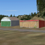
A scenery upgrade to Okanagan Lake, BC, Canada. This scenery continues the upgrades to the Kelowna area near CYLW. South of the airport the lake received marinas and docks and a marina entrance station located near the bridge. As per Google Earth both sides of the lake at the bridge have several marinas, docks and small piers, lot's of boats and some added fictitious objects including a landable water helipad. This scenery is stand-alone. Nothing else is required. Read the text file for instructions and please enjoy. By Savageale.
| Filename: | Okanagan_Lake_British_Columbia_Canada_Upgrades.zip |
| License: | Freeware |
| Added: | 4th December 2011, 08:08:34 |
| Downloads: | 992 |
| Author: | Tim Durham |
| Size: | 1.58 MB |
| Category: Flight Simulator X - Scenery | |
| CTH3 Canada, Quebec, Les Grandes-Bergeronnes |
|
Images related to this file:
File Description:
This is the scenery Les Grandes Bergeronnes ( CTH3 ) which represents the reality. Les Grandes Bergeronnes is a small village located on Northern bank of the St-Laurent river of Quebec at Canada. This scenery is design with FSDS and it accepts Mesh of Gilles Gauthier.This scenery has the function for FS-X.
| Filename: | CTH3_Canada_Quebec_Les_GrandesBergeronnes.zip |
| License: | Freeware |
| Added: | 31st December 2009, 04:53:04 |
| Downloads: | 567 |
| Author: | Regis Dassylva |
| Size: | 725.14 KB |
| Category: Flight Simulator X - Scenery | |
| CYSM Fort Smith, Northwest Territories, Canada |
|
File Description:
Fort Smith Airport, (IATA: YSM, ICAO: CYSM), is located approximately 4 Km west of town of Fort Smith.
| Filename: | CYSM_Fort_Smith_Northwest_Territories_Canada.zip |
| License: | Freeware |
| Added: | 17th April 2010, 16:32:13 |
| Downloads: | 1,533 |
| Author: | Robert Catherall |
| Size: | 4.51 MB |
| Category: Prepar3D V1-4 - AI Aircraft | |
| Air Canada "NC" Bombardier CRJ-900 |
|
Images related to this file:
File Description:
Textures only for UTT CRJ-900.
Model and paint kit by: UTT.
Converted model from FS9 to FSX native and P3D by UTT.
Tested with FSX SE and P3D-V4 (night and day).
Included registrations for the plane for real traffic.
Paint by Joel Branchu
October 2017
| Filename: | Air_Canada_NC_Bombardier_CRJ900.zip |
| License: | Freeware |
| Added: | 19th October 2017, 18:39:08 |
| Downloads: | 422 |
| Author: | Joel Branchu |
| Size: | 1006.63 KB |
| Category: Flight Simulator 2002 - AI Flight Plans | |
| Jazz flights for Eastern Canada(Maritimes) |
|
File Description:
These flights are athentic flights for the new year. All flights are correct to the best of my ability.I left no island untouched.Works well with my Flycan.E.zip which covers all flights between the mainland and NFLD.
| Filename: | Jazz_flights_for_Eastern_CanadaMaritimes.zip |
| License: | Freeware |
| Added: | 7th January 2003, 01:24:09 |
| Downloads: | 401 |
| Author: | Al J Sibley |
| Size: | 14.08 KB |
| Category: Flight Simulator 2004 - Original Aircraft | |
| Air Canada Boeing B787-10 v4 |
|
Images related to this file:
File Description:

FS2004 Air Canada Boeing 787-10 v4. This CamSim version 4 features an improved aircraft wing root design, new wider pax doors with revised window shapes,
additional animated air ducts, additional comm and satellite antennas, increasingly more Animated Ground Servicing (AGS),
including additional animations featuring trucks hooking and unhooking trailers and static displays.
Model design and paint by Camil Valiquette.
| Filename: | Air_Canada_Boeing_B78710_v4.zip |
| License: | Freeware |
| Added: | 5th July 2013, 05:45:55 |
| Downloads: | 581 |
| Author: | Camil Valiquette |
| Size: | 3.57 MB |
| Category: Flight Simulator X - Aircraft Repaints, Textures and Modifications | |
| Air Canada McDonnell-Douglas MD-83 |
|
File Description:
This is another repaint for the FSX AI Default MD-83. This is a fictional repaint because no MD-83 was in service for Air Canada, although part of the DC-9 Family. The DC-9 was in service until 2002. A repaint is portrayed to see if an MD-83 was in service today. Splash screen included. This repaint requires the MD-83 Flyable pack by Braden Peters.
| Filename: | Air_Canada_McDonnellDouglas_MD83.zip |
| License: | Freeware, limited distribution |
| Added: | 18th February 2009, 08:21:54 |
| Downloads: | 408 |
| Author: | Victor Vu |
| Size: | 1.28 MB |
| Category: Flight Simulator 2004 - Scenery | |
| Matheson Point CWMP in Nunavut, Canada |
|
Images related to this file:
File Description:
This was a DEW line I Station on the southeast shore of King William Island; the island is around 70 miles square and Gjoa Haven is also on the southeast corner, 20 miles to the south. The station was closed in 1963 and has now been totally dismantled and removed except for a fallen 300 feet communications tower. The runway is still there (mostly) and is around 3,360 feet of gravel 120' wide, aligned 146T/326T. There are no lights, signage, or windsock, or any building remaining. All of these DEW line stations are not particularly impressive or even interesting. However, you can bet that any pilot flying regularly in the north along the coast knows where all these runways are, in case one of them suddenly becomes his favourite in the whole world just after the sudden silence.
| Filename: | Matheson_Point_CWMP_in_Nunavut_Canada.zip |
| License: | Freeware, limited distribution |
| Added: | 22nd November 2012, 16:28:19 |
| Downloads: | 178 |
| Author: | Roger Wensley |
| Size: | 785.57 KB |
| Category: Flight Simulator 2004 - AFCAD Files | |
| Alert, Northwest Territories, Canada (CYLT/YLT) |
|
File Description:
CYLT is the world's northernmost permanent airport, located at Alert, Nunavut, Canada, approximately 830 km south of the true North Pole about 10 km west of Cape Sheridan, the northeastern tip of Ellesmere Island, on the shore of ice-covered Lincoln Sea. It is operated by the Canadian Department of National Defense and is part of Canadian Forces Station Alert. This Afcad adds five (5) new parking spots to Alert. THIS AFCAD IS PURELY FICTIONAL!
| Filename: | Alert_Northwest_Territories_Canada_CYLTYLT.zip |
| License: | Freeware |
| Added: | 5th July 2007, 20:19:25 |
| Downloads: | 577 |
| Author: | Shane Sidsworth |
| Size: | 2.55 KB |
© 2001-2026 AVSIM Online
All Rights Reserved
Privacy Policy |