
Where Flight Simulation Enthusiasts Gather from Around the World!
AVSIM Library - Search Results

| Category: Flight Simulator 2004 - Flight Plans | |
| OB-96 Fort Worth Texas |

|
Images related to this file:
File Description:
FS2004 Flight Plan for OB-96 Fort Worth Texas IFR high speed low altitude military training route. This is the fifteenth in a series of FS2004 flight plans I have uploaded. This route goes through mostly flat and rolling terrain in Texas, Oklahoma and Louisiana. This route has two different sets of targets. These are great routes for B-52, F-111, B-1B, B-2 A6, A4, Vulcan and any fighter or bomber enthusiasts. Of course you can fly the route with any aircraft of your choice. Included in this package is a gauge by Karol Chlebowski for TFR flying at very low altitude. This gauge will greatly enhance your ability to fly these challenging routes and is a great companion of the flight plans. Another option to download Version 2.0 of my FS2004 mini panel which has all this functionality and more.
| Filename: | OB96_Fort_Worth_Texas.zip |
| License: | Freeware |
| Added: | 27th July 2011, 23:11:17 |
| Downloads: | 93 |
| Author: | Bill McClellan |
| Size: | 466.75 KB |
| Category: Flight Simulator 2004 - Flight Plans | |
| OB-97 Fayetteville Arkansas |
|
Images related to this file:
File Description:
FS2004 Flight Plan for OB-97 Fayetteville Arkansas IFR high speed low altitude military training route. This is the sixteenth in a series of FS2004 flight plans I have uploaded. This route goes through mostly flat and rolling terrain in Arkansas, Texas, Oklahoma and Kansas. This route has two different sets of targets. These are great routes for B-52, F-111, B-1B, B-2 A6, A4, Vulcan and any fighter or bomber enthusiasts. Of course you can fly the route with any aircraft of your choice. Included in this package is a gauge by Karol Chlebowski for TFR flying at very low altitude. This gauge will greatly enhance your ability to fly these challenging routes and is a great companion of the flight plans. Another option to download Version 2.0 of my FS2004 mini panel which has all this functionality and more.
| Filename: | OB97_Fayetteville_Arkansas.zip |
| License: | Freeware |
| Added: | 28th July 2011, 09:22:42 |
| Downloads: | 64 |
| Author: | Bill McClellan |
| Size: | 489.81 KB |
| Category: Flight Simulator 2004 - Flight Plans | |
| OB-98 Rapid City South Dakota |
|
Images related to this file:
File Description:
FS2004 Flight Plan for OB-98 Rapid City South Dakota IFR high speed low altitude military training route. This is the seventeenth in a series of FS2004 flight plans I have uploaded. This route goes through both mountainous and flat and rolling terrain in South Dakota, Nebraska, Wyoming and Montana. This route has two different sets of targets. These are great routes for B-52, F-111, B-1B, B-2 A6, A4, Vulcan and any fighter or bomber enthusiasts. Of course you can fly the route with any aircraft of your choice. Included in this package is a gauge by Karol Chlebowski for TFR flying at very low altitude. This gauge will greatly enhance your ability to fly these challenging routes and is a great companion of the flight plans. Another option to download Version 2.0 of my FS2004 mini panel which has all this functionality and more.
| Filename: | OB98_Rapid_City_South_Dakota.zip |
| License: | Freeware |
| Added: | 28th July 2011, 09:23:26 |
| Downloads: | 76 |
| Author: | Bill McClellan |
| Size: | 360.49 KB |
| Category: Flight Simulator 2004 - Scenery | |
| Tokyo Bay 2005 |
|
Images related to this file:
File Description:
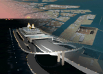
FS2004 Scenery Tokyo Bay Scenery 2005 Ver. 5.0
This add-on scenery improves specific scenerys (Tokyo Bay, Japan) of FS2004.
There are a lot of reclaimed land in Tokyo Bay.
They form an artificial peculiar coastline. This scenery reproduces these coastlines precisely.
And, this scenery reproduces the Keihin industrial area and the Keiyo industrial area in Tokyo Bay located west and east. In this scenery design, the coastline was reproduced as exactly as possible, following the specification of FS2004.
Moreover, 90m mesh geographical data is reproduced by using SRTM 3arc/sec.
The range of detailed coastline and 90m digital elevation data is as follows:
** [detailed coastline] N33:45 E138:45 to N36:55 E141:05 (included Izu Islands)
** [90m digital elevation data] N33:00 E138:00 to N37:00 E141:00 --
The Tokyo Wan AquaLine is arranged in the exact location. By Kazuo Kawamura
| Filename: | Tokyo_Bay_2005.zip |
| License: | Freeware, limited distribution |
| Added: | 3rd December 2011, 23:51:31 |
| Downloads: | 11,790 |
| Author: | Kazuo Kawamura |
| Size: | 9.74 MB |
| Category: Flight Simulator 2004 - Scenery | |
| South West Islands, Japan and Taiwan Ver.3.0 |
|
Images related to this file:
File Description:
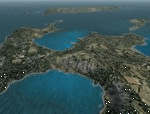
FS2004 Scenery SWIJT2004 Ver 3.0 (South West Islands, Japan and Taiwan)
These files improve specific scenerys (South West Islands of Japan and Taiwan, Asia) of FS2004. Included islands: Ohsumi Islands, Tokara Islands, Amami Islands, Okinawa lands, Kerama-Kume Islands, Miyako Islands, Yaeyama Islands and Taiwan Island.
In this scenery design, the coastline was reproduced as exactly as possible, following the specification of FS2004. Moreover, 90m mesh geographical data is reproduced by
using SRTM 3arc/sec. Correction of missing holes is perfect.
==NOTAM== I exhibited "SWIJ2k4.zip" on August 26, 2004.
However, it became clear that some of files of "SWIJ2k4" are infringing on the opyright of Microsoft. Then, I stopped public presentation of "SWIJ2k4". I apologize for having
made you trouble to those who already downloaded "SWIJ2k4.zip". New "SWIJT2k4.zip" is vast scenery which covered South West Islands, Japan and Taiwan Island. Please install new "SWIJT2k4".
By Kazuo Kawamura
| Filename: | South_West_Islands_Japan_and_Taiwan_Ver30.zip |
| License: | Freeware, limited distribution |
| Added: | 4th December 2011, 00:05:05 |
| Downloads: | 7,743 |
| Author: | Kazuo Kawamura |
| Size: | 20.5 MB |
| Category: Flight Simulator 2004 - Scenery | |
| Kerkira Airport Enhancement |
|
File Description:
This is old scenery which has been updated for FS2004 and enhances the visual environment of Ionian sea island airport of Kerkira, also known as Corfu. Its part of my “Greek Airfields” package that currently is not fully compatible with FS2004 since MS decided to move the airports in Greece and elsewhere to adjacent positions and ASD, which I use for placing these objects, is not compatible with FS2004. Here you will find airport & terrain enhancements for Hellenic airport of Kerkira LGKR that make it look closer to the real one; hotels, runway turning bay, perimeter fences, windsocks, radio antennae, new approach radar antenna to the southwest and most importantly, an exclusion of autogen scenery that is wrongfully generated on each side of the runway. A big difference is attributed to Babis Peribolas’s Kerkira mesh terrain that is included in this scenery. Scenery includes the necessary ASD 2.1 textures.
| Filename: | Kerkira_Airport_Enhancement.zip |
| License: | Freeware, limited distribution |
| Added: | 4th September 2003, 02:23:06 |
| Downloads: | 12,178 |
| Author: | Kyprianos Biris |
| Size: | 1.94 MB |
| Category: Flight Simulator 2004 - Scenery Design | |
| TDFCalc2004 (Version 3) |
|
File Description:
This package is for FS2004 and FS2002 terrain designers. TDFCalc2004 is made for use with FSUIPC and FS2004. This is a version that includes true heading readings, and LOD8 Zone coordinates for VTP2 lines and polys. It is an FSUIPC registered freeware program that requires version 3.? of FSUIPC.dll installed to the FS2004 Module folder. FSUIPC is avaliable on the internet, and this program requires an application registration entered within FSUIPC. Usage with FS2002 or CFS2 requires no registration with the older versions of FSUIPC. LandCalc and TDFCalc2 are small programs which require the input of Latitude and Longitude, in 'DD:MM.decimal' format. Landcalc returns the names of the "CUSTOM" textures required by photoreal ( CUSTOM ) BGLs, and LandClass BGLs ( using values #253 or #252 ). TDFCalc2 returns valuable information concerning the X, Y coordinates needed for the creation of LWM and VTP polygons/lines. TMFViewerCalc requires input as Decimal Degrees.
| Filename: | TDFCalc2004_Version_3.zip |
| License: | Freeware |
| Added: | 5th October 2003, 18:48:15 |
| Downloads: | 1,324 |
| Author: | Richard Ludowise |
| Size: | 926.55 KB |
| Category: Flight Simulator 2004 - AI Flight Plans | |
| STA-Trans African Pack |
|
File Description:
STA Trans African Airlines is a Bamako,Mali based airlines linking Bamako to 9 cities in Africa and Europe.The flights are operated with Let 410 (Domestic),DC-9 (Africa) and A310 (Europe)
When the multinational carrier Air Afrique (based in Abidjan and Dakar) filed for bankruptcy,there was a lack of regional carriers in West Africa.STA Trans African Airlines was created to link Bamako to other cities in west Africa and Paris.
In 2002 the airport of Kayes( GAKY) was replaced by a brand new one (Kayes-Dag Dag -GAKD).This the reason why there're two different airport from FS2002 to FS2004.
In this package,you will find:
-Two 100% accurate 2004 flight plans (one for FS2002 and one for FS2004)
-vcpmod for the airline call sign
-vcpmod for Kayes airport name
-Afcad for Kayes airport -GAKY(FS2002)
-Afcad for Kayes airport -GAKD(FS2004)
| Filename: | STATrans_African_Pack.zip |
| License: | Freeware |
| Added: | 24th April 2004, 01:50:28 |
| Downloads: | 1,149 |
| Author: | Patrick Lattarullo |
| Size: | 8.92 KB |
| Category: Flight Simulator 2004 - Original Aircraft | |
| Seagul G-2 (Galeb) |
|
File Description:
FS2002/FS2004 Soko Galeb-2 v1.1 package. The Soko G2-A Galeb (seagull) is a Yugoslav made two-seat advanced trainer powered by the Rolls Royce Viper Mk22-6 engine.

Includes installer for both FS2002 and FS2004. Features full animated moving parts - all control surfaces, canopy, gears, "live" pilots, ejection seats, crash effects, custom sounds, cockpit sound effects, high detail dynamic 3D virtual cockpit with clickable gauges and separate flight dynamics files for FS2002 and FS2004.

Package includes different visual models with nine real life paint schemes for Croatian, Serbian, Libyan and Yugoslav Air Forces, and civilian 'Acro' and 'USAF' markings. Texture templates included. Flight dynamics, panel and XML gauges by Goran Savic, FSDS2 model by Luka Midic.
| Filename: | Seagul_G2_Galeb.zip |
| License: | Freeware |
| Added: | 6th August 2004, 02:47:25 |
| Downloads: | 20,524 |
| Author: | Luka Midic, Goran Savic, Zoran Sivcev, Milan Jeftic |
| Size: | 12.38 MB |
| Category: Flight Simulator 2004 - AI Aircraft | |
| air Baltic Bombardier CSeries 300 V5L |
|
Images related to this file:
File Description:

FS2004 CamSim AI Aircraft, air Baltic Bombardier CSeries 300 V5L.
This model is design for AI traffic only, base from my CSeries 300 ags V5L
but without AGS and static displays.
Model design and paint by Camil Valiquette.
| Filename: | air_Baltic_Bombardier_CSeries_300_V5L.zip |
| License: | Freeware |
| Added: | 12th August 2017, 15:19:10 |
| Downloads: | 373 |
| Author: | Camil Valiquette |
| Size: | 1.49 MB |


© 2001-2026 AVSIM Online
All Rights Reserved
Privacy Policy |