
Where Flight Simulation Enthusiasts Gather from Around the World!
AVSIM Library - Search Results

| Category: Flight Simulator X - Scenery | |
| KAFW Fort Worth Alliance Airport - Texas, US |

|
Images related to this file:
File Description:
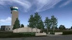
Ft. Worth Alliance Airport opened in 1989 and was billed as the world's first purely industrial airport. It is located around 14 miles North of the central business district of Ft. Worth and is also nearby the Dallas/Ft. Worth International Airport (KDFW). The airport serves general aviation, corporate jet, cargo, and military air traffic on a daily basis and it's proximity to the Texas Motor Speedway (only a few miles) brings extra dense traffic on race weekends. The airport is home to the American Airlines 777 and 767 maintenance base, FedEx Southwest Regional Sort Hub, Bell-Helicopter Training Center, DEA Air Operations Center and DynCorp International. Sadly the American Airlines maintenance base is set to close at the end of 2012 but is being kept alive in FSX!
This scenery features custom 3d buildings and objects bringing you a very accurate rendition of Ft. Worth Alliance Airport. Requires FSX Acceleration for the all scenery objects to display correctly.
Note: These files MUST be installed for the scenery to work correctly (otherwise there will be missing scenery objects at the airport):
-Filename: fsx_lts.zip - Ramp Lighting for FSX by Jim Dhaenens
-Filename: dlfcorelibraries2fsx.zip - Dan French Core Library Vol. 2
-Filename: lightstoo.zip - Jim Dhaenens Airfield Lighting
-Filename: objlib-jgse-fsx.zip - John Stinstrom JGSE Yellow Objects - this newer file replaces the older FS9 libraries with FSX versions
-Filename: objlib-ggse-fsx.zip - John Stinstrom GGSE Green Objects - this file also replaces FS9 libraries with FSX versions
| Filename: | KAFW_Fort_Worth_Alliance_Airport__Texas_US.zip |
| License: | Freeware, limited distribution |
| Added: | 12th December 2012, 16:56:36 |
| Downloads: | 2,936 |
| Author: | Brandon Thetford |
| Size: | 439.24 MB |
| Category: Flight Simulator 2004 - Miscellaneous Files | |
| The World Tour |
|
Images related to this file:
File Description:
01) https://youtu.be/36ZpHnGq7a4
02) https://youtu.be/vFImsajMgLc
03) https://youtu.be/X_FfupH_-MU
04) https://youtu.be/oU6ypwHF6ik
05) https://youtu.be/qz_-HPTv2oo
06) https://youtu.be/Qnbnwi_UAwk
07) https://youtu.be/qeS94k8_hkE
08) https://youtu.be/Rz93YNRQbvw
09) https://youtu.be/BlisZXwgG3Q
10) https://youtu.be/jwor56LaRb4
11) https://youtu.be/IkbSk6z2bfw
12) https://youtu.be/2u8jqtNQxyM
13) https://youtu.be/8qx8R_zCfQ0
14) https://youtu.be/j5kiDHzTBH8
15) https://youtu.be/6z1mLJ-Ne6M
16) https://youtu.be/6sypz9ljSXQ
17) https://youtu.be/_rw5LwjfsmQ
18) https://youtu.be/cp0kDNPjxLc
19) https://youtu.be/eMB7uzHBgeE
20) https://youtu.be/0ohUqRADcjU
21) https://youtu.be/y2PNB0w9SEE
22) https://youtu.be/YHqzjlB8xoo
23) https://youtu.be/bMpS536hPDc
24) https://youtu.be/edd7OmU1674
25) https://youtu.be/vsnCD_dUbEk
26) https://youtu.be/iGR9LkmZ6iI
27) https://youtu.be/G4MeInVKUII
28) https://youtu.be/5RtNJ5N2OuE
29) https://youtu.be/3Ob42QNz6uk
30) https://youtu.be/bdmgdFnADVQ
31) https://youtu.be/uRxygmvyRS8
32) https://youtu.be/mSH-Hh2ShIw
33) https://youtu.be/1HjKTsvub2Y
34) https://youtu.be/An-MndXznow
35) https://youtu.be/aT-Y69R9XeI
36) https://youtu.be/kXwDY1AiIKM
37) https://youtu.be/7VwxMboQCAI
38) https://youtu.be/yFfNxZdcQ6w
39) https://youtu.be/KyRHD9WWpb4
40) https://youtu.be/0zbj7IsSva8
41) https://youtu.be/Z81ixHuSUJE
42) https://youtu.be/rxS0BsyVy8Q
43) https://youtu.be/-9AeEfNRG9c
44) https://youtu.be/hAq9jOC6wFM
45) https://youtu.be/-HuzxYh2cao
46) https://youtu.be/eCngRAujuB4
47) https://youtu.be/_DL0rOV6li0
48) https://youtu.be/DgM4e_bS0uY
49) https://youtu.be/MD0K_VAGtWA
50) https://youtu.be/x6-rHHgb5As

This is only an Utility, to fly a tour of the world in 50 steps. It was Built for FS9, it has not been tested for other simulators (FSX, etc). For presentation, suggestions and other see enclosed file The World Tour.pdf. Contents: 50 flight plans, with FLT, WX and PLN files for each plan and Krakatoa scenery with a fictional scenery of Krakatoa volcano. Enjoy your flights
| Filename: | The_World_Tour.zip |
| License: | Freeware |
| Added: | 29th November 2016, 15:07:29 |
| Downloads: | 232 |
| Author: | Aldo Della Vedova |
| Size: | 35.66 MB |
| Category: Prepar3D V1-4 - Aircraft Repaints, Textures and Modifications | |
| North American P-51D 359th FG (CS-L) 'Daddy's Girl' |
|
Images related to this file:
File Description:
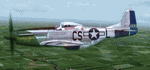
This folder contains a repaint for the A2A WoP3 P-51D Mustang (with AccuSim), in the colors of P-51D-10-NA 44-14377 as flown by Captain Ray S. "X-ray eyes" Wetmore, of the 370th FS/ 359th FG. Born in Kerman, California, Ray Shuey Wetmore enlisted in the Army in November 1941 at age 18 and entered pilot training eight months later. Upon commissioning in March 1943 he joined the new 359th Fighter Group which was sent to England in October that year. Flying with the 370th Fighter Squadron, in February and March 1944 Wetmore scored his first 4.25 victories flying the Republic P-47 Thunderbolt. Upon conversion to P-51 Mustangs the group ranged farther afield and Wetmore became a 20-year-old ace with a double victory on May 19, downing two Me-109s. At month's end his tally was 8.25. At year's end he was a captain with nearly 15 kills, flying several Mustangs named Daddy's Girl.
He flew 44-14377 between 2 november 1944 and 10 march 1945, when it was damaged by Flak near Remagen. He scored nine victories with this aircraft, making it his most successful mount
Upon return from leave in the U.S., then-Captain Wetmore scored steadily from November 1944 to January 1945. In that period he downed 12 more enemy fighters including 4.5 FW-190s on January 14. His final victory was a rocket-powered Me-163 on March 15. His final score was 21.25 destroyed and one damaged in aerial combat, highest score in the 359th Fighter Group and eighth best of all Americans in the European Theater. On VE-Day he was a 21-year-old major and the highest scoring ace still on active duty in the 8th AF. Repaint by Jan Kees Blom, based on the A2A paintkit.
| Filename: | North_American_P51D_359th_FG_CSL_Daddys_Girl.zip |
| License: | Freeware |
| Added: | 10th November 2018, 16:48:16 |
| Downloads: | 95 |
| Author: | Jan Kees Blom |
| Size: | 13.48 MB |
| Category: Flight Simulator X - Aircraft Repaints, Textures and Modifications | |
| FSX/P3D TAI DC-3 1962 |
|
Images related to this file:
File Description:
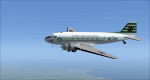
This is a repaint of the DC-3 in TAI (Transports Aeriens Intercontinentaux) colors. The freeware DC-3/C-47 v3 by Manfred Jahn is needed for this repaint. In 1946 the French government allowed the creation of some independent air carriers. On June 1 of that year TAI (Transports Aeriens Internationaux) was formed, and was based in Orly, France. Flights began on July 1, with a Junkers Ju-52. The following year they purchased 7 ex KLM DC-4s, along with 3 Bristol 170 freighters. In 1954 DC-6Bs started to replace the DC-4s. Their route network serviced mainly Africa, the Far East, the French Pacific territories, and Australasia. Prior to 1956 their network wa mainly in Africa, and Asia. On May 6, 1960, a partnership was formed with Air France, whereby TAI flew the South Pacific leg of the state carrier’s around the world service via New Caledonia and Tahiti. Later, on September 4 1960, TAI began a Douglas DC-8-32 service from Paris to Darwin via Athens, Teheran, Karachi, Bangkok, Phnom Penh, and Saigon, and on September 12, it inaugurated a route from Sydney to Los Angeles via Noumea, Nandi, Papeete, and Honolulu with the DC-8. On September 14 1961, TAI agreed, in principle, to a future merger with Union Aeromaritime de Transport (UAT). The two airlines integrated their schedules in 1962 and the amalgamation of TAI and UAT was completed on October 1, 1963, resulting in a new airline: UTA (Union de Transports Aeriens). This DC-3, F-BGXN, flew for TAI from 1956 to 1959. Textures are DXT5. This repaint was tested on FSX-SE and should work on FSX & P3D v1-3.
| Filename: | FSXP3D_TAI_DC3_1962.zip |
| License: | Freeware |
| Added: | 19th March 2019, 17:01:24 |
| Downloads: | 187 |
| Author: | Ted Giana |
| Size: | 8.29 MB |
| Category: Flight Simulator 2004 - Scenery | |
| Anticosti Island in Quebec Canada |
|
Images related to this file:
File Description:
Anticosti Island is in the Gulf of St Lawrence, around 25 miles off the Quebec mainland coast. It is some 40 miles wide and 130 miles long on an east west axis. There are few urban areas and only one that can be described as a small town, namely Port Menier at the western end of the southern coast, with a population of under 1,000. There is a ferry service to the harbour. The airport, Port Menier CYPN, is around 3 miles northeast of the town, with an asphalt runway aligned 11-28, 4,875 feet long and 150 feet wide with PAPI at each end. In 2010 (the approximate date of this scenery) a gravel runway was still visible at the eastern end of the field. This was no longer in use by 2010, except perhaps by small planes on skis in the winter. The island, with its small population, small urban area, and no industry other than logging, has as a result a mainly undisturbed wildlife population. This has made deer hunting and fishing the main tourist activities, with one company (called Safari) having an exclusive licence to exploit large areas of mountains and rivers. Planeloads of hunters and fishermen are flown in on chartered Nolinor Aviation planes from the south. There are a further two airfields in the eastern end of the island, and in 2010 Rivere-Aux-Saumons CTH7 had a 5,500 feet gravel runway, linked by road to a lodge area at the mouth of the river. This is the only lodge area that I have been able to locate, but there are others. To the south Riviere Bell CRB5 had at that time a gravel runway that was 3,000 feet long. This has been lengthened since then and both runways were recently (2021) asphalted. If you find an error email me please, and note that my email address has been changed to rogwens at Gmail dot com.
| Filename: | Anticosti_Island_in_Quebec_Canada.zip |
| License: | Freeware, limited distribution |
| Added: | 31st July 2021, 18:23:40 |
| Downloads: | 80 |
| Author: | Roger Wensley |
| Size: | 11.78 MB |
| Category: Flight Simulator 2004 - Scenery | |
| Pemberton CYPS in British Columbia Canada |
|
Images related to this file:
File Description:
Pemberton is a small village in the Coast Mountains of British Columbia, with a permanent population of under 3,000 and reliant on logging and increasing tourism. It is around 40 miles north of Squamish and 15 miles north of Whistler and the flight north is best described as scenic. The Nairn Falls, a scenic attraction for tourists, are close by. The runway is 3,920 feet of asphalt aligned 06-24, between and close to the join of the Lillooet River and the Green River. The airfield buildings are to the north of the runway, and at the eastern end is a Fire Base for the expected summer forest fires. To the south and west is the Pemberton Golf Course. All the buildings are replicated, and once again this is not an airport, it is an airfield without any lighting and typical of my future posts which are updated versions of airfield scenery made some time ago and not posted. This one is probably more intricate than most that will follow. The lack of lighting is actually very sensible as landing in the mountains in the dark..... Gun Lake is included here, but not for regular use as it is a deserted dirt strip 40 miles to the north that was once used for fire fighting and there is nothing to see. Just a part of the scenery in this area of BC. If you want to follow this trip on Google Earth the next stop is Cache Creek. If you find a defect, email me. Do not email me about the strange doors to the front of the Blackcomb hangar. I was surprised when I saw it and then discovered that the "doors" are actually flexible curtains that are rolled up and down and if rolled down too far...
I have the ok to use the Bell 212 CCG helicopter as a scenery object, but not to post the entire object library of the Red Deer CYQF scenery; if you have the scenery it should show up here.
| Filename: | Pemberton_CYPS_in_British_Columbia_Canada.zip |
| License: | Freeware, limited distribution |
| Added: | 17th November 2020, 17:29:13 |
| Downloads: | 112 |
| Author: | Roger Wensley |
| Size: | 16.18 MB |
| Category: Flight Simulator X - Scenery | |
| EPGO Goraszka 2010 - The Airshow Challenge |
|
Images related to this file:
File Description:
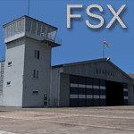
EPGO Goraszka 2010 - The Airshow Challenge is a freeware, extremely detailed scenery of a general aviation airport located 12nm (20km) south-east of Warsaw downtown and Warsaw Frederic Chopin International Airport, Poland. EPGO Goraszka airfield was built in 1994 and currently belongs to General Aviation company, which offers aero-taxi flights, air transport and special flights (air photo, patrol) and airport services. The airport has a 800m-long runway and a lightened helipad, which can be used by helicopters up to 5700kg weight. General Aviation's fleet includes Antonov AN-2, PZL-104 Wilga 80, Bell 407 and 427. Since 1996 the International Air Picnic Goraszka is organized every year by "Polish Eagles" Foundation created on initiative of Zbigniew Niemczycki.
The scenery is equipped with an automatic installer. Currently we support a safe, manual way of adding new sceneries to Scenery Library in Flight Simulator. This is just one thing users need to do for themselves. Detailed instructions will be given during the installation process.
Scenery features:
-Compatible with FSX only
-Highest level of accuracy in geographic positioning, modelling and texturing
-Incredibly high quality photoreal textures of all airport buildings. Textures are based on over 300 real world -photographs made for this project.
-Hundrieds of 3D objects like tents, exhibitions, airport buildings and surrounding buildings
-Life in the airport: people and cars will enchance your feelings
-AI traffic, animations and effects, designed specifically for FSX
-Some buildings include interior (control tower)
-High quality aerial photos of the airport surrondings (5 seasons + night) with autogen and water mask
-Ultra high quality aerial photos of the airport (with seasons)
-Plain airport scenery with no airshow objects available too (details in the manual)
-Product includes manual and airport charts in PDF format
EPGO Goraszka 2010 - The Airshow Challenge scenery is compatible with almost every payware add-on, including Ultimate Terrain Eastern Europe and Warsaw Photo Scenery by Simdesign. Scenery by Drzewiecki Design - www.drzewiecki-design.net .
| Filename: | EPGO_Goraszka_2010__The_Airshow_Challenge.zip |
| License: | Freeware |
| Added: | 16th July 2010, 12:31:42 |
| Downloads: | 4,715 |
| Author: | Drzewiecki Design - Stanislaw Drzewiecki, Jakub Paczek |
| Size: | 237.18 MB |
| Category: Flight Simulator 2004 - Scenery | |
| EPGO Goraszka 2010 - The Airshow Challenge |
|
Images related to this file:
File Description:
EPGO Goraszka 2010 - The Airshow Challenge is a freeware, extremely detailed scenery of a general aviation airport located 12nm (20km) south-east of Warsaw downtown and Warsaw Frederic Chopin International Airport, Poland. EPGO Goraszka airfield was built in 1994 and currently belongs to a General Aviation company, which offers aero-taxi flights, air transport and special flights (air photo, patrol) and airport services. The airport has a 800m-long runway and a lightened helipad, which can be used by helicopters of up to 5700kg weight. General Aviation's fleet includes Antonov AN-2, PZL-104 Wilga 80, Bell 407 and 427. Since 1996 the International Air Picnic Goraszka is organized every year by the "Polish Eagles" foundation created on initiative of Zbigniew Niemczycki.
The scenery is equipped with an automatic installer. Currently we support a safe, manual way of adding new sceneries to the Scenery Library in Flight Simulator. This is just one thing users need to do for themselves. Detailed instructions will be given during the installation process.
Scenery features:
-Compatible with FS2004 only
-Highest level of accuracy in geographic positioning, modeling and texturing
-Incredibly high quality photoreal textures of all airport buildings. Textures are based on over 300 real world -photographs made for this project.
-Hundreds of 3D objects like tents, exhibitions, airport buildings and surrounding buildings
-Life in the airport: people and cars will enhance your feelings
-AI traffic, animations and effects, designed specifically for FS2004
-Some buildings include interior (control tower)
-High quality aerial photos of the airport surroundings (5 seasons + night) with autogen and water mask
-Ultra high quality aerial photos of the airport (with seasons)
-Plain airport scenery with no airshow objects available too (details in the manual)
-Product includes manual and airport charts in PDF format
EPGO Goraszka 2010 - The Airshow Challenge scenery is compatible with almost every payware add-on, including Ultimate Terrain Eastern Europe and Warsaw Photo Scenery by Simdesign.
Scenery by Drzewiecki Design - www.drzewiecki-design.net
| Filename: | EPGO_Goraszka_2010__The_Airshow_Challenge.zip |
| License: | Freeware |
| Added: | 14th July 2010, 09:49:07 |
| Downloads: | 3,756 |
| Author: | Drzewiecki Design - Stanislaw Drzewiecki, Jakub Paczek |
| Size: | 132.03 MB |
| Category: Flight Simulator 2004 - Miscellaneous Files | |
| Flight dynamics Douglas DC-3 V7.0 |
|
File Description:
This Corrected Aircraft.cfg VERSION.7 dated OCTOBER 13th, 2003 Features the Following....
1. The DC-3 will now not level itself out on a coordinated turn
(This was the biggest issue and is now fixed)
2. Flaps now have a little more drag when used.
(Will realistically slow down for landings and you
wont roll down the runway so much)
3. Differential braking now has a little more power.
(Will realistically allow for tighter turns during taxi)
4. The DC-3 itself now has a little more power.
(Default version is underpowered and used up too much runway,
and.. Default version cruise speed was a little low).
5. Corrected Manifold pressure from 47" to 48" full power
(Default version had it slightly wrong)
6.Fuel is now down to 200 per tank
(Default has version was a little over)
7. All control surfaces, ailerons, rudder and elevators now have delay
(There is a certain lag time when flying a DC-3 and it now shows
with these corrections which delays your input to the controls)
8. Elevator trim is now fixed
(To much play in the default elevator trim , it is now fixed with
less play and also has a delay/lag effect)
9. Rudder trim now with delay/lag
10. Aileron trim now with delay/lag
11. Fuel Flow is now fixed, the DC-3 will burn 90 GPH instead of the original 118 GPH
12. Increased power scalar very slightly for correct cruise airspeed
13. Manifold pressure will decrease 1" MAP per 1,000 feet after 2,000 feet Altitude
13.Exactly 140 kias on full tanks at 9,000' ASL
14. Added Strobe Lights to the wings
15. Adjusted steering (just a tad) for better taxiing
16.Prop (rpm) and Power (map) throttles interact correctly
Took off some delay with ailerons and rudder
Removed some drag and pitch up from the flaps
Added more brake power to the differentials
17. Added a working NAV light to the Nose
I have also added a corrected DC-3 reference sheet". In the zip there are two aircraft.cfg's.. one is modified if you are already using the add-on for special effects.
| Filename: | Flight_dynamics_Douglas_DC3__V70.zip |
| License: | Freeware |
| Added: | 13th October 2003, 19:43:08 |
| Downloads: | 4,569 |
| Author: | Trev Morson |
| Size: | 16.58 KB |
| Category: Flight Simulator 2004 - Scenery | |
| Anticosti Island in Quebec Canada |
|
Images related to this file:
File Description:
Anticosti Island is in the Gulf of St Lawrence, around 25 miles off the Quebec mainland coast. It is some 40 miles wide and 130 miles long on an east west axis. There are few urban areas and only one that can be described as a small town, namely Port Menier at the western end of the southern coast, with a population of under 1,000. There is a ferry service to the harbour.
The airport, Port Menier CYPN, is around 3 miles northeast of the town, with an asphalt runway aligned 11-28, 4,875 feet long and 150 feet wide with PAPI at each end. In 2010 (the approximate date of this scenery) a gravel runway was still visible at the eastern end of the field. This was no longer in use by 2010, except perhaps by small planes on skis in the winter.
The island, with its small population, small urban area, and no industry other than logging, has as a result a mainly undisturbed wildlife population. This has made deer hunting and fishing the main tourist activities, with one company (called Safari) having an exclusive licence to exploit large areas of mountains and rivers. Planeloads of hunters and fishermen are flown in on chartered Nolinor Aviation planes, landing at CYPN. There are a further two airfields in the eastern end of the island, and in 2010 Rivere-Aux-Saumons CTH7 had a 5,500 feet gravel runway, linked by road to a lodge area at the mouth of the river. This is the only lodge area that I have been able to locate, but there are others. To the south Riviere Bell CRB5 had at that time a gravel runway that was 3,000 feet long. This has been lengthened since then and both runways were recently (2021) asphalted.
If you find an error email me please, and note that my email address has been changed to rogwens at Gmail dot com. The reason I am posting this now is that I discovered that my original post ended up in MSFS Original Aircraft instead of in FS2004 Scenery. Ooops!
| Filename: | Anticosti_Island_in_Quebec_Canada.zip |
| License: | Freeware, limited distribution |
| Added: | 28th January 2022, 17:39:46 |
| Downloads: | 121 |
| Author: | Roger Wensley |
| Size: | 11.78 MB |


© 2001-2026 AVSIM Online
All Rights Reserved
Privacy Policy |