
Where Flight Simulation Enthusiasts Gather from Around the World!
AVSIM Library - Search Results

| Category: Flight Simulator 2004 - Sounds | |
| FS2004/FSX Boeing 737 Next-Generation (600-900ER) CFMI CFM56-7B Soundpack |

|
File Description:
This sound is intended for use on Project Opensky's models, but they'll work pretty good I am sure on other freeware and payware planes. After month's of hard precision work, I present to you my new realistic and accurate 737NG CFM56-7B soundpack for Microsoft Flight Simulator 2004 and X. The interior sounds are mainly from a passenger perspective. Once you load your aircraft with these sounds, you'll hear the APU System and Fans in the cabin. You hear the humming sound of the CFM56-7B at idle after you have started the engines. You spool up the engines at takeoff then hear the buzzsaw-like sound of the CFM56-7B engine's fans. Once you lift off and put up the landing gear you will hear a chime from the cabin. It features realistic cockpit sounds like the autopilot deactivation sound, stall clicker, overspeed clicker, gear up warning sound buzzer, flaps lever, rolling whine, and touch-down. I am sure that if you are a frequent Boeing 737 Next-Generation aircraft flyer, or if you're a pilot or flight crew onboard a 737NG aircraft, that you'll pretty impressed by these sounds. Give this soundpack a try, I am sure you won't be disappointed!
| Filename: | FS2004FSX_Boeing_737_NextGeneration_600900ER_CFMI_.zip |
| License: | Freeware |
| Added: | 15th July 2010, 01:38:47 |
| Downloads: | 9,286 |
| Author: | Adam Murphy - SkyHigh Sound Systems |
| Size: | 55.26 MB |
| Category: Flight Simulator 2004 - Scenery | |
| Mary River CMR2 on Baffin Island in Nunavut Canada |
|
Images related to this file:
File Description:
This is a very early version of an airfield in Nunavut built to serve an iron ore mine some 100 miles south of Pond Inlet on Baffin Island. In 2004 the airstrip was just being built, with a very basic camp set up for the construction crew who then went on to develop the roads etc in the immediate area. The original plan was for an opencast mine, with ore being transported south on a new (and expensive) railroad link to a new port on the south shore of Baffin Island. This plan was later changed to a (much cheaper) road to Milne Inlet, north of Mary River. And there my story rests, as although production has now started I have no further information about the operating mine. Nolinor currently flies regular supply flights into the camp; the AI here is for the early days. The gravel runway is 4,800 feet long and 150 feet wide, aligned 124T-304T as all runway headings in the north are given as true rather than the unreliable magnetic, which would be 12-30. Runway lighting and PAPI was installed early on and is included here; signage is not and the apron is the early version.
| Filename: | Mary_River_CMR2_on_Baffin_Island_in_Nunavut_Canada.zip |
| License: | Freeware, limited distribution |
| Added: | 18th August 2018, 02:57:19 |
| Downloads: | 136 |
| Author: | Roger Wensley |
| Size: | 4.82 MB |
| Category: Flight Simulator 2004 - Scenery | |
| VGEG Chittagong/Shah Amanat International, Bangladesh |
|
Images related to this file:
File Description:

Googly scenery for VGEG Chittagong/Shah Amanat International (known as M A
Hannan until 2005) - an important airport in Bangladesh that is poorly provided
for in Flight Simulator 2004. These scenery files add taxiways, aprons,
buildings and other airport features, including the military area at the north
end and the general aviation ramps, so that you and your "AI" traffic can land,
taxi, park and take off in a realistic manner.
The city of Chittagong and its port are served regularly by jets ranging in size
from the Fokker 28 to the Douglas DC10 from operators like Air Arabia, Air Asia,
Biman Bangladesh Airlines, Oman Air, Thai Airways International, and turboprops of
GMG Airlines, United Airways and Zoom Airways.
The scenery does not purport to be ultra-accurate. Based on high-detail satellite
imagery from Google Earth, the layout is proportionally correct but the added
airport features, such as buildings, are built from default Microsoft objects
and add-on libraries so will not look like the real thing.
You are not obliged to download and install any additional scenery libraries,
but to enjoy this scenery in its entirety, you may wish to. It will work fine,
with or without.
[File re-uploaded at request of AVSIM]
| Filename: | VGEG_ChittagongShah_Amanat_International_Banglades.zip |
| License: | Freeware |
| Added: | 14th May 2010, 05:10:02 |
| Downloads: | 3,079 |
| Author: | John Hinson |
| Size: | 71.7 KB |
| Category: Flight Simulator 2004 - Scenery | |
| VGCB Cox's Bazar, Bangladesh |
|
File Description:
Googly scenery for VGCB Cox's Bazar, Bangladesh, a small domestic airport
serving the fishing town of the same name in the Bay of Bengal, to the
south of Chittagong. It boasts extensive sandy beaches which has allowed
tourism development. The unusual name comes from Captain Hiram Cox of the
British East India Company who was appointed Superintendent of the outpost
in the late 1700s. The airport, which was originally a Pakistan Air Force
base, sees domestic flights (mostly to/from Dhaka) operated by Hawker
Siddeley 748s, de Havilland Dash 8s and Fokker Fellowship aircraft of Biman
Bangladesh Airlines, GMG Airlines, United Airways and Zoom Airlines.
Flight Simulator 2004 has made no provision for traffic with only a runway
provided and this scenery seeks to redress the situation.
The scenery does not purport to be ultra-accurate. Based on high quality
satellite imagery from Google Earth, the layout is proportionally correct but the
added airport features, such as buildings, are built from default Microsoft objects
and add-on libraries so will not look exactly like the real thing.
You are not obliged to download and install any additional scenery libraries,
but to enjoy this scenery in its entirety, you may wish to. It will work fine,
with or without.
| Filename: | VGCB_Coxs_Bazar_Bangladesh.zip |
| License: | Freeware |
| Added: | 14th April 2008, 21:13:08 |
| Downloads: | 1,352 |
| Author: | John Hinson |
| Size: | 67.71 KB |
| Category: Flight Simulator 2004 - AI Flight Plans | |
| JetBlue Airways, Winter 2010 |
|
Images related to this file:
File Description:

Thank you for downloading my first flightplan set in well over two years. While I'm not entirely satisfied with the results of this effort, enough changes in destinations, liveries, and aircraft numbers should be sufficient for those seeking an update to the two year old plans currently available.
The schedule used in the compilation of this flightplan set came directly from Jetblue's desktop schedule. Note: These flightplans do not include any of the charter flights Jetblue is well known for but do include the new routes and frequencies to Jamaica and elsewhere. For painters, here is an opportunity to work on the new Jetblue livery, Blueberries; three of which are currently in the JBU fleet.
JetBlue Airways is an American low-cost airline owned by JetBlue Airways Corporation (NASDAQ: JBLU). The company is headquartered in the Forest Hills neighborhood of the New York City borough of Queens.[2] Its main base is John F. Kennedy International Airport, also in Queens. In 2001, JetBlue began a focus city operation at Long Beach Airport in Long Beach, California, and another at Boston's Logan International Airport, in 2004. It also has focus city operations at Fort Lauderdale, Washington-Dulles and Orlando International Airport. The airline mainly serves destinations in the United States, along with flights to the Caribbean, the Bahamas, Bermuda, Colombia, Costa Rica, Jamaica, and Mexico.
| Filename: | JetBlue_Airways_Winter_2010.zip |
| License: | Freeware |
| Added: | 14th December 2009, 22:49:10 |
| Downloads: | 935 |
| Author: | Mark Lupus |
| Size: | 71.65 KB |
| Category: Flight Simulator 2002 - Scenery | |
| Nam Phong Royal Thai Air Force Base (Scenery Upgrade) |
|
File Description:
A model of Nam Phong RTAFB as it appeared in mid-1972 when much of it was still under construction. Nam Phong was originally an obscure Thai Air Force training facility located about 60 miles south-southeast of the large USAF/Air America base at Udorn. In response to increasing NVA attacks in the Central Highlands of South Vietnam, the US Marine Corps transferred three fighter/attack squadrons (known as "Task Force Delta")from Da Nang to Nam Phong. A new 10,000 ft. concrete runway was built, and roads, aircraft parking and housing/storage areas were hacked out of the jungle by a joint USN/USMC engineering team. Nam Phong was nicknamed "The Rose Garden" in jest due to the extremely primitive conditions that existed there when the Marines first arrived. The nickname was borrowed from the Marine Corps advertising slogan, "We don't promise you a rose garden", which in turn was inspired by the lyrics of a popular country & western song by Lynn Anderson. The three USMC fighter/attack squadrons that took up permanent residence at Nam Phong were the VMFA-115 "Silver Eagles", the VMFA-232 "Red Devils", and the VMA(AW)-533 "Nighthawks." This enhanced model supercedes the Nam Phong scenery that was uploaded three years ago. It should be compatible with FS 2004. Requires the trees_v3.zip object library by Gerrish Gray.
| Filename: | Nam_Phong_Royal_Thai_Air_Force_Base_Scenery_Upgrad.zip |
| License: | Freeware |
| Added: | 29th January 2006, 23:52:08 |
| Downloads: | 319 |
| Author: | George Knowles |
| Size: | 959.86 KB |
| Category: Flight Simulator 2004 - Scenery | |
| Tongass Remote Airfield (RATR) - for "Tongass Fjords" (FS9) |
|
Images related to this file:
File Description:
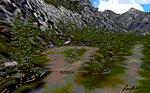
"Tongass Remote Airfield" (RATR) Alaskan scenery (Fictitious)
Tongass Remote Airfield is for Flight Simulator 2004 and for the "Tongass Fjords" (FS9) addon by Holger Sandmann & Bill Womack . You must have "Tongass Fjords" (FS9) for this to work.
Field history and description:
In the early days this area was well known to prospectors and hunters. A small mine was established and later abandoned. Around the late 40���¢��������s a crew was contracted to clear a small landing area to gain easier access for hunters and campers. Due to the extreme remoteness of this area that clearing took several years. The last phase was the approach, clearing by hand a descending glide slope through just the tops of the tall trees. There is now just enough room for a very experienced pilot to get in and out of this field. The airfield is 26 miles north of Petersburg Alaska (PAPG). This is a tricky narrow approach with a left hand dogleg and then an immediate right hand dogleg turn just before the final approach. Not much time to set up your approach, also, it's a very short runway. For experienced pilots only, and make sure that your life insurance is up to date. See enclosed Maps and info. Good luck.
| Filename: | Tongass_Remote_Airfield_RATR__for_Tongass_Fjords_F.zip |
| License: | Freeware, limited distribution |
| Added: | 11th February 2010, 00:49:22 |
| Downloads: | 623 |
| Author: | Jay Langham |
| Size: | 3.51 MB |
| Category: Prepar3D V1-4 - Aircraft Repaints, Textures and Modifications | |
| DELTA CONNECTION Operated by Republic Airways E170SU (N815MD) |
|
Images related to this file:
File Description:

Republic Airways is a regional airline operating for American, Delta and United as American Eagle, Delta Connection, and United Express respectively. Republic currently operates an EJet airfleet of E170's and E175's. It is based in Indianapolis, Indiana home to the legendary Indianapolis Motor Speedway, nicknamed "The Brickyard", from which the airline derived its callsign. Because of a Chapter 11 bankruptcy filing in 2016, Republic Airways is now a merger with Shuttle America. To date, Republic Airways has the largest fleet of E170's and E175's in the world. This airframe, an E170SU, was delivered to US Airways Express in 2004, is msn 34 and now flies in the DELTA CONNECTION livery. This particular airframe, registration N815MD, flies primarily routes in the Northeast and Northcentral United States. I tried to represent this aircraft as best I could by including details like wheel colors and the "E170" under the nose of the aircraft. There are inaccuracies in the model, especially the doors, but this is as accurate as I could get it.The repainted textures in this package are 32-bit with no mipmaps for best clarity and quality. This is the Version 3 model of the FeelThere Embraer 170. You must own a copy of the Feelthere E-JETS E170/E190 V3 to enjoy this repaint.
| Filename: | DELTA_CONNECTION_Operated_by_Republic_Airways_E170.zip |
| License: | Freeware, limited distribution |
| Added: | 10th April 2020, 15:46:22 |
| Downloads: | 1,083 |
| Author: | Jeffrey S. Bryner, FeelThere |
| Size: | 27.59 MB |
| Category: Flight Simulator 2004 - Scenery Design | |
| WBGT/WBTM Long Banga, Tanjung Manis, Malaysia |
|
Images related to this file:
File Description:
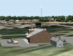
Googly scenery for WBGT Long Banga, Tanjung Manis (sometimes also referred to
under the ICAO code WBTM) - a small domestic airport in Malaysia that it seems
Microsoft forgot to provide in in Flight Simulator 2004. These scenery
files create the airport and add taxiways, aprons, buildings and other airport
features, so that you and your "AI" traffic can land, taxi, park and take off in
a realistic manner. Also added is the missing TMS non-directional beacon at
this airport (on frequency 264.0).
The airport serves the township of Sarikei, capital of the Sarekei district in
the Sarekei Division (are you following this?) of Sarawak in Eastern Malaysia.
Flights are provided by MASwings, a subsidiary of Malaysian Airlines, with De
Havilland Twin Otter aircraft calling here a few times per week.
The scenery does not purport to be ultra-accurate. Based on high-detail satellite
imagery from Google Earth, the layout is proportionally correct but the added
airport features, such as buildings, are built from default Microsoft objects
and add-on libraries so will not look exactly like the real thing.
You are not obliged to download and install any additional scenery libraries,
but to enjoy this scenery in its entirety, you may wish to. It will work fine,
with or without.
[File re-uploaded at request of AVSIM]
| Filename: | WBGTWBTM_Long_Banga_Tanjung_Manis_Malaysia.zip |
| License: | Freeware |
| Added: | 23rd May 2010, 01:23:38 |
| Downloads: | 964 |
| Author: | John Hinson |
| Size: | 51.04 KB |
| Category: Flight Simulator 2004 - Scenery | |
| HLLQ El Beida/Labraq |
|
Images related to this file:
File Description:
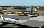
Googly scenery for HLLQ El Beida/Labraq - a joint civilian and military airport
near the north coast of Libya that is poorly provided for in Flight Simulator
2004. These scenery files add taxiways, aprons, buildings and other airport
features, so that you and your "AI" traffic can land, taxi, park and take off
in a realistic manner.
The city of Al Beida, or Al Bayda' or El Beda or Al Baidhah (depending on who
you are) has achieved its own airport status by using the end of a dead runway
at Labraq Air Base. In turn the airbase has contracted to use the opposite end
of the runway as its base of activity. The city is served by jets of Libyan
Airways and turboprop craft of Air One Nine and Ghadames Air Transport.
The scenery does not purport to be ultra-accurate. Based on high-detail satellite
imagery from Google Earth, the layout is proportionally correct but the added
airport features, such as buildings, are built from default Microsoft objects
and add-on libraries so will not look like the real thing.
You are not obliged to download and install any additional scenery libraries,
but to enjoy this scenery in its entirety, you may wish to. It will work fine,
with or without. [File re-uploaded at request of AVSIM]
| Filename: | HLLQ_El_BeidaLabraq.zip |
| License: | Freeware |
| Added: | 28th May 2010, 20:42:26 |
| Downloads: | 1,286 |
| Author: | John Hinson |
| Size: | 73.79 KB |


© 2001-2026 AVSIM Online
All Rights Reserved
Privacy Policy |