
Where Flight Simulation Enthusiasts Gather from Around the World!
AVSIM Library - Search Results

| Category: Flight Simulator 2004 - Scenery | |
| Chicago O'Hare International Airport circa 2018 (reupload) |

|
File Description:
This is a reupload of my Chicago O'Hare redevelopment (KORD). I apologize for the first time, but it appeared I had uploaded xml files into avsim instead of bgl files so it may not work at all.
Description from before: This is a complete makeover of the default O'Hare scenery. For a long time no freeware addon scenery existed for O'Hare, and the paywares that exist now are outdated by several years and, aren't free. I entirely used the default airport buildings utilized by the airport, but added lots of jetways and parking assignments to match the real world layout based on Google Maps. This will give you a March 2018 rendition of the airport. More about the airport in the readme file. Screenshots enclosed, however I recommend only looking at one or two of them first to evaluate, and to fly into the airport first from any other airport of your choice so you can see it for the first time flying in.
| Filename: | Chicago_OHare_International_Airport_circa_2018_reu.zip |
| License: | Freeware |
| Added: | 8th July 2020, 17:31:26 |
| Downloads: | 1,279 |
| Author: | Carlos Si |
| Size: | 37.44 MB |
| Category: Flight Simulator 2004 - Scenery | |
| Health Bay CAD7 in British Columbia, Canada |
|
Images related to this file:
File Description:
This is the fourth in a series of new and renovated float bases in BC. Health Bay is a small village on the west coast of Gilford Island, just 13 miles northwest of Minstrel Island (the previous post in this series). There is no fuel or oil available. The AI is a further adaptation of the original CF36 AI and involves a Baxter Beaver flying from Port Hardy on a round trip in the area through Port McNeill, Health Bay, Echo Bay, and Sullivan Bay. At Health Bay the AI appears to work for both landing and takeoff, though landing will still depend on wind direction. I have played with circuit height and runway length at Minstrel Island and there are improvements, so there is a Minstrel Island replacement bgl. All of these float bases can be installed together in the same folders, with a saving in duplicate textures. So a series called BC Floats (or whatever you want to call it) or individually installed float bases; your choice. The next in the series will be Echo Bay, shown in an included screenshot.
| Filename: | Health_Bay_CAD7_in_British_Columbia_Canada.zip |
| License: | Freeware, limited distribution |
| Added: | 18th January 2017, 01:15:57 |
| Downloads: | 175 |
| Author: | Roger Wensley |
| Size: | 4.63 MB |
| Category: Flight Simulator 2004 - Scenery | |
| Hricziscse Ranch, Oregon v2 |
|
File Description:
A small mixup resulted in a couple incorrect files for a short time in previous version. Check inside folder "FS9 Default Mesh" for bgl files "hricz.bgl" and "hricz_A16N.bgl". They should be dated 4/28/2004. If you have the earlier dated version then you will want to download this fixed version. Sorry for the inconvenience.--------------------------
A simulation of the real-world 483 acre Hricziscse Ranch located in Langell Valley, southeast Oregon, 21nm east of KLMT. Of course, I don't really have an airstrip, but it would be neat. Landclass also used to more closely depict the agricultural nature of the valley. Some artistic leeway is used in the depiction of the ranch and its surroundings. It's a lot cleaner (sterile) in FS than real-life. Rwy 29/11_1500' x 50' grass_alt 4211.3'_night lighting (airstrip does not exist in real world). This scenery is a bit of a frame-hog. --This scenery is designed for use with FSGenesis Westcoast mesh. Alternate files provided for FS9 default mesh users. See install readme for options--
| Filename: | Hricziscse_Ranch_Oregon_v2.zip |
| License: | Freeware, limited distribution |
| Added: | 1st May 2004, 01:42:15 |
| Downloads: | 1,116 |
| Author: | Brent Hricziscse |
| Size: | 7.24 MB |
| Category: Flight Simulator 2004 - Miscellaneous Files | |
| Active ILS - KIAH v2.0 |
|
File Description:
UPDATED KIAH see the readme file -- By design KIAH is now another Airport that features advanced ATC control. As most know initiating the ILS at certain airports for AI Traffic is not a function at this time when using AFCAD2. If you add a new ILS runway to an airport such as KIAH (8L/26R) only the user aircraft can use this runway when visibility falls below 3 miles. ATC will no longer use this runway for AI Traffic because FS9 sees it as a visual runway. This will cause ATC to vector your AI Traffic back to 8/26 (old numbers) 8R/26L (new numbers) which is also a Terminal Departure Runway. All 5 runways for KIAH are now simultaneously active for departure and arrival. There are many additional options added to version 2.0 so follow the instructions in the README and just sit back (or fly) and plane spot either VMC or IMC for a very active airport. *** SimFlyers Scenery AFCAD2 and special ILS bgl also included ***
| Filename: | Active_ILS__KIAH_v20.zip |
| License: | Freeware, limited distribution |
| Added: | 26th August 2004, 02:23:19 |
| Downloads: | 2,720 |
| Author: | Jim Vile |
| Size: | 81.21 KB |
| Category: Flight Simulator 2004 - Scenery | |
| Frazier Lake Airpark (1C9) California Scenery |
|
File Description:
This is a scenery upgrade for Frazier Lake, California (1C9). This is part Eight of a series of small airstrip and minor airfield scenery enhancements which are based on real world data from Google Earth. The scenery mainly reflects the appearance of the airpark from directly above. If you are familiar with the place when on the ground, due to the limited number of buildings available it probably looks quite different. There is now however, a water strip for float planes which was missing from the default. It is proper FS9 water so you may land on it. Also, a few images from the net show that the ground varies from green grass to bare earth so I have made four .bgl files for the base texture. Note, I am using Flight1 Ground Environment; the default fields will look different. You must have rwy12 and EZ scenery libraries installed for the buildings to show. Both libraries of objects are free. EZ Library is available at http://www.abacuspub.com/pub/AbacusEZLibraries.exe. Rwy12 and additional EZ Custom libraries from Avsim. Search under Scenery design.
| Filename: | Frazier_Lake_Airpark_1C9_California_Scenery.zip |
| License: | Freeware |
| Added: | 31st March 2006, 01:00:25 |
| Downloads: | 501 |
| Author: | Kim Gowney |
| Size: | 400.27 KB |
| Category: Flight Simulator 2004 - AI Aircraft | |
| Antonov An-2 for AI Traffic Complete Package |
|
File Description:
Low-poly AI Antonov An-2 by Rysiek Winawer. Features 10 different visual, 7-LOD models, many animations and eye-candies. Flying on FDE by Mike 'Magic' MacIntyre. A paintkit by Mike Pearson included as well as 7 repaints. Expect military package(s), including the model, thanks to Military AI Works (MAIW) group members. A custom made Ketrzyn-Wilamowo EPKE scenery included, utilizing some EZ-Scenery library object (it will work without them though, an included AFCAD file and traffic BGL files are the most important).
Demo flightplans included. You may design own flightplans as well, using RPP_FPGen sheet.
The An-2 is the largest single-engine biplane ever produced. By 1960 the USSR had produced over 5,000 units. Since 1960, most An-2s have been built at Poland's WSK factory in Mielec, with over 13,000 made there before full production ended in 1991. Limited production from parts stocks, as well as spares and maintenance coverage continues. China also builds the An-2 under license as the Shijiazhuang Y-5.
See readme file for all copyrights and additional info.
| Filename: | Antonov_An2_for_AI_Traffic_Complete_Package.zip |
| License: | Freeware, limited distribution |
| Added: | 26th May 2008, 23:32:46 |
| Downloads: | 6,071 |
| Author: | Rysiek Winawer |
| Size: | 9.37 MB |
| Category: Flight Simulator 2004 - Scenery | |
| Northern Oman SRTM mesh |
|
File Description:
This terrain mesh scenery covers northern of Oman emirate as well as some parts of United Arab Emirates (Dubai, Sharjah, Ras Al Khaima, Fujiarah...). The southern and western boundaries are approx 22°N / 54°E.
No part of Iran has been included.
Based on SRTM Data (3 arcsec, 90m) and sampled to LOD9 resolution (76m) using Matthew Styles's program "SRTM To BGL v1.04". While only tested with Fs2004, this mesh should also run with FS2002.
SRTM 3 arcsec dataset has numerous void areas in this part of the world. But thanks to John Child's beautiful and powerful "Blackart" utility it's now easy to patch these areas with lower resolution dataset: I took the coupled interpolation method to merge SRTM 3-arcsec with SRTM 30-arcsec dataset when needed. This gives the best results, as patched areas with 30-arcsec data are blending naturally with surrounding 3-arcsec mesh. Of course the resolution of patched areas is quite poor, but still a bit better than the default LOD5 mesh.
| Filename: | Northern_Oman_SRTM_mesh.zip |
| License: | Freeware, limited distribution |
| Added: | 20th June 2004, 14:11:59 |
| Downloads: | 8,224 |
| Author: | Yohann Baptiste |
| Size: | 16.44 MB |
| Category: Flight Simulator X - Scenery | |
| Area 51 V1.1 |
|
Images related to this file:
File Description:
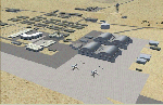
In V1 I added tower comms, taxiways/signs, and deleted start points for all those dirt & other closed runways and made the primary/secondary 14/32.
In V1.1 I have gone through the rest of the airport, aligning and cleaning up scattered oddly placed buildings and placed them in a logical manner - aligned with roads. with parking lots and/or pavement or concrete around their base. Gravel roads added thru the warehouses, sand maintenance roads to water tower and power station, Rec center pool and ballfield touched up. Fire station is in same place but turned towards flight line and added the trucks an ambulance. Fencing all around the flight line.
Also you get the F-117 and Janet 737 WITH traffic file. The Janet 737 is the shuttle aircraft for the Area 51 workers. Watch as the Janet flights arrive each morning from KLAS and depart each night Mon-Fri. KLAS (Las Vegas) Bgl also included with assigned parking at the Janet Terminal.
| Filename: | Area_51_V11.zip |
| License: | Freeware |
| Added: | 24th October 2014, 11:47:01 |
| Downloads: | 2,464 |
| Author: | Jeff Reed |
| Size: | 17.66 MB |
| Category: Flight Simulator 2004 - Scenery | |
| Palermo Punta Raisi Area 2013 |
|
Images related to this file:
File Description:

Dear Friends simmer, using the great objects bgl by mr Gianluca Giovannini, I tried to fill with autogen trees / buildings , the urban area near the international airport of Palermo "Falcone Borsellino". With the current integration of scenery i have created the town of Cinisi, Villagrazia di Carini, Torre Muzza and part of the smalls village near Airport.
Warning Very Important: the scenery "is not complete" and to get the best result YOU MUST INSTALL the following files:
-mesh by Pietro mauri (or SIMILAR mesh OF Sicily) (available HERE);
-install the wonderfull scenery LICJ by Francesco Salsano (available HERE);
-the "Palermo Vfr" by Fulvio Mazzokan (available HERE).
Most information inside the read me file. I hope you like this for your eternal fs 2004 and for your flights in Sicily. Best regards from Italy, Fabio Ferrari Castione della Presolana (bg).
| Filename: | Palermo_Punta_Raisi_Area_2013.zip |
| License: | Freeware, limited distribution |
| Added: | 20th February 2013, 21:57:36 |
| Downloads: | 2,716 |
| Author: | Fabio Ferrari |
| Size: | 4.72 MB |
| Category: Flight Simulator 2004 - Scenery | |
| Milano Malpensa Area (ISD) 2013 |
|
Images related to this file:
File Description:
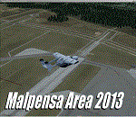
Dear Friends simmer, as always taking advantage of the beautiful objects bgl Gianluca Giovannini, I tried to improve with a symmetric pairing of autogen trees / towns / industrial buildings, the urban area near the international airport of Milano Malpensa, in the best ever scenery by the ISD project.
With the current integration I have created the village of Casenuove, Cardano al Campo, Cascina Costa, Femo, part of the small towns near the attached industrial buildings and new parking in 3D for both terminals. I paid particular attention to the impact of the approach in view of the Ticino Park with a significant density of trees near the runway. Inside you will also find the file on the grass in 3D previously published by me, so if you have already installed, you can deactivate maintaining this.
Warning Very Important: the scenery "is not complete" and to get the best result, you must install ISD LIMC 2009 (limc2009v1.1.zip) - available HERE.
| Filename: | Milano_Malpensa_Area_ISD_2013.zip |
| License: | Freeware |
| Added: | 22nd February 2013, 17:15:22 |
| Downloads: | 4,756 |
| Author: | Fabio Ferrari "fafo air" |
| Size: | 4.51 MB |


© 2001-2026 AVSIM Online
All Rights Reserved
Privacy Policy |