
Where Flight Simulation Enthusiasts Gather from Around the World!
AVSIM Library - Search Results

| Category: Flight Simulator X - AFCAD Files | |
| UKOO - Odesa Intl. Odesa, Ukraine |

|
File Description:
Odesa International Airport(IATA: ODS, ICAO: UKOO) is an airport located 7 km (4.3 mi) southwest from the centre of Odesa, Ukraine.
It serves both domestic and international flights. Airport's runways either were or are co-used by the Ukrainian Air Force.
The airport was built in 1961. In 2009, the airport served 651,000 passengers.
The area of Odessa International airport is 570 hectares. The airport concerns to group of the largest airports of Ukraine and connects Odesa by airlines with many cities of Ukraine and CIS, Western Europe, Asia and Africa.
Technical service of airport is based on 2800 square meters area and represented by 4 parking places to provide technical service to 4 planes simultaneously. European standards classify the airport as "class 1".
In May 2007, the airport started construction work that includes extending the main runway. The airport has ILS CAT I status.
The airport charts can be found here.
This file has the right coordenates, with the apron and characteristics of the airport and buildings.
| Filename: | UKOO__Odesa_Intl_Odesa_Ukraine.zip |
| License: | Freeware |
| Added: | 19th October 2012, 23:37:31 |
| Downloads: | 3,044 |
| Author: | Anwar Gonzalez |
| Size: | 484.36 KB |
| Category: Civil Flight Simulators - Looking Glass Flight Unlimited 3 | |
| New Elevation data GeoTiles.tag for FU3 Seattle Region |
|
File Description:
The test elevation meshes for Switzerland and UK Region using the data from
NASA SRTM_V2 program ( 3 arc second resolution, about 90m grid ) was so successful that I have tried to do a new elevation file for the Seattle Region using the 1 arc second elevation from the same source ( US area only ) 30m grid resolution. Each elevation point ( 64m grid in FU3 ) is now converted from the UTM coordinate to the exact Lat/Long WGS84 coordinate and for this point the elevation data are picked up and stored.
The Geotiles.tag file residing in the /region/seattle/geos/ folder contains this data.
To benefit from this new elevation experience FIRST RENAME YOUR ORIGINAL GEOTILES.DAT FILE INTO XGEOTILES.DAT then copy the geotiles.tag from this zip into the geos folder of the Seattle region. Start FU3 and enjoy the new perfect fitted landscape. Best way is to start directly from the air and not from an airport then all airport are no more flat, have hills and holes. Models and runways are floating over the ground or are into the ground.
| Filename: | New_Elevation_data_GeoTilestag_for_FU3_Seattle_Reg.zip |
| License: | Freeware, limited distribution |
| Added: | 26th September 2006, 23:37:55 |
| Downloads: | 170 |
| Author: | Andre Meystre |
| Size: | 19.28 MB |
| Category: Flight Simulator X - Scenery | |
| FSX: Enhanced Major Metro Autogen (requires FSX Enhanced Autogen World ) |
|
File Description:
This is the second and final part of our enhanced autogen release. This package repairs and upgrades 48 major city autogen building textures world-wide and RESTORES the light maps Aces missed in which large numbers of buildings (Paris, Berlin, London, etc) have been dark since the release of FSX. It includes North America, South America, Asia, Eurasia, Middle East, Europe, Africa and Australia. You MUST install PART ONE (fsx_enhanced_autogen.zip) before using this package. There are links included with the instructiions of this package to PART 1 should you need them along with instructions for FTX users. The included textures will add all the default missing light maps, blend perfectly with GEX Enhanced USA/Canada and are a great match for our upcoming GEX Europe release. Please note these are only textures for major metro auto-generated buildings and are not the city skyscrapers and landmarks. There is absolutely no performance loss -or- performance gain when using these textures which are ONLY for FSX and can not be used in FS9. Happy Holidays from Team GEX to the entire sim community!
| Filename: | FSX_Enhanced_Major_Metro_Autogen_requires_FSX_Enha.zip |
| License: | Freeware, limited distribution |
| Added: | 27th December 2008, 02:28:47 |
| Downloads: | 14,658 |
| Author: | Nick Needham and Anthony Vos of Ground Environment X |
| Size: | 14.21 MB |
| Category: Flight Simulator X - Aircraft Repaints, Textures and Modifications | |
| WASP PT-17 Stearman (N59293) |
|
Images related to this file:
File Description:
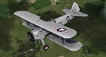
This is a repaint only, for the payware Vertigo Studios Stearman Vol.1 set. This repaint depicts the restored Stearman PT-17 N59293, owned/operated by Andrew and Mike Porter, based at Spring Lake, New Jersey. The aircraft was manufactured as USAAF 41-25714 and was used continually from June 1942 until June 1945. During WWII the aircraft had multiple assignments, one of which included Avenger Field in Sweetwater, Texas, home of the WASP (Women's Airforce Service Pilots), where it was based from February 1943 until August 1944. Sold surplus after the war, the aircraft was used as a crop duster in New Mexico all the way until 1981. Starting in 2006, the aircraft was restored to factory-original award-winning condition, and painted in the same markings it wore while stationed at Avenger Field, flying as a tribute to all of the WASP pilots. (In one of the aircraft's other WWII training assignments, Donald Strait flew this aircraft during flight training and would go on to become a double-ace flying P-51's with the 361st Fighter Squadron).
| Filename: | WASP_PT17_Stearman_N59293.zip |
| License: | Freeware |
| Added: | 22nd January 2017, 04:09:36 |
| Downloads: | 162 |
| Author: | John Terrell |
| Size: | 24.37 MB |
| Category: Flight Simulator X - Aircraft Repaints, Textures and Modifications | |
| USAAF PT-17 Stearman (N38940) |
|
Images related to this file:
File Description:
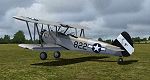
This is a repaint only, for the payware Vertigo Studios Stearman Vol.1 set. This repaint depicts the restored Stearman PT-17 N38940, owned/operated by Paul Bennett, based at Priory Farm, Norfolk, England. The aircraft was manufactured as USAAF 41-8263, and from 1941 until February 1944 the aircraft was used continually, despite being involved in 4 separate training accidents, with a 5th accident taking it out of service althogether. The remains of the aircraft were restored, with the aircraft first flying again in 1977, and later, sold to Paul Bennett in 1992, the aircraft was restored again, to factory-original award-winning condition and finished in the same all-silver color scheme it would have had in 1944. The contrast between the metal and fabric surfaces on this aircraft is period-authentic, as although the fabric surfaces were coated in silver dope, the metal panels were anodized and left bare. Two versions of the repaint are included, with one featuring the temporary 445th Bomb Group tail markings the aircraft sported in 2006.
| Filename: | USAAF_PT17_Stearman_N38940.zip |
| License: | Freeware |
| Added: | 22nd January 2017, 04:05:20 |
| Downloads: | 161 |
| Author: | John Terrell |
| Size: | 46.2 MB |
| Category: Prepar3D V1-4 - Scenery | |
| YMML - Melbourne (Tullamarine) Intl Airport, Victoria, Australia |
|
File Description:
This is Ray Smith's scenery file "fsx_ymml_rs.zip". Ray has given me permission to make his file available for Prepar3D v3. This airport is made with two versions: one version with the Crosswind runway 9/27 activated where both runways will be used for takeoff/landing and one version as the default runway operation: The new Terminal 4 concourse G added, assigned parking as per the their website including 6 gates for the A380, all International flights depart and arrive at the Terminal 2 (T2 - International) Qantas flights depart and arrive from Terminal 1 (T1 - Domestic) Virgin Australia flights depart and arrive from Terminal 3 (T3 - Domestic) and Regional Express (REX) arrives at Terminal 3 (T3 - Domestic). Tigerair and Jetstar flights depart and arrive from Terminal 4 (T4 - Domestic) and Regional Express (REX) departs at Terminal 4 (T4 - Domestic) taxiways and taxi signs updated to the latest charts, extra fuel trucks, support vehicle roads rebuilt and many other scenery improvements, airport views are from inside the control tower (when in tower view) please view the readme before installation.
| Filename: | YMML__Melbourne_Tullamarine_Intl_Airport_Victoria_.zip |
| License: | Freeware |
| Added: | 24th February 2017, 19:48:04 |
| Downloads: | 22,202 |
| Author: | Robert Catherall |
| Size: | 1.47 MB |
| Category: Flight Simulator X - Scenery | |
| KOAK - Metro Oakland Intl |
|
Images related to this file:
File Description:
This is a reasonably accurate and up-to-date version of Metro Oakland Intl airport with two optional files and made only for FSX users, do not use in P3D: There is one version with the Crosswind runways operating where all 4 runways will be used for takeoff/landing and one version as the default airport runway operation.
This update removes the "jfk jetways" mainly for those who have had issues installing the textures to get these Jetway to display, these have now been replaced by Jetway extensions that are more like the real world, Terminals 1 and 2 rebuilt with something better than the stock airport, assigned parking as per their website with extra parking, the Fedex and UPS ramps and buildings replaced, all taxiways and taxi signs updated to the latest charts, support vehicle roads rebuilt, extra fuel trucks, Helipad added to the GA apron and many other scenery improvements and objects added, airport views are from inside the control tower (when in tower view) please view the readme before installation.
| Filename: | KOAK__Metro_Oakland_Intl.zip |
| License: | Freeware, limited distribution |
| Added: | 29th January 2020, 01:05:10 |
| Downloads: | 44,395 |
| Author: | Ray Smith |
| Size: | 8.78 MB |
| Category: Flight Simulator X - Miscellaneous Files | |
| DX10 Shader Fixers V3.2.3 |
|
File Description:
DX10 Shader Fixes V3.2.3. These are a set of shader fixes for DX10 Preview mode in FSX. The patch should not effect DX9 in any way. It addresses the following bugs in the DX10 preview:
1) Flashing runways/taxiways
2) Yellow/white runway markings transparency
3) Opaque chain fences
4) Progressive Taxi markings missing
5) Missing night scenery/semi-transparent dusk scenery (often misdescribed as missing night textures)
6) Some addon cars with black headlights
7) Softer VC shadow
8) Eliminates false sun on VC roof and side wall
9) ORBX FTX Global lights with black background rectangles fixed
Also included are an optional replacement water shade, aircraft lights package and an optional replacement background texture. This can replace the light blue DX10 uses and is close to what DX9 uses in the same circumstances.
With Steve Parson's permission I have updated the shader_release_v3.2.2 patch to shader_release_v3.2.3 to now include a fix for DX10 ORBX FTX Global Lights.
| Filename: | DX10_Shader_Fixers_V323.zip |
| License: | Freeware, limited distribution |
| Added: | 11th July 2014, 13:56:13 |
| Downloads: | 35,715 |
| Author: | Steve Parsons / Steve Waite |
| Size: | 429.52 KB |
| Category: Flight Simulator X - Scenery | |
| RNAS Henstridge (HMS Dipper) |
|
File Description:
Royal Naval Air Station Henstridge or RNAS Henstridge (HMS Dipper) is a former Fleet Air Arm base located 7 miles (11 km) west of Shaftesbury, Dorset (Now Somerset) and 12.4 miles (20.0 km) east of Yeovil, Somerset in South West England.
The main part of the land (355 acres) was purchased in August 1941, after which building of the airfield and the marsh lane accommodation site commenced, it was commissioned on April 1, 1943 as HMS Dipper, principally as number 2 naval fighter school, on the 11th September 1942, another 18 acres was acquired at the adjoining gibbs marsh area for an aircraft repair and maintenance site. The design and lay-out of the airfield was quite unique, having 5 runways, 2 of these being east west lay-out (07-25) both 1000 yards long, the northern runway incorporated a dummy deck landing strip, complete with under-ground arresting gear with four above ground arrestor wires, which was a duplicate of that installed on HMS Implacable for training of aircraft carrier landings, these mainly being carried out with the Seafire, a naval version of the spitfire with folding wings. The site also had its own cinema and stage hall
March 1952 the airfield became inactive and was placed under care and maintenance, during 1953 Air whaling (now Bristow group) used the facilities for repairs to the whaling fleet of helicopters until moving out in June 1958.June 1957 it was finally closed as a naval establishment, from 1958-1960 the entire site was sold off. 27 June 1980 the BBC purchased the whole site and applied for planning permission to erect at the airfield a shortwave radio station consisting of 21 self-supporting towers holding aerial arrays and ancillary buildings on a 300-acre site. The station would transmit overseas radio services to Eastern Europe, the Soviet Union and perhaps South America the application failed and the BBC sold the land during January 1987 The airfield is also the home of the wessex strut, a general aviation club formed in January 1977, which holds an annual fly in and other events their first fly-in was on 17 April 1977 and attracted 107 aircraft. As of today the only usable runway is the north 07-25 runway, extant with the concrete dummy deck, and the underground machinery chamber, it is also the home to a large number of light aviation enthusiasts aircraft as well as the Yakolevs aerobatic display team and the Dorset and Somerset air ambulance
The current airfield is operated by EGHS and is an unlicensed airfield. The only usable runway is 07/25 tarmac/concrete 750 mts long x 6 mtr wide. Henstridge radio can be contacted on 130.250 MHz, it can be found at the south eastern stub of the Yeovilton MATZ
Source:Wikipedia
| Filename: | RNAS_Henstridge_HMS_Dipper.zip |
| License: | Freeware |
| Added: | 9th February 2017, 22:14:54 |
| Downloads: | 165 |
| Author: | Terry Boissel |
| Size: | 4.53 MB |
| Category: Flight Simulator 2004 - Scenery | |
| Bethel PABE in southwest Alaska |
|
Images related to this file:
File Description:
There are four main northwestern Alaska towns which have good airports and are serviced by Alaska Airlines. From these airports local flights connect to nearby villages, "nearby" in Alaska meaning up to 200 miles away. The northernmost is Barrow. Southwest of Barrow is Kotzebue, then Nome, and the furthest south is this one, Bethel. The town of Bethel has a population of just over 6,000 and is 50 miles from the sea on the Kuskowim River, that splits and forks into many tributaries. Bethel Airport is close to the town and provides the only contact with the rest of Alaska, as there is no connecting highway system. There are scheduled flights by Alaska Airlines, ERA (now called Ravn) and Grant Aviation, plus others such as Ryan Air. There are cargo flights by Everts, Northern, and Lynden, and redistribution onwards to nearby villages by the smaller locally-based planes; all of these are included in the AI. There are two main runways, one just under 6,400 feet and another just under 3,900 feet, both of them aligned 19-1. The third runway is around 1,800 feet and mainly gravel, aligned 11-29. Parking at PABE is on three aprons, the northern for smaller commercial planes of Grant, ERA, Ryan etc, the central for larger planes of Alaska, Northern, Everts, and Lynden, and the southern for a large collection of GA; each apron has further hangars for maintenance companies and smaller operators. There is also another separate apron for the local military and Coastguard. There is not much photographic information available for PABE, and I have never been there; as a result it was impossible to make detailed photographic textures for some of the buildings. However, for most hangars I have made textures of at least the right colour etc based on the information I assembled and if it is green with white trim and side windows then that is how it now appears here. The exceptions are the Alaska Airlines terminal building which has complicated curved elements, and the two military hangars and workshops where I had to settle for an Alaska terminal building from another airport and the same for the military. There are numerous small villages in the vicinity of Bethel, all of them being beside either a river tributary or the coast. There are two Google Earth screenshots to show the villages that are served by the flights from Bethel and that are (mostly) included in the AI. Some of these airfields were not included in FS9 but AI will still operate in and out of Bethel. The smaller area screenshot shows the villages that are close to Bethel, and of these eight I have so far made six and they are included in this post: Napaskiak PKA, Napakiak WNA, Kwethluk KWT, Atmautluak 4A2, Nunapitchuk 16A, and Kasigluk Z09. I will work my way through the rest of the area.
| Filename: | Bethel_PABE_in_southwest_Alaska.zip |
| License: | Freeware, limited distribution |
| Added: | 8th March 2019, 00:37:58 |
| Downloads: | 311 |
| Author: | Roger Wensley |
| Size: | 32.02 MB |


© 2001-2026 AVSIM Online
All Rights Reserved
Privacy Policy |