
Where Flight Simulation Enthusiasts Gather from Around the World!
AVSIM Library - Search Results

| Category: Flight Simulator X - Scenery | |
| KMFV - Accomack County Airport - Melfa, Virginia, USA |

|
Images related to this file:
File Description:
Accomack County Airport (IATA: MFV, ICAO: KMFV) is a county-owned public-use airport located 1 mile (1.6 km) west of the central business district of Melfa. The airport was built by the United States Army Air Forces about 1942, and was known as Melfa Flight Strip. It was an emergency landing airfield for military aircraft on training flights. It was closed after World War II, and was turned over for local government use by the War Assets Administration (WAA).
This is a complete re-work of the airport with added taxiways, parking and custom buildings. Created with Airport Design Editor by ScruffyDuck Software using current FAA documentation and Google Earth measurements, this package offers a replacement for FSX's stock airport. All these enhancements are as close to the real airport as I can get with stock library objects and custom buildings.
| Filename: | KMFV__Accomack_County_Airport__Melfa_Virginia_USA.zip |
| License: | Freeware |
| Added: | 16th February 2015, 11:56:40 |
| Downloads: | 430 |
| Author: | Wayne Roberts |
| Size: | 292.84 KB |
| Category: Flight Simulator X - Scenery Design | |
| Soarfly Airfield Essentials - Object Library |
|
Images related to this file:
File Description:

Airfield essentials is an object library for use in FSX.
We have included a wide range of objects you may wish to use to add some "jazz" to your scenery:
1. Open door DHL hangar
2. Open door Hangar with night lit floor
3. Closed large DHL hangar
4. Small Airfield Control Tower
5. Runway guard lights, wigwags and taxiway lights
Plus others. Also included is our ground illuminating ramp light.
These ramp lights are perfect for illuminating AFCAD airfields. They are a bit tricky to place using ADE so we recommend Instant Scenery, however ADE can still be used to place these objects.
The ramp lights give zero illumination during the day but at night they light an area of nearly 200 square metres (656 square feet).
| Filename: | Soarfly_Airfield_Essentials__Object_Library.zip |
| License: | Freeware, limited distribution |
| Added: | 30th July 2015, 13:40:42 |
| Downloads: | 2,863 |
| Author: | Mark Piccolo - Soarfly Concepts |
| Size: | 17.19 MB |
| Category: Flight Simulator X - Miscellaneous Files | |
| DX10 Shader Fixers V3.2.2 |
|
File Description:
DX10 Shader Fixes V3.2.2 (replaces v3.2.1). These are a set of shader fixes for DX10 Preview mode in FSX. The patch should not effect DX9 in any way. It addresses the following bugs in the DX10 preview:
1) Flashing runways/taxiways
2) Yellow/white runway markings transparency
3) Opaque chain fences
4) Progressive Taxi markings missing
5) Missing night scenery/semi-transparent dusk scenery (often misdescribed as missing night textures)
6) Some addon cars with black headlights
7) Softer VC shadow
8) Eliminates false sun on VC roof and side wall
Also included are an optional replacement water shade, aircraft lights package and an optional replacement background texture. This can replace the light blue DX10 uses and is close to what DX9 uses in the same circumstances.
| Filename: | DX10__Shader_Fixers_V322.zip |
| License: | Freeware, limited distribution |
| Added: | 21st December 2012, 22:25:51 |
| Downloads: | 57,608 |
| Author: | Steve Parsons |
| Size: | 430.01 KB |
| Category: Flight Simulator X - Scenery | |
| Istanbul Airport - LTFM - Turkey |
|
Images related to this file:
File Description:
This is a fairly accurate and up-to-date version of the new Istanbul Intl Airport, and created only for FSX users, not suitable for P3D: This airport reflects today's situation with its terminals and concourses including the Cargo aprons and buildings, all parking spots correctly numbered, airlines assigned to their domestic and International terminal gates where possible, Gates D19 and D20 allocated for the A380, taxiways and taxi signs updated to the latest charts, ILS added to runways 16R/34L, 17L/35R and 18/36 including some transitions, control towers, fuel trucks and support vehicle paths added, drainage channels, helipad at the VIP terminal and the state guest house, fuel tank farm and many other scenery enhancements and objects added to make this airport more realistic, airport views are from the roof of control tower 1.
| Filename: | Istanbul_Airport__LTFM__Turkey.zip |
| License: | Freeware, limited distribution |
| Added: | 2nd October 2020, 00:11:54 |
| Downloads: | 44,459 |
| Author: | JMS Designs |
| Size: | 2.02 MB |
| Category: Flight Simulator X - Miscellaneous Files | |
| High Quality Snow and Grass Textures ** UPDATED VERSION ** |
|
Images related to this file:
File Description:
Drzewiecki Design Grass is a freeware, fully automated package of ultra high quality, 4096x4096 pix grass and snow textures for Microsoft Flight Simulator 2004, Microsoft Flight Simulator X, FSX:SE and Lockheed Martin Prepar3D (all currently available versions). It will enhance ground textures in the whole FS.
Microsoft Flight Simulator X and Lockheed Martin Prepar3D have texture resolution limit, which is 1024x1024 pixels. It is possible to select higher resolution by manually editing configuration files but Drzewiecki Design Grass will do that for you automatically!
Default FS9's grass is 128x128pix and with Drzewiecki Design Grass you can admire the 1024x1024 ground texture resolution.
Extra features: Drzewiecki Design Grass will automatically add a HIGHMEMFIX=1 tweak to your FS, which will prevent texture disappearing from aircraft and buildings + snow texture for winter flying.
Enjoy your virtual flying with Drzewiecki Design!
| Filename: | High_Quality_Snow_and_Grass_Textures__UPDATED_VERS.zip |
| License: | Freeware, limited distribution |
| Added: | 25th May 2016, 11:14:26 |
| Downloads: | 3,108 |
| Author: | Drzewiecki Design |
| Size: | 9.21 MB |
| Category: Flight Simulator X - Scenery | |
| Palermo Punta Raisi LICJ, 2011 - version 2 |
|
Images related to this file:
File Description:
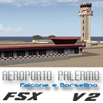
Palermo Falcone e Borsellino airport (also known as Punta Raisi) is an international airport serving the western part of Sicily Island. The airport itself is located 35 km west from Palermo. The airport (LICJ) ranks third by passenger number in southern Italy after Napoli and Catania. This scenery comes with custom terminals, tower, hangers, textures, night lighting, etc. It was designed to fit Mazzokan's Sicily photo scenery and Pietro Mauri's ItalyMesh2004. Both downloads are heavily encouraged. All details about these files are included in the LICJ 2011 User Manual. This scenery was created for FSX only. It has been tested with FSX sp2, but it should work fine with sp1.
This is version 2, it includes many more airport buildings than version 1, the existing buildings have been heavily updated, previous bugs are solved, etc.
| Filename: | Palermo_Punta_Raisi_LICJ_2011__version_2.zip |
| License: | Freeware, limited distribution |
| Added: | 15th July 2011, 14:58:16 |
| Downloads: | 11,040 |
| Author: | Thomas Lo Gerfo |
| Size: | 7.08 MB |
| Category: Flight Simulator 2004 - Scenery | |
| Europe SRTM mesh part 01: LOD7 buffer mesh |
|
File Description:
Europe SRTM LOD9 mesh part 1 of 13: This is a LOD7 mesh covering the whole Europe from 35°N to 60°N and 12°W to 30°E, to be used as a buffer mesh in conjection with the LOD9 mesh. This Europe SRTM project was optimized for the lowest HDD space use: Each part macthing exactly the boundaries of its neighbors, you'll have a complete corevage of Europe without gap or overlapping scenery. Based on SRTM Data v1 and v2 (3 arcsec, 90m) and sampled to LOD7 resolution (300m). Each SRTM tile was carefully checked and repaired with Blackart v4.02: water areas are now flattened (lighter mesh), and SRTM voids were treated taking advantage of Blackart's sophisticated interpolation algorithm. When required, biggest voids were patched with oversampled SRTM 30 arcsec data and/or manual input.
| Filename: | Europe_SRTM_mesh_part_01_LOD7_buffer_mesh.zip |
| License: | Freeware, limited distribution |
| Added: | 19th October 2005, 16:11:05 |
| Downloads: | 19,077 |
| Author: | Yohann Baptiste |
| Size: | 50.28 MB |
| Category: Flight Simulator 2004 - Scenery | |
| Peawanuck CYPO / Winisk CYWN - Northern Ontario, Canada |
|
Images related to this file:
File Description:
Peawanuck is on the bank of the Winisk River, 23 miles upstream from where the river empties into the Hudson Bay just west of James Bay. It has a population of around 240, and was established in 1986 when the original settlement (Winisk) at the mouth of the river was destroyed by a flood. The airport is on a bluff in a corner of the river at 171 feet ASL, with a gravel runway just over 3,500 feet long and aligned 11-29. There is only basic runway lighting, with no ILS, VASI, or PAPI; there is also no apron lighting, or fuel. Service is provided by Air Creebec with connector flights to Moosonee and Timmins, and on to Montreal. A search of their timetable did not provide any information regarding timings but I made the AI flight from Timmins a daily one; it is probably only once or twice a week. There is also a daily private Cessna from Moosonee. Winisk, at the mouth of the river, has another gravel runway which is over 6,000 feet long. There is also a large hangar and to the north the remaining buildings and fuel tanks etc of a Radar Control site which was closed in 1965 after only 7 years of use.
| Filename: | Peawanuck_CYPO__Winisk_CYWN__Northern_Ontario_Cana.zip |
| License: | Freeware, limited distribution |
| Added: | 29th December 2012, 09:14:03 |
| Downloads: | 282 |
| Author: | Roger Wensley |
| Size: | 2.61 MB |
| Category: Flight Simulator 2004 - Scenery | |
| CYHD - Dryden Regional - Ontario, Canada * Updated v2 * |
|
Images related to this file:
File Description:
This greatly modifies my previous (2009) post of Dryden; this version has bespoke buildings and is stand-alone and does not require you to have the previous post. There will also be follow-up posts of Sioux Lookout and Geraldton. Dryden is in northern Ontario, 110 miles east of the Manitoba border, 40 miles west of Sioux Lookout, and with the US border 90 miles to the south. The town is on the northern shore of Wabigoon Lake and has a population of around 7,800. The main business is pulp and paper, along with agriculture, tourism, and mining. The airport is 5 miles northeast of the town.
Dryden Regional has 6,000' of asphalt which in FS9 is aligned 11-29. The second runway is compacted sand 2,000' long and aligned 05-23. There are two aprons, the western being for the terminal building and some ga parking, and the eastern larger and used in the summer for parking fire fighting planes, along with maintenance hangarage and accomodation etc. The Ontario Fire Service planes were included with my original Geraldton post and are included here again; they fly back and forth and keep Dryden busy along with several Bearskin Airlines and Perimeter Aviation flights.
| Filename: | CYHD__Dryden_Regional__Ontario_Canada___Updated_v2.zip |
| License: | Freeware, limited distribution |
| Added: | 16th March 2013, 09:59:52 |
| Downloads: | 595 |
| Author: | Roger Wensley |
| Size: | 26.99 MB |
| Category: Flight Simulator 2004 - Scenery | |
| Port McNeill CAT5 in British Columbia, Canada |
|
Images related to this file:
File Description:
Port McNeill is at the northern end of Vancouver Island, on the coast and around 20 miles east of Port Hardy. The town population is just over 2,000 and the main industry is logging, followed by sand and gravel quarrying and exporting for the construction industry. Tourism rates third.
The airport, a mile or so east of the town, provides a swift connection for nearby islands and the surrounding area to the rest of the west coast, and serves as the HQ main base for West Coast Helicopters. Their newly built large hangar and office accommodation is next to their older hangar to one side of the central public parking area, opposite the club house cum terminal and hangars. There are two runways: 06-24 which is asphalt, 2,400 feet long, and lit; and 11-29 of gravel, 3,650 feet long and also lit. There is some taxiway lighting, but not, for instance, for the connection between runways, which is in real life a ramp up to the gravel runway which is 15 feet higher. There are no regularly scheduled flights and traffic consists mainly of the West Coast helicopters, plus GA and irregular charters, the latter being mostly from Port Hardy.
| Filename: | Port_McNeill_CAT5_in_British_Columbia_Canada.zip |
| License: | Freeware, limited distribution |
| Added: | 18th November 2018, 05:49:13 |
| Downloads: | 138 |
| Author: | Roger Wensley |
| Size: | 13.29 MB |


© 2001-2026 AVSIM Online
All Rights Reserved
Privacy Policy |