
Where Flight Simulation Enthusiasts Gather from Around the World!
AVSIM Library - Search Results

| Category: Flight Simulator X - Scenery | |
| Mesh South America / MeSA B06 |

|
File Description:
FSX Mesh South America Project:
This terrain mesh file is a part of a whole project covering all the Continent of South America and some islands, divided in tiles identified in a map by its column (letters) and rows (numbers).
Those files were multi-LOD compiled from 90m SRTM2 source data, reprocessed with 3DEM to remove voids and spikes, providing a 76.4m (LOD9) horizontal resolution topography intended for use only in FSX updated with SP1.
Although not well documented, to improve performance, the updated FSX loads DEM files in threads and only the closer terrain (about 5-10 NM from the point of view) is rendered in high detail, while at far distances FSX shows up its default low resolution mesh, when there is not a third part terrain mesh compiled in all others intermediate level of details (multi-LOD).
THIS FILE:
FSX_MeSA_B06 (Column B x Row 06)
This file covers the area inside the boundaries:
N = 11º 15' S; S = 16º 52,5' S;
W = 82º 30' W; E = 75º 0' W;
AUTHORS:
Hely Heck Junior - Magrao ( [email protected] )
and Jose Lobo ( [email protected] )
TerraBrasilis: www.terra-brasilis.org
| Filename: | Mesh_South_America__MeSA_B06.zip |
| License: | Freeware |
| Added: | 11th June 2007, 22:10:10 |
| Downloads: | 1,425 |
| Author: | Hely Heck Jr. and José Lôbo |
| Size: | 12.99 MB |
| Category: Flight Simulator X - Scenery | |
| Mesh South America / MeSA B11 |
|
File Description:
FSX Mesh South America Project:
This terrain mesh file is a part of a whole project covering all the Continent
of South America and some islands, divided in tiles identified in a map by its
column (letters) and rows (numbers).
Those files were multi-LOD compiled from 90m SRTM2 source data, reprocessed
with 3DEM to remove voids and spikes, providing a 76.4m (LOD9) horizontal
resolution topography intended for use only in FSX updated with SP1.
Although not well documented, to improve performance, the updated FSX loads DEM
files in threads and only the closer terrain (about 5-10 NM from the point of view)
is rendered in high detail, while at far distances FSX shows up its default low
resolution mesh, when there is not a third part terrain mesh compiled in all
others intermediate level of details (multi-LOD).
THIS FILE:
FSX_MeSA_B11 (Column B x Row 11)
covers the area inside the boundaries:
N = 39º 22,5' S; S = 45º 0' S;
W = 82º 30' W; E = 75º 0' W;
AUTHORS:
Hely Heck Junior - Magrao ( [email protected] )
and Jose Lobo ( [email protected] )
TerraBrasilis: www.terra-brasilis.org
| Filename: | Mesh_South_America__MeSA_B11.zip |
| License: | Freeware |
| Added: | 11th June 2007, 22:11:28 |
| Downloads: | 1,157 |
| Author: | Hely Heck Jr. and José Lôbo |
| Size: | 1.55 MB |
| Category: Flight Simulator X - Scenery | |
| Mesh South America / MeSA B08 |
|
File Description:
FSX Mesh South America Project:
This terrain mesh file is a part of a whole project covering all the Continent of South America and some islands, divided in tiles identified in a map by its column (letters) and rows (numbers).
Those files were multi-LOD compiled from 90m SRTM2 source data, reprocessed with 3DEM to remove voids and spikes, providing a 76.4m (LOD9) horizontal resolution topography intended for use only in FSX updated with SP1.
Although not well documented, to improve performance, the updated FSX loads DEM files in threads and only the closer terrain (about 5-10 NM from the point of view) is rendered in high detail, while at far distances FSX shows up its default low resolution mesh, when there is not a third part terrain mesh compiled in all
others intermediate level of details (multi-LOD).
THIS FILE:
FSX_MeSA_B08 (Column B x Row 08)
This file covers the area inside the boundaries:
N = 22º 30' S; S = 28º 7,5' S;
W = 82º 30' W; E = 75º 0' W;
AUTHORS:
Hely Heck Junior - Magrao ( [email protected] )
and Jose Lobo ( [email protected] )
TerraBrasilis: www.terra-brasilis.org
| Filename: | Mesh_South_America__MeSA_B08.zip |
| License: | Freeware |
| Added: | 11th June 2007, 22:10:37 |
| Downloads: | 1,211 |
| Author: | Hely Heck Jr. and José Lôbo |
| Size: | 1.51 MB |
| Category: Flight Simulator X - Scenery | |
| Mesh South America / MeSA B01 |
|
File Description:
FSX Mesh South America Project:
This terrain mesh file is a part of a whole project covering all the Continent of South America and some islands, divided in tiles identified in a map by its column (letters) and rows (numbers).
Those files were multi-LOD compiled from 90m SRTM2 source data, reprocessed with 3DEM to remove voids and spikes, providing a 76.4m (LOD9) horizontal resolution topography intended for use only in FSX updated with SP1.
Although not well documented, to improve performance, the updated FSX loads DEM files in threads and only the closer terrain (about 5-10 NM from the point of view) is rendered in high detail, while at far distances FSX shows up its default low resolution mesh, when there is not a third part terrain mesh compiled in all others intermediate level of details (multi-LOD).
THIS FILE: FSX_MeSA_B01 (Column B x Row 01)
This file covers the area inside the boundaries:
N = 16º 52,5' N; S = 11º 15' N;
W = 82º 30' W; E = 75º 0' W;
AUTHORS:
Hely Heck Junior - Magrao ( [email protected] )
and Jose Lobo ( [email protected] )
TerraBrasilis: www.terra-brasilis.org
| Filename: | Mesh_South_America__MeSA_B01.zip |
| License: | Freeware |
| Added: | 11th June 2007, 15:56:55 |
| Downloads: | 1,403 |
| Author: | Hely Heck Jr. and José Lôbo |
| Size: | 1.53 MB |
| Category: Flight Simulator X - Scenery Design | |
| Animated Flags |
|
Images related to this file:
File Description:
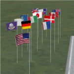
This scenery addon has been developed on Win 7 for FSX Flight Simulator SP1 or SP2. It has also been tested with Microsoft Acceleration, but compatibility is not guaranteed by the author.
The package provides a little collection of animated flags for scenery designers and FS users who do understand the handling of folders and files for FSX. The animated flag models have been developed with GMAX. Along with the textures the package includes the model (mdl) and bgl files. The XML files for the individual placement of a flag into a FSX scenery are included as well.
The documentation contains a step by step description on how to place the flag into the FSX scenery, on a position of your choice. In order to paint your own individual animated flag, the Appendix B of the documentation describes in detail on how to do it. However, a basic experience on how to work with graphical tools like Photoshop, GIMP, Paint Shop Pro etc. is required to paint the extures/colors for a new flag. For credits look at the pdf documentation inside the zip file. By Dietmar Loleit
| Filename: | Animated_Flags.zip |
| License: | Freeware |
| Added: | 17th October 2014, 22:59:25 |
| Downloads: | 662 |
| Author: | Dietmar Loleit |
| Size: | 5.98 MB |
| Category: Flight Simulator X - Original Aircraft | |
| USAF Boeing C-32B |
|
Images related to this file:
File Description:
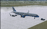
This version of the Boeing 757 is part of the U.S. Dignitary fleet of 5 aircraft of which only 2 are so modified as "B" models. All 5 can carry the Vice President, and when doing so the callsign is AIR FORCE TWO. Normally, this version is used for high altitude, long range missions without media attention. She is equipped for high altitude flights way beyond what a normal 757 can achieve due to higher cabin pressure and fortifications, as well as more powerful and efficient engines. Although the visual model presented is not so equipped in the real world, the engine/aerodynamic aspects for the C-32B have been fully employed within this model. In reality, this version is not painted with U.S. Colors, but is white.
Credits:
Model Designers (FS2004):
Lee Rosario
Albert Bouwman
C. Vincent Cho
Hiroshi Igami
Warren C. Daniel
Jaco du Preez
Ben Hewitt
Nick Peterson
Simon Ng
Repaint by Bobby Pitaya
Realistic Sound by Sanjay Blair
Aero/Engine Dynamics and Data Corrections for FSX:
Douglas E. Trapp
[email protected]
May 2018
This aircraft is designed for educational use protected under the Fair Use Doctrine:
http://www.expertlaw.com/library/intellectual_property/fair_use.html
| Filename: | USAF_Boeing_C32B.zip |
| License: | Freeware |
| Added: | 13th May 2018, 02:29:43 |
| Downloads: | 455 |
| Author: | Douglas E Trapp |
| Size: | 35.56 MB |
| Category: Flight Simulator 2004 - Aircraft Repaints, Textures and Modifications | |
| Wings of Power P-51D "Missouri Armada" |
|
File Description:
P-51D Mustang 44-14789 "Missouri Armada" flown by Capt. John "Johnny" B. England.John Brooke England was born in 1923 at Caruthersville, Missouri. His service number was O-739263 and he joined the 362nd FS of the 357th FG in April 1943 as a 1/Lt meaning that he was part of the original cadre that left the ZI in November 1943 for the UK. He was promoted to Captain and then to Major. He took command of the 362nd FS on 25 August 1944. He served two tours with the 357th FG for a total of 108 operational missions giving a total of 460 hours combat flying time. He was the second highest scorer in the 357th with a total of 17.5 victories. England finished his second tour and rotated home on 26 January 1945. He remained in the service after the war and was killed in an F-86 crash in November 1954 in France. Alexandria Air Force base in Louisiana was renamed England Air Force Base in his honor.Requires prior purchase/installation of Wings of Power P-51D/H Mustang pack available at www.shockwaveproductions.com
| Filename: | Wings_of_Power_P51D_Missouri_Armada.zip |
| License: | Freeware |
| Added: | 2nd December 2005, 17:41:29 |
| Downloads: | 342 |
| Author: | Stephan Pillon |
| Size: | 6.43 MB |
| Category: Flight Simulator X - AFCAD Files | |
| LQSA - Sarajevo Intl. Airport, Bosnia Herzegovina |
|
File Description:
Sarajevo International Airport (IATA: SJJ, ICAO: LQSA), also known as Butmir Airport, is the main international airport in Bosnia and Herzegovina, located 3.3 NM (6.1 km; 3.8 mi) southwest of the railway station in the capital city of Sarajevo in the suburb of Butmir. Since the Dayton Accord in 1996, the airport has welcomed a thriving commercial flight business which includes B&H Airlines, Austrian Airlines, Lufthansa, Jat Airways, Croatia Airlines, Turkish Airlines, Germanwings and others. In 2006, 466,186 passengers traveled through Sarajevo airport, compared to only 25,000 in 1996. In 2011 Sarajevo International Airport had 599,996 passengers which is more than all of the airports in Bosnia-Herzegovina had together and 6,5% more than in 2010. In 2012 the company has a slight decline in traffic. In 2005 the European branch of the Airports Council International awarded Sarajevo the award of Best Airport Under 1 Million Passengers. I just land in this airport, thank you to Sarajevo approach for a nice job. This file has the right coordinates, with runway 46 meters wide, apron and characteristics of the airport, airport vehicles and buildings.
| Filename: | LQSA__Sarajevo_Intl_Airport_Bosnia_Herzegovina.zip |
| License: | Freeware |
| Added: | 10th November 2012, 22:52:51 |
| Downloads: | 2,143 |
| Author: | Anwar Gonzalez |
| Size: | 4.44 MB |
| Category: Flight Simulator 2004 - Aircraft Repaints, Textures and Modifications | |
| British and Commonwealth Shipping Co. Ltd. Bristol Britannia 317 (G-APNB) |
|
Images related to this file:
File Description:
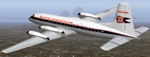
Textures for Jens B. Kristensens Bristol Britannia 300 model (BRT_V10.ZIP). These textures depict Britannia 317 c/n 13426, built at Filton and registered G-APNB Nov. 1958. She was delivered 30.04.1959 to British and Commonwealth Shipping Ltd .and in May 1960 transferred to the parent company Hunting Clan Air Transport Ltd. This aircraft and sister ship G-APNA made several UK - Far East trooping charter flights. Fitted with 114 rearward-facing seats, the interior layout was described as "unusually luxurious" for a troop carrier! Six flights each month were made between London, Singapore and Hong Kong with fuel stops at Istanbul, Karachi and Bombay. Further trooping contracts followed to Cyprus, Kenya and Aden also other charter services were flown (See video clip on https://www.youtube.com/watch?v=2p9feJUh_iE). Photos with an without colored engine cowlings exist. Cheetline and titles were repeatedly altered too. 1959-60 G-APNB was leased to East African Airways Corp., EAAC. In July 1960 both Britannias came to British United Airways, BUA by merger. G-APNB were sold to Donaldson Intl. 1967 and leased out to Lloyd Intl. 1967 and 1969. She retired 1971 and was broken up at Luton.
| Filename: | British_and_Commonwealth_Shipping_Co_Ltd_Bristol_B.zip |
| License: | Freeware |
| Added: | 6th December 2014, 03:06:26 |
| Downloads: | 185 |
| Author: | Manfred Meyer |
| Size: | 3.95 MB |
| Category: Flight Simulator 2004 - Scenery | |
| Antique Scenery, San Jose de Buenavista, Antique, Philippines |
|
File Description:
ANTIQUE SCENERY,Full Version 2.0
October 10,2003
Enjoy this ANTIQUE SCENERY located at San Jose de Buenavista,Antique,Philippines.This scenery features the new EVELIO B. JAVIER airport terminal,ATO building, and the Antique airport CRASH AND FIRE RESCUE STATION with full night lighting.
This scenery is designed to optimize framerates.Special thanks goes to CAPT. JOHN L. MAKANI for the AERIAL and CLOSE UP shots he made at this new Antique airport.
Asian Spirit now serves this airport three times a week. Using the ASIAN SPIRIT YS-11, or sometimes using the ASIAN SPIRIT LET-410,it serves antique airport on Mondays, Wednesdays and Fridays.Install the included TRAFFIC TOOLS FILES and watch out for the ASIAN SPIRIT YS-11 land perfectly in this airport M-W-F at 11:35 a.m.from Manila and take off again at 12:05 p.m. back to Manila.Install the included AFCAD files and watch your favorite genav aircraft land and take off perfectly at the center of the runway.Install the included Editvoicepack VCPMOD file and hear the Antique Tower pronounce the word "Antique" correctly or hear the ATC say "Antique" instead of "Romeo Papa Victory Sierra".
| Filename: | Antique_Scenery_San_Jose_de_Buenavista_Antique_Phi.zip |
| License: | Shareware, time limited |
| Added: | 11th October 2003, 02:08:18 |
| Downloads: | 4,114 |
| Author: | Ver Walter L. Gulfan |
| Size: | 1.73 MB |


© 2001-2026 AVSIM Online
All Rights Reserved
Privacy Policy |