
Where Flight Simulation Enthusiasts Gather from Around the World!
AVSIM Library - Search Results

| Category: Flight Simulator 2004 - Scenery | |
| VVCR Cam Ranh Airport |

|
Images related to this file:
File Description:
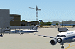
Cam Ranh is currently a fast-growing beauty spot and tourist area on the Vietnamese coast. In May 2004, Cam Ranh airport (VVCR) opened to commercial traffic, initially only serving domestic traffic but international flights will commence in 2005. The airport was once a massive US Air Force base, but was later used as a base for Russion spy plane activities.
This scenery adds this "missing" airport to Flight Simulator, but much is based around satellite views of the airport when the US were spying on the Russian base and other historical information and it may not accurately reflect the airport as it is today. Furthermore, my capabilities at scenery design are limited and restricted to scenery objects available through the Rwy12 scenery creation programme.
You do NOT need to download and install the full 45 MB Rwy 12 Object Placer programme, which is for the designers and not the end user.
Some of the scenery objects will appear without any extra downloads, but to get the greatest benefit from this scenery, you may optionally download following files, which should be installed according to the instructions within this download and not as described in their own download archive:
Level 2 objects
rwy12-lvl2.zip (Israel Roth and Seev Kahn/John Hinson),
Level 3 objects
jw_rwy12.zip (Shehryar Ansari),
tl_rwy12.zip (Todd Lucas) ,
ford_transit_collection.zip (S Legg),
hgrrwy12.zip (ESDG), and
ga-hangers_lib_for_rwy12.zip (S Legg)
Also included with this scenery are two EditVoicepack files which may be imported to that programme so that the controllers will be heard referring to "Cam Ranh".
[File re-uploaded at request of AVSIM] See also file vvcru11.zip.
| Filename: | VVCR_Cam_Ranh_Airport.zip |
| License: | Freeware |
| Added: | 15th May 2010, 01:13:46 |
| Downloads: | 4,180 |
| Author: | John Hinson |
| Size: | 21.36 KB |
| Category: Flight Simulator 2004 - Scenery | |
| KSBA New JUN08 AFCAD w/ Al Wheeler's objects |
|
File Description:
Contemporary KSBA, Santa barbara Municiple Airport scenery as of June 2008 with Scenery object by Al Wheeler.With wheeler's scenery objects, this scenery is packed individually, ready to use by itself. Installtion guide included. Changes included: 1) New taxiway M, K & P
2) original Alpha 07 end curve became P and A extended to the end of rwy 25
but the length of 25 did not change becuse it is "moved forward"
3) J and G near 25 is widen
4) 3 Helipads
5) Grass sides
6) closed link on the end of A and D
7) added taxi signs, you will never get lost a gain
hope you like it and log in to KSBA in vatsim - By James Luen
| Filename: | KSBA_New_JUN08_AFCAD_w_Al_Wheelers_objects.zip |
| License: | Freeware |
| Added: | 16th June 2008, 19:43:14 |
| Downloads: | 1,863 |
| Author: | James Luen |
| Size: | 5.46 MB |
| Category: Flight Simulator X - AFCAD Files | |
| Alliance Airport (23NJ), NJ |
|
File Description:
Located 02 miles SE of Pittsgrove, New Jersey on 3 acres of land, Alliance Airport is a privately-owned turf airstrip included in FSX. If you don't plan on making any trips here, then this AFCAD file will remove the runway and prevent it from randomly sticking out on the satellite textures.
Scenery constructed with use of satellite images/streetview, the author has not been there in person.
This scenery is meant to be used in conjunction with MegaScenery Earth New Jersey/Delaware 004. It is not required, but apron use is minimized to allow satellite scenery to show through as much as possible, and objects are placed based on the MSE textures - lack of it may make scenery look out of place.
| Filename: | Alliance_Airport_23NJ_NJ.zip |
| License: | Freeware |
| Added: | 22nd October 2010, 06:03:59 |
| Downloads: | 203 |
| Author: | Drew Sikora |
| Size: | 174.79 KB |
| Category: Flight Simulator X - AFCAD Files | |
| Markle Airport (2NJ6), NJ |
|
File Description:
Located 05 miles N of Phillipsburg, New Jersey, Markle Airport is a private turf strip. No transient services are offered. Trees are summertime ONLY. 30ft trees and some houses surround the runway to the south and the west, the eastern threshold is on the edge of a steep ravine leading down to the Delaware River.
Scenery constructed with use of satellite images/streetview, the author has not been there in person.
This scenery is meant to be used in conjunction with MegaScenery Earth New York 007. It is not required, but apron use is minimized to allow satellite scenery to show through as much as possible, and objects are placed based on the MSE textures - lack of it may make scenery look out of place.
| Filename: | Markle_Airport_2NJ6_NJ.zip |
| License: | Freeware |
| Added: | 29th October 2010, 21:31:35 |
| Downloads: | 172 |
| Author: | Drew Sikora |
| Size: | 329.68 KB |
| Category: Flight Simulator X - Scenery | |
| The Thames Barrier - England |
|
Images related to this file:
File Description:
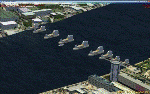
This scenery adds the Thames Barrier to Orbx EU England Regional scenery package. Compatible with both FSX & P3D. The Thames Barrier is the world's second-largest movable flood barrier (after the Oosterscheldekering in the Netherlands) and is located downstream of central London, United Kingdom. Its purpose is to prevent London from being flooded by exceptionally high tides and storm surges moving up from the sea. It needs to be raised (closed) only during high tide; at ebb tide it can be lowered to release the water that backs up behind it. Not tested with default FSX or any other setup. You must have Orbx EU England regional scenery to use the compiled scenery files as intended. By Bryan Wallis aka fltsimguy.
| Filename: | The_Thames_Barrier__England.zip |
| License: | Freeware, limited distribution |
| Added: | 27th January 2013, 01:08:30 |
| Downloads: | 1,341 |
| Author: | Bryan Wallis |
| Size: | 584.23 KB |
| Category: Flight Simulator 2004 - Scenery | |
| Rangiroa 2004 |
|
File Description:
FS2004 Scenery TAHITI RANGIROA SCENERY Ver.3.0
These files improve specific scenerys (Rangiroa
Islands, Tahiti, French Polynesia) of FS2004.
Rangiroa located About 200 miles northeast of
Tahiti Island. Rangiroa is the largest atoll in
the Tuamotu Archipelago. The lagoon is very very
beautiful!!! I tried my best to make the model of
this beautiful Islands. Especially I invented
penetration processing of the beautiful
coastline of Rangiroa. This scenery including
Kia-Ora Village, Avatoru and Tiputa.
Included atolls: Rangiroa, Tikehau, Mataiva, Manihi and Ahe.
This scenery has a quite long visibility
(approximately 100Km) with using LVR( Long Visual
Range Tool ). You can look around the whole
Rangiroa atoll. Furthermore you can see Tikehau
islands from Rangiroa, and Mataiva islands from
Tikehau.
| Filename: | Rangiroa_2004.zip |
| License: | Freeware, limited distribution |
| Added: | 18th May 2004, 22:42:50 |
| Downloads: | 9,190 |
| Author: | Kazuo Kawamura |
| Size: | 20.58 MB |
| Category: Flight Simulator X - Aircraft Repaints, Textures and Modifications | |
| Eurocypria Airlines B737-800 |
|
File Description:
Eurocypria was founded in 1992 and is an affiliated company of Cypriot Airlines. The company executes only charter flights from Cyprus to, mainly, Europe and its surrounding countries and cooperates with a lot of foreigner travelling agencies. Eurocypria transported in 2002 with a total of 1.700 flights 497.729 passengers (in 2001: 1.598 flights, 477.124 passengers and in 2000: 1.242 flights and 369.000 passengers), from mostly Great Britain. Eurocypria uses four B737-800 with 189 seats each. Till the receipt of the 737-800 (Spring 2003) the company used 5 A320 of Cyprus Airways for their service. These aircrafts withdrew from service, with the arrival of the Being 737. The B737-800 are leased from ILFC.The airline flies charter from Cyprus to across europe; Great Britain, Ireland, Germany, Sweden, Norway, Greece, Denmark, Austria, Finland, Iceland, Belgium, Italy and Switzerland; in cooperation with the biggest tour-operators in Europe. Repaint of the default FSX 737-800 aircraft.
| Filename: | Eurocypria_Airlines_B737800.zip |
| License: | Freeware, limited distribution |
| Added: | 19th October 2006, 19:13:52 |
| Downloads: | 4,631 |
| Author: | Thanasis Delizisis, Panagiotis Delizisis |
| Size: | 20.19 MB |
| Category: Flight Simulator 2004 - Scenery | |
| CYZS - Coral Harbour - Nunavut, Canada Modified V1 |
|
Images related to this file:
File Description:
This modified version of Coral Harbour corrects the PAPI postion on the runway, installs new taxiway lights and windsocks, and modifies the AI. This is a complete version and does not require you to have installed the original. Coral Harbour is on Southampton Island, which partly blocks the northern end of Hudson Bay and is around the size of Switzerland. The village has a population of just under 800 people and is some 200 miles from Cape Dorset, Ivujivik, and Repulse Bay, and 230 miles from Chesterfield Inlet to the southwest. The airfield is inland from the village and the 5,000 feet of gravel runway is aligned 155T/335T where T stands for "true" as opposed to magnetic in the Northern Domestic Airspace. JETA-1 fuel is officially available, and in practice so is 100LL, though the latter will be in drums. The visiting AI airlines are First Air and Calm Air, and there is a GA plane too that is stock FS9.
| Filename: | CYZS__Coral_Harbour__Nunavut_Canada_Modified_V1.zip |
| License: | Freeware, limited distribution |
| Added: | 23rd August 2014, 11:25:23 |
| Downloads: | 224 |
| Author: | Roger Wensley |
| Size: | 12.92 MB |
| Category: Flight Simulator 2004 - AFCAD Files | |
| DGAA, Kotoka Intl. Accra, Ghana |
|
File Description:
AF2 scenery enhancement file for DGAA, Kotoka Intl. Accra, Ghana
added Tower view plus full night lighting, additional parking for AI traffic (so finally one can see AI-traffic there),cargo bay and prepared for airline traffic.
| Filename: | DGAA_Kotoka_Intl_Accra_Ghana.zip |
| License: | Freeware, limited distribution |
| Added: | 31st March 2004, 16:50:08 |
| Downloads: | 1,195 |
| Author: | Karl F. Hajek |
| Size: | 2.96 KB |
| Category: Flight Simulator X - Scenery | |
| Alf's UK airfields-Volume 9 |
|
File Description:
My latest volume of airfields for FSX SP2 for the Standard generic scenery, using only FSX generic objects, consists of Caernarfon, Wales EGCK, Deanland/Lewes in Sussex EGKL and back to the West Country for Perranporth EGTP
| Filename: | Alfs_UK_airfieldsVolume_9.zip |
| License: | Freeware |
| Added: | 29th June 2008, 00:28:35 |
| Downloads: | 3,257 |
| Author: | Alf Denham |
| Size: | 1.48 MB |


© 2001-2026 AVSIM Online
All Rights Reserved
Privacy Policy |