
Where Flight Simulation Enthusiasts Gather from Around the World!
AVSIM Library - Search Results

| Category: Flight Simulator 2004 - Scenery | |
| RPLL Version 8 (Ninoy Aquino Internal Airport, Villamor Airbase, Sangley Airbase and Metro Manila) |

|
Images related to this file:
File Description:
Welcome to the latest version of the RPLL and Metro Manila scenery for FS9. This scenery is a a total rework of my previous scenery and contains a more accurate depiction of the entire metropolis. Over 4 years in the making and is the last upgrade for FS9.
This release coincides the first release sometime August of 2006. This scenery covers an area of around 1,400 sq. km. which includes major cities around Metro Manila: from Taytay in the east to Sangley in the west; from Alabang in the south to Novaliches/Caloocan-Bulacan boundaries in the north.
Sangley (RPLS) Airbase has also been redesigned (only the runway and taxiways). The entire Manila Bay coastline from Sangley to Novaliches has been recreated, adding fish-farms, correct coastal shape, breakwaters, reclaimed areas and marine ports. All major roads and river/water systems are also covered in this scenery.
The RPLL airport scenery contains 90 percent of the existing structures plus noticeable buildings around the vicinity including the new Newport City, Libingan ng mga Bayani, Fedex HQ and MIAA offices; and warehouse around rwys 06 and 24. 80 percent of the structures are individually textured. Also included in the package is Nestor d'Angelos Metro Manila buildings.
| Filename: | RPLL_Version_8_Ninoy_Aquino_Internal_Airport_Villa.zip |
| License: | Freeware, limited distribution |
| Added: | 4th August 2010, 03:48:52 |
| Downloads: | 4,620 |
| Author: | Lowil fred Espada |
| Size: | 25.37 MB |
| Category: Flight Simulator 2004 - Scenery | |
| OPDB Dalbandin, Pakistan |
|
Images related to this file:
File Description:
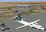
Googly scenery for OPDB Dalbandin, Pakistan - a quiet domestic airport for
which no operational facilities are provided in Flight Simulator 2004. These
scenery files add/correct the runways, apron, taxiways, buildings and other
airport features so that you and your "AI" traffic can land, taxi, park
and take off in a realistic manner.
The airport appears to be served all of once per week by ATRs of Pakistan
International Airways so will hardly buzz with activity, but you will be
assured of a friendly welcome when you arrive.
The scenery does not purport to be ultra-accurate. Based on high-detail satellite
imagery from Google Earth, the layout is proportionally correct but the added
airport features, such as buildings, are built from default Microsoft objects
and add-on libraries so will not look like the real thing.
You are not obliged to download and install any additional scenery libraries,
but to enjoy this scenery in its entirety, you may wish to. It will work fine,
with or without.
[File re-uploaded at the request of AVSIM]
| Filename: | OPDB_Dalbandin_Pakistan.zip |
| License: | Freeware |
| Added: | 5th May 2010, 22:32:37 |
| Downloads: | 1,017 |
| Author: | John Hinson |
| Size: | 65.99 KB |
| Category: Flight Simulator 2004 - Scenery | |
| VEPT Patna, India |
|
Images related to this file:
File Description:
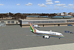
Googly scenery for VEPT Patna, India. In Flight Simulator 2004, the airport is
depicted at a pretty waterside location but only a small ramp for general aviation
aircraft is provided. In the real world it is served around six times a day by
Boeing jets on domestic flights by Alliance Air, Indian Airlines, Jet Airways, and
Sahara Airlines. These scenery files add aprons, taxiways, buildings and other
airport features to Flight Simulator's bland representation and allow "AI" traffic,
to land, taxi, park and take off in a realistic manner.
The scenery does not purport to be ultra-accurate. Based on high-detail satellite
imagery from Google Earth, the layout is proportionally correct but the added
airport features, such as buildings, are built from default Microsoft objects
and add-on libraries so will not look like the real thing.
You are not obliged to download and install any additional scenery libraries,
but to enjoy this scenery in its entirety, you may wish to. It will work fine,
with or without.
[File re-uploaded at request of AVSIM]
| Filename: | VEPT_Patna_India.zip |
| License: | Freeware |
| Added: | 7th May 2010, 11:02:44 |
| Downloads: | 1,705 |
| Author: | John Hinson |
| Size: | 65.91 KB |
| Category: Flight Simulator 2004 - Scenery | |
| SPHZ Anta/Comandante German Arias Grazz, Peru |
|
Images related to this file:
File Description:
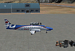
Googly scenery for SPHZ Anta/Comandante German Arias Grazz, Peru - a small
domestic airport for which nothing more than a runway is provided in Flight
Simulator 2004. These scenery files add the apron, taxiways, buildings and
other airport features so that you and your "AI" traffic can land, taxi, park
and take off in a realistic manner.
The airport is served daily by domestic operator L C Busre and perhaps also
others using small aircraft, but little information has been found on activity
in this area.
The scenery does not purport to be ultra-accurate. Based on high-detail satellite
imagery from Google Earth, the layout is proportionally correct but the added
airport features, such as buildings, are built from default Microsoft objects
and add-on libraries so will not look like the real thing.
You are not obliged to download and install any additional scenery libraries,
but to enjoy this scenery in its entirety, you may wish to. It will work fine,
with or without.
[File re-uploaded at request of AVSIM]
| Filename: | SPHZ_AntaComandante_German_Arias_Grazz_Peru.zip |
| License: | Freeware |
| Added: | 23rd May 2010, 01:24:24 |
| Downloads: | 1,224 |
| Author: | John Hinson |
| Size: | 65.15 KB |
| Category: Flight Simulator 2004 - Scenery | |
| YEVD Evans Head Memorial, Australia |
|
File Description:
Googly scenery for YEVD Evans Head Memorial, a former RAAF Training base in
New South Wales, Australia, now reduced to a single runway and small apron.
In its heyday it was home to the RAAF No 1 Bombing and Gunnery and the RAAF No 1
Air Observers Schools and it was said to be the largest training base in the
southern hemisphere - at that time it had four runways.
Flight Simulator 2004 has made no provision for traffic with only a runway
provided and this scenery seeks to redress the situation so that you and your
"AI" traffic can use the airport.
The scenery does not purport to be ultra-accurate. Based on high quality
satellite imagery from Google Earth, the layout is proportionally correct but the
added airport features, such as buildings, are built from default Microsoft objects
and add-on libraries so will not look exactly like the real thing.
You are not obliged to download and install any additional scenery libraries,
but to enjoy this scenery in its entirety, you may wish to. It will work fine,
with or without.
| Filename: | YEVD_Evans_Head_Memorial_Australia.zip |
| License: | Freeware |
| Added: | 19th April 2008, 10:23:02 |
| Downloads: | 546 |
| Author: | John Hinson |
| Size: | 71.78 KB |
| Category: Prepar3D V1-4 - AFCAD Files | |
| LGAT Athens Hellinikon - Disused v3 |
|
Images related to this file:
File Description:
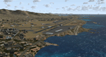
Version 3 of the scenery with refinements. This scenery includes the disused Athens, Greece, capital airport in its current status. Default FSX & P3D scenery do not include old LGAT airport at all and this why this scenery was created since the landsite still looks like this in that location. The airport closed in year 2002 after being replaced from Athens International Airport - Eleftherios Venizelos LGAV in March 2001. The northwest side of the airport was then used for Athens 2004 Olympics athletic installations and the southeast side remains disused. The scenery is a modification of Angelo Tassoglou (LGAT2B.ZIP) by permission of the author. It contains only basic stock MS objects without any custom items and therefore is very light in performance load. Angelo has moved the airport in the correct location where it should be (due to obsolete coordinates reference system used by MS). This, nowadays disused, airport is not meant to be used for flying in FS but only to have it visually correct when flying above. Version 3 removes some remaining ground taxiway lighting that was left in version 2.
| Filename: | LGAT_Athens_Hellinikon__Disused_v3.zip |
| License: | Freeware |
| Added: | 26th April 2016, 00:32:13 |
| Downloads: | 1,478 |
| Author: | Kyprianos Biris |
| Size: | 4.04 MB |
| Category: Flight Simulator 2004 - Scenery | |
| MRE Mara Serena, Kenya |
|
File Description:
Googly scenery for Mara Serena, Kenya, a small airfield serving the Mara Serena
Safari Lodge in the Masai Mara National park. The original metalled runway has
fallen into disuse and these days a rough dirt runway alongside it is used by
the twice daily flights of Air Kenya Express to and from Nairobi and the
occasional light aircraft.
Flight Simulator 2004 has made no provision for traffic with only a runway
provided and this scenery seeks to redress the situation. The airport has no
ICAO code (MRE is the IATA code) but Microsoft Flight Simulator has created an
unofficial ICAO of HK0A.
The scenery does not purport to be ultra-accurate. Based on high quality
satellite imagery from Google Earth, the layout is proportionally correct but the
added airport features, such as buildings, are built from default Microsoft objects
and add-on libraries so will not look exactly like the real thing.
You are not obliged to download and install any additional scenery libraries,
but to enjoy this scenery in its entirety, you may wish to. It will work fine,
with or without.
| Filename: | MRE_Mara_Serena_Kenya.zip |
| License: | Freeware |
| Added: | 16th April 2008, 19:19:33 |
| Downloads: | 991 |
| Author: | John Hinson |
| Size: | 68.01 KB |
| Category: Flight Simulator 2004 - AFCAD Files | |
| Seattle-Tacoma International Airport, Washington (KSEA) FlyTampa |
|
File Description:
This is an updated AFCAD2 file for Seattle-Tacoma Intl. (KSEA) airport scenery by FlyTampa for use with FS2004 only. AI Captains will follow the taxiways now correctly. Enjoy ....
| Filename: | SeattleTacoma_International_Airport_Washington_KSE.zip |
| License: | Freeware |
| Added: | 9th October 2005, 18:04:05 |
| Downloads: | 3,376 |
| Author: | Xaver Benz |
| Size: | 21.11 KB |
| Category: Flight Simulator X - Scenery | |
| EDHE |
|
File Description:
FSX scenery - Uetersen (EDHE)
Uetersen is a well known GA-
airfield west of EDDH and a
cheaper place for landing as well
as starting point for Hamburg
sightseeings flights.
| Filename: | EDHE.zip |
| License: | Freeware |
| Added: | 1st October 2007, 21:29:32 |
| Downloads: | 1,624 |
| Author: | Uwe Schweitzer |
| Size: | 2.77 MB |
| Category: Flight Simulator 2004 - Original Aircraft | |
| Fairchild C-123 Provider |
|
Images related to this file:
File Description:
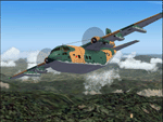
Here's a major panel and flight dynamics upgrade for Vlad's earlier version of the c123 and some Vietnam scenery and beacon only approaches for the not too IFR challenged.
| Filename: | Fairchild_C123_Provider.zip |
| License: | Freeware |
| Added: | 4th July 2010, 03:25:39 |
| Downloads: | 2,219 |
| Author: | Peter Mercy, Vladimir Zhyhulskiy |
| Size: | 29.81 MB |


© 2001-2026 AVSIM Online
All Rights Reserved
Privacy Policy |