
Where Flight Simulation Enthusiasts Gather from Around the World!
AVSIM Library - Search Results

| Category: Flight Simulator 2004 - Scenery | |
| Concorde at Heathrow |

|
File Description:
FS2004 Concorde at Heathrow scenery. This small scenery addon places a Concorde on the tarmac near runway 27R at London's Heathrow, which is where the last one really is at the time of writing. A second smaller scale Concorde is located at the entrance roundabout to the airport, where the current small scale model is. Original model by Graham Waterfield. Scenery assembled by Martyn Becker
| Filename: | Concorde_at_Heathrow.zip |
| License: | Freeware |
| Added: | 18th August 2005, 10:24:11 |
| Downloads: | 2,547 |
| Author: | Martyn Becker |
| Size: | 165.04 KB |
| Category: Flight Simulator 2004 - Scenery | |
| Discovery at Edwards AFB |
|
File Description:
FS2004 Shuttle Discovery scenery. This small scenery addon celebrates Discovery's safe return by replacing the default model at Edwards AFB with a replacement Discovery, plus the carrier 747 to take it back to Canaveral. FS9 exclude file included. Works with FS2002 but does not remove the barely recognizable default shuttle on the apron. Original models by Deane Baunton and David Pinero. Scenery assembled by Martyn Becker
| Filename: | Discovery_at_Edwards_AFB.zip |
| License: | Freeware |
| Added: | 18th August 2005, 10:24:46 |
| Downloads: | 2,423 |
| Author: | Martyn Becker |
| Size: | 173.5 KB |
| Category: Flight Simulator 2002 - Scenery | |
| Bohemia Mt Firewatch Tower |
|
File Description:
Using Lago's FSSE, this scenery represents the USFS firewatch tower and automatic weather station as it appeared in 1960 on top of Bohemia Mountain in West-Central Oregon State. Both the firewatch tower and the weather station were destroyed during a freak windstorm on Columbus Day in 1962. A registered copy of Lago's Flight Simulator Scenery Enhancer (FSSE) is required to view this scenery.
| Filename: | Bohemia_Mt_Firewatch_Tower.zip |
| License: | Freeware |
| Added: | 21st June 2002, 22:59:17 |
| Downloads: | 414 |
| Author: | Steve Cartwright |
| Size: | 827.48 KB |
| Category: Flight Simulator 2004 - Scenery | |
| Valkenburg Naval Air Station (NAS) V1.1a |
|
File Description:
Detailed and accurate scenery of the Dutch Naval Air Station
(vliegkamp) Valkenburg, the Netherlands. The airport is besides
the home of the P-3 Orion fleet also the VIP airport of Holland
cause of it's close location of the capitol Den Haag. Designed
to work with the default FS2004 scenery. It is also compatible
with FS2002 (either default or NL2000 scenery). Incl. charts.
By Marcel Ritzema
| Filename: | Valkenburg_Naval_Air_Station_NAS_V11a.zip |
| License: | Freeware, limited distribution |
| Added: | 14th September 2003, 16:46:55 |
| Downloads: | 4,560 |
| Author: | Marcel Ritzema |
| Size: | 730.88 KB |
| Category: Flight Simulator 2004 - AFCAD Files | |
| KSFO - San Francisco International Airport |
|
File Description:
This file is only suitable when using FS2004 default scenery. Has been compiled using Lee Swordy's excellent AFCAD 2 program. To install, simply place the file KSFO.BGL into the scenery folder of 'Addon Scenery' within Flight Simulator 9. I have delegated airlines to various terminals as per the SFO website. However, whilst those airlines listed are in the correct terminals, the list of airlines is not complete.
| Filename: | KSFO__San_Francisco_International_Airport.zip |
| License: | Freeware |
| Added: | 4th November 2003, 23:07:50 |
| Downloads: | 3,682 |
| Author: | Rob Payne |
| Size: | 15.3 KB |
| Category: Flight Simulator 2004 - Scenery | |
| Plymouth Municipal Airport KPYM |
|
Images related to this file:
File Description:
FS2004 Scenery - Plymouth Municipal Airport, (IATA: PYM, ICAO: KPYM) in Plymouth, Massachusetts, is a public airport owned by the Town of Plymouth. It has two runways, averages 303 flights per day, and has approximately 168 aircraft based on its field. Created with Instant Scenery. AI Aircraft included along with the author's scenery objects update. Default FS and Ultimate terrain compatible. By John B. Loney, Jr.
| Filename: | Plymouth_Municipal_Airport_KPYM.zip |
| License: | Freeware, limited distribution |
| Added: | 2nd November 2009, 19:58:05 |
| Downloads: | 485 |
| Author: | John B. Loney, Jr. |
| Size: | 6.21 MB |
| Category: Flight Simulator X - AFCAD Files | |
| HKJK - Jomo Kenyatta International Airport - Nairobi, Kenya |
|
File Description:
Jomo Kenyatta International Airport (IATA: NBO, ICAO: HKJK) serves Kenya's capital of Nairobi. The airport is the largest in Kenya and busiest in East Africa. The Kenya Air Force occupies the north side of the airport.
The scenery includes a relocated runway and taxiways, enlarged apron, a new terminal building, air bridges and cargo buildings.
This scenery was designed to be used with the default FSX scenery.
| Filename: | HKJK__Jomo_Kenyatta_International_Airport__Nairobi.zip |
| License: | Freeware |
| Added: | 21st July 2015, 16:31:29 |
| Downloads: | 2,125 |
| Author: | Bill Bridges |
| Size: | 46.71 KB |
| Category: Flight Simulator 2004 - Scenery | |
| Loney's Alaska Vol 1 |
|
File Description:
FS2004 Scenery-Loney's Alaska vol1. This download comprises of 6 Alaskan airports enhanced using Rwy12 and EZ Scenery. The airports include English Bay (KEB), Port Graham (PGM), Seldovia (PASO), Oyster Cove (2AK4), Kasitsna (5Z7) and Jakolof Bay (4Z9). There are some challenging approaches. Includes AI traffic through Traffic Tools with modified AFCAD files. Rwy12 and EZ Scenery libraries required. By John B. Loney, Jr.
| Filename: | Loneys_Alaska_Vol_1.zip |
| License: | Freeware |
| Added: | 19th February 2006, 23:59:57 |
| Downloads: | 1,708 |
| Author: | John B. Loney, Jr. |
| Size: | 772.85 KB |
| Category: Flight Simulator X - Scenery | |
| 52F North West Regional Airport (DFW TX) |
|
Images related to this file:
File Description:
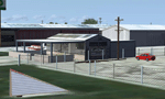
This airport scenery does not require any other software other than Microsoft Flight Sim X SP1 (minimum) - SP2 required for mission and display of some of the scenery items. However, it could help with performance on your PC if you install any accurate photo scenery for DFW. One such scenery is MEGASCENERY DFW photo scenery from http://www.megascenery.com/.
This is a custom developed scenery for airport, 52F - Northwest Regional, Roanoke, TX. 52F is next to Fort Worth Alliance in the Dallas Fort Worth Metroplex. It's a nice little airport.
This scenery package also includes a Mission called "52Foxtrot - Approach to Rwy 35 - Thermals". It is more of a free flight than the traditional FSX missions. The ones who fly for real at 52F-Northwest regional knows the quirks when coming into land at runway 35 on a hot day. The thermals at the cleared land and the sinking feeling when flying over the wooded area nearing the approach to 35. These thermal lifts and sinks have been modeled here. However, the only way to experience these thermals in FSX is via Missions. Once you select the mission "52Foxtrot - Approach to Rwy 35 - Thermals" and by selecting option "Enable changes in selected Mission", you could fly around like you would under "free flight". Except this time, you would have these thermal effects around 52F and get to experience what it's really like to fly and land at 52F.
| Filename: | 52F_North_West_Regional_Airport_DFW_TX.zip |
| License: | Freeware, limited distribution |
| Added: | 24th March 2010, 01:23:59 |
| Downloads: | 3,335 |
| Author: | Manny Mahadevan |
| Size: | 19.06 MB |
| Category: Flight Simulator 2004 - Scenery | |
| Tokyo Bay 2005 |
|
Images related to this file:
File Description:
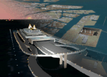
FS2004 Scenery Tokyo Bay Scenery 2005 Ver. 5.0
This add-on scenery improves specific scenerys (Tokyo Bay, Japan) of FS2004.
There are a lot of reclaimed land in Tokyo Bay.
They form an artificial peculiar coastline. This scenery reproduces these coastlines precisely.
And, this scenery reproduces the Keihin industrial area and the Keiyo industrial area in Tokyo Bay located west and east. In this scenery design, the coastline was reproduced as exactly as possible, following the specification of FS2004.
Moreover, 90m mesh geographical data is reproduced by using SRTM 3arc/sec.
The range of detailed coastline and 90m digital elevation data is as follows:
** [detailed coastline] N33:45 E138:45 to N36:55 E141:05 (included Izu Islands)
** [90m digital elevation data] N33:00 E138:00 to N37:00 E141:00 --
The Tokyo Wan AquaLine is arranged in the exact location. By Kazuo Kawamura
| Filename: | Tokyo_Bay_2005.zip |
| License: | Freeware, limited distribution |
| Added: | 3rd December 2011, 23:51:31 |
| Downloads: | 11,798 |
| Author: | Kazuo Kawamura |
| Size: | 9.74 MB |


© 2001-2026 AVSIM Online
All Rights Reserved
Privacy Policy |