
Where Flight Simulation Enthusiasts Gather from Around the World!
AVSIM Library - Search Results

| Category: Flight Simulator 2004 - AFCAD Files | |
| Ofu Island (Z08) and Tau Island (FAQ) (American Samoa) |

|
File Description:
These are AFCAD2 files for the two American Samoan Airports Ofu (Z08) and Tau Island (FAQ). These files are for the default FS2004 scenery.
| Filename: | Ofu_Island_Z08_and_Tau_Island_FAQ_American_Samoa.zip |
| License: | Freeware |
| Added: | 9th May 2007, 22:09:15 |
| Downloads: | 360 |
| Author: | Max Habighorst |
| Size: | 2.47 KB |
| Category: Flight Simulator 2004 - Scenery | |
| San Cristoban de las Casas, Chipas, Mexico (MMSC) |
|
Images related to this file:
File Description:
FS2004 Scenery for San Cristoban de las Casas, Chipas, Mexico - MMSC airport. Also compatible with FSX. For other sceneries and repaints visit http://fsbrasil.wordpress.com
| Filename: | San_Cristoban_de_las_Casas_Chipas_Mexico_MMSC.zip |
| License: | Freeware |
| Added: | 27th June 2011, 04:00:15 |
| Downloads: | 1,145 |
| Author: | Rui Mesquita |
| Size: | 20.07 MB |
| Category: Flight Simulator 2004 - Scenery | |
| Burbank and Ontario Enhancements by Rwy 12 |
|
File Description:
Scenery enhancements for KBUR and KONT with Afcads included. You must download and open Zip file for pics (too big to include as thumbnails)
| Filename: | Burbank_and_Ontario_Enhancements_by_Rwy_12.zip |
| License: | Freeware |
| Added: | 24th May 2005, 12:25:50 |
| Downloads: | 3,576 |
| Author: | William Morgan |
| Size: | 8.08 MB |
| Category: Flight Simulator 2004 - Scenery | |
| South Albany Airport 4b0 |
|
File Description:
FS2004 Scenery-South Albany Airport (4B0) serves South Bethlehem and Albany County and is owned by South Albany Corp.. The paved runway extends for 2860 feet. The facility is at an elevation of 190 feet at a distance of about 2 miles from South Bethlehem and about 10 miles from Albany International. Created with Rwy12 and EZ Scenery. Totally redone AFCAD2 file. Includes AL traffic where there were none before. Dynamic scenery from Lago's FSE. By John B. Loney, Jr.
| Filename: | South_Albany_Airport_4b0.zip |
| License: | Freeware |
| Added: | 19th June 2006, 02:05:26 |
| Downloads: | 529 |
| Author: | John B. Loney, Jr. |
| Size: | 425.16 KB |
| Category: Flight Simulator 2004 - AFCAD Files | |
| Boughaz Airstrip, Morocco (GBGZ) |
|
File Description:
"The scenery file "Boughaz Airstrip" is an Helipad near Gibraltar. It's a simply ICAO called GBGZ. This area is no lot far from the gate. For FS2004 but with "very dense" option. This scenery is better near "Gibraltar bridge" to have nice views of the gate with hélicos or vtol aircrafts. I think it's working only with FS2004 and not the others versions. To install this afcad helipad, just add the bgl file into your scenery file on FS9 directory.
| Filename: | Boughaz_Airstrip_Morocco_GBGZ.zip |
| License: | Freeware |
| Added: | 17th September 2007, 16:24:24 |
| Downloads: | 283 |
| Author: | Hassan Doukkali |
| Size: | 20.18 KB |
| Category: Flight Simulator 2004 - Scenery | |
| Glenorchy Airfield, New Zealand. NZGY. |
|
File Description:
Welcome to Glenorchy, a small rural airfield, 2 nautical miles south of the small village of Glenorchy,
on the shores of the beautiful Lake Wakatipu, in the South Island of New Zealand.
Glenorchy is only a very short flight from Queenstown Airport (NZQN), at the opposite end of Lake Wakatipu.
This scenery was built to fit into Robin Corn's freeware "Queenstown area Photoreal Scenery", freely
available on avsim.com ( filename.. nzqnv1.5.zip ).
Requires some EZ Scenery object sets (see INSTALL instructions for details).
| Filename: | Glenorchy_Airfield_New_Zealand__NZGY.zip |
| License: | Freeware, limited distribution |
| Added: | 12th September 2008, 09:06:11 |
| Downloads: | 1,011 |
| Author: | Lawrie Roache |
| Size: | 2.12 MB |
| Category: Flight Simulator X - Scenery Design | |
| Make photo-real ground textures |
|
Images related to this file:
File Description:
It is very easy to create your very own high-resolution, custom (photo-real) ground textures.
This document explains the concepts and techniques and illustrates the use of SBuilderX with which you can quickly and easily download aerial images and make this type of scenery.
So, why hesitate? Make Flight Simulator scenery as real as it gets!
Very sorry - no support of any kind is offered. Please do not write. For any questions, please post in the Avsim Scenery Design Forum.
| Filename: | Make_photoreal_ground_textures.zip |
| License: | Freeware |
| Added: | 21st November 2009, 23:20:06 |
| Downloads: | 19,284 |
| Author: | Luis Feliz-Tirado |
| Size: | 2.09 MB |
| Category: Flight Simulator 2004 - Scenery | |
| X04 Orlando Apopka Airport |
|
Images related to this file:
File Description:
FS2004/FS9 Scenery--Orlando Apopka Airport X04 formally known as Orlando Country. A re-do of the default scenery and airport located in Apopka, Florida (FL). Buildings, parking, taxiways, etc. placed in the correct positions per Google Earth and all comm frequencies are correct. I added over 30 buildings and extended the runway from 964 meters to it's true length of 1215 meters as per AirNav. Scenery was created using ADE 9x. For installation instructions view the readme file. Enjoy
| Filename: | X04_Orlando_Apopka_Airport.zip |
| License: | Freeware |
| Added: | 11th March 2012, 19:56:13 |
| Downloads: | 256 |
| Author: | Bruce Bouley |
| Size: | 83.16 KB |
| Category: Flight Simulator 2004 - AFCAD Files | |
| KCLT Charlotte/Douglas International Airport |
|
File Description:
This is an up to date AFCAD file for ImagineSim's KCLT scenery as of 21.11.12. All gate assignments are 100% correct with all commuter airlines ICAO's included (AWEX,EGF, ASH, SKW etc); councourse E (US Airways Express flights) is now booming with aircraft as the original afcad had previous icao's (USAX). Runways are crosswind activated. ImagineSim's KCLT Payware scenery is required.
THIS DOES NOT INCLUDE THE NEW RUNWAY 18L/36R as the scenery by ImagineSim is quite old now.
| Filename: | KCLT_CharlotteDouglas_International_Airport.zip |
| License: | Freeware |
| Added: | 21st November 2012, 19:44:40 |
| Downloads: | 459 |
| Author: | Olly Pollard |
| Size: | 16.17 KB |
| Category: Flight Simulator X - AFCAD Files | |
| KPSO - Stevens Field, Pagosa Springs, Colorado, USA - V2.0 |
|
Images related to this file:
File Description:
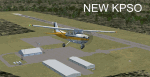
Updated scenery of Stevens Field, Pagosa Springs Airport nested in the high-altitude Rocky Mountains of Colorado. This scenery includes the airport and land class for surrounding areas to include the many small lakes, the city of Pagosa, and nearby inhabited areas. Airport features runway distance markers, new taxiways, taxiway signs, realistic parking, scenery objects, hangars, and FBO. How is your high-altitude flying? Enjoy! Version 2 includes updated taxiway structure circa 2013, signage, major roads added, and land class tweaks.
| Filename: | KPSO__Stevens_Field_Pagosa_Springs_Colorado_USA__V.zip |
| License: | Freeware |
| Added: | 30th May 2013, 06:10:06 |
| Downloads: | 536 |
| Author: | AJ Cook |
| Size: | 17.21 KB |


© 2001-2026 AVSIM Online
All Rights Reserved
Privacy Policy |