
Where Flight Simulation Enthusiasts Gather from Around the World!
AVSIM Library - Search Results

| Category: Flight Simulator 2004 - Scenery | |
| Cape Liberty Cruise Port |

|
File Description:
FS2004 Scenery - Cape Liberty Cruise Port, located in Bayonne, NJ. Features an AFCAD file for an AI cruise ship, baggage cars and passenger shuttle bus. Fits nicely with David "Opa" Marshall's Queen Mary II scenery (qmbrook.zip). Bonus scenery for the New York Harbor area. Scenery requires EZ Scenery libraries and the Freedom of the Seas Cruise Ship by Mitsuya Hamaguchi(Hama) (shipfrdm.zip). By John B. Loney, Jr.
| Filename: | Cape_Liberty_Cruise_Port.zip |
| License: | Freeware, limited distribution |
| Added: | 6th October 2007, 16:44:58 |
| Downloads: | 1,034 |
| Author: | John B. Loney, Jr. |
| Size: | 547.81 KB |
| Category: Flight Simulator 2004 - Aircraft Repaints, Textures and Modifications | |
| EuroAtlantic Airways Boeing 767-3Y0/ER |
|
File Description:
Painting of an EuroAtlantic Airways 763ER on the SkySpirit2010 Boeing 767V5 model. This aircraft flies in these colours at present. We can also find, making flights to FlysunWing.com . EuroAtlantic never flew 767s with winglets, but this file includes an optional winglet version. Also includes layers of clean aircraft and repaints of the Skyspirit2010 Boeing 767 ground service vehicles. Works in both FS9 and FSX.
| Filename: | EuroAtlantic_Airways_Boeing_7673Y0ER.zip |
| License: | Freeware |
| Added: | 18th November 2012, 16:14:24 |
| Downloads: | 464 |
| Author: | Pedro Rodriguez, SkySpirit2010 |
| Size: | 19.18 MB |
| Category: Flight Simulator 2004 - AFCAD Files | |
| Sarajevo International Airport - Butmir (LQSA/SJJ) 95 % correct AFCAD file & Parking Positions Chart |
|
File Description:
This brand new AFCAD file gives you Sarajevo International Airport - Butmir (LQSA/SJJ) & Sarajevo Military Airfield - Butmir (LQSM) very detailed with 95 % correct layout as it is found in primo October 2005. The file contains an AFCAD file for LQSA including LQSM as helipad start positions and an exclude file, which excludes the objects and taxiway signs, as they are misplaced. Soon will an objects scenery be uploaded! Also included are a Parking Positions Chart and 4 text documents, being: ReadMe, Installation Guide, Parking Guide and Airport History. © by flybosna®com airPORTS™ -the only real low-cost-airline of Bosnia and Herzegovina- (Mirza Ibrahimovic - Director & Founder).
| Filename: | Sarajevo_International_Airport__Butmir_LQSASJJ_95_.zip |
| License: | Freeware |
| Added: | 5th October 2005, 18:26:46 |
| Downloads: | 1,457 |
| Author: | flybosna®com airPORTS™ - Mirza Ibrahimovic |
| Size: | 158.83 KB |
| Category: Flight Simulator 2004 - Miscellaneous Files | |
| Afcad - Some Tips and Tricks |
|
Images related to this file:
File Description:

Afcad Tips and Tricks - an Illustrated Tutorial. Although Lee Swordy's indispensible program includes very complete documentation, this tutorial illustrates several of the less obvious things you can do with the program. Topics include creating a quick flatten, decorating the edges of a runway, use of the polygon feature to enhance terrain adjacent to an airport, drawing "roads", creating invisible taxiways, moving or removing the Helicopter "H" and use of the "jump here" command. Even if you are an experienced user of Afcad, you will likely find some useful ideas in this tutorial. Compiled in .doc and .pdf formats for your flying enjoyment by David "Opa" Marshall.
| Filename: | Afcad__Some_Tips_and_Tricks.zip |
| License: | Freeware |
| Added: | 18th January 2007, 15:56:25 |
| Downloads: | 8,948 |
| Author: | David "Opa" Marshall |
| Size: | 3.24 MB |
| Category: Flight Simulator 2004 - Scenery | |
| World's Highest Airfield @ 16600 feet - Daulat Beg Oldie |
|
File Description:
Located at an altitude of 16600 feet in North Eastern Ladakh near the strategic Karakoram Pass, DBO is an important Indian Army post which links with the ancient Silk Route to China. The Indian army maintains a helipad and an airstrip here, which is highest in the world. It is just 8 km south the Chinese border and 9 km northwest of the Aksai Chin & line of actual control between China and India. The scenery is truly fictional as no information is available on internet regarding the orientation of airstrip. Works best with Himalayan Peaks LOD10 Mesh, Volume 6 - Jammu and Kashmir avaiable at avsim: (fs_him_06.zip)
| Filename: | Worlds_Highest_Airfield__16600_feet__Daulat_Beg_Ol.zip |
| License: | Freeware |
| Added: | 26th June 2008, 10:57:26 |
| Downloads: | 965 |
| Author: | Deepak Blassi |
| Size: | 1.3 MB |
| Category: Flight Simulator X - Scenery | |
| SLOR - Juan Mendoza Airport - Oruro, Bolivia |
|
File Description:
The new Juan Mendoza y Nernuldez Airport (Spanish: Aeropuerto Juan Mendoza y Nernuldez) (IATA: ORU, ICAO: SLOR)is an public airport serving the city of Oruro, in the Cercado province of the Oruro department of Bolivia.
The airport resides at an elevation of 12.146 ft (3.702 m) above mean sea level. The new airport has one runway designated 01/19 with an asphalt surface measuring 13,123 by 147.63 ft (4,000 m by 45 m). The older alternative runway 09/27 with a grass surface measuring 6,125 by 120 feet (1,867 m × 37 m), is not operational.
Compatible with both FSX and P3D.
| Filename: | SLOR__Juan_Mendoza_Airport__Oruro_Bolivia.zip |
| License: | Freeware |
| Added: | 27th October 2015, 12:11:55 |
| Downloads: | 961 |
| Author: | Marcos A. Rivas Torrez |
| Size: | 38.48 MB |
| Category: Flight Simulator 2004 - AI Aircraft | |
| Lockheed Constellation for AI Traffic (Part 1) |
|
Images related to this file:
File Description:

Lockheed Constellation for AI Traffic (Part 1). The Lockheed Constellation was a medium-to-long range airliner, military transport, and later an electronic warfare platform, in production from 1943 to 1958, and in service long after that, many eventually finishing up their careers as freighters in remote parts of the world. I present an 8-LOD AI traffic model to bring this vintage transport aircraft to the flightsim world. Part 1 contains the electronic warfare and reconnasaince variants, with 15 models and 34 repaints. This is an FS9-native model, so it is compatible up through P3Dv3. Aircraft model, flight dynamics, and repaints by Michael Pearson.
| Filename: | Lockheed_Constellation_for_AI_Traffic_Part_1.zip |
| License: | Freeware |
| Added: | 2nd October 2017, 18:53:52 |
| Downloads: | 441 |
| Author: | Michael Pearson |
| Size: | 15.02 MB |
| Category: Flight Simulator 2004 - AI Aircraft | |
| Lockheed Constellation for AI Traffic (Part 3) |
|
Images related to this file:
File Description:

Lockheed Constellation for AI Traffic (Part 3). The Lockheed Constellation was a medium-to-long range airliner, military transport, and later an electronic warfare platform, in production from 1943 to 1958, and in service long after that, with many eventually finishing up their careers as freighters in remote parts of the world. I present an 8-LOD AI traffic model to bring this vintage transport aircraft to the flightsim world. Part 3 contains the L-049, L-649, and L-749 variants, with 9 models and 40 repaints. This is an FS9-native model, so it is compatible up through P3Dv3. Aircraft model, flight dynamics, and repaints by Michael Pearson.
| Filename: | Lockheed_Constellation_for_AI_Traffic_Part_3.zip |
| License: | Freeware |
| Added: | 11th October 2017, 00:56:59 |
| Downloads: | 372 |
| Author: | Michael Pearson |
| Size: | 22.37 MB |
| Category: Prepar3D V1-4 - Scenery | |
| KJQD, Ohio County Airport Hartford, KY USA |
|
Images related to this file:
File Description:
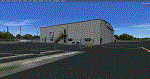
KJQD is a public use, one runway airport located 3 miles NE of Hartford KY.
Runway 3/21 is an asphalt runway 5000x75 feet long. 100LL and Jet-A are available at this airport.
I added an area of photo real about a mile square around the airport. It blends best with Orbx Global and LC North America. All the airport objects such as hangers, fences, fuel tanks, signs, etc. are all custom made objects based on pictures obtained on-site. The runways, taxiways and aprons are all custom textures as well as runway and taxiway lights. This is an authentic recreation of the real world airport.
| Filename: | KJQD_Ohio_County_Airport_Hartford_KY_USA.zip |
| License: | Freeware |
| Added: | 22nd January 2018, 23:09:44 |
| Downloads: | 354 |
| Author: | Shannan G Landreth |
| Size: | 46.33 MB |
| Category: Prepar3D V1-4 - Scenery | |
| KCEY, Kyle-Oakley Field Murray KY USA (P3D) |
|
Images related to this file:
File Description:
KCEY is a public use, single runway airport located 4 miles NW of Murray KY. Runway 5/23 is an asphalt runway 6203x100 feet long. 100LL, Jet-A and MOGAS are available at this airport.
I added an area of photo real about a mile square around the airport. It blends best with Orbx Global and LC North America. All the airport objects such as hangers, fences, fuel tanks, signs, etc. are all custom made objects based on pictures obtained on-site. The runways, taxiways and aprons are all custom textures as well as runway and taxiway lights. This is an authentic recreation of the real world airport.
| Filename: | KCEY_KyleOakley_Field_Murray_KY_USA_P3D.zip |
| License: | Freeware |
| Added: | 12th March 2018, 22:15:59 |
| Downloads: | 204 |
| Author: | Shannan G Landreth |
| Size: | 66.74 MB |


© 2001-2026 AVSIM Online
All Rights Reserved
Privacy Policy |