
Where Flight Simulation Enthusiasts Gather from Around the World!
AVSIM Library - Search Results

| Category: Flight Simulator 2004 - Scenery | |
| Himalayan Peaks Volume 2 - Mt. Everest photoreal textures |

|
File Description:
The photoreal textures in this package cover an area of about 100km (E/W) by 60km (N/S) featuring Mt. Everest and several neighboring peaks and are based on a Landsat 7 ETM 15-m multispectral image taken in October 2000. The relatively low resolution of the image makes for pretty grainy textures up close and I did not add any autogen, seasonal textures, or flattened water bodies. Nevertheless, I do believe the photoreal textures do a much better job at showing the grandiose alpine features of this area - rock faces, snow fields, glaciers, and bare ground - than generic landclass textures possibly can. The textures are placed for a best fit with our Mt. Everest area LOD10 terrain mesh, fs_him_01.zip, but probably work OK with the default LOD8 mesh of this area or third-party terrain mesh files.
| Filename: | Himalayan_Peaks_Volume_2__Mt_Everest_photoreal_tex.zip |
| License: | Freeware |
| Added: | 10th March 2010, 22:27:43 |
| Downloads: | 25,493 |
| Author: | Holger Sandmann |
| Size: | 75.71 MB |
| Category: Flight Simulator X - Scenery | |
| CZBB - Boundary Bay, BC, Canada (2011) Version 2 |
|
Images related to this file:
File Description:
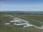
CZBB (2011) portrays the Boundary Bay (British Columbia, Canada) Airport (CZBB) - Canada's fifth-busiest airport by number of operations - and surrounding area as it appeared in mid-2011. Every significant structure on the airfield (50+) is included - all modeled with GMax and painted with hand-drawn textures. CZBB (2011) is compatible with ORBX FTX USA Canada Pacific Northwest, Ultimate Terrain and Vancouver+. A selection of SAMM-generated static aircraft are scattered around the aprons supplemented by a number of AI aircraft that do touch 'n gos from time to time.
Aside from the new custom approach and airfield lighting, generally, this new version is visually identical to its predecessor - even though quite different internally. As well, to the extent possible, it is compatible with Prepar3Dv2.
| Filename: | CZBB__Boundary_Bay_BC_Canada_2011_Version_2.zip |
| License: | Freeware, limited distribution |
| Added: | 20th June 2014, 05:10:24 |
| Downloads: | 3,489 |
| Author: | Don Grovestine |
| Size: | 73.9 MB |
| Category: Flight Simulator 2004 - Scenery | |
| Himalayas LOD9 Base Mesh, Volume 2 - Southcentral Ranges |
|
Images related to this file:
File Description:
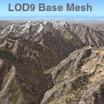
Detailed terrain mesh of the Southcentral Himalayan Ranges, N26-32 E82-90. The files in this package are based on Shuttle Radar (SRTM) Version 2 data but with many of the void areas, especially the most significant sections, filled with elevation data generated from topographic maps by Jonathan de Ferranti. While Jonathan's work is unrelated to flight simulation he kindly gave me permission to compile his data for use in FS. The result is a wonderful improvement in detail and accuracy over any existing mesh file, freeware or commercial, based on SRTM or DTED data alone.
Due to the large area of the Himalayas I've compiled the source data as two separate series: the "Himalayan Peaks" series covers prominent mountains and ranges in higher detail and locally overrides any existing LOD9 terrain mesh. In addition, a LOD9 "base mesh" series, with LOD8 and LOD7 "buffer" mesh files, covering the entire Himalayas, is meant for those who do not yet have an add-on terrain mesh of these beautiful mountains.
| Filename: | Himalayas_LOD9_Base_Mesh_Volume_2__Southcentral_Ra.zip |
| License: | Freeware, limited distribution |
| Added: | 29th May 2010, 09:05:56 |
| Downloads: | 9,453 |
| Author: | Holger Sandmann, Jonathan de Ferranti |
| Size: | 90.25 MB |
| Category: Flight Simulator 2004 - AFCAD Files | |
| King County International (Boeing Field - KBFI) Version 2 |
|
File Description:
This is a revised version of my AFCAD for King County International (Boeing Field -- KBFI). The enclosed AF2_KBFI.bgl file replaces the original provided in boeing_field_kbfi.zip available at AVSIM.com. Many thanks to Mr. Tom Hibben who, as a 33-year Boeing employee, spent almost his entire career at the Boeing Flight Test Center. Tom sent me numerous e-mails to improve the AFCAD including the Flight Center picture attached. All aircraft are backed into place (vice nose in as I had previously designed) and there is no parking of aircraft directly in front of the large hangar known as the B-52 hangar.
| Filename: | King_County_International_Boeing_Field__KBFI_Versi.zip |
| License: | Freeware |
| Added: | 30th March 2004, 04:39:53 |
| Downloads: | 3,297 |
| Author: | Steve Lewis |
| Size: | 61.24 KB |
| Category: Flight Simulator X - Scenery | |
| ZSSS Hongqiao - Shanghai F1 Circuit, CHINA (Part 2) |
|
Images related to this file:
File Description:

Photorealistic scenery for FSX (should work on P3D V 1-4).
Overlapping edges from photo into default scenery.
Enhanced airport close to real with custom buildings and some static objects.
Day and Night textures.
Some autogen at airport, circuit and surrounding areas.
FTX Global and Vector compatible.
THIS SCENERY REQUIRES ZSSS Hongqiao - Shanghai F1 Circuit, CHINA (part 1)
| Filename: | ZSSS_Hongqiao__Shanghai_F1_Circuit_CHINA_Part_2.zip |
| License: | Freeware |
| Added: | 1st July 2021, 03:48:25 |
| Downloads: | 255 |
| Author: | Ignacio Del Muro |
| Size: | 338.23 MB |
| Category: Flight Simulator 2004 - AI Flight Plans | |
| USAF T-1A's Part 2 Complete AI Package |
|
Images related to this file:
File Description:

Military AI Works is proud to bring you the USAF T-1A's Part 2 Complete AI Package for FS2004. This package is the second and last part in a two part series depicting the Beechjet/Hawker T-1A Jayhawk trainer in service with various training units in the USAF. This second part depicts the units stationed at Vance AFB, Laughlin AFB and NAS Pensacola. Credits: Models by Henry Tomkiewicz, Repaints by Aaron Haase and Graham King, Flightplans by Aaron Haase, AFCADs by Mike Guenthner, Joe Wilkers, Paul Stevens, Aaron Haase and Desmond Burell and VCPs by Stewart Pearson, Aaron Haase and Mike Guenthner
| Filename: | USAF_T1As_Part_2_Complete_AI_Package.zip |
| License: | Freeware, limited distribution |
| Added: | 25th July 2010, 21:31:22 |
| Downloads: | 1,403 |
| Author: | Aaron Haase, Military AI Works (MAIW) |
| Size: | 12.29 MB |
| Category: Flight Simulator 2004 - AI Flight Plans | |
| French Mirage 2000 Part 2 Complete AI Package |
|
Images related to this file:
File Description:

Military AI Works is proud to bring you the French Mirage 2000 Part 2 Complete AI Package for FS2004. This package is the second in a multipart series depicting the Mirage 2000s in service with the French Air Force. Part 2 depicts the Mirage 2000s stationed at Cambrai-Epinoy AB.
Credits:
Models by Fernando Martinez;
Repaints by Graham King and Aaron Haase;
Effets by Henry Tomkiewicz;
AFCADs, Flightplans, VCPs and Scenery Enhancements by Nick Black; and
Scenery Objects by John Stinstrom, Mike Guenthner, Matthew Tomkins and Ted Andrews
| Filename: | French_Mirage_2000_Part_2_Complete_AI_Package.zip |
| License: | Freeware, limited distribution |
| Added: | 9th June 2010, 02:56:40 |
| Downloads: | 1,408 |
| Author: | Nick Black, Military AI Works (MAIW) |
| Size: | 17.09 MB |
| Category: Flight Simulator 2004 - AFCAD Files | |
| EDDP - Leipzig/Halle Airport - German Airports 2 - 2012 |
|
File Description:
This is a modified AFCAD file for EDDP from "German Airports 2 - 2012" for FS2004/FS9, to make AI aircraft able to use the DHL area on southern apron if they have the matching parking code, instead of make them blocking out the passenger gates on EDDP (Leipzig-Halle Airport) like the original file does.
Installation info: look into readme.
| Filename: | EDDP__LeipzigHalle_Airport__German_Airports_2__2012.zip |
| License: | Freeware |
| Added: | 2nd September 2016, 20:57:54 |
| Downloads: | 468 |
| Author: | Sven Wittig |
| Size: | 9.35 KB |
| Category: Prepar3D V1-4 - Scenery | |
| LGTT - Dekeleia / Tatoi Airbase - Decelea, Greece - Version 2 |
|
Images related to this file:
File Description:
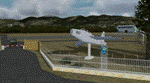
This is a small update to my 2010 scenery, mainly to address compatibility of the AFCAD with Lockheed Martin Prepar3D versions 2 and 3. It has also been tested with the latest Prepar3D v3.2. It will also work fine with FSXA or FSX SE. Includes also a few new features and corrections listed in the changelog. Previous version, also found here, is not required.
Compatible with FSX and P3D.
| Filename: | LGTT__Dekeleia__Tatoi_Airbase__Decelea_Greece__Ver.zip |
| License: | Freeware |
| Added: | 8th March 2016, 18:42:09 |
| Downloads: | 1,844 |
| Author: | Vassilios Dimoulas |
| Size: | 13.19 MB |
| Category: Flight Simulator X - Scenery | |
| Detailed Terrain Features for Southern Africa, Update 2 |
|
Images related to this file:
File Description:
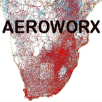
Scenery consist of Updated Terrain Vector data concerning coastlines, rivers, dams, streams, roads, traffic, railroads, power lines and extrusion bridges for Southern Africa countries South of the Equator. The Scenery was updated by utilizing Satellite image backgrounds. This scenery is important and will be needed with release of future scenery by Aeroworx. Please install fsxWorx01.zip and update (fsxworx01upd1.zip) before this file.
| Filename: | Detailed_Terrain_Features_for_Southern_Africa_Upda.zip |
| License: | Freeware |
| Added: | 11th November 2012, 17:55:20 |
| Downloads: | 4,252 |
| Author: | Hannes Steyn, Aeroworx |
| Size: | 10.72 MB |


© 2001-2026 AVSIM Online
All Rights Reserved
Privacy Policy |