
Where Flight Simulation Enthusiasts Gather from Around the World!
AVSIM Library - Search Results

| Category: Prepar3D V1-4 - Scenery | |
| VECC Airport For P3dv4 |

|
File Description:
Netaji Subhas Chandra Bose International Airport (IATA: CCU, ICAO: VECC) is an international airport located in Kolkata, West Bengal, India, serving the Kolkata metropolitan area. It is located approximately 17 kilometers (11 mi) from the city center.
I am new custom Ground poly development. Currently I am learning from Fsdeveloper forum about scenery development.
If you face any problems you can contact me on [email protected] or you can search me over Facebook.
| Filename: | VECC_Airport_For_P3dv4.zip |
| License: | Freeware |
| Added: | 12th May 2020, 18:12:17 |
| Downloads: | 1,616 |
| Author: | Mayukh Deb |
| Size: | 105.54 MB |
| Category: Flight Simulator 2004 - AI Aircraft | |
| Piper Warrior for AI |
|
Images related to this file:
File Description:
Piper Warrior models for AI traffic with several LODS and animations and many generic repaints. Do not upload to any other site.
| Filename: | Piper_Warrior_for_AI.zip |
| License: | Freeware, limited distribution |
| Added: | 17th February 2011, 20:48:20 |
| Downloads: | 2,194 |
| Author: | model: Andras Neuman paintkit: Charles Dayhuff/Graham Eccleston Flight dynamics: Michael MacIntyre |
| Size: | 4.95 MB |
| Category: Flight Simulator 2004 - Utilities | |
| Added Libraries for SBuilder |
|
Images related to this file:
File Description:
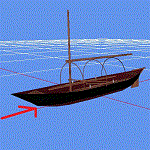
During development of VFR on Lario project has manifested the need for adding generic objects, easily accessible and using FS9 standard textures, to cover the areas where the function Autogen is not active. For this reason I created libraries, for buildings and an additional generic one,
that do not require addition of any new textures. These new libraries are of course free
and can be used at your own liking. In this revision please find a quick instruction for the direct download when some adding arises. Enjoy
| Filename: | Added_Libraries_for_SBuilder.zip |
| License: | Freeware |
| Added: | 13th June 2012, 20:03:16 |
| Downloads: | 826 |
| Author: | Aldo Della Vedova |
| Size: | 3.36 MB |
| Category: Flight Simulator 2002 - Flight Plans | |
| NAT tracks for FSnavigator |
|
File Description:
This file contains all the north atlantic tracks for FSnavigator.
| Filename: | NAT_tracks_for_FSnavigator.zip |
| License: | Freeware |
| Added: | 21st October 2002, 19:46:29 |
| Downloads: | 1,193 |
| Author: | Jurrien Hufkens |
| Size: | 6.93 KB |
| Category: Prepar3D V1-4 - Original Aircraft | |
| Mirage F1 for P3Dv4 |
|
Images related to this file:
File Description:
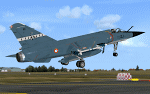
Kirk Olsson's FS9 gmax Mirage F1 converted for use in P3Dv4. Includes: New textures, configuration manager. The cockpit is almost completely rebuild and features a.o. 3D modeled gauges/switches and P3D dynamic mirrors. Just like the original FS9 model, the layout is based on the Mirage F1.CR version.
This package is created for / tested in P3Dv4 (also works in P3Dv5) and requires XMLTools (64bit) to enable all features (weight and fuel gets updated by changing payload/fuel options, dumping fuel or in flight refueling. Radio preset frequencies are loaded from a customizable text file).
Credits: Kirk Olsson for allowing use of his files, Frank Safranek for his valuable feedback and testing, Jens Ole Kjolberg for the F.1ZA textures.
| Filename: | Mirage_F1_for_P3Dv4.zip |
| License: | Freeware, limited distribution |
| Added: | 24th August 2020, 23:13:53 |
| Downloads: | 1,440 |
| Author: | Original FS2004 package by Kirk Olsson, P3Dv4 conversion by Henk Schuitemaker |
| Size: | 63.91 MB |
| Category: Prepar3D V1-4 - Scenery | |
| EBWE-Weelde for P3Dv4 |
|
Images related to this file:
File Description:
EBWE Weelde for P3Dv4 is a nato reserve airfield in the North of Belgium .
| Filename: | EBWEWeelde_for_P3Dv4.zip |
| License: | Freeware |
| Added: | 28th January 2018, 01:34:54 |
| Downloads: | 576 |
| Author: | Peter Ziegler (zzip) |
| Size: | 45.9 MB |
| Category: Flight Simulator 2004 - Miscellaneous Files | |
| Sign Library for Rwy12 |
|
File Description:
Library of 86 Signs for use with Runway12.
| Filename: | Sign_Library_for_Rwy12.zip |
| License: | Freeware |
| Added: | 6th January 2005, 06:05:25 |
| Downloads: | 7,078 |
| Author: | Dennis Waggoner |
| Size: | 1.41 MB |
| Category: Flight Simulator 2004 - Scenery | |
| Trees for Honolulu Int. |
|
File Description:
Adds hundreds of trees to Honolulu Int. Airport and 2 generic nicely manicured golfcourses. Not compatible with FS2002 as airport layout is different. Very fun low level flying.
| Filename: | Trees_for_Honolulu_Int.zip |
| License: | Freeware |
| Added: | 15th September 2003, 17:27:11 |
| Downloads: | 3,021 |
| Author: | William Tracy |
| Size: | 280.07 KB |
| Category: Flight Simulator 2004 - Scenery | |
| Alaska South Slope 9; Wales IWK |
|
Images related to this file:
File Description:
There are four main northwestern Alaska towns which are serviced by Alaska Airlines, and from which local flights spread out. The northernmost is Barrow. Southwest of Barrow is Kotzebue, then Nome, and the furthest south is Bethel (not yet made). This is the second in a series for local flights from Nome, and it is on the furthermost mainland western point of Alaska, Wales IWK. It is 110 miles northwest of Nome and on the eastern shore of the Bering Strait, with a view of the two Diomede Islands. Wales is a small village with a population of only around 145, strung along the beach on a single road. The airfield is at the northwestern end of the village, with a runway of 4,500 feet of lit gravel aligned 35-17 and an apron at the southern end. There are scheduled flights by the usual Era and Bering Air, both of them originating in Nome and also visiting Shishmaref. The AI includes these flights along with Northern Air Cargo and GA. The runway is just long enough to accomodate a DC6 (as is Shishmaref) and I have revised the AI to include this, along with a revision of the parking at Shishmaref. To the southeast of Wales is Tin City, which was built as a base for the support of radar on the hills between the two. The radar is now automatic and unmanned and the base is unused except for the annual maintenance and fuel supply; I have left the airfield untouched but I have added the hilltop radar and the remains of the cable lift, which was used to get the material for the original station up to the top from the beach below.
| Filename: | Alaska_South_Slope_9_Wales_IWK.zip |
| License: | Freeware, limited distribution |
| Added: | 22nd October 2016, 01:26:24 |
| Downloads: | 570 |
| Author: | Roger Wensley |
| Size: | 3.77 MB |
| Category: Flight Simulator X - Scenery | |
| Victoria, Canada including US Southern Gulf Islands and San Juan Islands - Part 1 of 2 |
|
Images related to this file:
File Description:
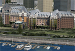
FSX-only version of Victoria, Canada area scenery including the Southern Gulf Islands and the San Juan Islands of the US. Includes automated installer and configurator by Scot Fraser.
Features:
-accurate shorelines, lakes and streams;
-landclass;
-FSX multi-LOD mesh with 10m maximum resolution;
-complete road network with moving traffic;
-railroads;
-utility corridors;
-marinas and ferry terminals;
-many static boats, including a custom model of the Canada Coast Guard ship Sir Wilfred Laurier;
-detailed models of major buildings and the Ogden Point Terminal;
-many bridges;
-nearly 300 marine lights; and corrected antennae locations.
Facilities include Don Grovestine's famous CYYJ (Victoria International Airport); 12 other Canadian land-based airports: Butler Field, Duncan (CAM3), Gaines, Hastings, Hudson Island, James Island, Thomas, Village Bay, Raven Field (CML2), Saltspring, Sidney Island, Whiskey Point; 20 US airports Blakely (38WA), Burden (61WA), Center Island (79WA), Clam Harbor (WA35), Crane Island, Decatur Shores (WN07), Decatur-Jones (WA18), Waldronaire (90WA), Orcas Island (KORS), Friday Harbour (KFHR), Lopez Island (S31), Pile Point, Roche Harbor (WA09), Shaw Island, Stuart Island Airpark (7WA5), Stuart Island West (2WA3), Wilding (6WA5), Windsock (4WA4); 12 floatplane facilities: Bedwell (CAB3), Fisherman's Bay (WA81), Friday Harbor (W33), Ganges (CAX6), Maple Bay, Mayne (CAW7), Port Washington (CAP8), Roche Harbor (W39), Rosario (W49), Shawnigan Lake (CAV8), Victoria Harbour (CYWH), Victoria International (CAP5) and Westsound, Orcas (WA83) - many with AI traffic; 9 heliports: Ganges (CAL7), Mayne (CBF5), Camel Point (CBF7), Jubilee (CBK8), Victoria General (CBW7) Madrona Bay (CBW9), Shoal Point (CBZ7), Mount Belcher (CMBH).
AI models include the DHC-2 floatplane in local liveries, a cruise ship model (by Mitsuya Hamaguchi) and two repaints, pilot boat, and small boats (by Larry Silsbee).
Ultimate Terrain X compatible (not required). Users of Vancouver+ for FSX will also get additional cruise ship traffic and additional floatplane and helicopter traffic. Full documentation. By Don Grovestine, Jon Patch and Holger Sandmann. Many other contributors: see documentation. Part 1 of 2 - you also need file vicenh7b.zip
| Filename: | Victoria_Canada_including_US_Southern_Gulf_Islands.zip |
| License: | Check within download |
| Added: | 29th January 2010, 21:23:17 |
| Downloads: | 23,161 |
| Author: | Don Grovestine, Jon Patch and Holger Sandmann |
| Size: | 56.8 MB |


© 2001-2026 AVSIM Online
All Rights Reserved
Privacy Policy |