
Where Flight Simulation Enthusiasts Gather from Around the World!
AVSIM Library - Search Results

| Category: Flight Simulator 2004 - AI Aircraft | |
| Northwest Airlines Cargo Boeing 747-200 Fleet |

|
File Description:
A Boeing 747-200F from AI Aardvark designed especially for AI traffic. Features 16 LOD models and moving parts. Very detailed, includes animated gear, flaps & spoilers, antennas, flap canoes and simulated gear bays and specular highlights. Extremely frame rate friendly. To be used with the 747-200F PW (PW CARGO Model) and 747-200 PW (PW PAX Model). Base Files packages available separately.
| Filename: | Northwest_Airlines_Cargo_Boeing_747200_Fleet.zip |
| License: | Freeware, limited distribution |
| Added: | 11th August 2004, 05:04:29 |
| Downloads: | 1,680 |
| Author: | AI-Aardvark, Kaveh Payandeh |
| Size: | 1.48 MB |
| Category: Flight Simulator X - Scenery | |
| North Central Ecuador v3, including SEQM (SEQU) and SEIB |
|
Images related to this file:
File Description:
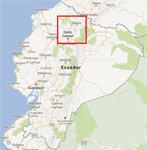
FSX/P3D Version 3 of this scenery is a completely new build of SEQM from the ground up. The entire complex is rendered using FSX objects along with the new highway that connects to the highway infrastructure with AI road traffic. The airport is now at a mean altitude that better blends with the newly included NASA SRTM GL1 30m mesh for the region. The tower is at the correct altitude. Buildings use more accurate footprints, new models, floating jetways, and updated landclass, and work seamlessly with the roads added by FTX Global/Vector. Lakes are corrected within roughly 100 square miles. Although the Ibarra/Atahualpa (SEIB) airport no longer exists, there is an option to add it back. Startup files are included to fly from the lakes and the Ibarra/Atahualpa (SEIB) airport. As a “bonusâ€, SEQU was restored in this version, because much of the footprint of the airport still remains as part of its conversion to a park. As such, a custom and fully functional SEQU is included for users who would like to revisit the old airport. AI Traffic can be restored at SEQU by simply using the "Reversed SEQU-SEQM AI Traffic" option. Scenery was created using Airport Design Editor X v1.76.6715, SBuilderX 3.13, and the FSX Object Placement Tool. Scenery objects were added and modified from stock FSX scenery to resemble as closely as possible the actual airport. Bill Leaming's Ramp Lights for P3D/FSX illuminate the aprons.
| Filename: | North_Central_Ecuador_v3_including_SEQM_SEQU_and_S.zip |
| License: | Freeware |
| Added: | 22nd March 2020, 22:13:37 |
| Downloads: | 4,102 |
| Author: | Carlyle Sharpe |
| Size: | 29.44 MB |
| Category: Flight Simulator 2004 - Scenery | |
| Kugaaruk CYBB and DEW Pelly Bay CWPB in Nunavut, Canada |
|
Images related to this file:
File Description:
Kugaaruk is on the coast of northern mainland Canada on the Boothia Peninsula, 60 miles into a deep north-south fjord-like inlet called Pelly Bay. The name was changed from Pelly Bay in 1999, and the population is around 800. Gjoa Haven is 150 miles to the west, and Hall Beach just over 200 miles to the east. Six miles south of the village, and connected by a gravel road, there is a NWS station and what remains of a DEW Auxiliary Site; the DEW site was closed in 1992, a year after the NWS station became operational. There is also a 3,350 feet long gravel runway beside Barrow Lake 2 miles east of the site, Pelly Bay CWPB. Kugaaruk airfield is adjacent to the village and the 5,000 feet of 100 feet wide gravel runway is aligned 049T/229T where T stands for "true" as opposed to magnetic. There are flights by First Air and Canadian North and the AI includes a daily flight of each from Yellowknife via Gjoa Haven (as per real life) plus a cargo visit by Buffalo. Although the runway is long enough to accomodate a 737 it is not licensed for regular scheduled jet flights; the reason for this is that the approach lighting is "inadequate". Included here is a new .bgl for Gjoa Haven which will remove the small hold short line from the gravel; my mistake.
| Filename: | Kugaaruk_CYBB_and_DEW_Pelly_Bay_CWPB_in_Nunavut_Ca.zip |
| License: | Freeware, limited distribution |
| Added: | 25th November 2012, 00:43:07 |
| Downloads: | 427 |
| Author: | Roger Wensley |
| Size: | 6.1 MB |
| Category: Prepar3D V1-4 - Scenery | |
| Kebbi Airport - DNBK FSXP3D |
|
File Description:
Sir Ahmadu Bello International Airport (SABIA) (ICAO: DNBK) is an airport serving Birnin Kebbi in the Kebbi State of Nigeria. It is 16 kilometres (9.9 mi) east of Birnin Kebbi, along the Birnin Kebbi-Argungu road.
The runway was extended from its original 2,200 metres (7,200 ft) to 3,100 metres (10,200 ft) and had a new ramp and terminal built in 2013. The Birnin Kebbi VOR-DME (Ident: BIK) is located on the field.
Photoreal Background, Corrected Parkings, Added more buildings, Ramp Lights(Dyanmic Lights only for P3D v4).
| Filename: | Kebbi_Airport__DNBK_FSXP3D.zip |
| License: | Freeware, limited distribution |
| Added: | 20th December 2019, 02:53:06 |
| Downloads: | 228 |
| Author: | Raheem Adeleke |
| Size: | 18.46 MB |
| Category: Flight Simulator 2004 - Scenery | |
| Alexandria CNS4 field near Ottawa, Ontario, Canada |
|
Images related to this file:
File Description:
This was the thirteenth of a projected 16 airfields in the Ottawa area originally posted in 2006; this version has specifically modeled buildings. Alexandria is just a mile east of the town of the same name, 50 miles east of Ottawa International and 16 miles north of Cornwall. It has one grass runway which is 2,020' long and 100' wide and which parallels the road. There are two hangers and a two storey clubhouse, and fuel. And in the summer look out for the gliders doing right hand circuits and the parachutists on vertical finals.
| Filename: | Alexandria_CNS4_field_near_Ottawa_Ontario_Canada.zip |
| License: | Freeware, limited distribution |
| Added: | 16th February 2010, 01:41:39 |
| Downloads: | 440 |
| Author: | Roger Wensley |
| Size: | 1.33 MB |
| Category: Flight Simulator 2004 - Miscellaneous Files | |
| Pure VFR Tutorial Flight |
|
File Description:
This is a simple tutorial flight using a road map and the view out of the windscreen as the only one navigational aid. The entire flight is step by step explained in the manual, even the correct engine and mixture handling. The flight was generated with "Flight Trip Chooser 1.0", a good chance to have a look at this tool. The package includes the saved flight for MSFS 2004 starting with a cold a dark cockpit of the Cessna 172SP and the weather file containing the real weather from October 3rd 2004.
| Filename: | Pure_VFR_Tutorial_Flight.zip |
| License: | Freeware |
| Added: | 12th October 2006, 21:56:16 |
| Downloads: | 2,557 |
| Author: | Gerhard Scheuerecker |
| Size: | 15.55 MB |
| Category: Flight Simulator 2004 - Scenery | |
| Arnot Power Station, South Africa |
|
Images related to this file:
File Description:

Arnot Power Station, South Africa with photoreal textures and seasonal textures.
The power station, airfield building, objects and fences were all custom made in Gmax, while Rietkuil village (Arnot) is also represented by means of almost 800 hand placed autogen buildings. Arnot is also well known for the large amount of trees in the area, on approach to rwy 13 and lining the road seperating the village from the power station, and these are also represented by more than 4 000 hand placed trees. The "Ash-dam" south of the runway is also included.
| Filename: | Arnot_Power_Station_South_Africa.zip |
| License: | Freeware, limited distribution |
| Added: | 16th November 2012, 23:45:27 |
| Downloads: | 542 |
| Author: | Kobus van Wyk |
| Size: | 11.86 MB |
| Category: Flight Simulator X - Scenery | |
| Falklands_2007 ** REPOST ** |
|
File Description:
Welcome to Falklands 2007 for Flight Simulator X.
This scenery has been released to commemorate the liberation of the Falkland Islands 25 years ago.
The scenery replaces the default mesh, landclass, coastlines and models with completely new and hand built components.
There are 325 ponds, not including the Black Tarn and Colorado ponds; my apologies if I have inadvertently missed out your favourite fishing hole!
There are 40 rivers.
There are 42 road segments.
There are 89 beaches.
There are 240 separate islands (not including the East and West Falklands themselves).
| Filename: | Falklands_2007__REPOST_.zip |
| License: | Freeware |
| Added: | 2nd June 2016, 15:40:58 |
| Downloads: | 1,912 |
| Author: | Brian Jamieson |
| Size: | 10.06 MB |
| Category: Flight Simulator 2004 - Scenery | |
| Heathrow - Myrtle Avenue (Beta Test) |
|
File Description:
This is a small scenery add-on designed to work with the UK2000 Heathrow Xtreme Scenery. It adds the famous spotting area known as Myrtle Avenue, which is situated near the threshold to Heathrow's runway 27L. It also includes some detailing of the A30 perimeter road, in order to enhance the views of approaching aircraft in this area.
The scenery is released in Beta Test form, and I therefore welcome comments and suggestions as to how it can be improved or enhanced. Please refer to the included read me for more details.
| Filename: | Heathrow__Myrtle_Avenue_Beta_Test.zip |
| License: | Freeware, limited distribution |
| Added: | 5th July 2010, 13:41:48 |
| Downloads: | 2,925 |
| Author: | Tim Faithfull |
| Size: | 13.51 MB |
| Category: Flight Simulator X - Scenery | |
| Scenery Pokhara Airport Nepal VNPK |
|
Images related to this file:
File Description:

Scenery for Pokhara Airport Nepal VNPK,Scenery done using ADE9X based on google Satellite images,with additional animated scenery like flying birds ecc.enjoy it.
| Filename: | Scenery_Pokhara_Airport_Nepal_VNPK.zip |
| License: | Freeware |
| Added: | 5th November 2009, 21:08:13 |
| Downloads: | 2,093 |
| Author: | Antoine Calleja |
| Size: | 184.31 KB |
© 2001-2026 AVSIM Online
All Rights Reserved
Privacy Policy |