
Where Flight Simulation Enthusiasts Gather from Around the World!
AVSIM Library - Search Results

| Category: Flight Simulator X - Aircraft Repaints, Textures and Modifications | |
| Fictional Alaska Airlines Northern Lights Livery 737 MAX 8 |

|
Images related to this file:
File Description:
Fictional Alaska Airlines Northern Lights Livery for FSX 737-Max8 model by TDS. Credits go to Hiroshi Igami for this FSX Boeing 737-Max8 model. Jacques Louw for the beautiful textures. Assembled and prepared for FSX by Chris Evans. Repaint by Gus Rodriguez
Before installing, make sure that you have downloaded the base pack of TDS 737 MAX 8 as this containing .zip files are texture only. (TDS_B737MAX8_BASE_PACKAGE.ZIP). You can download it from either Avsim or Flightsim.com
| Filename: | Fictional_Alaska_Airlines_Northern_Lights_Livery_7.zip |
| License: | Freeware |
| Added: | 14th November 2016, 16:14:39 |
| Downloads: | 594 |
| Author: | Gus Rodriguez |
| Size: | 20.31 MB |
| Category: Prepar3D V5 - AI Aircraft | |
| P3DV4-5 FSPXAI Boeing 767-300 Northern Air fleet |
|
Images related to this file:
File Description:
Textures only for FSPXAI - BOEING B767 FOR P3DV4&V5 AI-TRAFFIC P3D payware. Fantastic model and paint kit with PBR textures by Mitsushi Yukata. Four variations: PW, GE standard, sharklets and Stratair. Painted by Joel Branchu for realtraffic with the registrations. Apr 2023
| Filename: | P3DV45_FSPXAI_Boeing_767300_Northern_Air_fleet.zip |
| License: | Freeware |
| Added: | 7th April 2023, 14:41:25 |
| Downloads: | 53 |
| Author: | Joel Branchu |
| Size: | 4.98 MB |
| Category: Flight Simulator 2004 - Aircraft Repaints, Textures and Modifications | |
| First Air Boeing 737-217/Adv 'Aurora - Northern Lights' |
|
File Description:
First Air livery for the Tinmouse II Boeing 737 200. Textures only! This livery depicts the Aurora - Northern Lights, painted on the tail. First Air is a Canadian Airline with passenger and cargo service. This livery has a fictional tail number.
Included in this upload is a texture fix for the "Inukshuk" stone tail livery for the Tinmouse Boeing 737 from an earlier upload. This texture fix aligns the rudder hinge markings on the vertical tail to the hinges on the Tinmouse II Boeing 737 200.
| Filename: | First_Air_Boeing_737217Adv__Aurora__Northern_Light.zip |
| License: | Freeware |
| Added: | 13th April 2007, 19:59:51 |
| Downloads: | 502 |
| Author: | David Lewis, Jr./Tinmouse |
| Size: | 1.72 MB |
| Category: Flight Simulator 2004 - Scenery | |
| Arctic Runway Signs in the "Northern Domestic Airspace", Canada |
|
Images related to this file:
File Description:
These are scenery bgl's to replace those previously posted for Cape Dorset, Gjoa Haven, Igloolik, and Whale Cove. All of these airfields are within what is marked on the chart as "Northern Domestic Airspace" and their runway signage is not given as a magnetic bearing but as a true bearing. This is because at those latitudes, close to magnetic north, the magnetic field is more vertical than horizontal and magnetic readings become unreliable. Planes report their course as a true course, and fly at a height that reflects their true course instead of their magnetic course. The picture shows the runway sign for Qikiqtarjuaq CYVM (which used to be called Broughton Island) which I am working on right now, and I realised that my training was so far behind me that I had forgotten all of the above. The boundary line of the two air spaces is not a straight line; the furthest south it reaches is on the west coast of Hudson Bay just north of Churchill. To the east it passes through the southern end of Baffin Island, and to the west it is north of the coast at the Alaskan border, and there is an illustration included here.
| Filename: | Arctic_Runway_Signs_in_the_Northern_Domestic_Airsp.zip |
| License: | Freeware, limited distribution |
| Added: | 11th June 2011, 03:06:36 |
| Downloads: | 307 |
| Author: | Roger Wensley |
| Size: | 1.21 MB |
| Category: Flight Simulator 2004 - Scenery | |
| Longue-Pointe de Mingan CYLP, Quebec, Canada |
|
Images related to this file:
File Description:
This scenery represents real the airport of Longue-Pointe of Mingan (CYLP). I carried out this scenery with FSDS. Longue-Pointe of Mingan is localised on northern bank of the St-Laurent river in Quebec, Canada. This scenery is built for both FS-2004 and FS-X.
| Filename: | LonguePointe_de_Mingan_CYLP_Quebec_Canada.zip |
| License: | Freeware |
| Added: | 30th December 2009, 21:28:47 |
| Downloads: | 898 |
| Author: | Regis Dassylva |
| Size: | 9.69 MB |
| Category: Flight Simulator 2004 - Scenery | |
| FS2004 Panama Tocument Int Airport |
|
File Description:
Scenery of the Airport TOCUMEN International detailed that includes
the northern extension of the terminal, Moving jetways and some catering service
for your plane, Moving stairs at the South Ramp, Moving vehicles, Night lights over all scenery
Development and donated as freeware By VIRTUALCOL FS SOFTWARE
Email: [email protected]
| Filename: | FS2004_Panama_Tocument_Int_Airport.zip |
| License: | Freeware, limited distribution |
| Added: | 31st March 2019, 00:30:09 |
| Downloads: | 1,278 |
| Author: | Virtualcol FS Software |
| Size: | 14.11 MB |
| Category: Flight Simulator 2004 - Scenery | |
| DBWsim: Tinian 2004 |
|
File Description:
DBWsim’s first scenery for Flightsim2004 covers the Northern Marianas island of Tinian in its entirety, and includes fully updated and improved scenery of the remnants of historical WWII airbases on the island, Northfield and Westfield, as well as a significantly enhanced West Tinian Airport and full island landclass.
| Filename: | DBWsim_Tinian_2004.zip |
| License: | Freeware |
| Added: | 24th December 2003, 18:04:10 |
| Downloads: | 3,646 |
| Author: | Derek and Brendan Webb |
| Size: | 2.17 MB |
| Category: Flight Simulator 2004 - Scenery | |
| Greece SRTM Mesh Part 1 |
|
File Description:
This terrain mesh scenery covers Greece, including all Aegean sea islands, plus most parts of Albania and Macedonia up to 41°50'N. Some parts of Bulgaria and Turkey are also included in northern and eastern boundaries of the mesh. The greek island of Crete isn't part of this mesh because SRTM data isn't yet released for the whole island.
Based on SRTM Data (3 arcsec, 90m), generated with Matthew Styles's program "SRTM To BGL v1.04", sampled to LOD9 resolution (76m). While only tested with Fs2004, this mesh should also run with FS2002.
This part contains northern parts of the mesh: Greece-N.bgl, Greece-NE1.bgl and Greece-NE2.bgl. See Greece_Mesh_Part1-1.jpg for exact bgl coverage.
| Filename: | Greece_SRTM_Mesh_Part_1.zip |
| License: | Freeware |
| Added: | 10th November 2003, 02:08:20 |
| Downloads: | 10,984 |
| Author: | Yohann Baptiste |
| Size: | 17.75 MB |
| Category: Flight Simulator 2002 - Aircraft Repaints, Textures and Modifications | |
| Lauda Air Boeing 777 |
|
File Description:
This rendition of the 777 has been completely built from scratch in GMax for FS2002 and features a 32-sided fuselage and engines; brand new "maintenance mode" featuring opening engine cases, deployable Ram Air Turbine, opening gear bay doors on ground, opening Captain's window; virtual cabin (Business Class); Folding Wings; Flexing Wings; dynamic wingviews; animated reversers with animated fan air blocker doors; see through engines; animated landing gear with fully modeled struts and hydraulic pistons, also featuring animated flexible gear hoses; animated flaps, slats, ailerons, elevators, and spoilers with animated hydraulic pistons; advanced logic nosegear and maingear steering; animated primary and secondary rudder; dynamic shine and reflective surfaces; 3D APU; 3D gear, flap, slat bays; seamless wing-root fairing; dimensioned to high accuracy; accurate flight dynamics; extremely detailed all round.
| Filename: | Lauda_Air_Boeing_777.zip |
| License: | Freeware |
| Added: | 11th January 2003, 23:54:21 |
| Downloads: | 928 |
| Author: | Michael Mittermeier |
| Size: | 3.41 MB |
| Category: Flight Simulator 2004 - Scenery | |
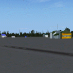
| Fort Nelson CYYE in British Columbia, Canada |
|
Images related to this file:
File Description:
Fort Nelson is close to the Peace River in the northeast corner of British Columbia, around 70 miles from the northern border, 90 from the eastern border, and 80 miles east of the Rockies. The wartime construction of the Alaska Highway actually started from Fort Nelson, as there was already a road from Fort St John (which is close to Dawson Creek) north to Fort Nelson. The airfield was part of this construction effort and after the wartime ferrying of planes to Russia it was used by the US Army Air Force and then by the Canadian Air Force. Fort Nelson flourished with the oil and gas exploration of the 1950's and the following years, and this continued to grow until the collapse of the oil price in 2014.
The town of Fort Nelson became the capital of the Northern Rockies Regional District when it was founded in 2009, and as a result the official name of the Fort Nelson airport is the Northern Rockies Regional Airport. The date for this scenery is around 2016, by which time the economic fortunes of the town were in decline. Five times per day flights by Central Mountain Air were starting to be reduced in number to the current (in 2022) one per day and none on Sunday; in the AI included here there are two flights per day. The main resident users of the airport are four helicopter companies, the helicopters presumably used for maintenance trips to whatever parts of the oil and gas fields that are still in use in the surrounding area.
There are two runways, the main one is aligned 03-21, 6,400 feet long and 200 feet wide, with ILS at the southern end and PAPI at the northern. The second runway (a narrower rebuild on a previously existing runway) is aligned 07-25 and 77 feet wide, and is without any lights. These are the alignments as per the original build of FS9 and not as per the approximate 2016 date of the buildings; I had a problem at a very late stage in making this scenery which prevented me from continuing with some final details.
On YouTube there is a series of posts by Angle of Attack showing the preparation and then the flight of an old Cessna 172 from Homer to Oshkosh for the installation of modern instruments. Interesting for me as they visit or fly over airfields I have made (Homer, Merrill, Tok Junction, Burwash, Silver City, Haines Junction, Watson Lake, Fort Nelson, and Grande Prairie) but in the winter so it all looks very different.
| Filename: | Fort_Nelson_CYYE_in_British_Columbia_Canada.zip |
| License: | Freeware, limited distribution |
| Added: | 23rd January 2022, 20:11:18 |
| Downloads: | 186 |
| Author: | Roger Wensley |
| Size: | 28.35 MB |
© 2001-2026 AVSIM Online
All Rights Reserved
Privacy Policy |