
Where Flight Simulation Enthusiasts Gather from Around the World!
AVSIM Library - Search Results

| Category: Microsoft Flight Simulator (2020) - Scenery | |
| Airport Saglek CYSV in Canada, Labrador |

|
File Description:
Saglek Airport CYSV (Route additions to radar etc.)
The airport is located north of New Fourdland in Canada, there is a radar station on the mountain near the Atlantic.
In 1945, he had research on BPS.
The scenery comes from information collected from Google Earth and other images.
Runway 17 has an ILS approach on frequency 110.10.
Runway 35 also has an ILS approach on frequency 112.10.
The landing is quite critical because we are close to the ground.
ATC control is active for approaches and ground service.
Special Warning:
If you have another CYSV scene in Community, please delete it or remove it from the Community.
Installation: unzip the folder: rd-airport-cysv-saglek-v4.zip and place the rd-airport-saglek folder in the community.
| Filename: | Airport_Saglek_CYSV__in_Canada_Labrador.zip |
| License: | Freeware |
| Added: | 6th November 2023, 15:25:17 |
| Downloads: | 25 |
| Author: | Regis Dassylva |
| Size: | 5.9 MB |
| Category: Flight Simulator 2004 - Scenery | |
| Union Island TVSU in the Grenadines |
|
Images related to this file:
File Description:
Union Island is in the southern tail of the chain of islands known as St Vincent and the Grenadines, between Canouan and Carriacou. Union is another small island, 3.5 miles long and at its widest 1.5 miles wide; the resident population is around 3,000, mostly in the two towns Clifton and Ashton.
The airport is at the eastern end of the island, and has been extended into the sea on landfill. The runway is now around 2,480 feet long, aligned 08 (and with the southeast trade winds it is unlikely that you will find yourself using 26) and with a displaced threshold of 530 feet due to the hill to the west. The terminal is adjacent to a rather small apron; there is parking on the grass north of the taxiway. There are connecting flights by SVG to Barbados and the other islands and these are reflected in the AI. The airport has no lighting, and flights are obliged to land and depart in daylight hours only, outside of which the airport is closed.
| Filename: | Union_Island_TVSU_in_the_Grenadines.zip |
| License: | Freeware, limited distribution |
| Added: | 11th June 2013, 23:26:50 |
| Downloads: | 435 |
| Author: | Roger Wensley |
| Size: | 2.02 MB |
| Category: Online ATC - Software | |
| VAT-Spy adding airports in ASIA |
|
File Description:
VATSpy addition covers areas:
1) Airports by ICAO code: O
OA - Afghanistan
OB - Bahrain
OE - Saudi Arabia
OI - Iran<
OJ - Jordan
OK - Kuwait
OL - Lebanon
OM - United Arab Emirates
OO - Oman
OP - Pakistan
OR - Iraq
OS - Syria
OT - Qatar
OY - Yemen
2) Airports by ICAO code: R
RC - Taiwan
RJ RO - Japan
RK - South Korea
3) Airports by ICAO code: V
VA VE VI VO - India
VA - Mumbai Center (VABF)
VE - Kolkata Center (VECF)
VI - Delhi Center (VIDF)
VO - Chennai Center (VOMF)
VC - Sri Lanka
VD - Cambodia
VG - Bangladesh
VH - Hong Kong
VL - Laos
VM - Macau
VN - Nepal
VQ - Bhutan
VR - Maldives
VT - Thailand
VV - Vietnam
VY - Myanmar (Burma
4) Airports by ICAO code: Z
Mainland China
ZB -
ZG -
ZH -
ZJ -
ZL -
ZP -
ZS -
ZU -
ZW -
ZY -
ZK - North Korea
ZM - Mongolia
| Filename: | VATSpy_adding_airports_in_ASIA.zip |
| License: | Freeware |
| Added: | 1st July 2014, 15:16:36 |
| Downloads: | 157 |
| Author: | Porutchikov Fedor |
| Size: | 1.06 MB |
| Category: Flight Simulator 2004 - Aircraft Repaints, Textures and Modifications | |
| F7U Cutlass in Blue Angels colors |
|
Images related to this file:
File Description:

Re-uploaded Blue Angels repaint for the fantastic payware Alphasim F7U Cutlass.
| Filename: | F7U_Cutlass_in_Blue_Angels_colors.zip |
| License: | Freeware |
| Added: | 11th May 2010, 23:28:19 |
| Downloads: | 825 |
| Author: | Repaints by pierre lheureux - Plane by Alphasim |
| Size: | 1.42 MB |
| Category: Flight Simulator 2004 - Scenery | |
| Talkeetna Village AK44 in Alaska, REVISED |
|
Images related to this file:
File Description:
The town of Talkeetna is around 75 miles north of Anchorage in Alaska, on the east shore of the Susitna River where the Susitna, Talkeetna, and Chulitna rivers join. The town is where Don Sheldon started Talkeetna Air Services. His story is told in "Wager With The Wind" by James Greinar and is well worth reading for the descriptions of mountain flying. There are two airfields at Talkeetna, PATK with its long asphalt runway and Talkeetna Village AK44 in the town. This is AK44; measuring the space left for the runway between the river bank in the south and the curve in the road that marks the north end of the field there is just enough space for the 900 feet of runway that is described in the book. The result is a step back in time to 1973, when the second hangar was built. Neither hangar has survived to today.
| Filename: | Talkeetna_Village_AK44_in_Alaska_REVISED.zip |
| License: | Freeware, limited distribution |
| Added: | 18th April 2010, 09:52:26 |
| Downloads: | 871 |
| Author: | Roger Wensley |
| Size: | 3.47 MB |
| Category: Flight Simulator X - Scenery | |
| Matekane Airfield in Lesotho (FXME) / Africa |
|
Images related to this file:
File Description:
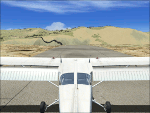
Matekane airfield is a very small airfield and is located in South Africa in Lesotho. The airfield is located on a mountain. This Scenery is designd for FSX sp2/Acc + DX10.
Have Fun!
| Filename: | Matekane_Airfield_in_Lesotho_FXME__Africa.zip |
| License: | Freeware |
| Added: | 9th March 2010, 03:26:00 |
| Downloads: | 988 |
| Author: | Ulukan Zafer |
| Size: | 27.07 MB |
| Category: Miscellaneous Files - General Utilities | |
| AusAir Monthly Fly-In (02-2011) |
|
File Description:
Aus Air Monthly fLy-In Package for Feburary 2011
| Filename: | AusAir_Monthly_FlyIn_022011.zip |
| License: | Freeware |
| Added: | 30th January 2011, 15:37:58 |
| Downloads: | 52 |
| Author: | Bob Mathnoprasueth |
| Size: | 814.14 KB |
| Category: Flight Simulator 2004 - Scenery | |
| PASN St Paul Island in Alaska |
|
Images related to this file:
File Description:
This is St Paul Island airport, plus the town and the harbour which has featured alongside Dutch Harbor in the tv series Deadliest Catch.
St Paul is in the Pribilof group of five islands around 250 miles north of Dutch Harbour. The town has a population of less than 600, so a lot smaller than Dutch Harbour and with only one processing plant, Trident.
The Ai includes a PenAir flight, a Coast Guard C-130, and Coast Guard helicopters; sea AI includes a fishing boat and a Coast Guard cutter. The Coast Guard C-130 and helicopter flights are to Dutch Harbor, so both sceneries are required to make it work as it should. The airport has 6,500 feet of 150 feet wide asphalt with 1,000 feet of over-run at each end, aligned 36/18, lit, and with two aprons at the southern end. There is no hangerage except for Coast Guard helicopters. Runway 36 has at its northern end a hill.
In real life the runway slopes up to the north by over 60 feet, but in FS9 it doesn't; hence the change in airport elevation to 80 feet ASL to get the northern end at least partly out of a box canyon. There is fuel available and it is dispensed from a truck, there are no pumps.
| Filename: | PASN_St_Paul_Island_in_Alaska.zip |
| License: | Freeware, limited distribution |
| Added: | 12th August 2012, 17:39:02 |
| Downloads: | 1,100 |
| Author: | Roger Wensley, Sidney Schwartz |
| Size: | 4.06 MB |
| Category: Flight Simulator X - Scenery | |
| 7FL6 Spruce Creek Fly-in Community |
|
Images related to this file:
File Description:

Touted as the worlds most famous residential airpark, this airfield resides within the Daytona Beach International Airport (KDAB) controlled airspace. More information is available at www.7fl6.com. The scenery includes photo landclass changes, rework of the runway, taxiways, aprons and parking; custom scenery objects and placement of library objects. Scenery in this package is based on Virtual Earth (Bing) and Google Earth imagery and photos taken locally. The package includes airport arrival-departure procedures (PDF) published by the Fly-in and scenery associated with the VFR "Tank Departure".
| Filename: | 7FL6_Spruce_Creek_Flyin_Community.zip |
| License: | Freeware |
| Added: | 13th July 2012, 05:40:50 |
| Downloads: | 1,033 |
| Author: | Art Poole |
| Size: | 5.13 MB |
| Category: Flight Simulator 2004 - Scenery | |
| Buffalo Narrows CYVT in Saskatchewan, Canada |
|
Images related to this file:
File Description:
Buffalo Narrows is a small town (around 1,400 folks) 130 miles west and a bit north of La Ronge in Saskatchewan, and I discovered that the Buffalo Narrows airfield, wrongly positioned in FS9, had been flooded out by Ultimate Terrain's lake; this is the rescue package. Actually that would be several lakes as the place is surrounded by water including Churchill Lake, Little Peter Pond Lake, and of course Big Peter Pond Lake.
There are two runways, the longest being 5,006' of 100' wide asphalt aligned 11/29, and the other 2,297 and 75' wide, also asphalt. Both runways are lit, and there is JetA and 100LL fuel available. I have placed taxiway lights, but I haven't made proper signage or placed runway lights, or a ton of other things, but it is now landable and with the buildings and fire chemical retarder tanks etc, and there is AI that includes a CL-415. The roads have also been modified to fit.
| Filename: | Buffalo_Narrows_CYVT_in_Saskatchewan_Canada.zip |
| License: | Freeware, limited distribution |
| Added: | 15th July 2012, 19:31:20 |
| Downloads: | 499 |
| Author: | Roger Wensley |
| Size: | 1.8 MB |


© 2001-2026 AVSIM Online
All Rights Reserved
Privacy Policy |