
Where Flight Simulation Enthusiasts Gather from Around the World!
AVSIM Library - Search Results

| Category: Flight Simulator 2004 - Scenery | |
| Hells Canyon, Oregon / Idaho SRTM30_1ArcSec Terrain Mesh |

|
File Description:
This 38m terrain mesh is centered in Hells Canyon of the Snake River
between Oregon and Idaho. Coverage area: From West 116.2° to West 117.1°
and North 45.0° to North 46.5°. It includes the City of Lewiston,
Hells Canyon National Recreation Area with Snake and Imnaha River,
Salmon River and the Seven Devils mountain peaks.
| Filename: | Hells_Canyon_Oregon__Idaho_SRTM30_1ArcSec_Terrain_.zip |
| License: | Freeware, limited distribution |
| Added: | 29th December 2003, 16:58:59 |
| Downloads: | 3,031 |
| Author: | Andreas Trawny |
| Size: | 6.16 MB |
| Category: Flight Simulator 2004 - Scenery | |
| Update - Terrain Mesh for Canada's Maritime Provinces |
|
File Description:
This package contains two files updating river and lake elevation for FS2002 and FS2004 in LOD09 terrain mesh (in Maritimes09a.zip and Maritimes09b.zip) for Canada's Maritime Provinces (including also Newfoundland, parts of Labrador and Saint-Pierre-et-Miquelon).
| Filename: | Update__Terrain_Mesh_for_Canadas_Maritime_Province.zip |
| License: | Freeware, limited distribution |
| Added: | 1st September 2003, 01:52:28 |
| Downloads: | 4,244 |
| Author: | Gilles Gauthier |
| Size: | 12.86 KB |
| Category: Flight Simulator 2004 - Scenery | |
| Ultimate Malta - Landclass, Mesh, Roads and Towns |
|
File Description:
With this file you will get one of the best freeware sceneries for the island of Malta, including:
----- a more realistical landclass mixed with green grounds and southern dry grounds ----- Important roads around the airport ----- a more realistical mesh with small mountain, cliffs and beaches ----- Important towns that do not exist in FS2004 inlc. the capital of Malta, villages around the airport as well as the harbor town in the very south of Malta and some important ones more -----
| Filename: | Ultimate_Malta__Landclass_Mesh_Roads_and_Towns.zip |
| License: | Freeware |
| Added: | 7th September 2008, 22:59:31 |
| Downloads: | 4,543 |
| Author: | Dave Sheffield |
| Size: | 38.14 KB |
| Category: Flight Simulator 2004 - Scenery | |
| Europe SRTM mesh Part 11: Southern Italy |
|
File Description:
Europe SRTM LOD9 mesh part 11 of 13: Covers southern Italy, Sardinia, Corsica and parts of Croatia and Bosnia.
This Europe SRTM project was optimized for the lowest HDD space use: Each part macthing exactly the boundaries of its neighbors, you'll have a complete corevage of Europe without gap or overlapping scenery. Based on SRTM Data v1 and v2 (3 arcsec, 90m) and sampled to LOD9 resolution (76m). Each SRTM tile was carefully checked and repaired with Blackart v4.02: water areas are now flattened (lighter mesh), and SRTM voids were treated taking advantage of Blackart's sophisticated interpolation algorithm. When required, biggest voids were patched with oversampled SRTM 30 arcsec data and/or manual input.
| Filename: | Europe_SRTM_mesh_Part_11_Southern_Italy.zip |
| License: | Freeware, limited distribution |
| Added: | 20th October 2005, 11:17:43 |
| Downloads: | 14,241 |
| Author: | Yohann Baptiste |
| Size: | 27.86 MB |
| Category: Flight Simulator 2004 - Scenery | |
| Europe SRTM mesh part 10: Lower Danube |
|
File Description:
Europe SRTM LOD9 mesh part 10 of 13: Covers a wide area centered over the Danube valley from Novi Sad to the Black Sea (42°N-46°N, 19°E-30°E). Includes Balkans & Transylvanian moutain ranges, and parts of the following countries: Romania, Bulgaria, Serbia and Albania.
This Europe SRTM project was optimized for the lowest HDD space use: Each part macthing exactly the boundaries of its neighbors, you'll have a complete corevage of Europe without gap or overlapping scenery. Based on SRTM Data v1 and v2 (3 arcsec, 90m) and sampled to LOD9 resolution (76m). Each SRTM tile was carefully checked and repaired with Blackart v4.02: water areas are now flattened (lighter mesh), and SRTM voids were treated taking advantage of Blackart's sophisticated interpolation algorithm. When required, biggest voids were patched with oversampled SRTM 30 arcsec data and/or manual input.
| Filename: | Europe_SRTM_mesh_part_10_Lower_Danube.zip |
| License: | Freeware, limited distribution |
| Added: | 19th October 2005, 17:55:10 |
| Downloads: | 11,741 |
| Author: | Yohann Baptiste |
| Size: | 39.14 MB |
| Category: Flight Simulator 2004 - Scenery | |
| Europe SRTM mesh Part 02: UK & Ireland |
|
File Description:
Europe SRTM LOD9 mesh part 2 of 13: Covers all of UK & Ireland except the Shetlands, and a tiny part of France (from Calais to Abbeville).
This Europe SRTM project was optimized for the lowest HDD space use: Each part macthing exactly the boundaries of its neighbors, you'll have a complete corevage of Europe without gap or overlapping scenery. Based on SRTM Data v1 and v2 (3 arcsec, 90m) and sampled to LOD9 resolution (90m). Each SRTM tile was carefully checked and repaired with Blackart v4.02: water areas are now flattened (lighter mesh), and SRTM voids were treated taking advantage of Blackart's sophisticated interpolation algorithm. When required, biggest voids were patched with oversampled SRTM 30 arcsec data and/or manual input.
| Filename: | Europe_SRTM_mesh_Part_02_UK__Ireland.zip |
| License: | Freeware, limited distribution |
| Added: | 19th October 2005, 16:11:56 |
| Downloads: | 17,967 |
| Author: | Yohann Baptiste |
| Size: | 36.17 MB |
| Category: Flight Simulator 2004 - Scenery | |
| Atlas Mountains, Morocco 76m SRTM Terrain Mesh |
|
File Description:
USGS SRTM 3 arc-second, resampled to LOD9 (76 meters). This is a terrain mesh scenery of the Atlas Mountains in Morocco, Africa. It includes the High Atlas, the cities of Agadir & Marrakech and northwestern parts of the Sahara Desert.
| Filename: | Atlas_Mountains_Morocco_76m_SRTM_Terrain_Mesh.zip |
| License: | Freeware |
| Added: | 4th April 2004, 19:46:58 |
| Downloads: | 15,262 |
| Author: | Andreas Trawny |
| Size: | 15.95 MB |
| Category: X-Plane - Scenery | |
| BR RJ SBRJ - Santos Dumont Airport v1.0.0 |
|
Images related to this file:
File Description:
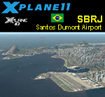
This is an X-Plane 11 and X-Plane 10 scenery package for Santos Dumont Airport (IATA: SDU, ICAO: SBRJ), which is the second major airport serving Rio de Janeiro, in Brazil. It includes corrected aprons, ramps, gates, taxiways, lighting system, city buildings, ortho-photoscenery for the airfield area, and (XP11 only) airport ground services (like push back). VERY IMPORTANT: In order to work properlly, please download and install, beforehand, the X-Plane scenery file: "Rio de Janeiro improved mesh 2.0, by Rossicev, released February 4, 2016 (33.87 MB)". Found in here: http://forums.x-plane.org/index.php?/files/file/29114-rio-de-janeiro-improved-mesh/ - Without this file, your terrain mesh will not look right, and a few objects may be displaced in your scenery. Only the default X-Plane 11 libraries, by Laminar Research, are needed. No third party libraries are used.
| Filename: | BR_RJ_SBRJ__Santos_Dumont_Airport_v100.zip |
| License: | Freeware |
| Added: | 20th April 2017, 07:22:54 |
| Downloads: | 372 |
| Author: | Rui Mesquita |
| Size: | 47.11 MB |
| Category: Flight Simulator 2004 - Scenery | |
| Colorado Lakes Project III |
|
File Description:
This project features the lakes of Southwest Colorado, replaces the default Navajo Lake on the Colorado-New Mexico border, and adds over 300 highly detailed lakes to Colorado. They fit seamlessly with my "Colorado Lakes Project II" (colorado_lakes_project_2.zip) and "Colorado Lakes Project I" (colorado_lakes_project_1.zip) lakes. The original "Colorado Lakes Project I" is recommended to complete this package, as it contains McPhee, Lemon, and Vallecito Reservoirs.
These lakes are specifically designed to show off their photo realistic detail when used in combination with "FSGenesis-The Rockies 38.2m Terrain Mesh-Colorado" available as "fsg_dem38m_usrk_co.zip" at avsim.com, or comparable mesh. The free FSGenesis US National Landclass Project Beta 6 also adds beautifully to the landscape. These lakes work equally as well with the default mesh.
All lake information was projected from satellite imagery and compiled with a beta version of Jim Keir's "Slartibartfast" utility.
| Filename: | Colorado_Lakes_Project_III.zip |
| License: | Freeware |
| Added: | 3rd June 2004, 21:54:46 |
| Downloads: | 5,016 |
| Author: | Carlyle Sharpe |
| Size: | 444 KB |
| Category: Flight Simulator 2004 - Scenery | |
| Colorado Lakes Project IV |
|
File Description:
This project features the lakes of North Central Colorado, replaces all of the prominent reservoirs and lakes of the region (Dillon, Green Mountain, Granby, Williams Fork, and more), and adds over 500 highly detailed lakes to Colorado. They fit seamlessly with my "Colorado Lakes Project III" (colorado_lakes_project_3.zip), "Colorado Lakes Project II" (colorado_lakes_project_2.zip) and "Colorado Lakes Project I" (colorado_lakes_project_1.zip) lakes.
These lakes are specifically designed to show off their photo realistic detail when used in combination with "FSGenesis-The Rockies 38.2m Terrain Mesh-Colorado" available as "fsg_dem38m_usrk_co.zip" at avsim.com, or comparable mesh. The free FSGenesis US National Landclass Project Beta 6 also adds beautifully to the landscape. These lakes work equally as well with the default mesh.
All lake information was projected from satellite imagery and compiled with a beta version of Jim Keir's "Slartibartfast" utility.
| Filename: | Colorado_Lakes_Project_IV.zip |
| License: | Freeware |
| Added: | 10th June 2004, 04:27:10 |
| Downloads: | 4,837 |
| Author: | Carlyle Sharpe |
| Size: | 743.4 KB |


© 2001-2026 AVSIM Online
All Rights Reserved
Privacy Policy |