
Where Flight Simulation Enthusiasts Gather from Around the World!
AVSIM Library - Search Results

| Category: Flight Simulator 2004 - Scenery | |
| Pennsylvania 30 meter Mesh Scenery Revision |

|
File Description:
Pennsylvania 30 meter Mesh Scenery revision. "pamesh3.bgl" was replaced from "pa_30m_mesh2_8.zip". Removes the three erroneous mountain peaks from the area near Pittsburgh. Note: This download is a replacement for the original "pa_30m_mesh2_8.zip". If yo downloaded the original and the fix, you don't need this file.
| Filename: | Pennsylvania_30_meter_Mesh_Scenery_Revision.zip |
| License: | Freeware |
| Added: | 14th December 2003, 23:34:24 |
| Downloads: | 2,302 |
| Author: | Phil Cruikshank |
| Size: | 4.95 MB |
| Category: Flight Simulator 2004 - Scenery | |
| Terrain Mesh of Glacier National Park |
|
File Description:
New and updated scenery enhancements for the mountain ranges of southeastern British Columbia and parts of the Alberta Rocky Mountains. They require an existing installation of my files bcmesh9d.zip and/or bcmesh9e.zip. Scenery coverage follows the Trans-Canada Highway from Banff National Park to west of Revelstoke (~350km), with accurate transportation network, rivers and lakes, hydro dams, ski hills, glaciers, and landclass/waterclass updates based on satellite imagery. Also, similar enhancements to the parks and towns of the southern Kootenay, Selkirk, and Monashee mountains. The mesh source data are 0.75-arcsec (~23-m) CDED files, compiled at LOD10 (38-m) resolution. Due to significant changes in FS2004 to vector layering and autogen features, the special scenery enhancements cannot be used with FS2002. However, terrain mesh, new lakes and land/waterclass replacements will work well in FS2002.
| Filename: | Terrain_Mesh_of_Glacier_National_Park.zip |
| License: | Freeware, limited distribution |
| Added: | 18th December 2003, 23:17:35 |
| Downloads: | 8,858 |
| Author: | Holger Sandmann |
| Size: | 12.79 MB |
| Category: Flight Simulator 2004 - Scenery | |
| Northern Venezuela SRTM Mesh Part 1 |
|
File Description:
This terrain mesh scenery covers north of Venezuela (southern boundary is 8°48'N) and Dutch caribeans: Aruba, Curacao & Bonaire islands.
Based on SRTM Data (3 arcsec, 90m), generated with Matthew Styles's program "SRTM To BGL v1.04", sampled to LOD9 resolution (76m) with 5 interpolation passes.
This part contains Venezuela-NE.bgl, Venezuela-N.bgl plus all islands. See venezuela_n_mesh_pt1-1.jpg for the .BGL files coverage.
| Filename: | Northern_Venezuela_SRTM_Mesh_Part_1.zip |
| License: | Freeware |
| Added: | 7th October 2003, 18:15:30 |
| Downloads: | 8,993 |
| Author: | Yohann Baptiste |
| Size: | 13.93 MB |
| Category: Flight Simulator 2004 - Scenery | |
| Northern Venezuela SRTM Mesh part 2 |
|
File Description:
This terrain mesh scenery covers north of Venezuela (southern boundary is 8°48'N) and Dutch caribeans: Aruba, Curacao & Bonaire islands.
Based on SRTM Data (3 arcsec, 90m), generated with Matthew Styles's program "SRTM To BGL v1.04", sampled to LOD9 resolution (76m) with 5 interpolation passes.
This part contains Venezuela-NW.bgl. See venezuela_n_mesh_pt2-1.jpg for the .BGL files coverage.
| Filename: | Northern_Venezuela_SRTM_Mesh_part_2.zip |
| License: | Freeware |
| Added: | 7th October 2003, 18:19:24 |
| Downloads: | 8,633 |
| Author: | Yohann Baptiste |
| Size: | 14.31 MB |
| Category: Flight Simulator 2004 - Scenery | |
| SW Alberta1 3 Arc 2nd Mesh |
|
File Description:
First of 3 parts for SW Alberta LOD9 at 3 arc second SRTM.
| Filename: | SW_Alberta1_3_Arc_2nd_Mesh.zip |
| License: | Freeware |
| Added: | 13th January 2004, 00:10:04 |
| Downloads: | 2,462 |
| Author: | Dwayne Matheson |
| Size: | 6.25 MB |
| Category: Flight Simulator 2004 - Scenery | |
| SW Alberta2 3 Arc Second Mesh |
|
File Description:
Second file for SW Alberta at 3 arc second SRTM
| Filename: | SW_Alberta2_3_Arc_Second_Mesh.zip |
| License: | Freeware |
| Added: | 13th January 2004, 00:18:55 |
| Downloads: | 2,374 |
| Author: | Dwayne Matheson |
| Size: | 4.11 MB |
| Category: Flight Simulator 2004 - Scenery | |
| SW Alberta3 3 Arc Second Mesh |
|
File Description:
Third file of SW Alberta 3 arc sec SRTM
| Filename: | SW_Alberta3_3_Arc_Second_Mesh.zip |
| License: | Freeware |
| Added: | 13th January 2004, 00:22:02 |
| Downloads: | 2,408 |
| Author: | Dwayne Matheson |
| Size: | 4.46 MB |
| Category: Flight Simulator 2002 - Scenery | |
| Dominica Scenery (Mesh Terrain and Landclass) |
|
File Description:
This is a Mesh Terrain / Landlcass scenery addon for the Caribbean island of Dominica. The FS2002 default scenery is flat in the area although Dominica is a mountainous and very picturesque island.
| Filename: | Dominica_Scenery_Mesh_Terrain_and_Landclass.zip |
| License: | Freeware |
| Added: | 23rd December 2002, 18:39:44 |
| Downloads: | 2,250 |
| Author: | David Maldonado, Rainer Labie |
| Size: | 486.91 KB |
| Category: Orbiter - Spaceships | |
| Saturn1B Highres Mesh for NASSP4 Package |
|
File Description:
nasa saturn1b mesh only package to replace the nassp default saturn1b launcher. two versions included, one lowres with 20000 polys and one one highres. works only with the NASSP4 package. all files by Thomas Ruth
| Filename: | Saturn1B_Highres_Mesh_for_NASSP4_Package.zip |
| License: | Freeware, limited distribution |
| Added: | 6th May 2003, 16:13:02 |
| Downloads: | 2,137 |
| Author: | Thomas Ruth |
| Size: | 739.95 KB |
| Category: Flight Simulator 2004 - Scenery | |
| Turkey Mesh SRTM V2, Part I |
|
Images related to this file:
File Description:
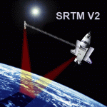
SRTM Version 2 is the result of a substantial editing effort by the National Geospatial Intelligence Agency and exhibits well-defined water bodies and coastlines and the absence of spikes and wells.
| Filename: | Turkey_Mesh_SRTM_V2_Part_I.zip |
| License: | Freeware |
| Added: | 25th January 2011, 14:32:24 |
| Downloads: | 3,450 |
| Author: | Tuncer Celik |
| Size: | 88.4 MB |


© 2001-2026 AVSIM Online
All Rights Reserved
Privacy Policy |