
Where Flight Simulation Enthusiasts Gather from Around the World!
AVSIM Library - Search Results

| Category: Flight Simulator 2002 - Scenery | |
| Mercier bridge, Montreal, Quebec, Canada. for those WITHOUT the CYHU 29-Apr-2004 kits. |

|
File Description:
Re-upload. It is imperative to install Gilles Gauthier's MESHes, from
library.avsim.net/search.php?CatID=root&SearchTerm=gilles+gauthier&Sort=Added&ScanMode=1&Go=Change+View
What's listed for FS2002 is OK for 2004. NOT reverse.
FS2004, get Some Islands of St.Lawrence river & Quebec Terrain Mesh (1 @ 5).
FS2002, get the kit CYHU, or MERCIER2 & Quebec Terrain Mesh (1 @ 5).
| Filename: | Mercier_bridge_Montreal_Quebec_Canada_for_those_WI.zip |
| License: | Freeware |
| Added: | 1st June 2010, 01:28:16 |
| Downloads: | 481 |
| Author: | Jean Morissette |
| Size: | 23.55 KB |
| Category: Flight Simulator 2004 - Scenery | |
| Crested Butte Ski Area |
|
File Description:
This project adds the ski trails to Crested Butte Mountain, Colorado. This scenery will look best when combined with "FSGenesis-The Rockies 38.2m Terrain Mesh-Colorado" available as "fsg_dem38m_usrk_co.zip" at avsim.com, or comparable mesh. The free FSGenesis US National Landclass Project Beta 6 also adds beautifully to the landscape. Made with Ground2K4 v5.33, by Christian Fumey.
| Filename: | Crested_Butte_Ski_Area.zip |
| License: | Freeware |
| Added: | 11th June 2004, 19:48:37 |
| Downloads: | 2,367 |
| Author: | Carlyle Sharpe |
| Size: | 149.55 KB |
| Category: Flight Simulator 2004 - Scenery | |
| Heckman Lake Ranch Update |
|
File Description:
Adds Heckman Lake Ranch to FS9's GPS, map, and airport selection screen. Requires file heckman.zip to be installed, an FS2002 scenery that works fine in FS9. Default FS9 mesh and Denney's Alaska2000 mesh was tested. Thanks to Lee Swordy and his AFCAD2 that allowed easy placement of the airport identifier and NDB for Heckman Lake.
| Filename: | Heckman_Lake_Ranch_Update.zip |
| License: | Freeware |
| Added: | 24th January 2004, 03:42:28 |
| Downloads: | 491 |
| Author: | Brent Hricziscse |
| Size: | 34.68 KB |
| Category: Flight Simulator 2004 - AFCAD Files | |
| Samedan LSZS Switzerland |
|
File Description:
AFCAD file for FS2004 default scenery of Samedan LSZS airport near St. Moritz in southeast Switzerland.
Update by permission to Andreas Hegi scenery (lszs2004.zip)
Removes approach & night lighting as in the real airport.
Samedan is Europe's highest elevation airport (5600 ft.) with surrounding terrain of the swiss alps.
There is no night lighting at this airport. Visual approach vicinity charts included.Update to lszs2004.zip
| Filename: | Samedan_LSZS_Switzerland.zip |
| License: | Freeware, limited distribution |
| Added: | 19th March 2010, 09:08:32 |
| Downloads: | 525 |
| Author: | Kyprianos Biris |
| Size: | 689.29 KB |
| Category: Prepar3D V1-4 - Scenery | |
| LOGI-Airport |
|
Images related to this file:
File Description:
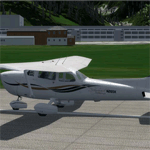
The airfield Trieben (LOGI) is certainly one of the best starting points for distance
flights in the Eastern Alps. Above all, the haul flights always made with more than 12
hours flight time and many flights over 1000km.
This airfield is transfered, with kind permission from Mr. Gerhard Scholz, from his x-plane Version with ADE.
have a look on his homepage http://www.x-plane.at.
| Filename: | LOGIAirport.zip |
| License: | Freeware |
| Added: | 4th October 2017, 03:30:45 |
| Downloads: | 457 |
| Author: | Karl Malle |
| Size: | 5.79 MB |
| Category: Flight Simulator 2004 - Scenery | |
| Colombian Airports - Update |
|
File Description:
This is an update to my previous Colombian Airports upload colapts1.zip.
The update contains mainly some navaid corrections to SKFL, SKIB, and SKVP, and adds the airport SKSJ Jorge E. Gonzales of San Jose del Guaviare; this is now at the correct location and altitude and has buildings, objects, and landclass added. It is for FS9 default scenery and the Colombia freeware mesh by Raimondo Taburet. However, the scenery should also work with the default or any other mesh but I have not tested it.
However, please NOTE:
that in the default scenery without mesh the airport SKSJ will be below the rest of the surface whereas with the mesh, the airport will be at the same altitude as the rest of the scenery with the exception of the river which now runs at a higher (the default) altitude (see screenshots). For me flying without the mesh does not make any sense, so I live with that restriction. If you don't like it, you can always delete or deactivate the files starting with "SKSJ".
| Filename: | Colombian_Airports__Update.zip |
| License: | Freeware |
| Added: | 10th September 2014, 14:50:05 |
| Downloads: | 1,439 |
| Author: | Detlev J. Rohmer |
| Size: | 5.4 MB |
| Category: Flight Simulator 2004 - Scenery | |
| "Himalayan Peaks" LOD10 Mesh, Volume 8 - Tirich Mir and Pamir |
|
Images related to this file:
File Description:
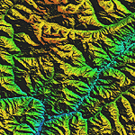
Highly detailed terrain mesh of the Tirich Mir and Pamir areas, N36-39 E71-74. The files in this package are based on Shuttle Radar (SRTM) Version 2 data but with many of the void areas, especially the most significant sections, filled with elevation data generated from topographic maps by Jonathan de Ferranti. While Jonathan's work is unrelated to flight simulation he kindly gave me permission to compile his data for use in FS. The result is a wonderful improvement in detail and accuracy over any existing mesh file, freeware or commercial, based on SRTM or DTED data alone.
Due to the large area of the Himalayas I've compiled the source data as two separate series: the "Himalayan Peaks" series covers prominent mountains and ranges in higher detail and locally overrides any existing LOD9 terrain mesh. In addition, a LOD9 "base mesh" series covering the entire Himalayas will be available for those who do not yet have an add-on terrain mesh of these beautiful mountains.
| Filename: | Himalayan_Peaks_LOD10_Mesh_Volume_8__Tirich_Mir_an.zip |
| License: | Freeware, limited distribution |
| Added: | 29th May 2010, 08:52:47 |
| Downloads: | 9,114 |
| Author: | Holger Sandmann, Jonathan de Ferranti |
| Size: | 47.94 MB |
| Category: Flight Simulator 2004 - Scenery | |
| Ile d'Aix France Photo real |
|
File Description:
Photo scenery of "Ile d'Aix", small island between La Rochelle and Fort Boyard France.
Includes no mesh but provides customized autogen.
| Filename: | Ile_dAix_France_Photo_real.zip |
| License: | Freeware |
| Added: | 8th July 2006, 13:43:19 |
| Downloads: | 1,726 |
| Author: | Alain Nicco |
| Size: | 344.94 KB |
| Category: Flight Simulator X - Scenery | |
| Horn Of Africa Mesh, part 1/3 |
|
Images related to this file:
File Description:
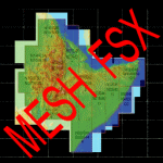
Part 1 of 3: Mesh (lod 1 to 9) of the "Horn Of Africa": Ethiopia, Erythrea, Djibouti and Somalia. (Re-upload)
| Filename: | Horn_Of_Africa_Mesh_part_13.zip |
| License: | Freeware, limited distribution |
| Added: | 10th June 2010, 08:57:38 |
| Downloads: | 2,253 |
| Author: | Marcel "Teutonique" Wislet |
| Size: | 82.73 MB |
| Category: Flight Simulator X - Scenery | |
| Horn Of Africa Mesh, part 2/3 |
|
Images related to this file:
File Description:
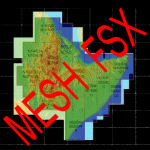
Part 2 of 3: Mesh (lod 1 to 9) of the "Horn Of Africa": Ethiopia, Erythrea, Djibouti and Somalia. (Re-upload)
| Filename: | Horn_Of_Africa_Mesh_part_23.zip |
| License: | Freeware, limited distribution |
| Added: | 10th June 2010, 08:59:50 |
| Downloads: | 2,094 |
| Author: | Marcel "Teutonique" Wislet |
| Size: | 88.72 MB |


© 2001-2026 AVSIM Online
All Rights Reserved
Privacy Policy |