
Where Flight Simulation Enthusiasts Gather from Around the World!
AVSIM Library - Search Results

| Category: Flight Simulator X - Scenery | |
| LSZB Bern Belp, Switzerland for FSX (P3D) Version1.0 |

|
Images related to this file:
File Description: This scenery is very detailed in design fitting the newest airport layout from 2017. All important buildings are new designed, partly recreated by basicly using objects from the Sketchup Warehouse. Nighttextures are completely integrated. The surrounding area was adapted to the real surroundings by new landclasses. Also the mesh round the airport is adjusted. There are three Photobackgrounds aviable fitting the FSX standardscenery (all seasons), the Switzerland ProX (summer and winter) and Mega Scenery Earth (only summer). RECOMMENDED LIBRARIES:
Many smaller objects, such as people, cars, or static planes in this scenery, are taken from three popular freeware libraries, for which I got the kind permission of the authors. If these libraries are not installed, many objects are not visible! The following libraries are used: 1. FS-Piloten_Objektlibrary:
http://www.fs-piloten.de/thread.php?threadid=1063 2. FSX_FlightPortLib
http://www.flightport.de/libraries/flightport-library/ 3. 3d People Library and 3d People Library BUGFIX
https://library.avsim.net/search.php?SearchTerm=people+3d&CatID=fsxsd&Go=Search
| Filename: | LSZB_Bern_Belp_Switzerland_for_FSX_P3D_Version10.zip |
| License: | Freeware |
| Added: | 13th June 2017, 00:24:32 |
| Downloads: | 5,230 |
| Author: | Wolfgang Allers |
| Size: | 370.96 MB |
| Category: Flight Simulator X - Scenery | |
| Goma Intl (FZNA) DRC and Gisenyi (HRYG) Rwanda |
|
Images related to this file:
File Description:
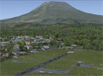
This project includes the neighboring Goma Intl (FZNA) and Gisenyi (HRYG) airports. After Goma's only runway was severely damaged by the eruption of Mount Nyiragongo in 2002, the runway, originally 3000m long, was reduced to 1800m of serviceable pavement after lava flowed onto the northern part runway and through the city center. In 2013, German NGO Welthungerhilfe ("World Hunger Aid") signed a contract to rehabilitate 500m of runway damaged by the lava flow. Goma resumed scheduled international flights in 2015, and this project reflects the airport as of March 2016, with runway 18/36 renumbered to 17/35. SRTMGL1 (30m) mesh brings the volcanoes in the area into much greater detail. This scenery is complimented by the Kigali Intl (HRYR) scenery (FSX_HRYR_Kigali_2016.zip).
Updates were created or rebuilt in a manner which carefully aligns airport data with current satellite imagery. Scenery was created using Airport Design Editor X v1.70.6042, SBuilderX 3.13, and the FSX Object Placement Tool. Scenery objects were added and modified from stock FSX scenery to resemble as closely as possible the actual airports. The FSX apron lights included are from the set created by Jim Dhaenens.
| Filename: | Goma_Intl_FZNA_DRC_and_Gisenyi_HRYG_Rwanda.zip |
| License: | Freeware |
| Added: | 4th August 2016, 21:11:20 |
| Downloads: | 2,284 |
| Author: | Carlyle Sharpe |
| Size: | 5.25 MB |
| Category: Flight Simulator 2004 - AFCAD Files | |
| China Airports |
|
File Description:
Afcads, Exclude files and grass skirtings to create 29 minor airports in China which Microsoft omitted from FS9.
Made primarily with Ultimate Traffic users in mind, and designed for use together with Curt Jardey's China_1.zip, China_2.zip and China_3.zip, and Jan "Uranusjay" Martin's tibet_95.zip, to activate all the Chinese airports in UT's database and provide full UT traffic in China. Airports built using official CAAC charts, so runway locations, dimensions, alignments, elevations, navaids, and apron dimensions are fairly accurate. Parking spots mostly fictional! And no airport buildings included!
Tested only with default FS9 scenery mesh.
Includes: DLU/ZPDL Dali, DIG/ZPDQ Diqing, DOY/ZSDY Dongying, DNH/ZLDH Dunhuang, GYS/ZUGU Guangyuan, HEK/ZYHE Heihe, HYN/ZSLQ Huangyan/Luqiao, JDZ/ZSJD Jingdezhen, JJN/ZSQZ Jinjiang, JUZ/ZSJU Quzhou (Juzhou), KRL/ZWKL Korla, KCA/ZWKC Kuqa, LYG/ZSLG Lianyungang, LNJ/ZPLC Lincang, LLF/ZGLG Ling Ling, LYI/ZSLY Linyi, LYA/ZHLY Luoyang, LUM/ZPMS Luxi/Mangshi, MXZ/ZGMX Meixian, NTG/ZSNT Nantong, SHP/ZBSH Qinhuangdao, TCG/ZWTC Tacheng, WXN/ZUWX Wanxian, WEF/ZSWF Weifang, WEH/ZSWH Weihai, WUS/ZSWY Wuyishan, YBP/ZUYB Yibin, YIH/ZHYC Yichang, HSN/ZSZS Zhoushan.
| Filename: | China_Airports.zip |
| License: | Freeware |
| Added: | 17th April 2005, 18:29:18 |
| Downloads: | 3,249 |
| Author: | Adrian Wright |
| Size: | 81.6 KB |
| Category: Flight Simulator X - Scenery | |
| Bhutan Airports and Paro Valley |
|
Images related to this file:
File Description:
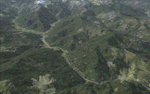
This project adds and updates all of the airports of Bhutan. Bathpalathang (VQBT) and Gelephu (VQGP) are added, Yongphulla (VQ10) is updated and recoded as VQTY, and Paro (VQPR) is fully updated to reflect current satellite imagery. These are all fully functioning AI airports as well. Special attention was given to the entire Paro Valley, and numerous road/river vectors were updated around Gelephu. Accurate coastlines, lakes, road and river data, as well as corrected landclass are provided based on the latest available satellite imagery. They are optimized to fit seamlessly with FTX Vector's roads/water, but they should be fully functional in all FSX configurations.
GA-encoded flight plans for the Buddha Air/Kathmandu charter are provided to enhance service to Paro. NASA SRTM Global 3 arc second terrain mesh is also included for all of Bhutan. Updates were created or rebuilt in a manner which carefully aligned airport data with current satellite imagery, when available. Scenery was created using Airport Design Editor X v1.61.5298, SBuilderX 3.13, and the FSX Object Placement Tool. Scenery objects were added and modified from stock FSX scenery to resemble as closely as possible the actual airports.
| Filename: | Bhutan_Airports_and_Paro_Valley.zip |
| License: | Freeware |
| Added: | 19th January 2015, 06:09:17 |
| Downloads: | 11,448 |
| Author: | Carlyle Sharpe |
| Size: | 21.4 MB |
| Category: Flight Simulator 2004 - Scenery | |
| LIMN Cameri, Italy (UPDATED v2) |
|
Images related to this file:
File Description:
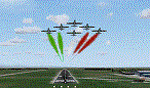
This scenery is a homage to the great military airport of Cameri NO, Italy; it has been revised with complete new ground that solves the previous flickering problems; it is builded-up with ownmade GMax objects and other existing ones; some buildings by GMax, remainder by others and by Generic Building system.
Information: Built during 1910 close to Novara, it became a prestigious Flight School where a lot of pilots of WWI where trained. Later, Gabardini/CANSA entered by promoting and developing aviation activities, mainly establishing a military flight school. On 27th July 1914, first of story's time, a flight from Cameri crossed the Alps (Camery - Viege, over Monte Rosa) with a Gabardini 80HP aircraft and pilot Achille Landini together with Giuseppe Lampugnani passenger. On 1930 the school closed, but the field still remained as aviation workshop. During the WWII the airport was quite destroyed by the german army, during their retreat. After the war, the rebuild operations carried on to Cameri several details, of which the acrobatic patrol of "Lancieri Neri" and, 1967-1999, the great 53th "Stormo Caccia". On 1998 the storm was moved to Gioia del Colle airport and the base was restructured as Comand Airport, where some technical departments still works (the 453th Operative Technical Services Group, the 553th Logistic Operative Services Group and, mainly the 1st Aircrafts Maintenance Dep.nt)
Contents: all around new great terrain for about 4.5 x 3.5 km; static aircraft inside hangar as Tornado, Eurofighter and historic monoliths at admittance and inside airport; ground equipments, cars outside and inside airport, bus, tankers, emergency trucks; military shelters (10) and workshop ones (5); buildings outside/inside airport, control tower, VOR, radar tower and some other navaids; lights at hangars, admittance and all over the boundaries; more then 10 km boundary by walls and fences of the complete areas; thousands trees all over the scenery. This scenery includes the airport scenery content only. You can find separate further sceneries for Babini Army station and Museum
| Filename: | LIMN_Cameri_Italy_UPDATED_v2.zip |
| License: | Freeware |
| Added: | 20th October 2011, 00:20:05 |
| Downloads: | 2,359 |
| Author: | Aldo Della Vedova, Daniele Lanfranchi |
| Size: | 25.08 MB |
| Category: Flight Simulator X - Scenery | |
| Crosswind Runways for California Central Coast Scenery for FSX with CCFSXMSG.ZIP or CCFSXMS.ZIP Installed |
|
Images related to this file:
File Description:
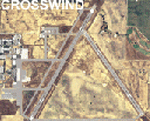
This scenery contains several revised files for my previously uploaded California Central Coast sceneries CCFSXMSG.ZIP and CCFSXMS.ZIP. These are the versions of my CCC scenery for FSX with MegaScenery Earth. The "G" version also requires Genesis Terrain Mesh but is the most complete version. Included here are revised AFCAD files for the major airports in those sceneries which will add interesting crosswind capability to C80, PRB, SBP, SMX and SBA airports. Additionaly, revised AFCAD and associated files for IZA, LPC, L52 and VBG are included. In some cases ground traffic has been added, a few glitches repaired and minor improvements effected. The crosswind AFCAD's for the 5 airports with tangential or crossing runways were revised using the technique developed by Jim Vile and executed by Airport Design Editor (ADEX). This procedure will unavoidably bolix up the ATIS runway advisories at the 3 tower controlled airports with ATIS (SBA, SBP and SMX) but will make all of the runways useable for AI traffic depending on wind conditions. This is not a problem at C80 and PRB since they are uncontrolled fields and have no ATIS available. Therefore, I've included revised AFCADs for SBA, SBP and SMX that do not have crosswind provisions that can be substituted if desired.
| Filename: | Crosswind_Runways_for_California_Central_Coast_Sce.zip |
| License: | Freeware |
| Added: | 7th January 2010, 22:05:25 |
| Downloads: | 514 |
| Author: | Al Wheeler |
| Size: | 194.42 KB |
| Category: Flight Simulator X - AFCAD Files | |
| Herr Mountain Airport (5NJ2), NJ |
|
File Description:
Located 02 miles N of Stanton, New Jersey, Herr Mountain Airport is a private turf strip. No aircraft are based here, so don't expect much except for ample room to land and take off again. There is a residence on the property, but no hangar or storage facilities. The runway is 2800x100 feet so not too hard to arrive and depart from. Approaching Runway 25 can be a slight challenge given that you need to level off your descent to cross over a mountain top before diving in to land. There is no hard surface runway, so you will be landing on terrain - be gentle! It's recommended to have your mesh complexity set as high as possible to get the full effect. The runway is not lit so daytime VFR operations only are allowed at this airport.
Scenery constructed with use of satellite images/streetview/aerial photos - the author has not been there in person.
This scenery is meant to be used in conjunction with MegaScenery Earth New Jersey/Delaware 001. It is not required, but apron use is minimized to allow satellite scenery to show through as much as possible, and objects are placed based on the MSE textures - lack of it may make scenery look out of place.
| Filename: | Herr_Mountain_Airport_5NJ2_NJ.zip |
| License: | Freeware |
| Added: | 1st February 2011, 23:06:28 |
| Downloads: | 187 |
| Author: | Drew Sikora |
| Size: | 422.37 KB |
| Category: Flight Simulator X - AFCAD Files | |
| Thomas Browne Airpark Airport (61NJ), NJ |
|
File Description:
Located 02 miles W of Glassboro, New Jersey, Thomas Browne Airpark Airport is a private turf strip 2000��80 feet. There is no hard-surfaced runway, which means you will be landing on terrain so it is recommended you set your mesh resolution as high as possible. Watch out for trees and buildings alongside and at opposite ends of the runway. Crop fields are planted to the south of the runway and border the runway. You won't crash if you run into them but it certainly won't put you in good favor with the field owners! Take caution to avoid the transmission line towers as they are not lit at night! Neither is the runway, for that matter, so daytime VFR operations only are recommended for this airfield.
Scenery constructed with use of satellite images/streetview/aerial photos - the author has not been there in person.
This scenery is meant to be used in conjunction with MegaScenery Earth New Jersey/Delaware 004. It is not required, but apron use is minimized to allow satellite scenery to show through as much as possible, and objects are placed based on the MSE textures - lack of it may make scenery look out of place.
| Filename: | Thomas_Browne_Airpark_Airport_61NJ_NJ.zip |
| License: | Freeware |
| Added: | 4th February 2011, 02:47:24 |
| Downloads: | 166 |
| Author: | Drew Sikora |
| Size: | 1.41 MB |
| Category: Flight Simulator X - AFCAD Files | |
| Strawberry Fields Airport (89NJ), NJ |
|
File Description:
Located 02 miles N of Mays Landing, New Jersey on 220 acres of land, Strawberry Fields Airport is a private turf/sand strip. SkyVector lists the runway as 2200' long, but as measured during development it is closer to 3000'. In addition to Runways 14 and 32, there is a second runway that is not listed in the airport directory and presumed closed. However if you need it in an emergency the numbers are 03 and 21 (no starts are available for these runways). This airport is not lit and is best used only during daytime VFR conditions. The windsock can be found at the intersection of the two runways and is also not lit. You will be landing on bare terrain so have your mesh complexity slider set as high as possible for best effect.
Scenery constructed with use of satellite images/streetview/aerial photos - the author has not been there in person.
This scenery is meant to be used in conjunction with MegaScenery Earth New Jersey/Delaware 003. It is not required, but apron use is minimized to allow satellite scenery to show through as much as possible, and objects are placed based on the MSE textures - lack of it may make scenery look out of place.
| Filename: | Strawberry_Fields_Airport_89NJ_NJ.zip |
| License: | Freeware |
| Added: | 17th February 2011, 07:55:52 |
| Downloads: | 204 |
| Author: | Drew Sikora |
| Size: | 1.75 MB |
| Category: Flight Simulator X - AFCAD Files | |
| Halka Nurseries Airport (9NJ6), NJ |
|
File Description:
Located 02 miles W of Fairton, New Jersey on 150 acres of land, Halka Nurseries Airport is a private turf strip 2400' in length. The airspace has been analyzed and deemed suitable for aircraft up to a light twin. Take caution on the Runway 18 approach as power lines are strung up along the street opposite the runway. There is no hard surfaced runway so have your terrain mesh set as high as possible to experience bumpy terrain. There is no windsock, so be sure to know your weather before arriving or departing - the winds in this area are predominantly out of the west and this runway is north/south. Trees and bushes are close to some areas of the runway and can pose a danger in high crosswinds. There are no services for transient aircraft.
Scenery constructed with use of satellite images/streetview/aerial photos - the author has not been there in person.
This scenery is meant to be used in conjunction with MegaScenery Earth New Jersey/Delaware 005. It is not required, but apron use is minimized to allow satellite scenery to show through as much as possible, and objects are placed based on the MSE textures - lack of it may make scenery look out of place.
| Filename: | Halka_Nurseries_Airport_9NJ6_NJ.zip |
| License: | Freeware |
| Added: | 6th April 2011, 03:27:56 |
| Downloads: | 207 |
| Author: | Drew Sikora |
| Size: | 829.12 KB |


© 2001-2026 AVSIM Online
All Rights Reserved
Privacy Policy |