
Where Flight Simulation Enthusiasts Gather from Around the World!
AVSIM Library - Search Results

| Category: X-Plane - Scenery | |
| WX15 Susi Air Apowo Airstrip v1.0.0 |

|
Images related to this file:
File Description:
This is an X-Plane 11 scenery for Apowo Airstrip (WX15) in Apowo, Papua, Indonesia.
It is said to be home to the world shortest commercial flight, between Kegata Airstrip (WZ38) and Apowo Airstrip (WX15), duration of 1min and 15sec from take off to landing, and operated by Susi Air. This is one of the destinations for "PT ASI Pujiastuti Aviation", operating as Susi Air, an Indonesia airlines established in late 2004 by Mrs. Susi Pudjiastuti. This scenery was tested and is operational (as of January 07, 2017) in "X-Plane 11 Public Beta #5 64 bit", Windows 10 Home. It was also tested but is NOT operational (as of January 07, 2017) in "X-Plane 10.51 64 bit", Windows 10 Home (terrain mesh issues + exclusion areas from XP11 do not work in XP10 = scenery with quite bad mesh). Sorry, XP11 only.
| Filename: | WX15_Susi_Air_Apowo_Airstrip_v100.zip |
| License: | Freeware |
| Added: | 8th January 2017, 23:37:40 |
| Downloads: | 59 |
| Author: | Rui Mesquita |
| Size: | 1.95 MB |
| Category: Prepar3D V1-4 - Scenery | |
| Bloukrans and Storms River (Paul Sauer) bridges – South Africa |
|
Images related to this file:
File Description:
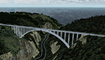
The Bloukrans and Paul Sauer (over the Storms river) bridges are on the N2 highway between Plettenberg Bay and Port Elizabeth on the scenic garden route in the Eastern Cape, South Africa. I made the custom scenery to try some Blender techniques using the P3D 4.5 SDK and tested it in P3D V5 using the ORBX Africa LC and Pilots NG2020 mesh products (I included a fix for the default V5 mesh). You will find the world's highest commercial bungee jump from the Bloukrans bridge, 216m above the river below. Take off from FAPG and fly a heading of 95 degrees for 32 km to get to the Bloukrans bridge (just off the coast). Follow the highway further east for another 26 km to get to the 120m high Paul Sauer bridge, where I included some additional eye candy.
| Filename: | Bloukrans_and_Storms_River_Paul_Sauer_bridges__Sou.zip |
| License: | Freeware |
| Added: | 14th July 2020, 19:15:53 |
| Downloads: | 179 |
| Author: | Johan Pienaar |
| Size: | 26.95 MB |
| Category: Flight Simulator 2004 - Scenery | |
| Quebec sceneries Enhancements Update |
|
File Description:
Enhanced sceneries and mesh update of the province of Quebec, Canada. Must be used with
Scenes_du_Quebec_2k4.zip and qc09_2K4a.zip, qc09_2K4b.zip, qc09_2K4c.zip,
qc09_2K4d.zip files (AVSIM files library).Installation procedure in INSTALLATION_SETUP.txt.
Mise � jour et nouvelles sc�¨nes de la province de Qu�©bec. Pour utiliser cette mise � jour, il faut obligatoirement avoir d�©j� install�© les sc�¨nes du Qu�©bec contenues dans Scenes_du_Quebec_2k4.zip (sur AVSIM). Inclus aussi une mise � jour des �©l�©vations de terrain (mesh - lod09) de la province de Qu�©bec (qc09_2K4a.zip, qc09_2K4b.zip, qc09_2K4c.zip, qc09_2K4d.zip sur AVSIM). L'installation des fichiers est d�©crite dans INSTALLATION_SETUP.txt.
| Filename: | Quebec_sceneries_Enhancements_Update.zip |
| License: | Freeware, limited distribution |
| Added: | 1st November 2009, 06:49:03 |
| Downloads: | 4,759 |
| Author: | Gilles Gauthier |
| Size: | 6.81 MB |
| Category: Orbiter - Spaceships | |
| Saturn V Crawler Rollout version 10.. |
|
File Description:
This is the Saturn V VAB to Launch Centre Crawler version 10 with the NASSP 5.0 Apollo 11 attached...High detail (High Polygon Count)...Not For Low End Computers..The Saturn V Mesh is included because it needed to be rotated 90', but the Module and Textures are not included so the NASSP ver 5.0 must be downloaded and installed first before you install this add-on,it can be found at ( http://spacebarjoe.free.fr/NASSP5.zip ), the mesh names are changed so it will not overwrite.Press CTRL and Minus on the numpad to get rolling, throttle back to maintain a velocity of 1..In Scenario 4 use K to operate the Crane and G to operate the Gangway and Swingarms.Uses Vinka's Spacecraft2.DLL(included)...Needs OrbiterSound 3.0 or higher installed and the latest Orbiter Version and Patch.
| Filename: | Saturn_V_Crawler_Rollout_version_10.zip |
| License: | Freeware |
| Added: | 24th August 2005, 19:11:58 |
| Downloads: | 1,242 |
| Author: | Kev Shanow |
| Size: | 3.63 MB |
| Category: Flight Simulator 2004 - Scenery | |
| New Terrain Mesh of the Province of Quebec in LOD09 (1/4) |
|
File Description:
The files in this package contain terrain mesh files of the province of Quebec (N45 to N53) to be used with my Quebec enhanced sceneries for FS2004 (Scenes_du_Quebec_2k4.zip). The public data sources are the Shuttle Radar Topography Mission (SRTM-3, 90m) and the Canadian Digital Elevation Data (CDED - 0.75s/arc - 23m). (QC09_2k4a.zip to QC09_2k4d.zip - 4 parts)
***********************
Les fichiers de ces archives contiennent les donnees d'elevation de terrain (mesh files - lod09), pour FS2004, du territoire de la province de Quebec sous le 53ieme degre de latitude nord. Ils ont ete crees pour etre utilises avec mes nouvelles scenes du Quebec contenues dans Scenes_du_Quebec_2k4.zip. Les donnees sources sont du domaine public et proviennent de la Shuttle Radar Topography Mission (SRTM-3, 90m) et des donnees numerique d'elevation du Canada (DNEC - 0.75s/arc -23 m). (QC09_2k4a.zip to QC09_2k4d.zip - 4 parties)
| Filename: | New_Terrain_Mesh_of_the_Province_of_Quebec_in_LOD09_14.zip |
| License: | Freeware, limited distribution |
| Added: | 27th January 2010, 18:10:18 |
| Downloads: | 8,915 |
| Author: | Gilles Gauthier |
| Size: | 23.76 MB |
| Category: Flight Simulator 2004 - Scenery | |
| New Terrain Mesh of the Province of Quebec in LOD09 (2/4) |
|
File Description:
The files in this package contain terrain mesh files of the province of Quebec (N45 to N53) to be used with my Quebec enhanced sceneries for FS2004 (Scenes_du_Quebec_2k4.zip). The public data sources are the Shuttle Radar Topography Mission (SRTM-3, 90m) and the Canadian Digital Elevation Data (CDED - 0.75s/arc - 23m). (QC09_2k4a.zip to QC09_2k4d.zip - 4 parts)
***********************
Les fichiers de ces archives contiennent les donnees d'elevation de terrain (mesh files - lod09), pour FS2004, du territoire de la province de Quebec sous le 53ieme degre de latitude nord. Ils ont ete crees pour etre utilises avec mes nouvelles scenes du Quebec contenues dans Scenes_du_Quebec_2k4.zip. Les donnees sources sont du domaine public et proviennent de la Shuttle Radar Topography Mission (SRTM-3, 90m) et des donnees numerique d'elevation du Canada (DNEC - 0.75s/arc -23 m). (QC09_2k4a.zip to QC09_2k4d.zip - 4 parties)
| Filename: | New_Terrain_Mesh_of_the_Province_of_Quebec_in_LOD0.zip |
| License: | Freeware, limited distribution |
| Added: | 1st November 2009, 06:47:09 |
| Downloads: | 4,627 |
| Author: | Gilles Gauthier |
| Size: | 27.78 MB |
| Category: Flight Simulator 2004 - Scenery | |
| New Terrain Mesh of the Province of Quebec in LOD09 (3/4) |
|
File Description:
The files in this package contain terrain mesh files of the province of Quebec (N45 to N53) to be used with my Quebec enhanced sceneries for FS2004 (Scenes_du_Quebec_2k4.zip). The public data sources are the Shuttle Radar Topography Mission (SRTM-3, 90m) and the Canadian Digital Elevation Data (CDED - 0.75s/arc - 23m). (QC09_2k4a.zip to QC09_2k4d.zip - 4 parts)
***********************
Les fichiers de ces archives contiennent les donnees d'elevation de terrain (mesh files - lod09), pour FS2004, du territoire de la province de Quebec sous le 53ieme degre de latitude nord. Ils ont ete crees pour etre utilises avec mes nouvelles scenes du Quebec contenues dans Scenes_du_Quebec_2k4.zip. Les donnees sources sont du domaine public et proviennent de la Shuttle Radar Topography Mission (SRTM-3, 90m) et des donnees numerique d'elevation du Canada (DNEC - 0.75s/arc -23 m). (QC09_2k4a.zip to QC09_2k4d.zip - 4 parties)
| Filename: | New_Terrain_Mesh_of_the_Province_of_Quebec_in_LOD0.zip |
| License: | Freeware, limited distribution |
| Added: | 27th January 2010, 18:15:12 |
| Downloads: | 7,495 |
| Author: | Gilles Gauthier |
| Size: | 29.35 MB |
| Category: Flight Simulator 2004 - Scenery | |
| New Terrain Mesh of the Province of Quebec in LOD09 (4/4) |
|
File Description:
The files in this package contain terrain mesh files of the province of Quebec (N45 to N53) to be used with my Quebec enhanced sceneries for FS2004 (Scenes_du_Quebec_2k4.zip). The public data sources are the Shuttle Radar Topography Mission (SRTM-3, 90m) and the Canadian Digital Elevation Data (CDED - 0.75s/arc - 23m). (QC09_2k4a.zip to QC09_2k4d.zip - 4 parts)
***********************
Les fichiers de ces archives contiennent les donnees d'elevation de terrain (mesh files - lod09), pour FS2004, du territoire de la province de Quebec sous le 53ieme degre de latitude nord. Ils ont ete crees pour etre utilises avec mes nouvelles scenes du Quebec contenues dans Scenes_du_Quebec_2k4.zip. Les donnees sources sont du domaine public et proviennent de la Shuttle Radar Topography Mission (SRTM-3, 90m) et des donnees numerique d'elevation du Canada (DNEC - 0.75s/arc -23 m). (QC09_2k4a.zip to QC09_2k4d.zip - 4 parties)
| Filename: | New_Terrain_Mesh_of_the_Province_of_Quebec_in_LOD0.zip |
| License: | Freeware, limited distribution |
| Added: | 27th January 2010, 18:17:08 |
| Downloads: | 7,854 |
| Author: | Gilles Gauthier |
| Size: | 20.94 MB |
| Category: Flight Simulator 2002 - Flight Plans | |
| Gliding: Swiss Sky Soar |
|
File Description:
"The engine is the heart of an airplane but the pilot is its soul." If that's true than without the engine this experience is about your soul, what many like to call a real sense of flying. Launching the flight will immediately place you behind the controls of your airborne Schleicher ASW28, 7000ft over the city of Thun, Switzerland. With your flightplan loaded on your GPS you got a highway of canyons stretching ahead for 60.9nm to destination. Weather conditions ( wind and thermals) are favourable and will help even the less experienced stay clear of the pretty but dangerous terrain below. Enough push and lift to soar gracefully the Swiss Alps for 40-80 minutes. Enjoy the flight!( Thermal scenery included. Recommended add-on: Schleicher ASW28 By Peter Franke, Roland Stuck, Max Roodveldt, filename:asw28.zip ).
| Filename: | Gliding_Swiss_Sky_Soar.zip |
| License: | Freeware |
| Added: | 19th August 2002, 20:11:53 |
| Downloads: | 1,196 |
| Author: | Fs-Icarus Crew |
| Size: | 23.81 KB |
| Category: Flight Simulator 2004 - Scenery | |
| Tibet Scenery v9.0 |
|
File Description:
Addon scenery for Microsoft Flight Simulators FS2004 both missing airports in Tibet
- ZULS LXA Lhasa Gongkar Airport (other names: Gonggar, Gonga)
- ZUBD BPX Changdu International Airport (other names: Bangda, Bamda, Pomda, Qamdo)
Includes now Potala Palace, seasonal textures and new terminal at Lhasa, corrected river and mesh and 3 detailed flightplans. AFCAD files available later after the release of the new AFCAD program.
By UranusJay - Jan Martin
| Filename: | Tibet_Scenery_v90.zip |
| License: | Freeware |
| Added: | 19th August 2003, 01:09:08 |
| Downloads: | 4,020 |
| Author: | Jan Martin |
| Size: | 863.35 KB |
© 2001-2026 AVSIM Online
All Rights Reserved
Privacy Policy |