
Where Flight Simulation Enthusiasts Gather from Around the World!
AVSIM Library - Search Results

| Category: Flight Simulator 2004 - Flight Plans | |
| Tour de France 2011 |

|
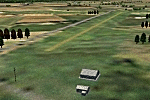
Images related to this file:
File Description:
On 2 July 2011, the Tour de France 2011 starts in Passage du Gois La Barre-de-Monts, France. The 21 VFR flight plans, for the default Cessna 172, follow the stages to a large extent.The stages # 18 and # 19 in the French Alps are a real challenge!
| Filename: | Tour_de_France_2011.zip |
| License: | Freeware |
| Added: | 1st July 2011, 09:32:02 |
| Downloads: | 267 |
| Author: | Nis Verkijk |
| Size: | 1.76 MB |
| Category: Flight Simulator 2004 - Scenery | |
| SE Alberta 3 Arc Second Mesh |
|
File Description:
Zipdive or check the jpg to see the extent of the mesh.
| Filename: | SE_Alberta_3_Arc_Second_Mesh.zip |
| License: | Freeware |
| Added: | 12th January 2004, 04:12:21 |
| Downloads: | 2,392 |
| Author: | Dwayne Matheson |
| Size: | 11.83 MB |
| Category: Flight Simulator 2004 - Scenery | |
| Galatea Aerodrome - NZGA |
|
Images related to this file:
File Description:
Aerodrome 27nm SE of Rotorua. Made for Christian Stock's NZ 20m mesh.
| Filename: | Galatea_Aerodrome__NZGA.zip |
| License: | Freeware |
| Added: | 15th January 2011, 19:08:44 |
| Downloads: | 203 |
| Author: | Godfrey Tier |
| Size: | 448.93 KB |
| Category: Orbiter - Spaceships | |
| Thor Family Patch |
|
File Description:
Patch file to replace corrupted GSAT mesh file in orgiional zip file.
| Filename: | Thor_Family_Patch.zip |
| License: | Freeware |
| Added: | 14th December 2003, 09:28:01 |
| Downloads: | 428 |
| Author: | Gene Kennedy |
| Size: | 392.26 KB |
| Category: Flight Simulator 2002 - Scenery | |
| Vestmannaeyjar, Iceland |
|
File Description:
Vestmannaeyjar, Iceland (Vestmann Islands) Airport (BIVM), Mesh terrain and landclass for Heimaey.
| Filename: | Vestmannaeyjar_Iceland.zip |
| License: | Freeware, limited distribution |
| Added: | 22nd January 2003, 13:45:54 |
| Downloads: | 1,020 |
| Author: | Raimund Rödel and Kjartan Helgason |
| Size: | 3.29 MB |
| Category: Flight Simulator X - Scenery | |
| FHAW Georgetown Ascension Island |
|
File Description:
Presented is a scenery plus mesh of Georgetown Ascension Island. FSX/FS2004.
| Filename: | FHAW_Georgetown_Ascension_Island.zip |
| License: | Freeware |
| Added: | 13th October 2010, 16:46:49 |
| Downloads: | 1,086 |
| Author: | Sergey Stoyanov |
| Size: | 792.91 KB |
| Category: Flight Simulator 2004 - Scenery | |
| strm Mesh for Horn Of Africa Part 1/9 |
|
File Description:
strm Mesh for Ethiopia, Erythrea, Djibouti and Sudan Made by FSDEM 1.1
| Filename: | strm_Mesh_for_Horn_Of_Africa_Part_19.zip |
| License: | Freeware |
| Added: | 11th December 2005, 20:39:15 |
| Downloads: | 3,804 |
| Author: | Marcel "Teutonique" Wislet |
| Size: | 16.79 MB |
| Category: Flight Simulator 2004 - Flight Plans | |
| VFR Tour de France 2005 |
|
File Description:
On 2 July 2005, the 22 days / 3,584 kilometres Tour de France 2005 will start in Fromentine, on the Atlantic coast of France. The 20 VFR flight plans, for the default Cessna 152, follow this tour to a large extent. Safe landings in stages 10 (French Alps) and 14 (Pyrenees)!
| Filename: | VFR_Tour_de_France_2005.zip |
| License: | Freeware |
| Added: | 25th June 2005, 17:22:11 |
| Downloads: | 1,211 |
| Author: | Nis Verkijk |
| Size: | 10.36 KB |
| Category: Flight Simulator X - Missions | |
| Hijack from Santorini |
|
Images related to this file:
File Description:
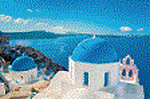
Take off from Santorini on a 737-800. You should land in Greece, Venice and some airports in Alps and finish your travel in Lyon, France.
Be carefull, your aircraft is old and your passengers are strange. An hijack is possible...
Reward at the end. Texts and Speech in French.
| Filename: | Hijack_from_Santorini.zip |
| License: | Freeware |
| Added: | 17th May 2017, 04:37:30 |
| Downloads: | 330 |
| Author: | Raph24 |
| Size: | 12.76 MB |
| Category: Fly! - Scenery | |
| Germany & South Tirole Elevation Map |
|
File Description:
This map covers all of Germany, most of Austria and Switzerland and South Tirole, all the way down to Rimini. The heightfield is based on GTOPO30 datasets and the alps look great with it. You should have the 1.01 optional patch installed which contains an updated heighset for the simulator.
| Filename: | Germany__South_Tirole_Elevation_Map.zip |
| License: | Check within download |
| Added: | 4th February 2003, 01:37:19 |
| Downloads: | 393 |
| Author: | Dennis Murczak |
| Size: | 3.76 MB |
© 2001-2026 AVSIM Online
All Rights Reserved
Privacy Policy |