
Where Flight Simulation Enthusiasts Gather from Around the World!
AVSIM Library - Search Results

| Category: Flight Simulator X - Scenery | |
| LGKO, Kos Airport, Greece |

|
Images related to this file:
File Description:
'Hippocrates' as the airport is often reverred to, is a popular tourist destination. It handles many chatered flights and regular flights.
This is an ADE upgrade of the FSX stock airport that I gave a photoreal background and some detail. My basic mesh is FreeMeshX. Tested only in FSX but may also work in P3D.
| Filename: | LGKO_Kos_Airport_Greece.zip |
| License: | Freeware |
| Added: | 18th June 2017, 20:43:28 |
| Downloads: | 3,827 |
| Author: | Tim van Ringen |
| Size: | 6.4 MB |
| Category: Flight Simulator X - Original Aircraft | |
| McDonnell Douglas DC-10 |
|
Images related to this file:
File Description:

FSX native model, needs FSX ServicePack1 or 2. Uses default panel and sound, no VC. FSX conversion of Erick Cantus beautiful FS9 WIP mesh. Contains six different model and texture versions, including a KC-10 Air Force tanker. PSP repaint resource, panel and VC to be released later.
By Thomas Ruth and Erick Cantu
| Filename: | McDonnell_Douglas_DC10.zip |
| License: | Freeware |
| Added: | 16th October 2011, 19:24:37 |
| Downloads: | 2,514 |
| Author: | Thomas Ruth, Eric Cantu |
| Size: | 38.17 MB |
| Category: Flight Simulator 2002 - Scenery | |
| Alaska Bush Scenery: Coghill Lake |
|
File Description:
Situated off College Fiord at the upper end of Prince William Sound, Coghill Lake is conveniently positioned for stopping off en-route between the Anchorage & Valdez areas. It's the actual location of a holiday cabin owned by the US Forest Service which can only be reached by floatplane, however I've added 2 airstrips to the area for extra interest. Coghill's main landing strip is sandy & partially overgrown, but has a good available length of 635m/2100' and some low-intensity edge lights. Ample parking for visitors is provided in a separate ramp area amongst the trees, reached via a basic but lit & signposted taxiway. Adjacent access by floatplane is possible using the small lagoon, as well as by College Fiord itself for larger loads. The other strip, a mile southwest across the river, only gets seasonal use by agricultural aircraft for spraying the local conifer plantations; its narrow gravel runway is slightly shorter at 588m/1930' & is a more challenging proposition with the surrounding trees and heavy brush all encroaching on the landing strip. Includes 2 versions: 1 for Eddie Denney's FS2002 mesh (recommended as this makes the airstrip profiles uneven), and another for both Eddie Denney's FS2000 mesh and the default mesh.
| Filename: | Alaska_Bush_Scenery_Coghill_Lake.zip |
| License: | Freeware, limited distribution |
| Added: | 28th May 2003, 19:07:22 |
| Downloads: | 1,933 |
| Author: | James Belk |
| Size: | 2.98 MB |
| Category: Flight Simulator 2004 - Scenery Design | |
| Kijik Lake_version2 |
|
File Description:
Version 2_contains the updated AFCAD2 BGL.
Kijik Lake, Alaska is located within the boundaries of the 4 million acre Lake Clark National Park and Preserve. It is 6nm north of Port Alsworth (TPO) on the NW side of Lake Clark. Two new cabins and homey wall tents are provided for hunters, fishermen, campers, hikers and explorers who wish to submerge themselves in the best of Alaska's wilderness scenery. This roadless and trailless wilderness is accessed by air service only. Kijik Lake has a new floatplane dock and a very landable dirt/gravel shoreline airstrip. Plan your next flight to Kijik Lake where you'll find a warm fire, a great meal and unsurpassed hospitality.
Created for FS9's default mesh, but works equally well with Eddie Denney's Alaska 2000 or 2002 mesh.
| Filename: | Kijik_Lake_version2.zip |
| License: | Freeware, limited distribution |
| Added: | 21st March 2004, 22:50:27 |
| Downloads: | 639 |
| Author: | Brent Hricziscse |
| Size: | 1.85 MB |
| Category: Flight Simulator X - AFCAD Files | |
| KSVC Grant County Airport - Silver City, New Mexico |
|
File Description:
This scenery updates KSVC Grant County airport located near Silver City, New Mexico. The apron was enlarged, cargo and small airline parking spots were added, apron access taxiways were added, a terminal building, two hangars, water tank, and fire watch tower were added, the airport access road was added, and the approach VASI lights were changed to PAPI lights. An optional landclass file is also included to depict the mining operation to the east of the airport. The scenery was designed with ORBX FTX Global Vector and Pilot's Global Ultimate terrain mesh installed, but it should work OK with the default vector scenery and mesh. This scenery was created using the awesome scenery tool Airport Design Editor by Scruffyduck Software. Please refer to the readme file for more details and installation instructions.
| Filename: | KSVC_Grant_County_Airport__Silver_City_New_Mexico.zip |
| License: | Freeware |
| Added: | 4th February 2017, 18:05:29 |
| Downloads: | 337 |
| Author: | David Midgett |
| Size: | 2.74 MB |
| Category: Flight Simulator 2004 - Scenery | |
| Altitude adjustment for Dawson City CYDA |
|
Images related to this file:
File Description:
I discovered that the Northern Canada Terrain Mesh that I installed a while back was dumping part of my Dawson City Airport CYDA into a deep hole. I tried making a flatten to reduce the height of the terrain mesh land but that did not look at all realistic. So, the solution is to raise CYDA to 1,457 feet above sea level instead of the correct (correct according to the Nav Canada Supplement) level of 1,215 feet so that it melts into the surrounding terrain. There are still some rocky faces but at least they are not in the airfield. Do you need it? Not if your version looks ok. If it doesn't look ok then try this, but save your current version so you can go back to it if you need to.
| Filename: | Altitude_adjustment_for_Dawson_City_CYDA.zip |
| License: | Freeware, limited distribution |
| Added: | 23rd July 2019, 17:24:26 |
| Downloads: | 104 |
| Author: | Roger Wensley |
| Size: | 855.58 KB |
| Category: Flight Simulator X - Scenery | |
| Yeu island - LFEY |
|
Images related to this file:
File Description:
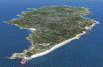
The island of Yeu (LFEY) is located in the west of France, in the south-west of Nantes. Its main runway is located on the wild coast, near the great lighthouse.
It is made up of :
- A new mesh based ASTER compiled in LOD11 and a very local mesh for the airport, compiled in LOD13 to get a good compatibility with the specific payware meshes.
- Photorealistic texture at 0.5 m/pixel based on aerial photography.
- The airfield and runway. The runway is flat, allowing to preserve the AI traffic. The grass strip is modeled with its relief. There is therefore no AI traffic on the grass strip.
- The port of Port-Joinville and several notable buildings made with Gmax (churches, chapel, castle, fort, ruins, beacons, etc)
- Generic or custom objects created with Gmax (boats, buildings).
| Filename: | Yeu_island__LFEY.zip |
| License: | Freeware |
| Added: | 29th December 2012, 04:03:47 |
| Downloads: | 1,719 |
| Author: | marc guitteny |
| Size: | 217.78 MB |
| Category: Prepar3D V1-4 - AFCAD Files | |
| FNDA Aeroporto of N'dalatando (Comandante Ngueto) - Angola |
|
Images related to this file:
File Description:
N'dalatando Airport (IATA: NDF) is an airport serving the city of N'dalatando, in Cuanza Norte Province, Angola. The runway is 6 kilometres (3.7 mi) east of the city.
The airport was capable of receiving medium-sized aircraft, such as Fokker 50s and Embraer 120s, 135s and 145s.
Optimized for ETM12m Africa - Enhanced Terrain Mesh 12m for ANGOLA vol.04.
| Filename: | FNDA_Aeroporto_of_Ndalatando_Comandante_Ngueto__An.zip |
| License: | Freeware |
| Added: | 18th September 2019, 02:31:55 |
| Downloads: | 254 |
| Author: | Giovanni Miduri |
| Size: | 4.15 MB |
| Category: Flight Simulator X - Scenery | |
| CYBA Banff V1.1 |
|
File Description:
CYBA Banff Airport Relocated to correct position and made runway to slope with terrain. Used default object libraries and Canada19 terrain mesh but this will work without it. Version 1.1 adds Banff townsite, removes trees from ends of runways, and fixes missing section of trans-canada highway. Screen shots have been removed to reduce download size
| Filename: | CYBA_Banff_V11.zip |
| License: | Freeware |
| Added: | 21st June 2010, 10:56:52 |
| Downloads: | 1,486 |
| Author: | Rick Lackey |
| Size: | 3.83 KB |
| Category: Flight Simulator 2002 - Scenery | |
| LightWeight Mesh Terrain for Europe and the Mediterranean (Part 3 of 4) |
|
File Description:
Framerate and download friendly mesh that covers all of the British Isles with the exception of the Shetlands, the northern tip of France, most of Belgium, all of the Netherlands, Denmark, Estonia, Latvia and Lithuania and parts of Norway, Sweden, Poland, the Czech Republic, Slovakia, Belarus and Russia (including Moscow). It is bounded by W20-E20-N60-N50.
| Filename: | LightWeight_Mesh_Terrain_for_Europe_and_the_Medite.zip |
| License: | Freeware |
| Added: | 25th July 2002, 16:25:27 |
| Downloads: | 10,631 |
| Author: | Svante Wendel |
| Size: | 13.17 MB |


© 2001-2026 AVSIM Online
All Rights Reserved
Privacy Policy |