
Where Flight Simulation Enthusiasts Gather from Around the World!
AVSIM Library - Search Results

| Category: Flight Simulator X - Scenery | |
| Kabel Car Complex - Cape Town South Africa |

|
File Description:
Kabel Car Complex for FSX,not the real thing just that i saw in Google.
For this scenery to work right you got to have a mesh installed,you can use the Aeroworx one from her at avsim or the NMG Trading one both will work.
| Filename: | Kabel_Car_Complex__Cape_Town_South_Africa.zip |
| License: | Freeware |
| Added: | 6th October 2008, 20:57:08 |
| Downloads: | 1,354 |
| Author: | Frits Beyer |
| Size: | 379.86 KB |
| Category: Flight Simulator 2004 - Scenery | |
| MMJA V2 |
|
File Description:
This scenery include much elements, and is very good in comparison of Default scenery.
-Correction of Runway.
-Grass in the area
-All taxiways & Gates
-50 trees 2D (two views), to have minimal impact on FS.
-Buildings outside the airport
-You can make spotting realistic, with cyclone mesh
| Filename: | MMJA_V2.zip |
| License: | Freeware |
| Added: | 30th May 2012, 23:08:18 |
| Downloads: | 690 |
| Author: | Luis Eduardo Gutierrez |
| Size: | 2.54 MB |
| Category: Flight Simulator 2004 - Scenery | |
| Armenia And Surrounding Area |
|
File Description:
Discover Armenia! This mesh includes the whole territory of Armenia, and also small parts at the borders, Georgia and Aserbaidschan. Also included is Büyük Agri, a 5197 meters high mountain in Turkey to the border to Armenia. SRTM 3 arc-second, resampled to LOD9 (76 meters).
| Filename: | Armenia_And_Surrounding_Area.zip |
| License: | Freeware |
| Added: | 13th April 2004, 03:18:39 |
| Downloads: | 4,682 |
| Author: | Michael Speck |
| Size: | 6.6 MB |
| Category: Flight Simulator X - Scenery | |
| Updated EGGP Liverpool |
|
File Description:
Updated EGGP - Liverpool Airport for FSX. Blended to fit Horizon GenX Scenery and Mesh, removing cliff and valley effect. This update fixes a problem with aircraft travelling to / from General Parking using section of runway instead of remaining on taxiway 'A' Original file was EGGP Liverpool.zip
| Filename: | Updated_EGGP_Liverpool.zip |
| License: | Freeware, limited distribution |
| Added: | 20th October 2007, 23:12:42 |
| Downloads: | 3,079 |
| Author: | Tony Meredith |
| Size: | 558.08 KB |
| Category: Flight Simulator 2004 - AFCAD Files | |
| Gerald's Bottom AFCAD/Montserrat SRTM |
|
File Description:
Montserrat has opened a brand new airport at Gerald's Bottom (MNI\TRPM), the newest airport in the Caribbean and a replacement for the destroyed Bramble airport. To commemorate its opening, here is an AFCAD file along with LOD9 Mesh data of the island for your flying enjoyment.
| Filename: | Geralds_Bottom_AFCADMontserrat_SRTM.zip |
| License: | Freeware |
| Added: | 11th July 2005, 07:40:54 |
| Downloads: | 975 |
| Author: | John Holden |
| Size: | 678.65 KB |
| Category: Flight Simulator X - Scenery | |
| Western Sahara VFR - Terrain Mesh SRTM 1 Arc/Sec version 3 |
|
Images related to this file:
File Description:
Enhanced Terrain Mesh from data source NASA SRTM 1 Arc/Sec (30 meters) version 3 at LOD 11 (19mt meters/pixel). Coverage: Lat 28 to Lat 20. Re-design coastline of the Western Sahara and replaced Dakhla Airport (GMMH). Fully compatible also with P3D.
| Filename: | Western_Sahara_VFR__Terrain_Mesh_SRTM_1_ArcSec_ver.zip |
| License: | Freeware |
| Added: | 27th April 2015, 12:58:28 |
| Downloads: | 926 |
| Author: | Giovanni Miduri |
| Size: | 373.13 MB |
| Category: Flight Simulator 2004 - Scenery | |
| Guadalupe Mountains National Park (Version 2) SRTM30_1ArcSec Terrain Mesh |
|
File Description:
This 38m terrain mesh is centered in the 'Panhandle' region of Western Texas.
Coverage area: From West 104.5° to West 105° and North 31.7° to North 32.2°.
It includes Guadalupe Mountains National Park and the surrounding mountains
of Lincoln National Forest. Version 2 replaces my former release of 'Guadalupe_Mountains_SRTM30.zip' which covered a too large area and had some scenery anomalies (craters). The new version now fixes these errors.
| Filename: | Guadalupe_Mountains_National_Park_Version_2_SRTM30.zip |
| License: | Freeware, limited distribution |
| Added: | 28th December 2003, 18:33:52 |
| Downloads: | 2,062 |
| Author: | Andreas Trawny |
| Size: | 1.27 MB |
| Category: Flight Simulator X - Scenery | |
| California Central Coast with Megascenery Earth and FSGenesis Mesh |
|
Images related to this file:
File Description:
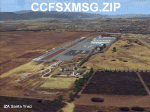
California Central Coast Scenery for FSX with Megascenery Earth and FSGenesis mesh. CCFSXMSG.ZIP covers the California coastal region from N36° 10' (Coalinga) to N34° 25' (Santa Barbara) and from the coast East to W119° 40'. It is a version of my previously created California Central Coast scenery redesigned and expanded to work with FSX MegaScenery Earth and FSGenesis USA Terrain Mesh for FSX V2 by Justin Tyme. Airstrips in the area covered by this scenery have been added for a total of 27 airports and airstrips. 6 imaginary water runways are also added for AI float plane traffic. Several other areas of interest such as the Santa Barbara marina, Morro Bay, etc. are included for a total of 41 points of interest. All airports, airstrips and related structures have been adjusted and realigned to conform to actual positions and dimensions as indicated by the MegaScenery Earth satellite textures. Megascenery Earth California-13, -14 and -15 are required and -12, -28 and -29 are recommended. By Al Wheeler 9/25/09.
| Filename: | California_Central_Coast_with_Megascenery_Earth_an.zip |
| License: | Freeware |
| Added: | 7th January 2010, 19:54:57 |
| Downloads: | 870 |
| Author: | Al Wheeler |
| Size: | 8.13 MB |
| Category: Flight Simulator 2004 - Scenery | |
| Backcountry USFS fields for 19m terrain mesh in Idaho |
|
Images related to this file:
File Description:
These backcountry airfields are for use with the FSGenesis 19m mesh of Idaho; they almost certainly do not work without it. I also have Ultimate Terrain installed, with the settings as noted. The 15 airfields included here are almost all United States Forestry Service fields: 1U1 Moose Creek, 2ID7 Cayuse Creek, 2U5 Shearer, 3U1 Warren, 12ID Flying B Ranch, 24K Krassel, 75c Orogrande, I08 Cabin Creek, ID67 Lower Loon Creek, ID76 Wilson Bar, S81 Indian Creek, S92 Fish Lake, U54 Bernard, U79 Chamberlain, U81 Cold Meadows. There is also a 85U bgl included to remove the remnants of Soldier Bar which is impossible to make into a scenery with the terrain mesh, and spoiled the surroundings if left untouched and intact. The screenshots are typical examples giving a good impression of the terrain.
| Filename: | Backcountry_USFS_fields_for_19m_terrain_mesh_in_Id.zip |
| License: | Freeware, limited distribution |
| Added: | 22nd July 2019, 16:38:48 |
| Downloads: | 100 |
| Author: | Roger Wensley |
| Size: | 22.2 MB |
| Category: Flight Simulator X - Scenery | |
| Whale Island (Hi Resolution Photo and mesh), New Zealand |
|
Images related to this file:
File Description:
Whale Island (Maori Name: Moutohora) is a small island located off the Bay of Plenty coast of New Zealand's North Island. It is located about 12 kilometers north of the town of Whakatane. A whaling station existed on the island during the 19th century. The 1.43 km island is a remnant of a complex volcano which has eroded, leaving two peaks. This is still an area of volcanic activity and there are hot springs on the island in Sulphur Valley, McEwans Bay, and Sulphur Bay.
This Hi Resolution scenery was created from a 0.25m pixel resolution Ortho-rectified Aerial mosaic owned by Environment Bay of Plenty (The Bay of Plenty Regional Council) and flown in 2007. The imagery has been slightly de-sampled for use in Flight Simulator X and utilizes the a custom hi resolution 5m Mesh derived from photogrammetry data off the photos. The textures are intended for summer daylight flying only, although due to the evergreen nature of New Zealand's native bush, the Islands appearance remains relatively constant throughout the year.
The island contains a small helicopter pad which is used for checking the various radio antennas on the Island. There is also a small Department of Conservation hut near the south western tip of the Island. These objects have been added from the FSX library of objects. Make sure to turn up your graphics sliders to make the most of this data! To find the Island fly north from Whakatane airport.
| Filename: | Whale_Island_Hi_Resolution_Photo_and_mesh_New_Zeal.zip |
| License: | Freeware, limited distribution |
| Added: | 20th January 2010, 10:12:14 |
| Downloads: | 4,650 |
| Author: | Tim Barnes |
| Size: | 9.94 MB |


© 2001-2026 AVSIM Online
All Rights Reserved
Privacy Policy |