
Where Flight Simulation Enthusiasts Gather from Around the World!
AVSIM Library - Search Results

| Category: Flight Simulator 2002 - Scenery | |
| Lillooet-Thompson Region, Southwestern B.C., Canada Mesh |

|
File Description:
New high-resolution (76-m) terrain mesh of 30,000 square km of southwestern British Columbia, covering a 4-degree longitude by 1-degree latitude transect from the mainland coast to Kamloops (N50-51, W120-124). This is probably one of the more spectacular regions of B.C. to represent in such vivid detail. Visit the Fraser and Stein River canyons, Princess Louisa Inlet, and the glacial lakes in the Pemberton area. Made from 50-m digital elevation data, resampled to LOD9 (76-m) horizontal spacing. Designed as an add-on to my LOD7 mesh of the entire province but can be used independently. By Holger Sandmann.
| Filename: | LillooetThompson_Region_Southwestern_BC_Canada_Mes.zip |
| License: | Freeware, limited distribution |
| Added: | 19th January 2003, 23:07:36 |
| Downloads: | 4,462 |
| Author: | Holger Sandmann |
| Size: | 5.35 MB |
| Category: Flight Simulator 2002 - Scenery Design | |
| Mesh Terrain Collection of VisionReal (Part 3) |
|
File Description:
Collection of realistic Mesh Terrain for scenery of VisionReal developer Group.
Include:
El Calafate y alrededores,
Comodoro Rivadavia y alrededores,
Bahía Blanca (Sierra de la Ventana),
Balcarce, Tandil y Mar del Plata,
Mendoza y Santiago de Chile,
San Martín de los Andes, Chapelco y Bariloche,
Cordoba y alrededores,
Salta y Jujuy,
Islas Malvinas (Homenaje)
This is Part 3 (Mendoza y Santiago de Chile, with Aconcagua Mountain)
This Mesh Terrain scenery are designed for MICROSOFT FLIGHT SIMULATOR 2002; tested on FLIGHT SIMULATOR 2002
Version Beta 0.7.
| Filename: | Mesh_Terrain_Collection_of_VisionReal_Part_3.zip |
| License: | Freeware, limited distribution |
| Added: | 28th June 2003, 20:09:25 |
| Downloads: | 815 |
| Author: | VisionReal |
| Size: | 7.19 MB |
| Category: Flight Simulator 2004 - Scenery | |
| Update - Terrain Mesh for Canada's Maritime Provinces |
|
File Description:
This package contains two files updating river and lake elevation for FS2002 and FS2004 in LOD09 terrain mesh (in Maritimes09a.zip and Maritimes09b.zip) for Canada's Maritime Provinces (including also Newfoundland, parts of Labrador and Saint-Pierre-et-Miquelon).
| Filename: | Update__Terrain_Mesh_for_Canadas_Maritime_Province.zip |
| License: | Freeware, limited distribution |
| Added: | 1st September 2003, 01:52:28 |
| Downloads: | 4,244 |
| Author: | Gilles Gauthier |
| Size: | 12.86 KB |
| Category: Flight Simulator X - Scenery | |
| Mesh for Northern Africa, Base Grid 0502 |
|
Images related to this file:
File Description:
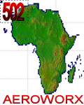
Highly detailed 76m SRTM mesh for Africa using the latest release of STRM Data V2.1. This file covers the Africa Area of base file 0502 (N23 and W00), North of the Equator, DO NOT DISABLE THE DEFAULT DEM 0502 FILE.
| Filename: | Mesh_for_Northern_Africa_Base_Grid_0502.zip |
| License: | Freeware |
| Added: | 12th January 2014, 08:43:02 |
| Downloads: | 2,499 |
| Author: | Martin du Preez, Hannes Steyn, Aeroworx |
| Size: | 138.53 MB |
| Category: Flight Simulator 2004 - Scenery | |
| Peninsular Malaysia Mesh Terrain: AREA 1/6 |
|
File Description:
Scenery based on SRTM-30 digital elevation model (DEM). Interpolation process done using Blackart and MicroDEM, all scenery files compiled at LOD9. Airport Coverage: Butterworth, Langkawi, Penang, Sultan Abdul Halim, Taiping, Hat Yai, Pattani, Songkhla, Trang
& Yala.
| Filename: | Peninsular_Malaysia_Mesh_Terrain_AREA_16.zip |
| License: | Freeware |
| Added: | 17th July 2005, 17:07:23 |
| Downloads: | 3,608 |
| Author: | Mohammad Omar |
| Size: | 4.63 MB |
| Category: Flight Simulator 2004 - Scenery | |
| Peninsular Malaysia Mesh Terrain: AREA 2/6 |
|
File Description:
Scenery based on SRTM-30 digital elevation model (DEM). Interpolation process done using Blackart and MicroDEM, all scenery files compiled at LOD9. Airport Coverage: Sultan Azlan Shah.
| Filename: | Peninsular_Malaysia_Mesh_Terrain_AREA_26.zip |
| License: | Freeware |
| Added: | 17th July 2005, 17:26:00 |
| Downloads: | 2,570 |
| Author: | Mohammad Omar |
| Size: | 4.11 MB |
| Category: Flight Simulator X - Scenery | |
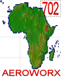
| Mesh for Northern Africa, Base Grid 0702 |
|
Images related to this file:
File Description: Highly detailed 76m SRTM mesh for Africa using the latest release of STRM
Data V2.1. This file covers the Africa Area of base file 0702 (N23 and E30),
North of the Equator, Arabia is not included, DO NOT DISABLE THE DEFAULT DEM
702 FILE.
| Filename: | Mesh_for_Northern_Africa_Base_Grid_0702.zip |
| License: | Freeware |
| Added: | 11th January 2014, 05:27:05 |
| Downloads: | 1,547 |
| Author: | Martin du Preez, Hannes Steyn, Aeroworx |
| Size: | 33.93 MB |
| Category: Flight Simulator 2004 - Scenery | |
| Hells Canyon, Oregon / Idaho SRTM30_1ArcSec Terrain Mesh |
|
File Description:
This 38m terrain mesh is centered in Hells Canyon of the Snake River
between Oregon and Idaho. Coverage area: From West 116.2° to West 117.1°
and North 45.0° to North 46.5°. It includes the City of Lewiston,
Hells Canyon National Recreation Area with Snake and Imnaha River,
Salmon River and the Seven Devils mountain peaks.
| Filename: | Hells_Canyon_Oregon__Idaho_SRTM30_1ArcSec_Terrain_.zip |
| License: | Freeware, limited distribution |
| Added: | 29th December 2003, 16:58:59 |
| Downloads: | 3,026 |
| Author: | Andreas Trawny |
| Size: | 6.16 MB |
| Category: Flight Simulator 2004 - Scenery | |
| OryxSim Khasab / Northern Oman SRTM Mesh -FIX- |
|
Images related to this file:
File Description:

This fix removes the steep hill north of the airport when using the OryxSim Khasab scenery in combination with the Northern Oman SRTM mesh by Yohann Baptiste. This fix is not recommended for users using the default scenery. This file requires version 2.0 of OryxSim Khasab.
| Filename: | OryxSim_Khasab__Northern_Oman_SRTM_Mesh__FIX.zip |
| License: | Freeware |
| Added: | 15th February 2010, 10:47:45 |
| Downloads: | 1,648 |
| Author: | OryxSim |
| Size: | 1.42 KB |
| Category: Flight Simulator X - Scenery | |
| Mesh for Southern Africa, Base Grid 0705 |
|
Images related to this file:
File Description:
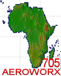
Highly detailed 76m SRTM mesh for Africa using the latest release of STRM Data V2.1. This file covers the Africa Area of base file 0705 (S23 and E30), South of the Equator, Madagascar included. DO NOT DISABLE THE DEFAULT DEM 705 FILE.
| Filename: | Mesh_for_Southern_Africa_Base_Grid_0705.zip |
| License: | Freeware |
| Added: | 13th January 2014, 12:51:14 |
| Downloads: | 2,621 |
| Author: | Martin du Preez, Hannes Steyn, Aeroworx |
| Size: | 43.04 MB |


© 2001-2026 AVSIM Online
All Rights Reserved
Privacy Policy |