
Where Flight Simulation Enthusiasts Gather from Around the World!
AVSIM Library - Search Results

| Category: Flight Simulator 2004 - Scenery | |
| Atlas Mountains, Morocco 76m SRTM Terrain Mesh |

|
File Description:
USGS SRTM 3 arc-second, resampled to LOD9 (76 meters). This is a terrain mesh scenery of the Atlas Mountains in Morocco, Africa. It includes the High Atlas, the cities of Agadir & Marrakech and northwestern parts of the Sahara Desert.
| Filename: | Atlas_Mountains_Morocco_76m_SRTM_Terrain_Mesh.zip |
| License: | Freeware |
| Added: | 4th April 2004, 19:46:58 |
| Downloads: | 15,261 |
| Author: | Andreas Trawny |
| Size: | 15.95 MB |
| Category: Flight Simulator 2004 - Scenery | |
| Cape Farvel, Greenland 76m SRTM Terrain Mesh |
|
File Description:
USGS SRTM 3 arc-second, resampled to LOD9 (76 meters). This is a terrain mesh scenery of Cape Farvel in southern Greenland. Coverage area: From West 45.6° to West 42.8° and North 59.6° to North 60.4°. (Cape Farvel is the only part of Greenland available as SRTM elevation model)
| Filename: | Cape_Farvel_Greenland_76m_SRTM_Terrain_Mesh.zip |
| License: | Freeware, limited distribution |
| Added: | 17th April 2004, 23:35:14 |
| Downloads: | 4,184 |
| Author: | Andreas Trawny |
| Size: | 1.55 MB |
| Category: Flight Simulator 2004 - Scenery | |
| Railroad "Under" textures for Ultimate Terrain v1.2 |
|
File Description:
The textures are for UT Canada/Alaska 1.2. These textures will greatly reduce the width of the underlay of Ultimate Terrain enhanced railroad tracks which I feel are too wide. Be aware that these changes will also affect the look of the divided Highways.
| Filename: | Railroad_Under_textures_for_Ultimate_Terrain_v12.zip |
| License: | Freeware |
| Added: | 15th December 2005, 04:10:26 |
| Downloads: | 1,794 |
| Author: | Jim Kanold - Flight Ontario |
| Size: | 50.66 KB |
| Category: Flight Simulator X - Scenery | |
| Nunavik project for Ultimate Terrain X Canada |
|
Images related to this file:
File Description:
Scenery files for 16 « forgotten » towns located in the northen part of Quebec, the Nunavik. Must have Ultimate Terrain X Canada installed. Airports modified to permit helicopter traffic and Air Inuit and First Air flights. More info in the *.rtf files.
| Filename: | Nunavik_project_for_Ultimate_Terrain_X_Canada.zip |
| License: | Freeware |
| Added: | 6th November 2009, 23:52:24 |
| Downloads: | 873 |
| Author: | Pierre Fauteux |
| Size: | 6.24 MB |
| Category: Civil Flight Simulators - Looking Glass Flight Unlimited 3 | |
| FU3 Outer Terrain GTL Tile Editor v2.0 |
|
Images related to this file:
File Description:
This spreadsheet allows you to view, edit and save changes to the outer terrain's GTL tiles. Tiles are loaded into a 256x256 grid and the 13 default terrain textures are represented by cell background colours, i.e. the Mesa texture is represented by a reddish-brown background colour. The controls for loading and saving tiles are deliberately located on a separate worksheet. When loading and saving tiles I recommend that you do NOT select the main FU3 GTL Editor worksheet until a message box informs you that the load/save has finished. Otherwise, load/saves times (approx. 30 seconds for an average tile) will increase dramatically if you watch the tile while it is being populated or saved.
This 2.0 version also allows you to load a tile's terrain elevation. This is useful because the rules-based approach to modifying the OT was based on altitude constraints and it helps to be able to view the elevation (on the same scale as the tile itself) when modifying the terrain. However, in order to load the elevation you must first load the corresponding GTL tile. There is no provision to modify or save the elevation, because we already have Andre's excellent tools for that.
A complete map of the outer terrain's 2296 GTL files (plus Andre's 164 tile extension to the north) is provided in a separate worksheet. This includes a search facility you can use to identify tiles based on FU3 world co-ordinates.
| Filename: | FU3_Outer_Terrain_GTL_Tile_Editor_v20.zip |
| License: | Freeware |
| Added: | 26th December 2009, 02:11:13 |
| Downloads: | 49 |
| Author: | Jonathan Stonehouse |
| Size: | 103.36 KB |
| Category: Civil Flight Simulators - Looking Glass Flight Unlimited 3 | |
| Outer Terrain GTL Grid Structure Map v2.0 |
|
Images related to this file:
File Description:
This version of my GTL grid structure map includes Andre's new outer terrain area north of Seattle and adds a search facility, which enables you to search for a tile using FU3 world co-ordinates. To find out the world co-ordinates of any OT area simply open Fled, set the top-down view to the latitude/longitude of the area you're interested in and click the latitude/longitude figures that appear in the bottom left hand corner of the screen. The latitude/longitude figures will disappear and be replaced by FU3 world co-ordinates as easting and northing values. Enter these values into my FU3 GTL Map, click the button and the spreadsheet will map these co-ordinates to the correct tile and return the tile name. If you don't know the latitude/longitude of the area you're interested in then you can always obtain this from within the game itself. Just start a flight in the area you're interested in and press Ctrl-z at any time to enter Zoar mode. This will pause the game and display the current latitude/longitude in the top left hand corner of the screen.
| Filename: | Outer_Terrain_GTL_Grid_Structure_Map_v20.zip |
| License: | Freeware |
| Added: | 29th December 2009, 23:16:52 |
| Downloads: | 35 |
| Author: | Jonathan Stonehouse |
| Size: | 198.97 KB |
| Category: Flight Simulator 2004 - Scenery | |
| Phoenix, Arizona 30 Meter Terrain Mesh Scenery |
|
File Description:
Mesh Scenery for Microsoft Flight Simulator 2004 and 2002.USGS NED 30 meter (1 arc-second), resampled to LOD10 (38.2 meters). This terrain mesh is centered at Phoenix, Arizona. Coverage area: From about West 111° to West 113° and North 33° to North 34°.
| Filename: | Phoenix_Arizona_30_Meter_Terrain_Mesh_Scenery.zip |
| License: | Freeware |
| Added: | 3rd January 2004, 19:53:36 |
| Downloads: | 3,719 |
| Author: | Phil Cruikshank |
| Size: | 4.66 MB |
| Category: Flight Simulator 2004 - Scenery | |
| Guadalupe Mountains National Park SRTM30_1ArcSec Terrain Mesh |
|
File Description:
USGS SRTM30 1 arc-second, resampled to LOD10 (38.2 meters).
This terrain mesh is centered in western Texas panhandle.
Coverage area: From West 104° to West 106° and North 31° to North 32°.
It includes Guadalupe Mountains National Park and its surrounding areas.
| Filename: | Guadalupe_Mountains_National_Park_SRTM30_1ArcSec_T.zip |
| License: | Freeware, limited distribution |
| Added: | 27th December 2003, 19:07:04 |
| Downloads: | 1,295 |
| Author: | Andreas Trawny |
| Size: | 7 MB |
| Category: Flight Simulator 2004 - Scenery | |
| Grand Canyon National Park NED Terrain Mesh |
|
File Description:
This mesh covers one of the most defining landscapes in the United States, The Grand Canyon.
Produced using NED 1arcsec/30m source data.
| Filename: | Grand_Canyon_National_Park_NED_Terrain_Mesh.zip |
| License: | Freeware, limited distribution |
| Added: | 8th May 2004, 18:09:02 |
| Downloads: | 9,749 |
| Author: | Tom Finley |
| Size: | 13.54 MB |
| Category: Flight Simulator 2004 - Scenery | |
| Vancouver Default Object Corrections for Ultimate Terrain |
|
Images related to this file:
File Description:
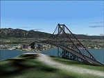
The default shorelines that come with Microsoft Flight Simulator 2004 are inaccurately placed. Consequently roads and other features are misplaced. Ultimate Terrain (R) from Flight One Software corrects this, however the Microsoft default objects are then misplaced. This software corrects the Lions Gate Bridge, Canada Place, Harbour Centre, Burrard Bridge, Science World and BC Place Stadium. Further it excludes a number of generic MS buildings that are now placed in False Creek. For developers, the XML code is included. Users may delete this file. Ultimate Terrain required. By Jon Patch
| Filename: | Vancouver_Default_Object_Corrections_for_Ultimate_.zip |
| License: | Check within download |
| Added: | 5th May 2010, 21:43:07 |
| Downloads: | 3,518 |
| Author: | Jon Patch |
| Size: | 288.76 KB |


© 2001-2026 AVSIM Online
All Rights Reserved
Privacy Policy |