
Where Flight Simulation Enthusiasts Gather from Around the World!
AVSIM Library - Search Results

| Category: Flight Simulator 2002 - Scenery Design | |
| Jetway Macros In GMAX |

|
File Description:
GMAX jetways in the three standard colours found at most airports around the US and the world. These macros are in api format for use by scenery designers (and any other). These jetways are designed to be used with the default scenery to make your default airports a bit more "As Real As It Gets", and require the the freeware program, 'Airport for Windows'. These macros and textures are designed to be as frame rate friendly as possible. Have fun! Requires Airport for Windows 2.60 Build 156. Can be found at www.airportforwindows.com.
| Filename: | Jetway_Macros_In_GMAX.zip |
| License: | Freeware, limited distribution |
| Added: | 18th October 2002, 18:50:09 |
| Downloads: | 2,915 |
| Author: | Shehryar Ansari |
| Size: | 1.54 MB |
| Category: Flight Simulator 2002 - AFCAD Files | |
| Cayman Islands MWCB, MWCR |
|
File Description:
These are two updated AFCAD files, all based on the default scenery, for MWCB - Cayman Brac, and MWCR - Grand Cayman Roberts Int'l. Little Cayman's airport, MWCL, is currently not required for AI traffic.
The primary reason for updating these airports was to add larger bays to accomodate the many visiting heavy jets. But also in the process I have improved the general airport structure, including enhanced runway approaches, end of runway turning circles, and extra comm frequencies. Please e-mail me with any comments that you may have.
| Filename: | Cayman_Islands_MWCB_MWCR.zip |
| License: | Freeware, limited distribution |
| Added: | 27th April 2003, 19:31:50 |
| Downloads: | 930 |
| Author: | Carl Edwards |
| Size: | 3.79 KB |
| Category: Flight Simulator 2002 - Utilities | |
| Airport's Chart Viewer v3.0 |
|
File Description:
This is a program that will generate and display a map of all the taxiways (with their IDs), gates, parkings, ILS and runways at any airport in the FS2002 world. Also allows you to view two airport charts simultaneously. It is now possible to save any airport's chart as an image file. Loads all the FS2002 airports more faster than the earlier versions. A new hot key for show/hide the chart's window without pausing your FS2002. Requires that you had installed any earlier version of Airport's Chart Viewer.
| Filename: | Airports_Chart_Viewer_v30.zip |
| License: | Freeware |
| Added: | 28th January 2003, 17:35:42 |
| Downloads: | 3,303 |
| Author: | Manuel Ambulo |
| Size: | 855.82 KB |
| Category: Flight Simulator 2004 - AFCAD Files | |
| Rockhampton (YBRK) Australia |
|
File Description:
This file is for the default airport with extra gates/GA parking, taxiway/runway lighting has been improved, and ILS added to rwy 15/33 and the VASI has also been corrected, although there is no official helipad at Rockhampton i have added one which has lighting, airport views are from the roof of the control tower (only when you are in tower view) i have not added the missing taxiway 'J' as it will not show up on the taxi signs which are shown incorrectly as 'K'
| Filename: | Rockhampton_YBRK_Australia.zip |
| License: | Freeware |
| Added: | 19th May 2004, 15:09:58 |
| Downloads: | 654 |
| Author: | Ray Smith |
| Size: | 3.6 KB |
| Category: Flight Simulator 2004 - Scenery | |
| Collings and Mansfield |
|
File Description:
FS2004 Scenery - In 1979 the Collings Foundation was founded to support "living history" events involving transportation. Originally founded with the focus of automobiles, the foundation moved to aircraft as the need for quality aviation history exhibits grew. Mansfield Municipal Airport (1B9) serves Mansfield and Bristol County, MA and is owned by the Town Of Mansfield. The airport has more than one runway. The longest is a paved runway extending 3498 feet. The facility is at an elevation of 122 feet. Created using Instant Scenery by John B. Loney, Jr.
| Filename: | Collings_and_Mansfield.zip |
| License: | Freeware, limited distribution |
| Added: | 3rd February 2010, 02:07:34 |
| Downloads: | 247 |
| Author: | John B. Loney, Jr. |
| Size: | 1.78 MB |
| Category: Flight Simulator X - Missions | |
| The Most Dangerous Airports: Narsarsauq |
|
Images related to this file:
File Description:
I have created the next in The Most Dangerous Airports Mission Series, namely Narsarsauq. The airport has a very unique feature, it is hidden inside a fjord and oh yes, most of the time the weather is really bad and during the long winter, the airport is closed. You have to approach from the south west and land on runway 7. You can fly the mission with the default king Air 350 or download the DHC Dash 7, it has a few gauges problems but the 3D cockpit works well.
| Filename: | The_Most_Dangerous_Airports_Narsarsauq.zip |
| License: | Freeware |
| Added: | 3rd February 2010, 02:24:37 |
| Downloads: | 1,378 |
| Author: | Robbie Albers |
| Size: | 2.82 MB |
| Category: Flight Simulator 2004 - Scenery | |
| UNNT Tolmachevo-2008, Novosibirsk (v 1.05) |
|
Images related to this file:
File Description:
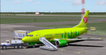
Novosibirsk Tolmachevo Airport (IATA: OVB, ICAO: UNNT) is situated in the town of Ob, 16 km from center of Novosibirsk, an industrial and scientific center in Siberia - Russia's third largest city. Novosibirsk airport is the biggest transit hub on the main routes between Europe and Asia beyond the Urals. There is a 3,600 m (11,811 ft) active runway and another 3,605 m runway under construction, along with 2 passenger terminals, 1 cargo terminal and 61 aircraft stands.
This archive contains all of the current bug fixes for the scenery.
| Filename: | UNNT_Tolmachevo2008_Novosibirsk_v_105.zip |
| License: | Freeware |
| Added: | 5th May 2010, 21:30:39 |
| Downloads: | 13,689 |
| Author: | Tolmachevo TEAM: Burakov Fedor and Usachev Pavel |
| Size: | 57.35 MB |
| Category: Flight Simulator 2004 - AFCAD Files | |
| Washington National "DCA" (KDCA) |
|
Images related to this file:
File Description:
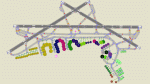
An AFCAD for the Washington National "DCA" (KDCA) scenery by Shehryar Ansari only. It should not be used with any other scenery, or the default airport. The file has been built from scratch, using information from the DCA Airport website, Airliners.net, and Google Map images. This file features accurate Taxiway naming, parking and Tower View. All gates are assigned correctly as of April 2010. There are now 100 parking positions (including overflow) provided for your traffic at this ariport:- 49 'Mainline', 18 'Express/Commuter', 31 'General Aviation' and 2 stands for BBJ sized aircraft. Enjoy!!
| Filename: | Washington_National_DCA_KDCA.zip |
| License: | Freeware |
| Added: | 18th April 2010, 20:57:14 |
| Downloads: | 1,087 |
| Author: | Lee Brompton |
| Size: | 598.63 KB |
| Category: Flight Simulator X - Missions | |
| The Most Dangerous Airports: Ronald Reagan |
|
Images related to this file:
File Description:
I have created the next in, The Most Dangerous Airport Mission Series: namely Ronald Reagan. This is a mission was real scheduled from Airtran and this particular approaches very unusual. The Ronald Reagan Visual Runway 19 approach is rated as a dangerous approach. The runway heading is in line with the White House Grounds and flying over these grounds is restricted. So what now. Simple, approaches from the west. No, not at all. One starts upstream follow the river and then make a right hand turn very close to the airport. Good luck.
| Filename: | The_Most_Dangerous_Airports_Ronald_Reagan.zip |
| License: | Freeware |
| Added: | 30th March 2010, 20:04:07 |
| Downloads: | 1,238 |
| Author: | Robbie Albers |
| Size: | 2.28 MB |
| Category: Flight Simulator X - Scenery | |
| EBCI Charleroi Brussels South Airport Update |
|
Images related to this file:
File Description:
Update for EBCI Charleroi Brussels South Airport for FSX only based on charts of July 2010 (http://beluxvacc.org/)
Features:
- the new customer terminal including Parking 11, 12, 13 and 14
- the North taxiway connecting the cust terminal to the rwy 07 holding point N1
- all other updated taxiways and parkings/gates.
- photoscenery map for ground textures including night and seasonal variations. (best blending result with UT X Europe)
- the industrial area south of the airport
- all buildings visible at dense scenery level
| Filename: | EBCI_Charleroi_Brussels_South_Airport_Update.zip |
| License: | Freeware |
| Added: | 8th February 2011, 15:33:29 |
| Downloads: | 7,352 |
| Author: | Thibault Dosunmu |
| Size: | 114.4 MB |


© 2001-2026 AVSIM Online
All Rights Reserved
Privacy Policy |